Moothedath Higher Secondary School is a high school in Taliparamba, Kerala, India. It is run by the Taliparamba Educational society. Notable alumni include former Chief Minister of Kerala E. K. Nayanar. Present President of the Society is K. Sivasankara Pillai and Secretary/ Manager is P. V. Balakrishnan.

Anastasavan is a town in the Yerevan Province of Armenia.

Saramej is a town in the Lori Province of Armenia.

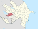
Zöhramlı is a village in the Davachi Rayon of Azerbaijan. The village forms part of the municipality of Pirəbədil.

Okrąglik is a village in the administrative district of Gmina Białobrzegi, within Białobrzegi County, Masovian Voivodeship, in east-central Poland. It lies approximately 7 kilometres (4 mi) east of Białobrzegi and 65 km (40 mi) south of Warsaw.

Dąbek is a village in the administrative district of Gmina Troszyn, within Ostrołęka County, Masovian Voivodeship, in east-central Poland. It lies approximately 3 kilometres (2 mi) east of Troszyn, 15 km (9 mi) east of Ostrołęka, and 105 km (65 mi) north-east of Warsaw.

Boreczek is a village in the administrative district of Gmina Małkinia Górna, within Ostrów Mazowiecka County, Masovian Voivodeship, in east-central Poland. It lies approximately 4 kilometres (2 mi) south of Małkinia Górna, 17 km (11 mi) south-east of Ostrów Mazowiecka, and 87 km (54 mi) north-east of Warsaw.

Nowa Trzcianka is a village in the administrative district of Gmina Grębków, within Węgrów County, Masovian Voivodeship, in east-central Poland. It lies approximately 6 kilometres (4 mi) south of Grębków, 21 km (13 mi) south of Węgrów, and 65 km (40 mi) east of Warsaw.

Czarnocin is a village in the administrative district of Gmina Skarszewy, within Starogard County, Pomeranian Voivodeship, in northern Poland. It lies approximately 4 kilometres (2 mi) south-west of Skarszewy, 11 km (7 mi) north-west of Starogard Gdański, and 40 km (25 mi) south of the regional capital Gdańsk.

Tulice Małe is a settlement in the administrative district of Gmina Stary Targ, within Sztum County, Pomeranian Voivodeship, in northern Poland. It lies approximately 4 kilometres (2 mi) south-east of Stary Targ, 13 km (8 mi) east of Sztum, and 64 km (40 mi) south-east of the regional capital Gdańsk.

Janowo is a village in the administrative district of Gmina Karnice, within Gryfice County, West Pomeranian Voivodeship, in north-western Poland. It lies approximately 5 kilometres (3 mi) west of Karnice, 20 km (12 mi) north-west of Gryfice, and 74 km (46 mi) north of the regional capital Szczecin.

Lurline is a former settlement in Colusa County, California. It lay at an elevation of 112 feet. It still appeared on maps as of 1918.
Bermudian is an unincorporated community in Adams and York counties, Pennsylvania, United States.

Dobrotin is a village in the municipality of Leskovac, Serbia. According to the 2002 census, the village has a population of 321 people.

Osmače is a village in the municipality of Srebrenica, Bosnia and Herzegovina.
Piltene Parish is an administrative unit of the Ventspils Municipality, Latvia. The parish has a population of 559 and covers an area of 187.856 km2.
Moléson-sur-Gruyères is a village in the Swiss Alps, located in the canton of Fribourg. The village is situated in the municipality of Gruyères, south of Bulle, at a height of 1,132 metres above sea level.
Painter Creek is an unincorporated community in Darke County, in the U.S. state of Ohio.

Alıbəyli is a village in the Kalbajar Rayon of Azerbaijan.


