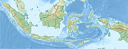
2018 East Java earthquake

Last updated
2018 East Java earthquake
2018-10-11 Cungapmimbo, Indonesia M6 earthquake shakemap (USGS).jpg
Shakemap of the earthquake
Indonesia Java relief location map.png
Bullseye1.png
Indonesia relief location map.jpg
Bullseye1.png
UTC  time2018-10-11 18:44:55
ISC  event 613407851
USGS-ANSS ComCat
Local date11 October 2018
Local time01:44:55 WIB
Magnitude6.0 Mw
Depth9 km (6 mi)
Epicentre 7°27′11″S114°27′22″E / 7.453°S 114.456°E / -7.453; 114.456
Max. intensity V (Moderate)
Aftershocks14 [1]
Casualties4 dead [2]
26 injured [3]

On 11 October 2018, an earthquake struck off the coast of East Java, Indonesia, with the epicentre located off the coast of Situbondo Regency. The earthquake, which struck at dawn, killing four people in addition to destroying or damaging hundreds of houses, mostly on the small island of Sapudi.

Contents

Earthquake

The earthquake occurred at 18:44:55 UTC (01:44:55 WIB), with a magnitude of Mw 6.0, at 9 km depth and epicenter location of 7°27′11″S114°27′22″E / 7.453°S 114.456°E / -7.453; 114.456 (USGS) [4] or Mw 6.3, 12 km depth and epicenter at 7°28′S114°26′E / 7.46°S 114.44°E / -7.46; 114.44 (BMKG). [5] [6] The epicenter was located underwater, around 60 km northeast of the town of Situbondo. [6] Indonesian Meteorology, Climatology, and Geophysical Agency reported 12 aftershocks, the strongest one occurring at 02:22 local time with a Mw of 3.5. [1] BMKG attributed the earthquake to an unmapped thrust fault, adding that the region historically saw relatively low seismicity and that the earthquake was not caused by the larger and more destructive earthquakes in Sulawesi and Lombok. [7] [8]

According to Indonesian National Board for Disaster Management (BNPB) spokesman Sutopo Purwo Nugroho, the earthquake was felt in 22 regencies and cities in East Java province, including the provincial capital and Indonesia's second-largest city Surabaya. [9] No tsunami warnings were issued, and none occurred. Attendees of the 2018 International Monetary Fund Summit in Denpasar reported feeling the earthquake, but no damage occurred and the summit continued without significant disruption. [10]

Casualties

The earthquake killed four people, and injured at least 26. As the earthquake struck around 2 am, many of the victims were asleep during the shaking and could not escape. [3] Three of the deaths occurred in Prambanan village of Sapudi Island and were caused by falling roof shrapnel, while the fourth fatality was in Jember, where a 47-year-old man died after he slipped and hit his head when running out of his house during the earthquake. [2]

Aftermath

Nearly 500 houses were reported to be damaged by the day following the earthquake in Sapudi Island alone, [11] with lesser damage in other regencies. [12] Cleanup operations, assisted by soldiers from Kodam V/Brawijaya, began soon after the earthquake. [13] Social minister Agus Gumiwang visited Sapudi later in the day of the earthquake. [14] Governor of East Java Soekarwo also visited the island, and promised that the provincial government would incur the costs of repairing damaged houses, with the provincial administration allocating Rp 23.7 billion (US$1.6 million) for the purpose. [13] [15] The central government also provided benefits of Rp 15 million (~USD 1,000) for the relatives of the fatalities, in addition to smaller benefits from the local governments. [16] [17]

See also

Related Research Articles

<span class="mw-page-title-main">2017 Java earthquake</span> 2017 earthquake centered in Tasikmalaya, West Java, Indonesia

The 2017 Java earthquake occurred on 15 December 2017 when a moment magnitude 6.5 earthquake struck the Indonesian island of Java, specifically the city of Tasikmalaya on 23:47:58 West Indonesian Time in West Java, Indonesia. The earthquake struck at a depth of 91 km and was categorized as a strong but deep earthquake. It was initially registered as a 7.3 magnitude earthquake by Indonesian agencies. Widespread damage was reported across Tasikmalaya, the nearest major city to the epicentre. A tsunami warning was immediately issued by the authorities but was subsequently cancelled. Four people have been confirmed dead.

2018 (MMXVIII) was a common year starting on Monday of the Gregorian calendar, the 2018th year of the Common Era (CE) and Anno Domini (AD) designations, the 18th year of the 3rd millennium and the 21st century, and the 9th year of the 2010s decade.

<span class="mw-page-title-main">July 2018 Lombok earthquake</span> Earthquake that occurred in July 2018 in Indonesia

A Mw 6.4 earthquake struck the island of Lombok on the morning of 29 July 2018 at a shallow depth of 14 km (8.7 mi). Widespread damage was reported in the area, and authorities confirmed that 20 people were killed in the earthquake while hundreds were injured.
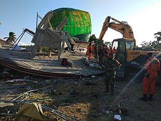
<span class="mw-page-title-main">5 August 2018 Lombok earthquake</span> Earthquake in Indonesia

On 5 August 2018, a destructive and shallow earthquake measuring Mw  6.9 struck the island of Lombok, Indonesia. It was the main shock following its foreshock, a nearby Mw  6.4 earthquake on 29 July. It was followed by a nearby 6.9 earthquake on 19 August 2018.

<span class="mw-page-title-main">2018 Sulawesi earthquake and tsunami</span> 7.5 Mw earthquake Landslide and tsunami in Indonesia

On 28 September 2018, a shallow, large earthquake struck in the neck of the Minahasa Peninsula, Indonesia, with its epicentre located in the mountainous Donggala Regency, Central Sulawesi. The magnitude 7.5 quake was located 70 km (43 mi) away from the provincial capital Palu and was felt as far away as Samarinda on East Kalimantan and also in Tawau, Malaysia. This event was preceded by a sequence of foreshocks, the largest of which was a magnitude 6.1 tremor that occurred earlier that day.

On 17 March 2019, an earthquake measuring Mw  5.6 struck the island of Lombok in West Nusa Tenggara, Indonesia. The earthquake triggered a landslide, killing six and injuring nearly 200 others.

<span class="mw-page-title-main">2019 North Maluku earthquake</span> July 14, 2019, earthquake in Indonesia

The 2019 North Maluku earthquake, a shallow 7.2 magnitude earthquake, struck the island of Halmahera, North Maluku, Indonesia on 14 July 2019 at 18:10 local time with its epicentre located at South Halmahera. It struck at a shallow depth of 10 km (6.2 mi) near Labuha, a small port town located in Bacan Island. The earthquake produced a non-destructive 20 cm tsunami, which struck Labuha just minutes after the shaking started. 14 people were killed by the earthquake while 129 people were injured, and more than 50,000 people were displaced. The earthquake inflicted a total damage of Rp 238 billion.
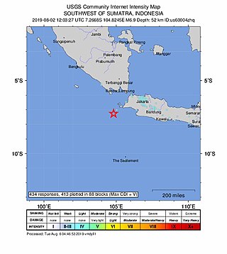
<span class="mw-page-title-main">2019 Sunda Strait earthquake</span> 2 August 2019, earthquake in Indonesia

The 2019 Sunda Strait earthquake occurred on the night of 2 August 2019, when a magnitude 6.9 earthquake rattled Sunda Strait at a moderate depth of 52.8 kilometres. The epicentre was located 214 km from Bandar Lampung, the capital of Lampung and 147 km west of Sumur, Pandeglang Regency. The earthquake struck with a maximum intensity of VI (Strong). The earthquake prompted a tsunami warning in the area, with authorities urging coastal residents to immediately evacuate to higher grounds.

<span class="mw-page-title-main">2019 Ambon earthquake</span> Earthquake affecting Maluku, Indonesia

On 26 September 2019, a strong magnitude 6.5 earthquake struck Seram Island in Maluku, Indonesia, near the provincial capital of Ambon. The earthquake struck at 07:46:44 Eastern Indonesia Time with a shallow depth of 18 km. The tremor could be felt throughout the island, with an intensity of very strong (VII) reportedly felt in the provincial capital of Ambon.

A moment magnitude 6.2 earthquake struck Majene Regency in West Sulawesi, Indonesia, on 15 January 2021, at 02:28 WITA. The reverse faulting shock initiated at 18.0 km (11.2 mi) depth with an epicenter inland, located 32 km (20 mi) south of Mamuju. It was preceded by a Mw  5.7 foreshock several hours prior. Shaking from the mainshock was assigned a maximum Modified Mercalli intensity of VI (Strong) in Majene and Mamuju. Four of the five regencies in West Sulawesi were affected. More than 6,000 structures were damaged or destroyed; damage was estimated at Rp829.1 billion rupiah. At least 105 people were confirmed dead; more than 3,300 were injured and thousands were displaced.
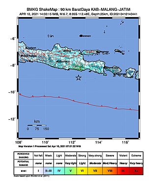
<span class="mw-page-title-main">2021 East Java earthquake</span> Earthquake in Indonesia

An earthquake occurred on 10 April 2021 at 14:00 local time (UTC+07:00) off the south coast of eastern Java. The epicenter of the earthquake is located 44 km south–southwest of Gondanglegi Kulon in East Java province. Measuring 6.0 or 6.1 on the moment magnitude scale (Mw ) and having a depth of 82.3 km, the earthquake caused moderate shaking measuring V on the Mercalli intensity scale. At least 10 individuals are known to have died from the earthquake and another 104 were seriously injured.

The 2021 Bali earthquake struck at 04:18 local time (UTC+08:00) when people were still sleeping on 15 October 2021. It resulted in 4 deaths and 73 more injured, despite having a moment magnitude of 4.7.

<span class="mw-page-title-main">2021 Flores earthquake</span> Earthquake in Indonesia

An earthquake occurred 112 km, offshore, north of Maumere in the Flores Sea on December 14. The quake had a moment magnitude of 7.3 according to the United States Geological Survey (USGS). One person was killed and 173 others suffered injuries.

<span class="mw-page-title-main">2022 Sumatra earthquake</span> Earthquake in Indonesia

On 25 February 2022 at 08:39 WIB, a moment magnitude (Mw ) 6.2 earthquake struck West Sumatra, Indonesia at a depth of 4.0 km (2.5 mi). Preceded by one foreshock and followed by over 200 aftershocks, the mainshock had an epicenter at the foot of Mount Talakmau in Pasaman Regency. The mainshock was the result of strike-slip faulting along a previously unidentified segment of the Great Sumatran Fault. At least 27 people died, 457 were injured, and 19,221 others were displaced. It inflicted 780 million Indonesian rupiahs (Rp) worth of damage. The heaviest damage was recorded at three villages around Mount Talakmau. Landslides and flash floods caused additional damage and casualties.

<span class="mw-page-title-main">2022 West Java earthquake</span> Earthquake in Indonesia

On 21 November 2022, at 13:21 WIB (UTC+07:00), a Mww 5.6 earthquake struck near Cianjur in West Java, Indonesia. The strike-slip earthquake occurred with a focal depth of 11 km (6.8 mi). Between 335 and 635 people died, 7,729 were injured and five remain missing. More than 62,628 homes were damaged across 16 districts in Cianjur Regency and the surrounding region. It is the deadliest earthquake to hit Indonesia since the 2018 Sulawesi earthquake. Damage evaluated after the event earned it a maximum Modified Mercalli intensity of VIII (Severe).

On 22 March 2024, at 11:22 WIB (UTC+07:00), a Mw 6.0 or Mww 5.6 earthquake struck near Bawean in East Java, Indonesia. Later, at 15:52 WIB, a second, larger event, measuring Mw 6.5 or Mww 6.4, occurred. The strike-slip mainshock occurred with a focal depth of 8.5 km (5.3 mi).

References

  1. 1 2 Suryasumirat, Ratu Annisaa (11 October 2018). "BMKG: Hasil Catatan Sensor Seismik, Gempa Situbondo Bermagnitudo 6,0". liputan6.com. Retrieved 17 November 2018.
  2. 1 2 "Korban Gempa Situbondo Bertambah, Jadi 4 Orang". Berita Satu (in Indonesian). 13 October 2018. Archived from the original on 13 October 2018. Retrieved 17 November 2018.
  3. 1 2 Islam, Syaiful (11 October 2018). "Info Terkini Gempa Situbondo, 26 Korban Terluka dan 36 Rumah Rusak". Okezone (in Indonesian). Retrieved 15 November 2018.
  4. "M 6.0 - 40km NNE of Cungapmimbo, Indonesia". USGS. Retrieved 17 November 2018.
  5. Yulika, Nila Chrisna (11 October 2018). "Gempa Situbondo, BMKG Mutakhirkan Data Magnitudo 6,4 Menjadi 6,3". liputan6.com (in Indonesian). Retrieved 17 November 2018.
  6. 1 2 Ikhsanudin, Arief (11 October 2018). "Ini Penyebab Gempa M 6,0 di Timur Laut Situbondo". detikNews (in Indonesian). Retrieved 17 November 2018.
  7. Nasution, Dedy Darmawan (11 October 2018). "Ini Penyebab Gempa Situbondo Menurut BMKG". Republika (in Indonesian). Retrieved 17 November 2018.
  8. Sartika, Resa Eka Ayu (12 October 2018). "Gempa Situbondo, Ternyata Penyebabnya Belum Diketahui dan Dipetakan". KOMPAS (in Indonesian). Retrieved 17 November 2018.
  9. "Gempa Magnitudo 6,3 di Situbondo Terasa hingga 22 Daerah". liputan6.com (in Indonesian). 11 October 2018. Retrieved 15 November 2018.
  10. "Three dead, IMF summit shaken as strong quake hits Indonesia's Java, Bali". Channel NewsAsia. 11 October 2018. Retrieved 15 November 2018.
  11. Kurnia, Dadang (12 October 2018). "Gempa Situbondo Sebabkan 498 Bangunan di Pulau Sapudi Rusak". Republika (in Indonesian). Retrieved 17 November 2018.
  12. "16 Rumah di Situbondo Rusak Setelah Gempa 6,3 SR". IDN Times (in Indonesian). 12 October 2018. Retrieved 17 November 2018.
  13. 1 2 "Soekarwo ke Lokasi Gempa Sapudi Sumenep: Rumah Rusak Kami Tanggung". Media Madura (in Indonesian). 11 October 2018. Archived from the original on 30 September 2020. Retrieved 17 November 2018.
  14. "Kunjungi Pulau Sapudi di Jatim, Mensos Pastikan Negara Hadir Tangani Dampak Bencana". KOMPAS (in Indonesian). 11 October 2018. Retrieved 17 November 2018.
  15. Boediwardhana, Wahyoe (14 October 2018). "Hundreds of houses collapse on E. Java island after powerful earthquake". The Jakarta Post. Retrieved 17 November 2018.
  16. Novianto, Raka Dwi (12 October 2018). "Pemerintah Pastikan Beri Bantuan Korban Gempa Situbondo". SINDOnews.com (in Indonesian). Retrieved 17 November 2018.
  17. Rahmatullah (23 October 2018). "Keluarga Koban Meninggal Akibat Gempa Dapat Santunan". medcom.id (in Indonesian). Retrieved 17 November 2018.