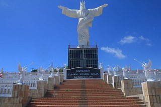
The Talaud Islands also spelled Talaur or Talaut, are a group of islands situated about 225 miles (360 km) northeast of Sulawesi, in Indonesia, north-east of the Sangihe Islands. The Talaud Islands are also the northernmost region of Eastern Indonesia, bordering south of the Philippines' Davao Region. The group, with a total area of 483 square miles, includes Karakelong, Salibabu, Kabaruan, and a small number of offshore islets. The seven tiny Nanusa Islands also lie north-east of Karakelong, with Miangas much further north-west.

Sorong is the largest city and the capital of the Indonesian province of Southwest Papua. The city is located on the western tip of the island of New Guinea with its only land borders being with Sorong Regency. It is the gateway to Indonesia's Raja Ampat Islands, species rich coral reef islands in an area considered the heart of the world's coral reef biodiversity. It also is the logistics hub for Indonesia's thriving eastern oil and gas frontier. Sorong has experienced exponential growth since 2010, and further growth is anticipated as Sorong becomes linked by road to other frontier towns in Papua's Bird's Head Peninsula. The city had a population of 190,625 at the 2010 Census and 284,410 at the 2020 Census; the latest official estimate is 289,767. It is served by Domine Eduard Osok Airport.

The September 2007 Sumatra earthquakes were a series of megathrust earthquakes that struck the Sunda Trench off the coast of Sumatra, Indonesia, with three of magnitude 7 or greater. A series of tsunami bulletins was issued for the area. The most powerful of the series had a magnitude of 8.5, which makes it in the top 20 of the largest earthquakes ever recorded on a seismograph.
2009 Indonesia earthquake may refer to:

The 2010 Mentawai earthquake occurred with a moment magnitude of 7.8 on 25 October off the western coast of Sumatra at 21:42 local time. The earthquake occurred on the same fault that produced the 2004 Indian Ocean earthquake. It was widely felt across the provinces of Bengkulu and West Sumatra and resulted in a substantial localized tsunami that struck the Mentawai Islands.

The Sangihe Islands Regency is a regency of North Sulawesi Province, Indonesia. It comprises a group of islands situated to the North of Sulawesi. It covers a land area of 736.98 km2, and had a population of 126,100 at the 2010 census and 139,262 at the 2020 census. The principal island is also named Sangihe, on which lies the main town of Tahuna. Minor island groups within the Regency include the Marore group considerably to the north of Sangihe Island, the Tatoareng group to the south, and the Nusa Tabukan group off the northeast coast of Sangihe Island. It borders the Philippines in the north, making it one of Indonesia's border regions.

The Talaud Islands Regency is a regency of North Sulawesi province, Indonesia. The Talaud Islands form an archipelago situated to the north-east of Sulawesi, with a land area of 1,251.02 km2. It had a population of 83,434 at the 2010 Census, increasing to 94,520 at the 2020 Census. The largest island is Karakelong, on which lies the regency seat in the town of Melonguane. To its south lie the islands of Salibabu and Kabaruan, while the Nanusa group lies to the northeast of Karakelong, and Miangas island is situated midway between Karakelong and the Philippines. It is one of the three regencies to the north of North Sulawesi that are located between Sulawesi and the Philippines, along with the Sitaro Islands Regency and Sangihe Islands Regency. The island of Miangas is the most northerly island in the regency and widely regarded as the northernmost point of Indonesia. As the result, it is often referenced to describe the territorial integrity of Indonesia in various patriotic statements and songs together with Sabang, Merauke, and Rote Island.

The Thousand Islands are a chain of islands to the north of Jakarta's coast. It forms the only regency of Jakarta, the capital of Indonesia. It consists of a string of 342 islands stretching 45 km (28 mi) north into the Java Sea at West Jakarta Bay and in fact north of Banten Province. Pramuka Island is the regency seat.

Londe or londi is a traditional boat from North Sulawesi, Indonesia. They are thought to have existed since 1500s, developed from ancient Sangir islands boat called bininta which is now enshrined in the symbol of the region of Sangir Islands District.
A moment magnitude 7.5–7.6 earthquake struck offshore near the Tanimbar Islands, Maluku, Indonesia, at a depth of 105.1 km, on 10 January 2023.


