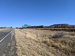
Joice is a city in Worth County, Iowa, United States. The population was 208 at the time of the 2020 census. It is part of the Mason City Micropolitan Statistical Area.

Casa Colorada is a census-designated place (CDP) in Valencia County, New Mexico, United States. The population was 272 at the 2010 census. It is part of the Albuquerque Metropolitan Statistical Area.

The Salinas Pueblo Missions National Monument is a complex of three Spanish missions located in the U.S. state of New Mexico, near Mountainair. The main park visitor center is in Mountainair. Construction of the missions began in 1622 and was completed in 1635.
Southeast Grove is an unincorporated community in Eagle Creek Township, Lake County, Indiana.
Oldrag is an unincorporated community located in Madison County, Virginia, on Old Rag Mountain.
Ickesburg is a village in Perry County, Pennsylvania, United States at the junction of Routes 17 and 74. It is located on the Panther Creek, which flows into the Buffalo Creek, a tributary of the Juniata River. Ickesburg is within Saville Township and is an unincorporated community. Its ZIP code is 17037 and it is served by area codes 717 and 223.
Curdsville is an unincorporated community in Buckingham County, in the U.S. state of Virginia.
Teeuinge is one of the principal Tewa Pueblo ancestral sites in New Mexico, US. It is situated in the southerly angle formed by the juncture of Rio Oso and Rio Chama. The site measures approximately 525 feet (160 m) by 210 feet (64 m). It is a large ruin situated on the rim of the mesa overlooking the valley, just below the confluence of the two rivers. It is about .25 miles (0.40 km) south of the river, and the bluff on which it stands is about 200 feet (61 m). The pueblo was constructed of adobe with some use of lava blocks in the foundation walls, and is now reduced to low mounds. It was built in two large adjoining quadrangles, or as one long rectangle divided by cross walls into two courts. The walls have a perimeter of 1,470 feet (450 m). Within and contiguous to the pueblo are ten circular, subterranean kivas. A few yards to the east is a ruined shrine in circular form, 8 feet (2.4 m) in diameter, built of lava blocks set on edge.
River Valley Community College (RVCC) is a public community college with campuses in Claremont, Keene, and Lebanon, New Hampshire. It is part of the Community College System of New Hampshire and is accredited by the New England Commission of Higher Education. The college offers over 35 degree and certificate programs.

Abo Canyon, also known as Abo Pass, is a mountain pass at the southern end of the Manzano Mountains of central New Mexico in the Southwest United States.

The Bursum Formation is a geologic formation in New Mexico. It preserves fossils dating back to the Early Permian period.

The Madera Group is a group of geologic formations in northern New Mexico. Its fossil assemblage dates the formation to the middle to late Pennsylvanian period.
Madrone is a census-designated place in Valencia County, New Mexico, United States. Its population was 707 as of the 2010 census. New Mexico State Road 304 passes through the community.
Alamillo is an unincorporated community and census-designated place in Socorro County, New Mexico, United States. Its population was 102 as of the 2010 census. Interstate 25 passes through the community.
Chamizal is an unincorporated community and census-designated place in Socorro County, New Mexico, United States. Its population was 101 as of the 2010 census. New Mexico State Road 408 passes through the community.
Escondida is an unincorporated community and census-designated place in Socorro County, New Mexico, United States. Its population was 47 as of the 2010 census. Interstate 25 passes through the community.
Las Nutrias is an unincorporated community and census-designated place in Socorro County, New Mexico, United States. Its population was 149 as of the 2010 census. New Mexico State Road 304 passes through the community.
San Pedro is an unincorporated community and census-designated place in Santa Fe County, New Mexico, United States. Its population was 184 as of the 2010 census. New Mexico State Road 344 passes through the community.
The Los Pinos Mountains are a small mountain range in the central part of New Mexico, US. They are the southernmost part of a mountain front, running north to south, that also includes the Sandia Mountains and the Manzano Mountains. The Los Pinos Mountains are separated from the Manzano Mountains by Abo Pass, which was cut by a small tributary to the Rio Grande. The mountains run slightly west of south for 15 miles (24 km) and widen to a maximum of about 4 miles (6.4 km) across before narrowing again. The southern end of the range is ill-defined, being marked by cuestas that merge into badlands to the south.


