Manzano, New Mexico

Last updated

Manzano, New Mexico
CDP
Torrance County New Mexico Incorporated and Unincorporated areas Manzano Highlighted.svg
Location of Manzano, New Mexico
Usa edcp location map.svg
Red pog.svg
Manzano, New Mexico
Location in the United States
Coordinates: 34°38′47″N106°20′42″W / 34.64639°N 106.34500°W / 34.64639; -106.34500
CountryUnited States
State New Mexico
County Torrance
Area
[1]
  Total1.69 sq mi (4.38 km2)
  Land1.69 sq mi (4.38 km2)
  Water0.00 sq mi (0.00 km2)
Elevation
[2]
7,195 ft (2,193 m)
Population
 (2020) [3]
  Total26
  Density15.38/sq mi (5.94/km2)
Time zone UTC-7 (Mountain (MST))
  Summer (DST) UTC-6 (MDT)
Area code 505
FIPS code 35-46730
GNIS feature ID2408170 [2]
Adobe homes with torreon (defensive tower), Manzano, circa 1900 Torreon, Manzano, New Mexico, 1900%3F.jpg
Adobe homes with torreon (defensive tower), Manzano, circa 1900

Manzano is a census-designated place (CDP) in Torrance County, New Mexico, United States. The population was 54 at the 2000 census. The Quarai Ruins of Salinas Pueblo Missions National Monument are located near the town. The center of population of New Mexico is located in Manzano. [4]

Contents

Manzano is part of the Albuquerque Metropolitan Statistical Area. Manzano comes from the Spanish word for apple.

Geography

According to the United States Census Bureau, the CDP has a total area of 1.7 square miles (4.4 km2), all land.

Demographics

Historical population
CensusPop.Note
2020 26
U.S. Decennial Census [5] [3]

As of the census [6] of 2000, there were 54 people, 17 households, and 12 families residing in the CDP. The population density was 32.0 inhabitants per square mile (12.4/km2). There were 22 housing units at an average density of 13.1 per square mile (5.0/km2). The racial makeup of the CDP was 55.56% White, 31.48% Native American, 11.11% from other races, and 1.85% from two or more races. Hispanic or Latino of any race were 87.04% of the population.

There were 17 households, out of which 41.2% had children under the age of 18 living with them, 41.2% were married couples living together, 11.8% had a female householder with no husband present, and 29.4% were non-families. 23.5% of all households were made up of individuals, and 5.9% had someone living alone who was 65 years of age or older. The average household size was 3.18 and the average family size was 3.75.

In the CDP, the population was spread out, with 31.5% under the age of 18, 7.4% from 18 to 24, 22.2% from 25 to 44, 18.5% from 45 to 64, and 20.4% who were 65 years of age or older. The median age was 40 years. For every 100 females, there were 170 males. For every 100 females age 18 and over, there were 105.6 males.

The median income for a household in the CDP was $13,750, and the median income for a family was $19,375. Males had a median income of $33,750 versus $0 for females. The per capita income for the CDP was $5,935. There were 35.0% of families and 37.7% of the population living below the poverty line, including 38.5% of under eighteens and 50.0% of those over 64.

Education

Its school district is Mountainair Public Schools. [7]

See also

Related Research Articles

<span class="mw-page-title-main">Torrance County, New Mexico</span> County in New Mexico, United States

Torrance County is a county located in the center of the U.S. state of New Mexico. As of the 2020 census, the population was 15,045. The county seat is Estancia.
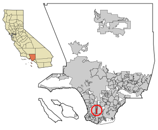
<span class="mw-page-title-main">West Carson, California</span> Unincorporated community in California, United States

West Carson is an unincorporated community in the South Bay region of Los Angeles County, California. The population was 22,870 at the 2020 census. For statistical purposes, the United States Census Bureau has defined West Carson as a census-designated place (CDP).

<span class="mw-page-title-main">Acomita Lake, New Mexico</span> Census-designated place in New Mexico, United States

Acomita Lake is a census-designated place (CDP) in Cibola County, New Mexico, United States. The population was 339 at the 2020 census.
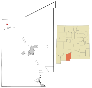
<span class="mw-page-title-main">Salem, New Mexico</span> CDP in New Mexico, United States

Salem is a census-designated place (CDP) in Doña Ana County, New Mexico, United States. The population was 942 at the 2010 census. It is part of the Las Cruces Metropolitan Statistical Area.
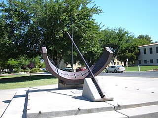
<span class="mw-page-title-main">University Park, New Mexico</span> Census-designated place in New Mexico, United States

University Park is a census-designated place (CDP) in Doña Ana County, New Mexico, United States. The population was 4,192 at the 2010 census. It is part of the Las Cruces Metropolitan Statistical Area.

<span class="mw-page-title-main">Beclabito, New Mexico</span> Census-designated place in San Juan County, New Mexico, United States

Beclabito is a census-designated place (CDP) in San Juan County, New Mexico, United States. The population was 317 at the 2010 census. It is part of the Farmington Metropolitan Statistical Area.

<span class="mw-page-title-main">Flora Vista, New Mexico</span> CDP in New Mexico, United States

Flora Vista is a census-designated place (CDP) in San Juan County, New Mexico, United States. The population was 1,383 at the 2000 census. It is part of the Farmington Metropolitan Statistical Area. Flora Vista was founded in 1877 by settlers from Colorado who built cabins along the Animas River. A post office was established the following year. The name derived from the view of wildflowers in the valley.

<span class="mw-page-title-main">Naschitti, New Mexico</span> CDP in New Mexico, United States

Naschitti is a census-designated place (CDP) in San Juan County, New Mexico, United States. The population was 360 at the 2000 census. It is part of the Farmington Metropolitan Statistical Area. The town was established in 1886, when Tom Bryan set up a trading post east of the Chuska Mountains. With a Navajo name, Naschitti means "badger springs."
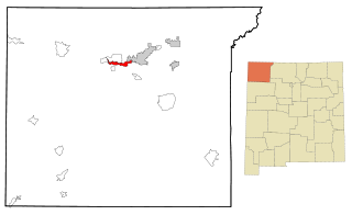
<span class="mw-page-title-main">Upper Fruitland, New Mexico</span> CDP in New Mexico, United States

Upper Fruitland is a census-designated place (CDP) in San Juan County, New Mexico, United States. The population was 1,664 at the 2000 census. It is part of the Farmington Metropolitan Statistical Area.

<span class="mw-page-title-main">Regina, New Mexico</span> CDP in New Mexico, United States

Regina is a census-designated place (CDP)) in Sandoval County, New Mexico, United States. The population was 99 at the 2000 census. It is part of the Albuquerque Metropolitan Statistical Area. It was named for Regina, Saskatchewan.

<span class="mw-page-title-main">Torreon, Sandoval County, New Mexico</span> Census-designate place in Sandoval County, New Mexico, United States

Torreon is a census-designated place (CDP) in Sandoval County, New Mexico, United States. The population was 297 at the 2000 census. It is part of the Albuquerque Metropolitan Statistical Area.
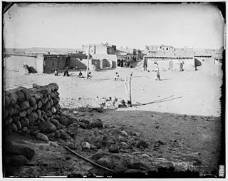
<span class="mw-page-title-main">Zia Pueblo, New Mexico</span> CDP in New Mexico, United States

Zia Pueblo is a census-designated place (CDP) in Sandoval County, New Mexico, United States. The population was 646 at the 2000 census, with 310 males and 336 females. The pueblo after which the CDP is named is included within the CDP; it is listed on the National Register of Historic Places.

<span class="mw-page-title-main">Cañada de los Alamos, New Mexico</span> CDP in New Mexico, United States

Cañada de los Alamos is a census-designated place (CDP) in Santa Fe County, New Mexico, United States. It is part of the Santa Fe, New Mexico Metropolitan Statistical Area. The population was 434 at the 2010 census.

<span class="mw-page-title-main">Cedar Grove, New Mexico</span> CDP in New Mexico, United States

Cedar Grove is a census-designated place (CDP) in Santa Fe County, New Mexico, United States. It is part of the Santa Fe, New Mexico Metropolitan Statistical Area. The population was 747 at the 2010 census. Cedar Grove was formerly a stage and freight stop. It has developed into a Santa Fe suburb. New Mexico "cedars" are abundant in the town.
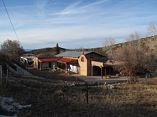
<span class="mw-page-title-main">Rio en Medio, New Mexico</span> CDP in New Mexico, United States

Rio en Medio is a census-designated place (CDP) in Santa Fe County, New Mexico, United States. It is part of the Santa Fe, New Mexico Metropolitan Statistical Area. The population was 131 at the 2000 census.

<span class="mw-page-title-main">Encino, New Mexico</span> Village in New Mexico, United States

Encino is a village in Torrance County, New Mexico, United States. The population was 51 at the 2020 census. It is part of the Albuquerque Metropolitan Statistical Area.

<span class="mw-page-title-main">Tajique, New Mexico</span> CDP in New Mexico, United States

Tajique is a unincorporated community in Torrance County, New Mexico, United States. The population was 148 at the 2000 census. For statistical purposes, the United States Census Bureau has defined that community as a census-designated place (CDP). It is part of the Albuquerque metropolitan area.
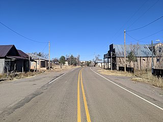
<span class="mw-page-title-main">Torreon, Torrance County, New Mexico</span> Census-designated place in Torrance County, New Mexico, United States

Torreon is a farming community and census-designated place (CDP) in Torrance County, New Mexico, United States. The population was 244 at the 2000 census. It is part of the Albuquerque Metropolitan Statistical Area.

<span class="mw-page-title-main">Berea, South Carolina</span> CDP in South Carolina, United States

Berea is a census-designated place (CDP) in Greenville County, South Carolina, United States. The population was 14,295 at the 2010 census. It is part of the Greenville–Mauldin–Easley Metropolitan Statistical Area.

Mexico is a census-designated place (CDP) in the town of Mexico in Oxford County, Maine, United States. The population was 1,946 at the 2000 census.

References

  1. "ArcGIS REST Services Directory". United States Census Bureau. Archived from the original on May 31, 2023. Retrieved October 12, 2022.
  2. 1 2 U.S. Geological Survey Geographic Names Information System: Manzano, New Mexico
  3. 1 2 "Census Population API". United States Census Bureau. Archived from the original on May 25, 2023. Retrieved October 12, 2022.
  4. "Population and Population Internal Points by State". 2000. Archived from the original on December 12, 2001.
  5. "Census of Population and Housing". Census.gov. Archived from the original on February 28, 2022. Retrieved June 4, 2016.
  6. "U.S. Census website". United States Census Bureau. Archived from the original on December 27, 1996. Retrieved January 31, 2008.
  7. "2020 CENSUS - SCHOOL DISTRICT REFERENCE MAP: Torrance County, NM" (PDF). U.S. Census Bureau. Archived (PDF) from the original on September 2, 2022. Retrieved September 3, 2022.