Moriarty, New Mexico

Last updated

Moriarty, New Mexico
Moriarty New Mexico Civic Center.jpg
Moriarty Civic Center
Torrance County New Mexico Incorporated and Unincorporated areas Moriarty Highlighted.svg
Location of Moriarty, New Mexico
Lisa's Truck Center.jpg
Lisa's Truck Center
Usa edcp location map.svg
Red pog.svg
Moriarty, New Mexico
Location in the United States
Coordinates: 34°59′35″N106°02′40″W / 34.99306°N 106.04444°W / 34.99306; -106.04444
Country United States
State New Mexico
County Torrance
Area
[1]
  Total6.93 sq mi (17.96 km2)
  Land6.93 sq mi (17.96 km2)
  Water0.00 sq mi (0.00 km2)
Elevation
[2]
6,224 ft (1,897 m)
Population
 (2020) [3]
  Total1,946
  Density280.61/sq mi (108.35/km2)
Time zone UTC-7 (Mountain (MST))
  Summer (DST) UTC-6 (MDT)
ZIP code
87035
Area code 505
FIPS code 35-50160
GNIS feature ID2411165 [2]
Website www.cityofmoriarty.org

Moriarty is a town in Torrance County, New Mexico, United States. The population was 1,910 at the 2010 Census. It is part of the Albuquerque Metropolitan Statistical Area.

Contents

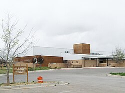
Moriarty is about ten miles east of Edgewood, New Mexico, and shares a school district with the town, despite them being in separate counties (Edgewood is in Santa Fe County).

Geography

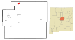
According to the United States Census Bureau, the city has a total area of 4.8 square miles (12 km2), all land.

Climate

Climate data for Moriarty, New Mexico (Elevation 6,220ft)
MonthJanFebMarAprMayJunJulAugSepOctNovDecYear
Record high °F (°C)68
(20)
70
(21)
81
(27)
85
(29)
94
(34)
97
(36)
100
(38)
96
(36)
92
(33)
85
(29)
77
(25)
67
(19)
100
(38)
Average high °F (°C)46.4
(8.0)
49.7
(9.8)
58.6
(14.8)
67.3
(19.6)
76.6
(24.8)
86.7
(30.4)
88.1
(31.2)
85.4
(29.7)
79.8
(26.6)
68.5
(20.3)
56.8
(13.8)
45.4
(7.4)
67.4
(19.7)
Average low °F (°C)15.6
(−9.1)
18.7
(−7.4)
24.1
(−4.4)
31.0
(−0.6)
40.1
(4.5)
48.5
(9.2)
54.5
(12.5)
52.5
(11.4)
44.1
(6.7)
33.9
(1.1)
22.3
(−5.4)
15.9
(−8.9)
33.4
(0.8)
Record low °F (°C)−9
(−23)
−9
(−23)
−10
(−23)
13
(−11)
16
(−9)
32
(0)
40
(4)
41
(5)
25
(−4)
14
(−10)
−1
(−18)
−16
(−27)
−16
(−27)
Average precipitation inches (mm)0.48
(12)
0.44
(11)
0.79
(20)
0.57
(14)
0.82
(21)
0.70
(18)
2.19
(56)
1.87
(47)
1.37
(35)
1.32
(34)
0.59
(15)
0.75
(19)
11.90
(302)
Average snowfall inches (cm)4.0
(10)
4.4
(11)
5.2
(13)
0.9
(2.3)
0
(0)
0
(0)
0
(0)
0
(0)
0
(0)
0.4
(1.0)
2.5
(6.4)
6.8
(17)
24.0
(61)
Source: The Western Regional Climate Center [4]

Culture

Every October, Moriarty plays host to the Pinto Bean Fiesta, which is composed of a bunch of simple games in Crossly Park, as well as a parade and crowning of a "Pinto Bean Queen."

The Albuquerque Soaring Club (ASC), established in 1960 in Albuquerque, New Mexico, is currently headquartered at the Moriarty Municipal Airport. Moriarty boasts some of the finest year round soaring conditions in the United States, including 15 knot thermals to 22,000 ft, mountain wave to 34,000 ft, and orographic lift off the Manzano, Sandia, Ortiz, and Sangre de Cristo mountain ranges. Many flights in excess of 300 miles are recorded each year. Many pilots have achieved all of their soaring diamonds out of Moriarty. Moriarty airport is also home to the United States Southwest Soaring Museum, and has a commercial glider operation, Sundance Aviation. [5]

Moriarty also serves as a fireworks Mecca for the Albuquerque metropolitan area with two year around stores as well as at least two other large tents which set up for the sixteen-day selling period allowed by New Mexico State Law from June 20 to July 6. Vendors sell both Black Cat and TNT brand fireworks. All vendors are located along old Route 66 and competition is always fierce. Almost all Class C fireworks are allowed for sale and use in Moriarty including firecrackers, mortars, Roman candles, and cakes up to 500 grams (the maximum allowance), and though pop rockets have been banned throughout New Mexico for the last three years, larger stick rockets are still allowed.

Moriarty is named after the first permanent settler in the town, Michael Timothy Moriarty. [6]

Demographics

Historical population
CensusPop.Note
1960 720
1970 7585.3%
1980 1,27668.3%
1990 1,3999.6%
2000 1,76526.2%
2010 1,9108.2%
2020 1,9461.9%
U.S. Decennial Census [7] [3]

As of the census [8] of 2000, there were 1,765 people, 668 households, and 478 families residing in the city. The population density was 368.2 inhabitants per square mile (142.2/km2). There were 775 housing units at an average density of 161.7 per square mile (62.4/km2). The racial makeup of the city was 73.54% White, 0.62% African American, 2.49% Native American, 0.28% Asian, 0.06% Pacific Islander, 18.75% from other races, and 4.25% from two or more races. Hispanic or Latino of any race were 40.79% of the population.

There were 668 households, out of which 41.6% had children under the age of 18 living with them, 47.5% were married couples living together, 19.9% had a female householder with no husband present, and 28.3% were non-families. 24.3% of all households were made up of individuals, and 9.1% had someone living alone who was 65 years of age or older. The average household size was 2.64 and the average family size was 3.12.

In the city, 33.6% of the population was under the age of 18, 7.4% from 18 to 24, 28.3% from 25 to 44, 20.0% from 45 to 64, and 10.8% who were 65 years of age or older. The median age was 32 years. For every 100 females, there were 86.2 males. For every 100 females age 18 and over, there were 85.2 males.

The median income for a household in the city was $25,150, and the median income for a family was $31,957. Males had a median income of $24,345 versus $20,000 for females. The per capita income for the city was $13,640. About 13.3% of families and 18.0% of the population were below the poverty line, including 21.8% of those under age 18 and 18.3% of those age 65 or over.

Notable people

Related Research Articles

<span class="mw-page-title-main">Torrance County, New Mexico</span> County in New Mexico, United States

Torrance County is a county located in the center of the U.S. state of New Mexico. As of the 2020 census, the population was 15,045. The county seat is Estancia.

<span class="mw-page-title-main">Santa Fe County, New Mexico</span> County in New Mexico, United States

Santa Fe County is located in the U.S. state of New Mexico. As of the 2020 census, the population was 154,823, making it New Mexico's third-most populous county, after Bernalillo County and Doña Ana County. Its county seat is Santa Fe, the state capital.

<span class="mw-page-title-main">Sandoval County, New Mexico</span> County in New Mexico, United States

Sandoval County is located in the U.S. state of New Mexico. As of the 2020 census, the population was 148,834, making it the fourth-most populous county in New Mexico. The county seat is Bernalillo.

<span class="mw-page-title-main">San Miguel County, New Mexico</span> County in New Mexico, United States

San Miguel County is a county in the U.S. state of New Mexico. As of the 2020 census, the population was 27,201. Its county seat is Las Vegas.

<span class="mw-page-title-main">Bernalillo County, New Mexico</span> County in New Mexico, United States

Bernalillo County is the most populous county in the U.S. state of New Mexico. As of the 2020 census, the population was 676,444. The county seat, Albuquerque, is the most populous city in New Mexico.

<span class="mw-page-title-main">Edgewood, Florida</span> City in Florida, United States

Edgewood is a city in Orange County, Florida, United States. The population was 2,503 at the 2010 census. It is part of the Orlando–Kissimmee–Sanford Metropolitan Statistical Area.

<span class="mw-page-title-main">Edgewood, Illinois</span> Village in Illinois, United States

Edgewood is a village in Effingham County, Illinois, United States. The population was 398 at the 2020 Census. Edgewood is part of the Effingham, IL Micropolitan Statistical Area.

<span class="mw-page-title-main">Edgewood, Indiana</span> Town in Indiana, United States

Edgewood is a town in Anderson Township, Madison County, Indiana, United States. It is part of the Indianapolis–Carmel–Anderson metropolitan statistical area. The population was 2,053 at the 2020 census.

<span class="mw-page-title-main">Edgewood, Iowa</span> City in Iowa, United States

Edgewood is a city in Clayton and Delaware counties in the U.S. state of Iowa. Highway 3, which runs through the center of town, is the dividing line between the two counties. The Edgewood post office was established in 1852 on the Clayton side of the town. Edgewood was formally incorporated in 1892, although it had a functioning council for some time before that date. The population was 909 at the time of the 2020 census, down from 923 in 2000.

<span class="mw-page-title-main">Edgewood, Kentucky</span> City in Kentucky, United States

Edgewood is a home rule–class city in Kenton County, Kentucky, United States. The population was 8,435 at the 2020 census. It was named for an early homestead in Walker Estates.

<span class="mw-page-title-main">Isleta Village Proper, New Mexico</span> Census-designated place in New Mexico, United States

Isleta Village Proper is a census-designated place (CDP) in Bernalillo County, New Mexico, United States. The population was 491 at the 2010 census. It is part of the Albuquerque Metropolitan Statistical Area.

<span class="mw-page-title-main">South Valley, New Mexico</span> Census-designated place in New Mexico, United States

South Valley is a census-designated place (CDP) and unincorporated community in Bernalillo County, New Mexico, United States. The population was 38,338 at the 2020 Census. It is part of the Albuquerque Metropolitan Statistical Area. The U.S. Postal Service uses "Albuquerque" for all South Valley addresses.

<span class="mw-page-title-main">Bloomfield, New Mexico</span> City in New Mexico, United States

Bloomfield is a city in northeastern San Juan County, New Mexico, United States. It is part of the Farmington Metropolitan Statistical Area. The population was 8,112 at the 2010 census.

<span class="mw-page-title-main">Bernalillo, New Mexico</span> Town in New Mexico, United States

Bernalillo is a town in and the county seat of Sandoval County, New Mexico, United States. As of the 2010 census, the town population was 8,320.

<span class="mw-page-title-main">Zia Pueblo, New Mexico</span> CDP in New Mexico, United States

Zia Pueblo is a census-designated place (CDP) in Sandoval County, New Mexico, United States. The population was 646 at the 2000 census, with 310 males and 336 females. The pueblo after which the CDP is named is included within the CDP; it is listed on the National Register of Historic Places.

<span class="mw-page-title-main">Cedar Grove, New Mexico</span> CDP in New Mexico, United States

Cedar Grove is a census-designated place (CDP) in Santa Fe County, New Mexico, United States. It is part of the Santa Fe, New Mexico Metropolitan Statistical Area. The population was 747 at the 2010 censuCedar Grove was formerly a stage and freight stop. It has developed into a Santa Fe suburb. New Mexico "cedars" are abundant in the town.

<span class="mw-page-title-main">Edgewood, New Mexico</span> Town in New Mexico, United States

Edgewood is a town in Santa Fe County, New Mexico, United States. Through annexations, its town boundaries now extend into Bernalillo and Sandoval counties. It is part of the Albuquerque–Santa Fe–Las Vegas combined statistical area.

<span class="mw-page-title-main">Encino, New Mexico</span> Village in New Mexico, United States

Encino is a village in Torrance County, New Mexico, United States. The population was 82 at the 2010 census. It is part of the Albuquerque Metropolitan Statistical Area.

<span class="mw-page-title-main">Willard, New Mexico</span> Village in New Mexico, United States

Willard is a village in Torrance County, New Mexico, United States. The population was 253 at the 2010 census. It is part of the Albuquerque Metropolitan Statistical Area. The village is not experiencing the same extreme growth that towns farther north in the state are. A wind farm has recently been constructed upon the mesa just south of the town. It provides power for about 25,000 homes in Arizona.

<span class="mw-page-title-main">Edgewood, Washington</span> City in Washington, United States

Edgewood is a city in Pierce County, Washington, United States. The population was 12,327 at the 2020 census. Neighboring towns include Fife to the west, Milton to the northwest, Federal Way to the north, Sumner to the east, and Puyallup to the south.

References

  1. "ArcGIS REST Services Directory". United States Census Bureau. Retrieved October 12, 2022.
  2. 1 2 U.S. Geological Survey Geographic Names Information System: Moriarty, New Mexico
  3. 1 2 "Census Population API". United States Census Bureau. Retrieved October 12, 2022.
  4. "Seasonal Temperature and Precipitation Information". Western Regional Climate Center. Retrieved November 18, 2013.
  5. "Home". abqsoaring.org.
  6. "City of Moriarty - Our History". www.cityofmoriarty.org. Archived from the original on February 19, 2014. Retrieved April 14, 2023.
  7. "Census of Population and Housing". Census.gov. Retrieved June 4, 2015.
  8. "U.S. Census website". United States Census Bureau . Retrieved January 31, 2008.
  9. Nash, Kate (December 7, 2008). "Alice King, 1930-2008: Former first lady said children were her legacy". Santa Fe New Mexican . Archived from the original on July 31, 2023. Retrieved July 31, 2023.