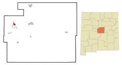
Tajique, New Mexico

Last updated

Tajique, New Mexico
CDP
San Antonio Catholic Church, Tajique NM.jpg
San Antonio Catholic Church
Torrance County New Mexico Incorporated and Unincorporated areas Tajique Highlighted.svg
Location of Tajique, New Mexico
Usa edcp location map.svg
Red pog.svg
Tajique, New Mexico
Location in the United States
Coordinates: 34°45′22″N106°17′17″W / 34.75611°N 106.28806°W / 34.75611; -106.28806
Country United States
State New Mexico
County Torrance
Area
[1]
  Total2.70 sq mi (7.00 km2)
  Land2.70 sq mi (7.00 km2)
  Water0.00 sq mi (0.00 km2)
Elevation
[2]
6,844 ft (2,086 m)
Population
 (2020) [3]
  Total106
  Density39.20/sq mi (15.14/km2)
Time zone UTC-7 (Mountain (MST))
  Summer (DST) UTC-6 (MDT)
ZIP code
87016
Area code 505
FIPS code 35-76060
GNIS feature ID2410052 [2]

Tajique is a census-designated place (CDP) in Torrance County, New Mexico, United States. The population was 148 at the 2000 census. It is part of the Albuquerque Metropolitan Statistical Area.

Contents

Geography

According to the United States Census Bureau, the CDP has a total area of 2.7 square miles (7.0 km2), all land.

History

Tajique was originally a Tiwa pueblo. The name Tajique may have been derived from the Tiwa name Tush-yit-yay. The original date of settlement is unknown. In the early 17th century, Tajique served as the seat of the San Miguel Mission. After an Apache raid in 1674, the inhabitants of the Quarai pueblo joined the Tajique pueblo, doubling the population to over 600 residents. In 1675, a subsequent Apache raid forced the abandonment of the Tajique pueblo. [4]

The Trigo Fire in April, 2008 threatened the area, and Tajique was later evacuated due to the Big Spring Fire in June of that year. The Big Spring Fire burned 5,478 acres (22.17 km2) and destroyed six homes and 10 outbuildings in Tajique. The Trigo Fire, which came near Tajique, burned 59 homes and charred 13,709 acres (55.48 km2).

Demographics

Historical population
CensusPop.Note
2020 106
U.S. Decennial Census [5] [3]

As of the census [6] of 2000, there were 148 people, 48 households, and 39 families residing in the CDP. The population density was 54.7 inhabitants per square mile (21.1/km2). There were 63 housing units at an average density of 23.3 per square mile (9.0/km2). The racial makeup of the CDP was 58.78% White, 2.03% Native American, 37.84% from other races, and 1.35% from two or more races. Hispanic or Latino of any race were 79.05% of the population.

There were 48 households, out of which 41.7% had children under the age of 18 living with them, 56.3% were married couples living together, 20.8% had a female householder with no husband present, and 16.7% were non-families. 12.5% of all households were made up of individuals, and 4.2% had someone living alone who was 65 years of age or older. The average household size was 3.08 and the average family size was 3.28.

In the CDP, the population was spread out, with 35.8% under the age of 18, 8.1% from 18 to 24, 28.4% from 25 to 44, 17.6% from 45 to 64, and 10.1% who were 65 years of age or older. The median age was 31 years. For every 100 females, there were 92.2 males. For every 100 females age 18 and over, there were 90.0 males.

The median income for a household in the CDP was $27,969, and the median income for a family was $27,969. Males had a median income of $33,000 versus $32,500 for females. The per capita income for the CDP was $7,645. There were 34.0% of families and 30.1% of the population living below the poverty line, including 34.3% of under eighteens and none of those over 64.

Related Research Articles

<span class="mw-page-title-main">Burnside, Arizona</span> CDP in Apache County, Arizona

Burnside is a native village and census-designated place (CDP) on the Navajo Nation in Apache County, Arizona, United States. The population was 537 at the 2010 census.

<span class="mw-page-title-main">Lukachukai, Arizona</span> CDP in Apache County, Arizona

Lukachukai is a census-designated place (CDP) in Apache County, Arizona, United States. The population was 1,701 at the 2010 census. It is within the Navajo Nation.

<span class="mw-page-title-main">Carnuel, New Mexico</span> Census-designated place in New Mexico, United States

Carnuel is a census-designated place (CDP) in Bernalillo County, New Mexico, United States. The population was 1,232 at the 2010 Census. It is part of the Albuquerque Metropolitan Statistical Area. Robert Julyan theorizes that name of the community, which has been spelled both Carnuel and Carnué, derives from the Tiwa word for "badger place."

<span class="mw-page-title-main">Tijeras, New Mexico</span> Village in New Mexico, United States

Tijeras is a village in Bernalillo County, New Mexico, United States. The population was 541 at the 2010 census. It is part of the Albuquerque metropolitan area.

<span class="mw-page-title-main">Paguate, New Mexico</span> Census-designated place in New Mexico, United States

Paguate is a census-designated place (CDP) in Cibola County, New Mexico, United States. The population was 421 at the 2010 census.

<span class="mw-page-title-main">Pueblo Pintado, New Mexico</span> CDP in New Mexico, United States

Pueblo Pintado is a census-designated place (CDP) in McKinley County, New Mexico, United States. The population was 247 at the 2000 census.

<span class="mw-page-title-main">Mescalero, New Mexico</span> Census-designated place in New Mexico, United States

Mescalero is a census-designated place (CDP) in Otero County, New Mexico, United States, located on the Mescalero Apache Reservation. The population was 1,338 at the 2010 census.

<span class="mw-page-title-main">Dulce, New Mexico</span> Census-designated place in New Mexico, United States

Dulce is a census-designated place (CDP) in Rio Arriba County, New Mexico, United States. The population was 2,743 at the 2010 census, almost entirely Native American. It is the largest community and tribal headquarters of the Jicarilla Apache Reservation.

<span class="mw-page-title-main">Pueblo of Sandia Village, New Mexico</span> Village in Sandoval County, New Mexico, US

Pueblo of Sandia Village is a census-designated place (CDP) in Sandoval County, New Mexico, United States. The population was 344 at the 2000 census. It is part of the Albuquerque Metropolitan Statistical Area.

<span class="mw-page-title-main">Regina, New Mexico</span> CDP in New Mexico, United States

Regina is a census-designated place (CDP)) in Sandoval County, New Mexico, United States. The population was 99 at the 2000 census. It is part of the Albuquerque Metropolitan Statistical Area. It was named for Regina, Saskatchewan.

<span class="mw-page-title-main">San Felipe Pueblo, New Mexico</span> CDP in New Mexico, United States

San Felipe Pueblo is a census-designated place (CDP) in Sandoval County, New Mexico, United States, and is located 10 miles (16 km) north of Bernalillo. As of the 2000 census, the CDP population was 2,080. It is part of the Albuquerque Metropolitan Statistical Area.

<span class="mw-page-title-main">Santa Ana Pueblo, New Mexico</span> CDP in New Mexico, United States

Santa Ana Pueblo is a census-designated place (CDP) in Sandoval County, New Mexico, United States. As of the 2000 census, the CDP had a total population of 479. It is part of the Albuquerque Metropolitan Statistical Area. The Pueblo, named Tamaya in Keres, administers a total reservation land of 73,000 acres (295 km2) in the Rio Grande valley and is composed of Native Americans who speak an eastern dialect of the Keresan languages.

<span class="mw-page-title-main">Zia Pueblo, New Mexico</span> CDP in New Mexico, United States

Zia Pueblo is a census-designated place (CDP) in Sandoval County, New Mexico, United States. The population was 646 at the 2000 census, with 310 males and 336 females. The pueblo after which the CDP is named is included within the CDP; it is listed on the National Register of Historic Places.

<span class="mw-page-title-main">Picuris Pueblo, New Mexico</span> CDP in New Mexico, United States

Picuris Pueblo is a historic pueblo in Taos County, New Mexico, United States. It is also a census-designated place (CDP) and a federally recognized tribe of Native American Pueblo people. The 2010 census estimated that 68 people lived in the CDP, while 267 people in the U.S. reported being of the tribal group Picuris alone and 439 reported being of the tribal group Picuris alone or in combination with other groups. Picurís Pueblo is a member of the Eight Northern Pueblos. Their own name for their pueblo is P'įwweltha, meaning "mountain warrior place" or "mountain pass place." They speak the Picuris dialect of the Northern Tiwa language, part of the Kiowa-Tanoan language family.

<span class="mw-page-title-main">Taos Pueblo, New Mexico</span> CDP in New Mexico, United States

Taos Pueblo is a census-designated place (CDP) in Taos County, New Mexico, just north of Taos. The population was 1,264 at the 2000 census.

<span class="mw-page-title-main">Manzano, New Mexico</span> CDP in New Mexico, United States

Manzano is a census-designated place (CDP) in Torrance County, New Mexico, United States. The population was 54 at the 2000 census. The Quarai Ruins of Salinas Pueblo Missions National Monument are located near the town. The center of population of New Mexico is located in Manzano.

<span class="mw-page-title-main">Torreon, Torrance County, New Mexico</span> Census-designated place in Torrance County, New Mexico, United States

Torreon is a farming community and census-designated place (CDP) in Torrance County, New Mexico, United States. The population was 244 at the 2000 census. It is part of the Albuquerque Metropolitan Statistical Area.

<span class="mw-page-title-main">Morrisville, Greene County, Pennsylvania</span> Census-designated place in Pennsylvania, United States

Morrisville is a census-designated place (CDP) in Franklin Township, Greene County, Pennsylvania, United States. The population was 1,265 at the 2010 census.

Dixonville is an unincorporated community in Indiana County, Pennsylvania, United States. The area is recorded as the "Dicksonville" census-designated place (CDP), with a population of 467 at the 2010 census. The CDP lies mostly on the western edge of Green Township, though a small portion extends west into Rayne Township.

<span class="mw-page-title-main">Jemez Pueblo, New Mexico</span> CDP in New Mexico, United States

Jemez Pueblo is a census-designated place (CDP) in Sandoval County, New Mexico, United States. The population was 1,788 at the 2010 census. It is part of the Albuquerque Metropolitan Statistical Area.

References

  1. "ArcGIS REST Services Directory". United States Census Bureau. Retrieved October 12, 2022.
  2. 1 2 U.S. Geological Survey Geographic Names Information System: Tajique, New Mexico
  3. 1 2 "Census Population API". United States Census Bureau. Retrieved October 12, 2022.
  4. Hodge, Fredrick Webb: "Handbook of American Indians North of Mexico", Vol 4 page 673. Digital Scanning Inc, 2003.
  5. "Census of Population and Housing". Census.gov. Retrieved June 4, 2016.
  6. "U.S. Census website". United States Census Bureau . Retrieved January 31, 2008.