Agwara

Last updated

Agwara
Kpacharka
LGA and town
Nickname: 
AGR CITY
Nigeria location map.svg
Red pog.svg
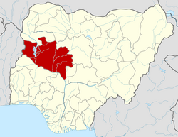
Agwara
Location in Nigeria
Coordinates: 10°42′N4°35′E / 10.700°N 4.583°E / 10.700; 4.583
CountryFlag of Nigeria.svg  Nigeria
State Niger State
Government
  Local Government Chairman and the Head of the Local Government CouncilAlh. Nura Mohammed
Area
  Total1,538 km2 (594 sq mi)
Population
 (2006 census)
  Total67,413
Time zone UTC+1 (WAT)
3-digit postal code prefix
923
ISO 3166 code NG.NI.AW
Agwara

Agwara (or Agwarra) is a Local Government Area in Niger State, Nigeria. Its headquarters are in the town of Agwara.

It has an area of 1,538 km2 and a population of 57,413 at the 2006 census.

The postal code of the area is 923. [1]

Climate

The climate is hot and oppressive, with a wet season that is overcast and partly cloudy, and a dry season that is partly cloudy. [2] [3]

A daily maximum temperature of 97°F is typical during the 2.3-month hot season, which runs from February 24 to May 2. April has an average high temperature of 99°F and low temperature of 80°F, making it the hottest month of the year in Agwara. [4] [2]

A daily high temperature below 88°F is typical during the 2.8-month cool season, which runs from July 3 to September 27. December, with an average low of 66°F and high of 90°F, is the coldest month of the year in Agwara. [2]

Related Research Articles

Suleja is a city in Niger State, Nigeria, pop. (2016) local government area, 260,240, just north of Abuja, capital of the Suleja Emirate. It is sometimes confused with the nearby city of Abuja, due to its proximity, and the fact that it was originally called Abuja before the Nigerian government adopted the name from the then Emir Sulayman Bal for its new federal capital in 1976.

Bida is a Local Government Area in Niger State, Nigeria and a city on the A124 highway which occupies most of the area.

<span class="mw-page-title-main">Gboko</span> Place in Benue State, Nigeria

Gboko is a Local Governments Area is in Benue state. North-central Nigeria. Its headquarters in the town of Gboko.

Agaie is a Local Government Area in Niger State, Nigeria. Its headquarters are in the town of Agaie on the A124 highway.

<span class="mw-page-title-main">Ganye</span> LGA and town in Adamawa State, Nigeria

Ganye is a town and Local Government Area of Adamawa State, Nigeria. Jada and Toungo Local Governments were carved out from Ganye local government area of Adamawa state Nigeria. Ganye is bordered by Jada Local Government Area to the North and East, Toungo Local Government Area to the South and Taraba State to the West. It is the headquarter of the Sama (Chamba) people worldwide.

Gombi is the Local Government Headquarter of Gombi Local Government Area of Adamawa State, Nigeria.

<span class="mw-page-title-main">Mubi North</span> LGA in Adamawa State, Nigeria

Mubi North is a Local Government Area of Adamawa State, Nigeria. The town is the location of the Adamawa State University and the Federal Polytechnic, Mubi.

Alkaleri is a Local Government Area of Bauchi State, Nigeria. Its headquarters are in the town of Alkaleri on the A345 highway in the north of the area at10°15′58″N10°20′07″E.The northeasterly line of equal latitude and longitude passes through the Local Government Area.

Birnin Gwari is a Local Government Area in Kaduna State, Nigeria. Its headquarters are in the town of Birnin Gwari.

Karu is a Local Government Area in Nasarawa State, central Nigeria. It is close in proximity to the Federal Capital Territory of Nigeria. It has an area of 2,640 km2. Karu local government has its headquarters in New Karu town. It was originally built to house the capital's civil servants and lower income families, but had no running water or good sanitation system. Karu has grown in population beyond its original planned capacity. Ensure Administrative convenience and bring government closer to the grass root people, Karshi Development Area was created with its administrative secretariat at Uke.

Chanchaga is a Local Government Area in Niger State, Nigeria. Its headquarters is in the state capital of Minna which occupies much of the Local Government Area.

Wushishi is a Local Government Area in Niger State, Nigeria. Its headquarters is in the town of Wushishi.

Rijau is a Local Government Area in Niger State, Nigeria. Its headquarters are in the town of Rijau.

Mokwa is a Local Government Area in Niger State, Nigeria. Its headquarters are in the town of Mokwa on the A1 highway in the west of the area.

Anka is a Local Government Area in Zamfara State, Nigeria. Its headquarters are in the town of Anka at 12°06′30″N5°56′00″E.

Tsafe is a Local Government Area L G A) in Zamfara State, Nigeria. Its headquarters is in the town of Chafe at11°56′00″N6°54′00″E. It has an area of 1,698 km2 and a population of 266,008 at the 2006 census. The postal code of the area is 880.

Birnin Magaji/Kiyaw is a Local Government Area in Zamfara State, Nigeria. Its headquarters are in the town of Birnin Magaji in the north of the LGA at12°33′00″N6°49′00″E. The LGA is also named from the town of Kiyaw to the south.

Ede North is a Local Government Area in Osun State, Nigeria. Its headquarters as Abere.

<span class="mw-page-title-main">Kumo, Nigeria</span> City

.

Apomu is a medium-sized town in the Osun state. It has a population of about 71,656 people.

References

  1. "Post Offices- with map of LGA". NIPOST. Archived from the original on 7 October 2009. Retrieved 2009-10-20.
  2. 1 2 3 "Agwara Climate, Weather By Month, Average Temperature (Nigeria) - Weather Spark". weatherspark.com. Retrieved 2023-09-10.
  3. "Weather Archive Agwara". meteoblue. Retrieved 2023-09-10.
  4. "Monthly climate in Agwara, Niger, Nigeria". nomadseason.com. Retrieved 2023-09-27.

2.

By Bello Usman Gidi

By Lukman Umar Atako