Mashegu | |
|---|---|
LGA and town | |
 Interactive map of Mashegu | |
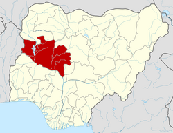
 Mashegu Location in Nigeria | |
| Coordinates: 9°57′N5°13′E / 9.950°N 5.217°E | |
| Country | |
| State | Niger State |
| Government | |
| • Local Government Chairman and the Head of the Local Government Council | Shuaibu Haruna Kulho |
| Area | |
• Total | 9,182 km2 (3,545 sq mi) |
| Population (2006 census) | |
• Total | 215,022 |
| Time zone | UTC+1 (WAT) |
| 3-digit postal code prefix | 923 |
| ISO 3166 code | NG.NI.MS |
Mashegu is a Local Government Area in Niger State, Nigeria. Its headquarters are in the town of Mashegu in the east of the area. Mashegu is bounded by the Niger River in the west and the Kaduna River in the northeast.
Contents
It has an area of 9,182 km2 and a population of 215,022 at the 2006 census.
The postal code of the area is 923. [1]