Borgu Local Government Area

Last updated

Borgu
Nigeria location map.svg
Red pog.svg
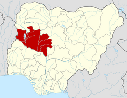
Borgu
Location in Nigeria
Coordinates: 9°53′N4°31′E / 9.883°N 4.517°E / 9.883; 4.517
CountryFlag of Nigeria.svg  Nigeria
State Niger State
Government
  Local Government Chairman and the Head of the Local Government CouncilAliyu Umar Wara
  Emir (Sarkin Borgu)Haliru Dantoro Kitoro III dan Muhammadu Sani
Area
  Total10,992 km2 (4,244 sq mi)
Population
 (2022 est) [1]
  Total296,500
  Density27/km2 (70/sq mi)
Time zone UTC+1 (WAT)
3-digit postal code prefix
913
Borgu Local Government Area

The Borgu Local Government Area is an administrative region in Niger State, Nigeria, It is one of the 25 Local Government Areas (LGAs) in the state, with the headquarter situated in the town of New Bussa. The postal code is 913. [2] The Borgu LGA was formerly part of Kwara State, but on 27 August 1991 it was transferred to Niger State. [3]

The LGA has the same extent as the Borgu Emirate, a Nigerian traditional state. [4] It contains part of the Borgu Game Reserve, a section of the Kainji National Park. [5]

In the 1991 census Borgu LGA had a total population of 110,000, with a mixed ethnic population as follows: [4]

Climate/Geography

The dry and wet seasons are the two main ones in Borgu Local Government Area. Borgu Local Government Area has an average humidity of 38% and an average wind speed of 13 km/h. The region's average temperature is 30 degrees Celsius.

Related Research Articles

<span class="mw-page-title-main">Kogi State</span> State of Nigeria

Kogi State is a state in the North Central region of Nigeria, bordered to the west by the states of Ekiti and Kwara, to the north by the Federal Capital Territory, to the northeast by Nasarawa State, to the northwest by Niger State, to the southwest by the Edo and Ondo states, to the southeast by the states of Anambra and Enugu, and to the east by Benue State. It is the only state in Nigeria to border ten other states. Named for the Hausa word for river (Kogi). Kogi State was formed from parts of Benue State, Niger State, and Kwara State on 27 August 1991. The state is nicknamed the "Confluence State" due to the fact that the confluence of the River Niger and the River Benue occurs next to its capital, Lokoja.

<span class="mw-page-title-main">Federal Capital Territory (Nigeria)</span> Federal territory of Nigeria

The Federal Capital Territory (FCT) is a federal territory in central Nigeria. Abuja, the capital city of Nigeria, is located in this territory. The FCT was formed in 1976 from parts of the states of old Kaduna, Kwara, Niger, and Plateau states, with the bulk of land mass carved out of Niger state. The Federal Capital Territory is within the North Central region of the country. Unlike other states of Nigeria, which are headed by elected Governors, it is administered by the Federal Capital Territory Administration, headed by a minister, who is appointed by the president.

<span class="mw-page-title-main">Benue State</span> State of Nigeria

Benue State is one of the North Central states in Nigeria with a population of about 4,253,641 in 2006 census. The state was created in 1976 among the seven states created at that time. The state derives its name from the Benue River which is the second largest river in Nigeria after the River Niger. The state borders Nasarawa State to the North; Taraba State to the East; Kogi State to the West; Enugu State to the South-West; Ebonyi and Cross-Rivers States to the South; and has an international border with Cameroon to the South-East. It is inhabited predominantly by the Tiv, Idoma,and Igede. Minority ethnic groups in Benue are Etulo, Igbo, Jukun peoples etc. Its capital is Makurdi. Benue is a rich agricultural region; popularly grown crops include: oranges, mangoes, sweet potatoes, cassava, soya bean, guinea corn, flax, yams, sesame, rice, groundnuts, and Palm tree.

<span class="mw-page-title-main">Niger State</span> State of Nigeria

Niger is a state in the North Central region of Nigeria and the largest state in the country by area. Niger state has three political zones, zone A, B and C. The state's capital is at Minna. Other major cities are Bida, Kontagora and Suleja. It was formed in 1976 when the then North-Western State was divided into Niger State and Sokoto State. It is home to Ibrahim Babangida and Abdulsalami Abubakar, two of Nigeria's former military rulers. The Nupe, Gbagyi, Kamuku, Kambari, Gungawa, Hun-Saare, Hausa and Koro form the majority of numerous indigenous tribes of Niger State.

<span class="mw-page-title-main">Kebbi State</span> State of Nigeria

Kebbi State is a state in northwestern Nigeria. Kebbi State is bordered east and north of Sokoto and Zamfara states, and to the south by Niger state while its western border forms part of the national borders with Benin Republic for 103 km and Niger for 207 km. Named for the city of Birnin Kebbi—the state's capital and largest city, Kebbi state was formed from Sokoto state on 27 August 1991. Of the 36 states of Nigeria, Kebbi is the tenth largest in area and 22nd most populous, with an estimated population of about 4.4 million as of 2016. The state is known as land of equity.

<span class="mw-page-title-main">Kwara State</span> State of Nigeria

Kwara State is a state in Western Nigeria, bordered to the east by Kogi State, to the north by Niger State, and to the south by Ekiti, Osun, and Oyo states, while its western border makes up part of the international border with Benin Republic. Its capital is the city of Ilorin and the state has 16 local government areas.

<span class="mw-page-title-main">Sokoto State</span> State of Nigeria

SokotoState is one of the 36 states of Nigeria, located in the extreme northwest of the country. Bounded by Republic of the Niger to the north and west for 363 km, and the states of Zamfara to the east, and Kebbi to the south and west, partly across the Ka River. Its capital and largest city is the city of Sokoto. Sokoto is located near to the confluence of the Sokoto River and the Rima River. As of 2022 it has an estimated population of more than 6.3 million.

<span class="mw-page-title-main">Kainji Lake</span> Reservoir

Kainji Lake, in North Central Nigeria, is a reservoir on the Niger River, formed by the Kainji Dam. It was formed in 1968 and is a part of Niger State and Kebbi State. Kainji Lake National Park (KNLP), situated around the lake, is Nigeria's oldest National Park, established in 1976.

<span class="mw-page-title-main">Kainji National Park</span> National park in Nigeria

Kainji National Park is a national park in Niger State and Kwara State, Nigeria. Established in 1978, it covers an area of about 5,341 km2 (2,062 sq mi). The park includes three distinct sectors: a part of the Kainji Lake in which fishing is restricted, the Borgu Game Reserve to the west of the lake, and the Zugurma Game Reserve to the southeast.

New Bussa is a town in Niger State, Nigeria. It is the new site of Bussa after the Kainji Lake dam set the previous location underwater. As of 2007 New Bussa had an estimated population of 24,449. New Bussa is the headquarters of the Borgu Emirate and the Borgu Local Government Area.

Busa, or Bisã, is the Mande language of the former Borgu Emirate in northwestern Nigeria and northern Benin. It is called Busanci in Hausa, and has also been called Zugweya.

<span class="mw-page-title-main">Baruten</span> LGA in Kwara State, Nigeria

Baruten is a local government area in the North Central district of Kwara State, Nigeria, sharing a long border with the Republic of Benin. The local government begins in Ilesha Baruba and ends in Chikanda, the border town. Its headquarters is in the town of Kosubosu.

Mariga is a Local Government Area in Niger State, Nigeria. Its headquarters are in the town of Bangi in the north of the area. Other towns in the LGA are Igwama and Inkwai. Various endangered Kamuku languages are spoken in Mariga LGA.

Mokwa is a Local Government Area in Niger State, Nigeria. Its headquarters are in the town of Mokwa on the A1 highway in the west of the area.

Bariba, also known as Baatonum, is the language of the Bariba people of Benin and Nigeria and was the language of the state of Borgu.

The Borgu Game Reserve is a section of the Kainji National Park, in the Borgu Local Government Area of Niger State and Baruten Local Government Area of Kwara State, Nigeria. It is bordered on the east by Kainji Lake and reaches almost to the border with Benin to the west, covering 397,002 hectares. It was amalgamated with the Zugurma Game Reserve in 1975 to form the Kainji Lake National Park.

The Zugurma Game Reserve is a section of the Kainji National Park, in the Mariga Local Government Area of Niger State, Nigeria. It is bordered by the Kontagora River to the northwest and the Manyara River to the north, and covers an area of 138,500 hectares. It was amalgamated with the Borgu Game Reserve in 1975 to form the Kainji Lake National Park.

Reshe is the most divergent of the Kainji languages of Nigeria. It is spoken on the northern and southern sides of Kainji Lake. It is spoken in Yauri LGA, Kebbi State, and in Borgu LGA, Niger State.

The Shingini language, is a Kainji language of Nigeria spoken by the Kambari people. Its two dialects are Tsishingini and Cishingini (Chishingini).

References

  1. "Borgu (Local Government Area in Nigeria)". www.citypopulation.de. Retrieved 5 February 2024.
  2. "Post Offices- with map of LGA". NIPOST. Archived from the original on 7 October 2009. Retrieved 21 October 2010.
  3. "Kwara State". Online Nigeria. 2 April 2003. Archived from the original on 15 March 2015. Retrieved 21 October 2010.
  4. 1 2 Ross Jones. "The ethnic groups of present day Borgu" (PDF). Archived from the original (PDF) on 12 January 2011. Retrieved 21 October 2010.
  5. "Kainji Lake National Park". United Nations Environment Programme: World Conservation Monitoring Centre. Archived from the original on 30 September 2007. Retrieved 21 October 2010.