Albertson, New York

Last updated

Albertson, New York
Albertson Welcome Sign, Albertson, Long Island, New York.jpg
A welcome sign to Albertson on Willis Avenue on June 12, 2021.
Nassau County New York incorporated and unincorporated areas Albertson highlighted.svg
Location in Nassau County and the state of New York
Location map Long Island.png
Red pog.svg
Albertson, New York
Location on Long Island
USA New York location map.svg
Red pog.svg
Albertson, New York
Location within the state of New York
Coordinates: 40°46′14″N73°38′55″W / 40.77056°N 73.64861°W / 40.77056; -73.64861
Country Flag of the United States.svg  United States
State Flag of New York.svg  New York
County Nassau
Town North Hempstead
Area
[1]
  Total0.68 sq mi (1.76 km2)
  Land0.68 sq mi (1.76 km2)
  Water0.00 sq mi (0.00 km2)
Elevation
128 ft (39 m)
Population
 (2020)
  Total5,220
  Density7,687.78/sq mi (2,968.34/km2)
Demonym Albertsonian
Time zone UTC-5 (Eastern (EST))
  Summer (DST) UTC-4 (EDT)
ZIP code
11507
Area code(s) 516, 363
FIPS code 36-01011
GNIS feature ID0942241

Albertson is a hamlet and census-designated place (CDP) in the Town of North Hempstead in Nassau County, on Long Island, in New York, United States. The population was 5,220 at the time of the 2020 census.

Contents

History

The first European settler was John Seren who came from Connecticut in 1644. Later Townsend Albertson started a farm and gristmill and the community became known as Albertson. [2]

In 1850, a road was built through Albertson on the lands of Isaac Underhill Willets. The road is still known as I.U. Willets Road. (Willets complained that Long Island has more roads than it would ever need). The Long Island Rail Road opened an Albertson train station in 1864. [2]

In 1908, the Vanderbilt Motor Parkway was built on the southern border of Albertson. In 1938, it was closed, and in 1940, it was replaced by the Northern State Parkway, which runs along the northern border of Albertson.

In 1946, suburbanization began with a small development by William Levitt. The last farms were developed in the mid-1960s. [2]

The Searingtown School (now in Albertson) was one of the schools involved in the landmark Supreme Court case Engel v. Vitale (1962), which disallowed government-directed prayers in public schools. [3]

Geography

U.S. Census map of Albertson. Albertson-ny-map.png
U.S. Census map of Albertson.

According to the United States Census Bureau, the CDP has a total area of 0.7 square miles (1.8 km2), all land. [4]

Albertson is located south & west of Roslyn Heights, east of Searingtown, and north of Williston Park. [4] [5]

Demographics

Historical population
CensusPop.Note
2020 5,220
U.S. Decennial Census [6]

As of the census [4] of 2010, there were 5,182 people, 1,812 households, and 1,442 families residing in the CDP. The population density was 7,866.8 inhabitants per square mile (3,037.4/km2). There were 1,853 housing units at an average density of 2,803.3 per square mile (1,082.4/km2). The racial makeup of the CDP was 70.4% White, 24.3% Asian, 0.3% African American, 0.02% Native American, 1.27% from other races, and 1.83% from two or more races. Hispanic or Latino of any race were 5.50% of the population.

There were 1,812 households, out of which 33.6% had children under the age of 18 living with them, 67.7% were married couples living together, 8.4% had a female householder with no husband present, and 20.4% were non-families. 17.9% of all households were made up of individuals, and 11.3% had someone living alone who was 65 years of age or older. The average household size was 2.87 and the average family size was 3.27.

In the CDP, the population was spread out, with 22.5% under the age of 18, 6.4% from 18 to 24, 27.1% from 25 to 44, 24.6% from 45 to 64, and 19.4% who were 65 years of age or older. The median age was 42 years. For every 100 females, there were 93.7 males. For every 100 females age 18 and over, there were 90.8 males.

The median income for a household in the CDP was $66,516, and the median income for a family was $77,516. Males had a median income of $55,000 versus $44,792 for females. The per capita income for the CDP was $31,222. About 4.5% of families and 4.7% of the population were below the poverty line, including 5.4% of those under age 18 and 5.5% of those age 65 or over.

Parks and recreation

Government

Town representation

As Albertson is an unincorporated hamlet, it has no government of its own, and is instead governed directly by the Town of North Hempstead in Manhasset. [5] [7]

Albertson is located within the Town of North Hempstead's 2nd council district, which as of January 2024 is represented on the North Hempstead Town Council by Edward Scott (R–Albertson). [7]

Representation in higher government

County representation

Albertson is primarily located within Nassau County's 9th Legislative district, which as of September 2022 is represented in the Nassau County Legislature by Richard Nicoello (RNew Hyde Park). [5] [8] However, the southeastern portion of the hamlet is located within Nassau County's 10th Legislative district, which as of September 2022 is represented in the Nassau County Legislature by Mazi Melesa Pilip (R–Great Neck). [5] [9] [10]

New York State representation

New York State Assembly

Albertson is split between the New York State Assembly's 16th and 19th State Assembly districts, which as of September 2022 are represented by Gina Sillitti (DManorhaven) and Edward Ra (RGarden City South), respectively. [5] [11] [12]

New York State Senate

Albertson is located in the New York State Senate's 7th State Senate district, which as of January 2024 is represented in the New York State Senate by Jack M. Martins (R–Mineola). [5] [13]

Federal representation

United States Congress

Albertson is located in New York's 3rd congressional district, which has had no representation in the United States Congress since the expulsion of George Santos on December 1, 2023. [5]

United States Senate

Like the rest of New York, Albertson is represented in the United States Senate by Charles E. Schumer (D) and Kirsten Gillibrand (D). [14]

Politics

Politically, Albertson is almost evenly split. [15] In the 2008 presidential election Democrat Barack Obama won 51% of the vote to Republican John McCain's 48%. [15]

Education

School districts

The Mineola UFSD's Meadow Drive Elementary School, which is located within the hamlet. Meadow Drive School, Albertson, Long Island, New York October 9, 2021 A.jpg
The Mineola UFSD's Meadow Drive Elementary School, which is located within the hamlet.

Albertson is located within the boundaries of (and is thus served by) the Mineola Union Free School District, the East Williston Union Free School District, the Herricks Union Free School District, and the Roslyn Union Free School District. [5] As such, children who reside within the hamlet and attend public schools will go to school in one of these four school districts depending on where they live within the hamlet. [5]

Library districts

Albertson is located within the boundaries of (and is thus served by) Roslyn's library district (the Bryant Library) and the Shelter Rock Library District. [5] The area of the hamlet located served by the Roslyn Union Free School District is served by the Bryant Library, and the areas of the hamlet served by the Herricks and Mineola Union Free School Districts are served by the Shelter Rock Public Library. [5]

Infrastructure

Transportation

Road

The Northern State Parkway forms the hamlet's northern border with Roslyn Heights. [5] [16] Other major roads which pass through the hamlet include I.U. Willets Road and Willis Avenue. [5] [16]

Additionally, the Long Island Motor Parkway used to run through the hamlet.

Rail

The Albertson Long Island Rail Road station in 2012. Albertson LIRR Xing jeh.jpg
The Albertson Long Island Rail Road station in 2012.

Albertson is served by the Albertson station on the Long Island Rail Road's Oyster Bay Branch. [5]

Bus

Roslyn Estates is served by the n23 bus route, which is operated by Nassau Inter-County Express (NICE). [17] This bus route travels along Willis Avenue through the hamlet, following the route of the former New York & North Shore Traction Company's trolley route between Mineola and Roslyn, which ran through the area in the early 20th century. [5] [17]

Utilities

Natural gas

National Grid USA provides natural gas to homes and businesses that are hooked up to natural gas lines in Albertson. [18] [19]

Power

PSEG Long Island provides power to all homes and businesses within Albertson. [18] [20]

Sewage

Albertson in its entirety is connected to the Nassau County Sewage District's sanitary sewer network. [5]

Water

Albertson is primarily located within the boundaries of the Albertson Water District. [5] However, smaller portions are served by the Garden City Park Water District, the Roslyn Water District, and the Village of Williston Park's water system. [5]

Notable people

Related Research Articles

<span class="mw-page-title-main">Nassau County, New York</span> County in New York, United States

Nassau County is a suburban county located on Long Island, immediately to the east of New York City. As of the 2020 United States census, Nassau County's population was 1,395,774, making it the sixth-most populous county in the State of New York, and reflecting an increase of 56,242 (+4.2%) from the 1,339,532 residents enumerated at the 2010 census. Its county seat is Mineola, while the county's largest town is Hempstead. Along with the remainder of Long Island, Nassau County lies in the southeastern portion of New York State.
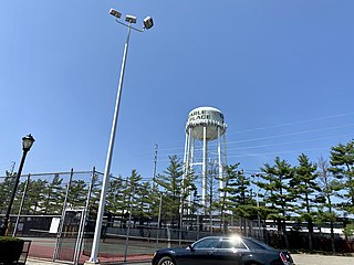
<span class="mw-page-title-main">Carle Place, New York</span> Hamlet and census-designated place in New York, United States

Carle Place is a hamlet and census-designated place (CDP) in the Town of North Hempstead in Nassau County, on Long Island, in New York, United States. The CDP's population was 5,005 at the time of the 2020 census.

<span class="mw-page-title-main">East Hills, New York</span> Village in New York, United States

East Hills is a village in Nassau County, on the North Shore of Long Island, in New York, United States. It is considered part of the Greater Roslyn area, which is anchored by the Incorporated Village of Roslyn. The population was 7,284 at the time of the 2020 census.

<span class="mw-page-title-main">Greenvale, New York</span> Hamlet and census-designated place in New York, United States

Greenvale is a hamlet and census-designated place (CDP) in the towns of North Hempstead and Oyster Bay in Nassau County, on the North Shore of Long Island, in New York, United States. It is considered part of the Greater Roslyn area, which is anchored by the Incorporated Village of Roslyn. The population was 1,069 at the time of the 2020 census.

<span class="mw-page-title-main">Harbor Hills, New York</span> Hamlet and census-designated place in New York, United States

Harbor Hills is a hamlet and census-designated place (CDP) located on the Great Neck Peninsula within the Town of North Hempstead in Nassau County, on the North Shore of Long Island, in New York, United States. The population was 575 at the 2010 census.
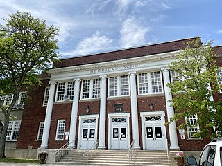
<span class="mw-page-title-main">Herricks, New York</span> Hamlet and census-designated place in New York, United States

Herricks is a hamlet and census-designated place (CDP) in Nassau County, on Long Island, in New York, United States. The population was 4,398 at the 2020 census.

<span class="mw-page-title-main">Manhasset Hills, New York</span> Hamlet and census-designated place in New York, United States

Manhasset Hills is a hamlet and census-designated place (CDP) in the Town of North Hempstead in Nassau County, on Long Island, in New York, United States. The population was 3,592 at the 2010 census. Neighboring communities include Herricks, North Hills, North New Hyde Park, and Lake Success.

<span class="mw-page-title-main">North Hempstead, New York</span> Town in New York, United States

North Hempstead is one of three towns in Nassau County, on Long Island, in New York, United States. The population was 237,639 at the time of the 2020 census. It is the 7th largest city or town in New York by population.
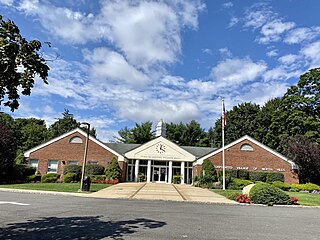
<span class="mw-page-title-main">North Hills, New York</span> Village in New York, United States

North Hills is a village in the Town of North Hempstead in Nassau County, on the North Shore of Long Island, in New York, United States. The population was 5,464 at the 2020 census.

<span class="mw-page-title-main">Port Washington, New York</span> Hamlet and CDP in Nassau County, New York

Port Washington is a hamlet and census-designated place (CDP) on the Cow Neck Peninsula in the Town of North Hempstead, in Nassau County, on the North Shore of Long Island, in New York. The hamlet is the anchor community of the Greater Port Washington area. The population was 16,753 at the 2020 census.

<span class="mw-page-title-main">Roslyn, New York</span> Village in the United States

Roslyn is a village in the Town of North Hempstead in Nassau County, on the North Shore of Long Island, in New York, United States. It is the Greater Roslyn area's anchor community. The population was 2,988 at the 2020 census.
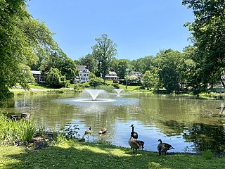
<span class="mw-page-title-main">Roslyn Estates, New York</span> Village in New York, United States

Roslyn Estates is a village in the Town of North Hempstead in Nassau County, on the North Shore of Long Island, in New York, United States. It is considered part of the Greater Roslyn area, which is anchored by the Incorporated Village of Roslyn. The population was 1,318 at the 2020 census.

<span class="mw-page-title-main">Roslyn Harbor, New York</span> Village in New York, United States

Roslyn Harbor is a village in Nassau County, on the North Shore of Long Island, in New York, United States. It is considered part of the Greater Roslyn area, which is anchored by the Incorporated Village of Roslyn. The population was 1,051 at the 2010 census.

<span class="mw-page-title-main">Roslyn Heights, New York</span> Hamlet and census-designated place in New York, United States

Roslyn Heights is a hamlet and census-designated place (CDP) in the Town of North Hempstead in Nassau County, on the North Shore of Long Island, in New York, United States. It is considered part of the Greater Roslyn area, which is anchored by the Incorporated Village of Roslyn. The population was 6,747 at the time of the 2020 census.

<span class="mw-page-title-main">Saddle Rock Estates, New York</span> Hamlet and census-designated place in New York, United States

Saddle Rock Estates is a hamlet and census-designated place (CDP) located on the Great Neck Peninsula within the Town of North Hempstead in Nassau County, on the North Shore of Long Island, in New York, United States. The population was 466 at the 2010 census.

<span class="mw-page-title-main">Searingtown, New York</span> Hamlet and census-designated place in New York, United States

Searingtown is a hamlet and census-designated place (CDP) in the Town of North Hempstead in Nassau County, on Long Island, in New York, United States. It is considered part of the Greater Roslyn area, which is anchored by the Village of Roslyn. The population was 4,915 at the 2010 census.

<span class="mw-page-title-main">University Gardens, New York</span> Hamlet and census-designated place in New York, United States

University Gardens is a hamlet and a census-designated place (CDP) in Nassau County, on the North Shore of Long Island, in New York, United States. It is located within the Town of North Hempstead and is part of the Greater Great Neck area. The population was 4,358 at the time of the 2020 census.

<span class="mw-page-title-main">Strathmore, New York</span> Hamlet in New York, United States

Strathmore is an unincorporated, Levitt & Sons-developed hamlet in the Town of North Hempstead in Nassau County, on the North Shore of Long Island, in New York, United States, within the census-designated place (CDP) of Manhasset.

<span class="mw-page-title-main">County Route E64 (Nassau County, New York)</span>

County Route E64 is a major, 4.51-mile (7.26 km) county road between the Incorporated Villages of Mineola and Flower Hill, in Nassau County, on Long Island, New York. It is owned by Nassau County and maintained by the Nassau County Department of Public Works.

<span class="mw-page-title-main">I.U. Willets Road</span> Road on Long Island, New York

I.U.Willets Road is a major west–east road between the Villages of North Hills and Old Westbury in the Town of North Hempstead, in Nassau County, on the North Shore of Long Island, in New York, United States.

References

  1. "ArcGIS REST Services Directory". United States Census Bureau. Retrieved September 20, 2022.
  2. 1 2 3 Newsday; Staff, Newsday (1999). Home Town Long Island: The History of Every Community on Long Island in Stories and Photographs. Newsday. ISBN   978-1-885134-21-9.
  3. Bezanson, Randall (2007). How Free Can Religion Be?. University of Illinois Press. ISBN   978-0-252-07520-9.
  4. 1 2 3 "U.S. Census website". United States Census Bureau . Retrieved January 31, 2008.
  5. 1 2 3 4 5 6 7 8 9 10 11 12 13 14 15 16 17 18 19 "Long Island Index: Interactive Map". www.longislandindexmaps.org. Retrieved October 31, 2021.
  6. "Census of Population and Housing". Census.gov. Retrieved June 4, 2016.
  7. 1 2 "Town of North Hempstead - Councilman Peter J. Zuckerman (2nd District)". www.northhempsteadny.gov. Retrieved June 29, 2021.
  8. "District 9 - Richard J. Nicolello | Nassau County, NY - Official Website". www.nassaucountyny.gov. Retrieved July 22, 2021.
  9. "District 10 - Mazi Melesa Pilip | Nassau County, NY - Official Website". www.nassaucountyny.gov. Retrieved March 11, 2022.
  10. Kornbluh, Jacob (November 29, 2021). "This one-time refugee and former Israeli paratrooper just won a seat in her county legislature". The Forward. Retrieved March 11, 2022.
  11. "Gina L. Sillitti - Assembly District 16 |Assembly Member Directory | New York State Assembly". nyassembly.gov. Retrieved July 22, 2021.
  12. "Edward P. Ra - Assembly District 19 |Assembly Member Directory | New York State Assembly". nyassembly.gov. Retrieved July 22, 2021.
  13. "NY Senate District 7". NY State Senate. Retrieved January 10, 2024.
  14. "U.S. Senate: Contacting U.S. Senators". www.senate.gov. Retrieved July 22, 2021.
  15. 1 2 Welch, Will (November 8, 2017). "How Long Island Voted". Newsday. Retrieved October 16, 2020.
  16. 1 2 "Nassau County Road Jurisdiction Viewer". County of Nassau, New York. Archived from the original on May 9, 2019. Retrieved July 21, 2021.
  17. 1 2 "Nassau Inter-County Express - Maps and Schedules". nicebus.com. Retrieved August 10, 2020.
  18. 1 2 "Long Island Utility Information - LIPA, Nat Grid, & Local Water Authorities". LongIsland.com. Retrieved October 24, 2020.
  19. "Natural Gas & Electricity | National Grid". www.nationalgridus.com. Retrieved July 21, 2021.
  20. "Home Page - PSEG Long Island". www.psegliny.com. Retrieved July 21, 2021.
  21. "Danny Masterson, Former Albertson Resident, Sentenced 30 Years For Rape". Nassau Daily Voice. September 7, 2023. Retrieved September 7, 2023.
  22. "Danny Masterson gets 30 years to life for rape after emotional victim statements". ABC News. September 7, 2023. Retrieved September 7, 2023.
  23. "Rick Pasqualone". IMDb. Retrieved March 2, 2021.