Ampriani

Last updated

Ampriani
Ampriani Village Plaine.jpg
Ampriani and the Tallone plain
Location of Ampriani
Ampriani
France location map-Regions and departements-2016.svg
Red pog.svg
Ampriani
Corse region location map.svg
Red pog.svg
Ampriani
Coordinates: 42°15′06″N9°21′26″E / 42.2517°N 9.3572°E / 42.2517; 9.3572
Country France
Region Corsica
Department Haute-Corse
Arrondissement Corte
Canton Ghisonaccia
Intercommunality Oriente
Government
  Mayor (20202026) Pierre François Dompietrini [1]
Area
1
2 km2 (0.8 sq mi)
Population
 (Jan. 2020) [2]
25
  Density13/km2 (32/sq mi)
Time zone UTC+01:00 (CET)
  Summer (DST) UTC+02:00 (CEST)
INSEE/Postal code
2B015 /20272
Elevation320–749 m (1,050–2,457 ft)
(avg. 560 m or 1,840 ft)
1 French Land Register data, which excludes lakes, ponds, glaciers > 1 km2 (0.386 sq mi or 247 acres) and river estuaries.

Ampriani is a commune in the Haute-Corse department on the island of Corsica, France.

Contents

Geography

Ampriani is a commune on the eastern side of Corsica in the heart of the Pieve (religious jurisdiction) in the Serra in the canton of Moita Verde. It is 30 km by road north-west from Aleria and significantly less in a direct line and 16 km south-west of Moïta in the Valley of the Cursigliese. Access is by the D116 road from Tallone in the south-east which continues north of the village north-west to Zuani. Ampriani is a small village of a single row of houses with a watchtower aligned on a ridge at an altitude of about 600 metres (lowest point 320 m, highest point: 749 m) overlooking the valley and almost the entire plain. The village is nearly deserted in winter, but has about a hundred people in summer. The road leading to the village is a dead end and ends on the old "helicopter pad". The terrain in the commune is rugged and heavily forested. [3]

Neighbouring communes and villages

[3]

History

Middle Ages

In the 16th century Ampriani was part of the Pieve di a Serra with two other villages which are in the current commune of Zuani. Around 1520 the three villages making up the Pieve were called:

From the 18th century to today

Before the 18th century Ampriani was still part of the Pieve di a Serra but to the three villages in 1520 were added the villages of:

The three original villages, meanwhile, had become:

In 1790, with the French Revolution the Pieves became cantons. The Pieve di a Serra became the Canton of Serra, before taking the name Canton of Moïta in 1830.

In 1954 the communes of Aléria, Ampriani, Matra, Moïta, Pianello, Tallone, Zalana, and Zuani formed the Canton of Moïta.

Between 1971 and 1973, the two cantons of Moïta and Pietra di Verde were merged. They form the current Canton of Moita Verde.

Today the Canton of Moita Verde is composed of fourteen communes. These are the six communes in the Canton of Pietra: Canale-di-Verde, Linguizzetta, Tox, Campi, A Petra, and Chiatra (to which can be added the two hamlets of Monticchio and Ersagie, which now belong respectively to the communes of Pietra-di-Verde and Chiatra and the second to U Monte). To these are added the eight communes of the Canton of Moïta to create the Canton of Moïta-Verde. [4]

Administration

List of Successive Mayors [5]

FromToName
19651995Ange Michel Renucci
19952008Huguette Ghilardi
20012026Pierre François Dompietrini

Demography

In 2017 the commune had 24 inhabitants.

Historical population
YearPop.±% p.a.
1800 88    
1806 124+5.88%
1821 142+0.91%
1831 160+1.20%
1836 162+0.25%
1841 158−0.50%
1846 168+1.23%
1851 171+0.35%
1856 164−0.83%
1861 137−3.53%
1866 142+0.72%
1872 116−3.31%
1876 117+0.21%
1881 94−4.28%
1886 110+3.19%
1891 112+0.36%
1896 111−0.18%
1901 111+0.00%
YearPop.±% p.a.
1906 135+3.99%
1911 135+0.00%
1921 95−3.45%
1926 88−1.52%
1931 94+1.33%
1936 127+6.20%
1946 74−5.26%
1954 39−7.69%
1962 44+1.52%
1968 34−4.21%
1975 41+2.71%
1982 36−1.84%
1990 31−1.85%
1999 14−8.45%
2007 9−5.37%
2012 13+7.63%
2017 24+13.05%
Source: EHESS [6] and INSEE [7]

Sites and Monuments

The Zuani Convent Cunventu di Zuani.jpg
The Zuani Convent

See also

Related Research Articles

<span class="mw-page-title-main">Bastia</span> Prefecture and commune in Corsica, France

Bastia is a commune in the department of Haute-Corse, Corsica, France. It is located in the northeast of the island of Corsica at the base of Cap Corse. It also has the second-highest population of any commune on the island after Ajaccio and is the capital of the Bagnaja region and of the department.

<span class="mw-page-title-main">Afa, Corse-du-Sud</span> Commune in Corsica, France

Afa a commune in the Corse-du-Sud department on the island and collectivity of Corsica, France.

<span class="mw-page-title-main">Arrondissement of Corte</span> Arrondissement in Corsica, France

The arrondissement of Corte is an arrondissement of France in the Haute-Corse department in the territorial collectivity of Corsica. It has 158 communes. Its population is 58,800 (2016), and its area is 2,853.4 km2 (1,101.7 sq mi).

<span class="mw-page-title-main">Aléria</span> Commune in Corsica, France

Aléria is a commune in the Haute-Corse department of France on the island of Corsica, former bishopric and present Latin Catholic titular see. It includes the easternmost point in Metropolitan France.

<span class="mw-page-title-main">Asco, Haute-Corse</span> Commune in Corsica, France

Asco is a commune in the Haute-Corse department of France on the island of Corsica.

<span class="mw-page-title-main">Campi, Haute-Corse</span> Commune in Corsica, France

Campi is a commune in the Haute-Corse department of France on the island of Corsica.

<span class="mw-page-title-main">Aghione</span> Commune in Corsica, France

Aghione is a commune in the Haute-Corse department of France on the island of Corsica.

<span class="mw-page-title-main">Albertacce</span> Commune in Corsica, France

Albertacce is a commune in the Haute-Corse department in the Corsica region of France.

<span class="mw-page-title-main">Altiani</span> Commune in Corsica, France

Altiani is a commune in the Haute-Corse department of France on the island of Corsica.

<span class="mw-page-title-main">Antisanti</span> Commune in Corsica, France

Antisanti is a commune in the Haute-Corse department of France on the island of Corsica.

<span class="mw-page-title-main">Aregno</span> Commune in Corsica, France

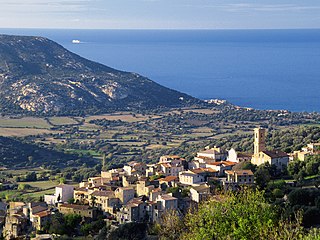
Aregno is a commune in the Haute-Corse department on the island of Corsica, France. The village was previously part of the piève of Aregnu in the former Genovese province of Balagna.

<span class="mw-page-title-main">Barbaggio</span> Commune in Corsica, France

Barbaggio is a commune in the French department of Haute-Corse on the island of Corsica. It is known for its wine, its scenery, and the prehistoric site of Strette.

Canale-di-Verde or Canale di Verde is a commune in the French department of Haute-Corse, collectivity and island of Corsica.

Moïta is a commune in the Haute-Corse department, on the island of Corsica, France.

<span class="mw-page-title-main">Pianello</span> Commune in Corsica, France

Pianello is a commune in the Haute-Corse department of France on the island of Corsica. The village is in the la Serra area, south east of Castagniccia.

<span class="mw-page-title-main">Pietra-di-Verde</span> Commune in Corsica, France

Pietra-di-Verde is a commune in the Haute-Corse department of France on the island of Corsica.

<span class="mw-page-title-main">Zalana</span> Commune in Corsica, France

Zalana is a commune in the Haute-Corse department of France on the island of Corsica.

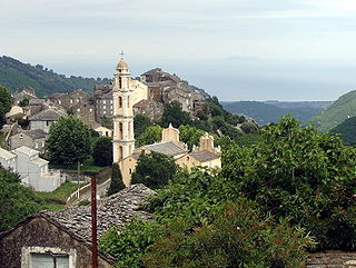
The Canton of Castagniccia is a canton of the Haute-Corse department, Corsica, France, named after the natural region of Castagniccia . It was created at the French canton reorganisation which came into effect in March 2015. Its seat is in San-Nicolao.

The canton of Ghisonaccia is an administrative division of the Haute-Corse department, southeastern France. It was created at the French canton reorganisation which came into effect in March 2015. Its seat is in Ghisonaccia.

<span class="mw-page-title-main">Bravone</span> River in the department of Haute-Corse, Corsica

The Bravone is a small coastal river in the department of Haute-Corse, Corsica, France.

References

  1. "Répertoire national des élus: les maires". data.gouv.fr, Plateforme ouverte des données publiques françaises (in French). 2 December 2020.
  2. "Populations légales 2020". The National Institute of Statistics and Economic Studies. 29 December 2022.
  3. 1 2 Google Maps
  4. "France, le trésor des régions: Département: Haut-Corse" (in French). Retrieved 6 May 2008..
  5. List of Mayors of France
  6. Des villages de Cassini aux communes d'aujourd'hui: Commune data sheet Ampriani, EHESS (in French).
  7. Population en historique depuis 1968, INSEE
  8. Ministry of Culture, Mérimée PA2B000011 Convent of Saint Francis of Zuani (in French)