Rusio

Last updated

Rusiu
Rusio Fb.jpg
A view of Rusio
Location of Rusiu
Rusio
France location map-Regions and departements-2016.svg
Red pog.svg
Rusiu
Corse region location map.svg
Red pog.svg
Rusiu
Coordinates: 42°21′45″N9°15′41″E / 42.3625°N 9.2614°E / 42.3625; 9.2614
Country France
Region Corsica
Department Haute-Corse
Arrondissement Corte
Canton Golo-Morosaglia
Government
  Mayor (20202026) Ange Toussaint Rocchi [1]
Area
1
8.58 km2 (3.31 sq mi)
Population
 (Jan. 2020) [2]
59
  Density6.9/km2 (18/sq mi)
Time zone UTC+01:00 (CET)
  Summer (DST) UTC+02:00 (CEST)
INSEE/Postal code
2B264 /20244
Elevation640–1,585 m (2,100–5,200 ft)
(avg. 950 m or 3,120 ft)
1 French Land Register data, which excludes lakes, ponds, glaciers > 1 km2 (0.386 sq mi or 247 acres) and river estuaries.

Rusio is a commune in the Haute-Corse department of France on the island of Corsica.

Contents

Geography

Climate

Rusio has a hot-summer Mediterranean climate (Köppen climate classification Csa). The average annual temperature in Rusio is 13.2 °C (55.8 °F). The average annual rainfall is 1,003.0 mm (39.49 in) with November as the wettest month. The temperatures are highest on average in August, at around 22.9 °C (73.2 °F), and lowest in January, at around 5.2 °C (41.4 °F). The highest temperature ever recorded in Rusio was 38.5 °C (101.3 °F) on 4 August 2017; the coldest temperature ever recorded was −10.5 °C (13.1 °F) on 27 February 2018.

Climate data for Rusio (1991−2020 normals, extremes 2007−2020)
MonthJanFebMarAprMayJunJulAugSepOctNovDecYear
Record high °C (°F)20.5
(68.9)
20.5
(68.9)
24.5
(76.1)
25.5
(77.9)
33.5
(92.3)
35.5
(95.9)
38.0
(100.4)
38.5
(101.3)
34.0
(93.2)
31.0
(87.8)
23.0
(73.4)
19.0
(66.2)
38.5
(101.3)
Average high °C (°F)9.1
(48.4)
9.5
(49.1)
12.4
(54.3)
16.5
(61.7)
19.9
(67.8)
25.2
(77.4)
28.9
(84.0)
29.1
(84.4)
23.9
(75.0)
18.9
(66.0)
13.1
(55.6)
10.2
(50.4)
18.1
(64.6)
Daily mean °C (°F)5.2
(41.4)
5.3
(41.5)
7.9
(46.2)
11.6
(52.9)
14.8
(58.6)
19.4
(66.9)
22.7
(72.9)
22.9
(73.2)
18.4
(65.1)
14.2
(57.6)
9.4
(48.9)
6.4
(43.5)
13.2
(55.8)
Average low °C (°F)1.3
(34.3)
1.1
(34.0)
3.4
(38.1)
6.7
(44.1)
9.7
(49.5)
13.7
(56.7)
16.5
(61.7)
16.6
(61.9)
12.8
(55.0)
9.5
(49.1)
5.7
(42.3)
2.6
(36.7)
8.3
(46.9)
Record low °C (°F)−6.0
(21.2)
−10.5
(13.1)
−5.0
(23.0)
−1.5
(29.3)
0.0
(32.0)
5.5
(41.9)
9.5
(49.1)
11.0
(51.8)
5.0
(41.0)
0.0
(32.0)
−4.0
(24.8)
−6.5
(20.3)
−10.5
(13.1)
Average precipitation mm (inches)80.1
(3.15)
94.6
(3.72)
94.5
(3.72)
67.0
(2.64)
93.6
(3.69)
49.1
(1.93)
48.9
(1.93)
35.1
(1.38)
63.3
(2.49)
113.1
(4.45)
172.9
(6.81)
90.8
(3.57)
1,003
(39.49)
Average precipitation days (≥ 1.0 mm)8.19.39.78.68.95.53.73.56.07.810.37.789.0
Source: Météo-France [3]

Population

Historical population
YearPop.±%
196299    
1968108+9.1%
1975100−7.4%
198283−17.0%
199057−31.3%
199966+15.8%
200877+16.7%

See also

Related Research Articles

<span class="mw-page-title-main">Calvi, Haute-Corse</span> Subprefecture and commune in Corsica, France

Calvi is a commune in the Haute-Corse department of France on the island of Corsica.

<span class="mw-page-title-main">Vitrolles, Hautes-Alpes</span> Commune in Provence-Alpes-Côte dAzur, France

Vitrolles is a commune in the Hautes-Alpes department in southeastern France.

<span class="mw-page-title-main">Sisco, Haute-Corse</span> Commune in Corsica, France

Sisco is a commune in the Haute-Corse department of France on the island of Corsica. It takes its name from the Ruisseau de Sisco, which flows through the commune and enters the Tyrrhenian Sea in the village of Sisco.

<span class="mw-page-title-main">Marignana</span> Commune in Corsica, France

Marignana is a commune in the Corse-du-Sud department of France on the island of Corsica.

<span class="mw-page-title-main">Pila-Canale</span> Commune in Corsica, France

Pila-Canale is a commune in the Corse-du-Sud department of France on the island of Corsica.

Sampolo is a commune in the Corse-du-Sud department of France on the island of Corsica.

<span class="mw-page-title-main">Calacuccia</span> Commune in Corsica, France

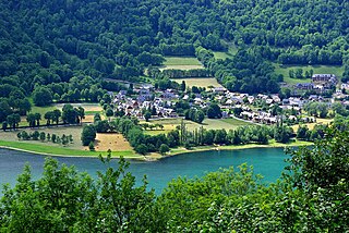
Calacuccia is a commune in the Haute-Corse department of France on the island of Corsica. It contains the Lac de Calacuccia, a hydroelectric reservoir, just south of the village of Calacuccia.

<span class="mw-page-title-main">Castirla</span> Commune in Corsica, France

Castirla is a commune in the Haute-Corse department of France on the island of Corsica.

<span class="mw-page-title-main">Galéria</span> Commune in Corsica, France

Galéria is a commune in the Haute-Corse department of France on the island of Corsica.

<span class="mw-page-title-main">Oletta</span> Commune in Corsica, France

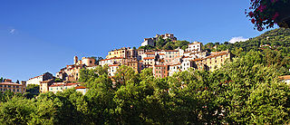
Oletta is a commune in the Haute-Corse department of France on the island of Corsica.

<span class="mw-page-title-main">Pietralba</span> Commune in Corsica, France

Pietralba is a commune in the Haute-Corse department of France on the island of Corsica.

<span class="mw-page-title-main">Ventiseri</span> Commune in Corsica, France

Ventiseri is a commune in the Haute-Corse department of France on the island of Corsica.

<span class="mw-page-title-main">Clarac, Haute-Garonne</span> Commune in Occitania, France

Clarac is a commune in the Haute-Garonne department in southwestern France.

<span class="mw-page-title-main">Palaminy</span> Commune in Occitania, France

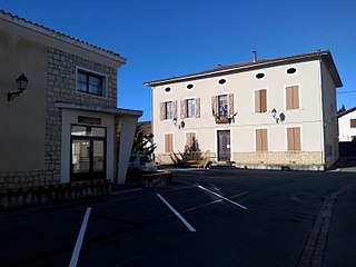
Palaminy is a commune in the Haute-Garonne department in southwestern France.

<span class="mw-page-title-main">Ségreville</span> Commune in Occitania, France

Ségreville is a commune in the Haute-Garonne department in southwestern France.

<span class="mw-page-title-main">Villematier</span> Commune in Occitania, France

Villematier is a commune in the Haute-Garonne department in southwestern France.

<span class="mw-page-title-main">Castelvieilh</span> Commune in Occitania, France

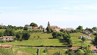
Castelvieilh is a commune in the Hautes-Pyrénées department in south-western France.

<span class="mw-page-title-main">Tournay, Hautes-Pyrénées</span> Commune in Occitania, France

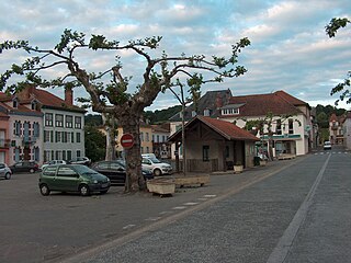
Tournay is a commune in the Hautes-Pyrénées department, southwestern France. Tournay station has rail connections to Toulouse, Tarbes and Pau.

<span class="mw-page-title-main">Génos, Hautes-Pyrénées</span> Commune in Occitania, France

Génos is a commune in the Hautes-Pyrénées department in south-western France.

Montégut is a commune in the Hautes-Pyrénées department in south-western France.

References

  1. "Répertoire national des élus: les maires". data.gouv.fr, Plateforme ouverte des données publiques françaises (in French). 2 December 2020.
  2. "Populations légales 2020". The National Institute of Statistics and Economic Studies. 29 December 2022.
  3. "Fiche Climatologique Statistiques 1991-2020 et records" (PDF) (in French). Météo-France . Retrieved 8 September 2022.