Olmeta-di-Capocorso

Last updated

Olmeta-di-Capocorso
Olmeta di Capicorsu (Corsican)
Olmeta-Capocorso-Piazze.jpg
The hamlet of Piazze, in Olmeta-di-Capocorso
Location of Olmeta-di-Capocorso
Olmeta-di-Capocorso
France location map-Regions and departements-2016.svg
Red pog.svg
Olmeta-di-Capocorso
Corse region location map.svg
Red pog.svg
Olmeta-di-Capocorso
Coordinates: 42°46′10″N9°22′19″E / 42.7694°N 9.3719°E / 42.7694; 9.3719
Country France
Region Corsica
Department Haute-Corse
Arrondissement Bastia
Canton Cap Corse
Intercommunality Cap Corse
Government
  Mayor (20202026) Mireille Boncompagni [1]
Area
1
21.57 km2 (8.33 sq mi)
Population
 (Jan. 2020) [2]
131
  Density6.1/km2 (16/sq mi)
Time zone UTC+01:00 (CET)
  Summer (DST) UTC+02:00 (CEST)
INSEE/Postal code
2B187 /20217
Elevation0–1,306 m (0–4,285 ft)
(avg. 200 m or 660 ft)
1 French Land Register data, which excludes lakes, ponds, glaciers > 1 km2 (0.386 sq mi or 247 acres) and river estuaries.

Olmeta-di-Capocorso (Corsican : Olmeta di Capicorsu) is a commune in the Haute-Corse department of France on the island of Corsica.

Contents

The commune is on the west coast of the Cap Corse peninsula. The Olmeta river flows through the commune and enters the sea in the village of Negru. [3]

Population

Historical population
YearPop.±%
1962203    
1968210+3.4%
1975175−16.7%
1982126−28.0%
1990104−17.5%
1999112+7.7%
2008132+17.9%

See also

Related Research Articles

<span class="mw-page-title-main">Arrondissement of Bastia</span> Arrondissement in Corsica, France

The arrondissement of Bastia is an arrondissement of France in the Haute-Corse department in the territorial collectivity of Corsica. It has 27 communes. Its population is 87,776 (2016), and its area is 473.8 km2 (182.9 sq mi).

<span class="mw-page-title-main">Arrondissement of Calvi</span> Arrondissement in Corsica, France

The arrondissement of Calvi is an arrondissement of France in the Haute-Corse department in the territorial collectivity of Corsica. It has 51 communes. Its population is 29,576 (2016), and its area is 1,338.4 km2 (516.8 sq mi).

Canale-di-Verde or Canale di Verde is a commune in the French department of Haute-Corse, collectivity and island of Corsica.

<span class="mw-page-title-main">Castellare-di-Casinca</span> Commune in Corsica, France

Castellare-di-Casinca is a commune in the Haute-Corse department of France on the island of Corsica.

<span class="mw-page-title-main">Castellare-di-Mercurio</span> Commune in Corsica, France

Castellare-di-Mercurio is a commune in the Haute-Corse department of France on the island of Corsica.

<span class="mw-page-title-main">Castello-di-Rostino</span> Commune in Corsica, France

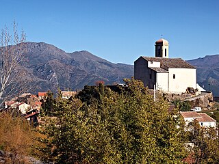
Castello-di-Rostino is a commune in the Haute-Corse department of France on the island of Corsica.

<span class="mw-page-title-main">Lugo-di-Nazza</span> Commune in Corsica, France

Lugo-di-Nazza is a commune in the Haute-Corse department of France on the island of Corsica.

<span class="mw-page-title-main">Olmeta-di-Tuda</span> Commune in Corsica, France

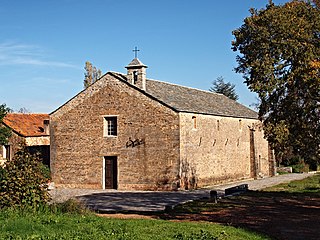
Olmeta-di-Tuda is a commune in the Haute-Corse department of France on the island of Corsica.

<span class="mw-page-title-main">Penta-di-Casinca</span> Commune in Corsica, France

Penta-di-Casinca or Penta di Casinca, is a commune in the Haute-Corse department of France on the island of Corsica.

<span class="mw-page-title-main">Poggio-di-Venaco</span> Commune in Corsica, France

Poggio-di-Venaco is a commune in the Haute-Corse department of France on the island of Corsica.

<span class="mw-page-title-main">Prunelli-di-Casacconi</span> Commune in Corsica, France

Prunelli-di-Casacconi is a commune in the Haute-Corse department of France on the island of Corsica.

<span class="mw-page-title-main">Prunelli-di-Fiumorbo</span> Commune in Corsica, France

Prunelli-di-Fiumorbo is a commune in the Haute-Corse department of France on the island of Corsica.

<span class="mw-page-title-main">Sant'Andréa-di-Bozio</span> Commune in Corsica, France

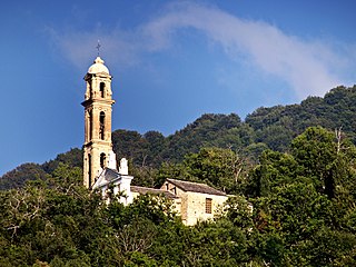
Sant'Andréa-di-Bozio is a commune in the Haute-Corse department of France on the island of Corsica.

<span class="mw-page-title-main">Serra-di-Fiumorbo</span> Commune in Corsica, France

Serra-di-Fiumorbo is a commune in the Haute-Corse department of France on the island of Corsica.

Valle-di-Campoloro or Valle di Campoloru, is a commune in the Haute-Corse department of France on the island of Corsica.

<span class="mw-page-title-main">Ville-di-Pietrabugno</span> Commune in Corsica, France

Ville-di-Pietrabugno is a commune in the Haute-Corse department of France on the island of Corsica.

<span class="mw-page-title-main">Torra di Negru</span> Genoese coastal defence tower in Corsica

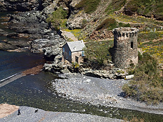
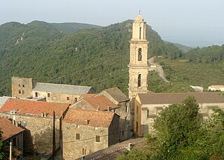
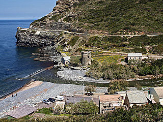
The Tower of Negru is a Genoese tower located in the commune of Olmeta-di-Capocorso (Haute-Corse) on the coast of the Corsica. The tower sits on the shore on the west coast of Capicorsu.

The canton of Biguglia-Nebbio is an administrative division of the Haute-Corse department, southeastern France. It was created at the French canton reorganisation which came into effect in March 2015. Its seat is in Biguglia.

<span class="mw-page-title-main">Monte Stello</span>

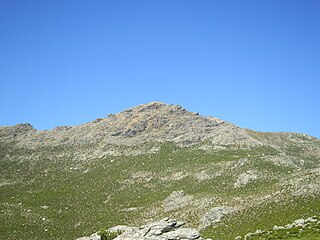
Monte Stello is a mountain in the department of Haute-Corse on the island of Corsica, France. It is the second highest point in the Monte Stello massif, which forms the backbone of Cap Corse.

<span class="mw-page-title-main">Olmeta</span> Stream in the department of Haute-Corse, Corsica

The Olmeta is a small coastal stream in the department of Haute-Corse, Corsica, France. It enters the Mediterranean Sea from the west of the Cap Corse peninsula.

References

  1. "Répertoire national des élus: les maires". data.gouv.fr, Plateforme ouverte des données publiques françaises (in French). 2 December 2020.
  2. "Populations légales 2020". The National Institute of Statistics and Economic Studies. 29 December 2022.
  3. "Relation: Rivière d'Olmeta (9422539)", OpenStreetMap, retrieved 15 January 2022