Ventiseri

Last updated

Ventiseri
Coasina89.jpg
Ruins of the fort of Coasina
Location of Ventiseri
Ventiseri
France location map-Regions and departements-2016.svg
Red pog.svg
Ventiseri
Corse region location map.svg
Red pog.svg
Ventiseri
Coordinates: 41°56′36″N9°20′00″E / 41.9433°N 9.3333°E / 41.9433; 9.3333
Country France
Region Corsica
Department Haute-Corse
Arrondissement Corte
Canton Fiumorbo-Castello
Government
  Mayor (20202026) François Tiberi [1]
Area
1
46.7 km2 (18.0 sq mi)
Population
 (Jan. 2020) [2]
2,520
  Density54/km2 (140/sq mi)
Time zone UTC+01:00 (CET)
  Summer (DST) UTC+02:00 (CEST)
INSEE/Postal code
2B342 /20240
Elevation0–1,033 m (0–3,389 ft)
(avg. 510 m or 1,670 ft)
1 French Land Register data, which excludes lakes, ponds, glaciers > 1 km2 (0.386 sq mi or 247 acres) and river estuaries.

Ventiseri is a commune in the Haute-Corse department of France on the island of Corsica.

Contents

Geography

Climate

Ventiseri has a mediterranean climate (Köppen climate classification Csa). The average annual temperature in Ventiseri is 16.7 °C (62.1 °F). The average annual rainfall is 798.7 mm (31.44 in) with October as the wettest month. The temperatures are highest on average in August, at around 25.2 °C (77.4 °F), and lowest in January, at around 9.9 °C (49.8 °F). The highest temperature ever recorded in Ventiseri was 39.9 °C (103.8 °F) on 4 July 1965; the coldest temperature ever recorded was −5.9 °C (21.4 °F) on 7 March 1971.

Climate data for Solenzara, Ventiseri (1991–2020 averages, extremes 1961−present)
MonthJanFebMarAprMayJunJulAugSepOctNovDecYear
Record high °C (°F)25.5
(77.9)
27.6
(81.7)
29.2
(84.6)
28.0
(82.4)
30.9
(87.6)
37.1
(98.8)
39.9
(103.8)
37.8
(100.0)
37.1
(98.8)
31.3
(88.3)
31.4
(88.5)
23.2
(73.8)
39.9
(103.8)
Average high °C (°F)13.7
(56.7)
14.1
(57.4)
16.2
(61.2)
18.6
(65.5)
22.5
(72.5)
26.6
(79.9)
29.5
(85.1)
29.9
(85.8)
26.3
(79.3)
22.1
(71.8)
17.6
(63.7)
14.5
(58.1)
21.0
(69.8)
Daily mean °C (°F)9.9
(49.8)
9.9
(49.8)
11.9
(53.4)
14.2
(57.6)
17.9
(64.2)
21.9
(71.4)
24.8
(76.6)
25.2
(77.4)
21.9
(71.4)
18.1
(64.6)
13.9
(57.0)
10.9
(51.6)
16.7
(62.1)
Average low °C (°F)6.2
(43.2)
5.8
(42.4)
7.7
(45.9)
9.8
(49.6)
13.3
(55.9)
17.1
(62.8)
20.1
(68.2)
20.5
(68.9)
17.4
(63.3)
14.1
(57.4)
10.3
(50.5)
7.3
(45.1)
12.5
(54.5)
Record low °C (°F)−4.8
(23.4)
−3.9
(25.0)
−5.9
(21.4)
0.6
(33.1)
5.0
(41.0)
8.3
(46.9)
12.4
(54.3)
12.9
(55.2)
9.5
(49.1)
3.9
(39.0)
−1.3
(29.7)
−2.7
(27.1)
−5.9
(21.4)
Average precipitation mm (inches)79.1
(3.11)
64.0
(2.52)
69.4
(2.73)
67.0
(2.64)
47.6
(1.87)
21.7
(0.85)
10.7
(0.42)
18.9
(0.74)
90.6
(3.57)
119.2
(4.69)
112.0
(4.41)
98.5
(3.88)
798.7
(31.44)
Average precipitation days (≥ 1.0 mm)6.66.36.76.84.62.71.71.95.17.39.28.167.0
Mean monthly sunshine hours 133.1143.7193.0211.8257.1299.6335.8306.4229.1174.1127.4128.72,539.7
Source: Météo France [3]

Population

Historical population
YearPop.±% p.a.
1968 1,314    
1975 1,280−0.37%
1982 1,702+4.15%
1990 2,005+2.07%
1999 2,023+0.10%
2007 2,216+1.15%
2012 2,357+1.24%
2017 2,481+1.03%
Source: INSEE [4]

See also

Related Research Articles

<span class="mw-page-title-main">Calvi, Haute-Corse</span> Subprefecture and commune in Corsica, France

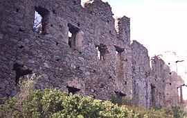
Calvi is a commune in the Haute-Corse department of France on the island of Corsica.

<span class="mw-page-title-main">Labarthe-Rivière</span> Commune in Occitania, France

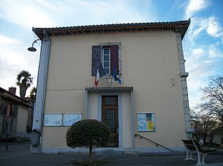
Labarthe-Rivière is a commune in the Haute-Garonne department in southwestern France.

<span class="mw-page-title-main">Conca, Corse-du-Sud</span> Commune in Corsica, France

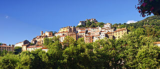
Conca is a commune in the Corse-du-Sud department of France on the island of Corsica. It is the southern terminus of the GR 20 walking route.

<span class="mw-page-title-main">Sisco, Haute-Corse</span> Commune in Corsica, France

Sisco is a commune in the Haute-Corse department of France on the island of Corsica. It takes its name from the Ruisseau de Sisco, which flows through the commune and enters the Tyrrhenian Sea in the village of Sisco.

<span class="mw-page-title-main">Marignana</span> Commune in Corsica, France

Marignana is a commune in the Corse-du-Sud department of France on the island of Corsica.

<span class="mw-page-title-main">Pila-Canale</span> Commune in Corsica, France

Pila-Canale is a commune in the Corse-du-Sud department of France on the island of Corsica.

<span class="mw-page-title-main">Quenza</span> Commune in Corsica, France

Quenza is a commune in the department of Corse-du-Sud, island and collectivity of Corsica, France.

<span class="mw-page-title-main">Calacuccia</span> Commune in Corsica, France

Calacuccia is a commune in the Haute-Corse department of France on the island of Corsica. It contains the Lac de Calacuccia, a hydroelectric reservoir, just south of the village of Calacuccia.

<span class="mw-page-title-main">Castirla</span> Commune in Corsica, France

Castirla is a commune in the Haute-Corse department of France on the island of Corsica.

<span class="mw-page-title-main">Galéria</span> Commune in Corsica, France

Galéria is a commune in the Haute-Corse department of France on the island of Corsica.

<span class="mw-page-title-main">Oletta</span> Commune in Corsica, France

Oletta is a commune in the Haute-Corse department of France on the island of Corsica.

<span class="mw-page-title-main">Pietralba</span> Commune in Corsica, France

Pietralba is a commune in the Haute-Corse department of France on the island of Corsica.

<span class="mw-page-title-main">Rusio</span> Commune in Corsica, France

Rusio is a commune in the Haute-Corse department of France on the island of Corsica.

<span class="mw-page-title-main">Clarac, Haute-Garonne</span> Commune in Occitania, France

Clarac is a commune in the Haute-Garonne department in southwestern France.

<span class="mw-page-title-main">Villematier</span> Commune in Occitania, France

Villematier is a commune in the Haute-Garonne department in southwestern France.

<span class="mw-page-title-main">Castelnau-Magnoac</span> Commune in Occitania, France

Castelnau-Magnoac is a commune in the Hautes-Pyrénées department in south-western France.

<span class="mw-page-title-main">Campistrous</span> Commune in Occitania, France

Campistrous is a commune in the Hautes-Pyrénées department in south-western France.

<span class="mw-page-title-main">Artigues, Hautes-Pyrénées</span> Commune in Occitania, France

Artigues is a commune in the Hautes-Pyrénées department in southwestern France.

Lomné is a commune in the Hautes-Pyrénées department in south-western France.

Montégut is a commune in the Hautes-Pyrénées department in south-western France.

References

  1. "Répertoire national des élus: les maires". data.gouv.fr, Plateforme ouverte des données publiques françaises (in French). 2 December 2020.
  2. "Populations légales 2020". The National Institute of Statistics and Economic Studies. 29 December 2022.
  3. "climate of Solenzara 1991-2020" (PDF) (in French). Météo-France . Retrieved 1 June 2022.
  4. Population en historique depuis 1968, INSEE