Archdale, North Carolina

Last updated

Archdale, North Carolina
Flag of Archdale, North Carolina.png
Seal of Archdale, North Carolina.png
Logo of Archdale, North Carolina.png
Motto: 
"Crossroad of progress" [1]
Guilford County North Carolina incorporated and unincorporated areas Archdale highlighted.svg
Location in Guilford County and the state of North Carolina
Coordinates: 35°54′12″N79°57′32″W / 35.90333°N 79.95889°W / 35.90333; -79.95889
Country United States
State North Carolina
Counties Randolph, Guilford
Founded1786
Incorporated1874, 1969
Named for John Archdale [2]
Government
  MayorBert Lance Stone
Area
[3]
  Total8.86 sq mi (22.95 km2)
  Land8.84 sq mi (22.89 km2)
  Water0.02 sq mi (0.06 km2)
Elevation
[4]
804 ft (245 m)
Population
 (2020)
  Total11,907
  Density1,347.25/sq mi (520.15/km2)
Time zone UTC-5 (Eastern (EST))
  Summer (DST) UTC-4 (EDT)
ZIP code
27263
Area code(s) 336
FIPS code 37-01720 [5]
GNIS feature ID2403108 [4]
Website www.archdale-nc.gov

Archdale is a city in Guilford and Randolph counties in the U.S. state of North Carolina. Located 15 miles southwest of Greensboro, it is part of the Greensboro-High Point Metropolitan Statistical Area of the Piedmont Triad metro region. The population of the city was 11,907 [6] at the 2020 census.

Contents

Geography

Archdale is located primarily in Randolph County and extends north into Guilford County. It is bordered to the southwest by the city of Trinity and to the north by the city of High Point.

Interstate 85 passes through Archdale, with access from Exits 111 and 113. I-85 leads northeast 16 miles (26 km) to Greensboro and southwest 77 miles (124 km) to Charlotte. Interstate 74 passes just east of Archdale, leading northwest 26 miles (42 km) to Winston-Salem and southeast 21 miles (34 km) to Asheboro.

According to the United States Census Bureau, Archdale has a total area of 8.2 square miles (21.3 km2), of which 0.02 square miles (0.06 km2), or 0.27%, is water. [7] The city is within the watershed of the Deep River, a tributary of the Cape Fear River. Muddy Creek, a tributary of the Deep River rises within the city limits of Archdale.

Demographics

Historical population
CensusPop.Note
1890 224
1900 182−18.7%
1910 145−20.3%
1920 17822.8%
1930 628252.8%
1940 1,09774.7%
1950 1,21811.0%
1960 1,52024.8%
1970 4,874220.7%
1980 5,3269.3%
1990 6,91329.8%
2000 9,01430.4%
2010 11,41526.6%
2020 11,9074.3%
2022 (est.)12,003 [8] 0.8%
U.S. Decennial Census [9]

2020 census

Archdale racial composition [10]
RaceNumberPercentage
White (non-Hispanic)8,83174.17%
Black or African American (non-Hispanic)7446.25%
Native American 550.46%
Asian 1,0618.91%
Pacific Islander 20.02%
Other/Mixed 4273.59%
Hispanic or Latino 7876.61%

As of the 2020 United States census, there were 11,907 people, 4,596 households, and 2,977 families residing in the city.

2010 census

As of the census [5] of 2010, there were 11,415 people, 4,556 households, and 3,137 families residing in the city. The population density was 1,151.8 inhabitants per square mile (444.7/km2). There were 4,916 housing units at an average density of 509.3 per square mile (196.6/km2). The racial makeup of the city was 87.8% White, 4% African American, 0.6% Native American, 4% Asian, 1.4% from other races, and 1.4% from two or more races. Hispanic or Latino of any race were 4% of the population.

There were 4,556 households, out of which 30.7% had children under the age of 18 living with them, 52.3% were married couples living together, 12.3% had a female householder with no husband present, and 31.1% were non-families. 26.6% of all households were made up of individuals, and 9.8% had someone living alone who was 65 years of age or older. The average household size was 2.46 and the average family size was 2.97.

In the city, the population was spread out, with 23.8% under the age of 18, 7.2% from 18 to 24, 26.6% from 25 to 44, 26.8% from 45 to 64, and 15.6% who were 65 years of age or older. The median age was 40 years. For every 100 females, there were 90.7 males. For every 100 females age 18 and over, there were 86 males.

The median income for a household in the city was $48,291, and the median income for a family was $55,872. Males had a median income of $34,449 versus $24,456 for females. The per capita income for the city was $22,830. About 6.7% of families and 9.7% of the population were below the poverty line, including 13.9% of those under age 18 and 7.8% of those age 65 or over.

History

Archdale, previously known as "Bush Hill", began as a predominantly Quaker settlement and received the name "Archdale" as a tribute to John Archdale, a lord proprietor and an early Quaker governor. [11] It was incorporated in July 1969. Water and sewer service were needed because the area was "heavy clay". Voters in the area held a referendum, though residents of Trinity decided not to join Archdale. [12]

The Moses Hammond House and Harper House are listed on the National Register of Historic Places. [13]

Jerry W. Tillman (1940–2023), North Carolina legislator, was born in Archdale. [14]

Attractions

Related Research Articles

<span class="mw-page-title-main">Randolph County, North Carolina</span> County in North Carolina, United States

Randolph County is a county located in the U.S. state of North Carolina. As of the 2020 census, the population was 144,171. Its county seat is Asheboro.

<span class="mw-page-title-main">Perquimans County, North Carolina</span> County in North Carolina, United States

Perquimans County is a county located in the U.S. state of North Carolina. As of the 2020 census, the population was 13,005. Its county seat is Hertford. The Harvey Point Defense Testing Activity facility is located in Perquimans County.

<span class="mw-page-title-main">Davie County, North Carolina</span> County in North Carolina, United States

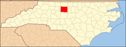
Davie County is a county located in the U.S. state of North Carolina. As of the 2020 census, the population was 42,712. Its county seat is Mocksville.

<span class="mw-page-title-main">Graham, North Carolina</span> City in North Carolina, United States

Graham is a city in Alamance County, North Carolina, United States. It is part of the Burlington, North Carolina Metropolitan Statistical Area. As of the 2020 census the population was 17,153. It is the county seat of Alamance County.

<span class="mw-page-title-main">Boiling Spring Lakes, North Carolina</span> City in North Carolina, United States

Boiling Spring Lakes is a city in Brunswick County, North Carolina, United States. The population was 5,943 at the 2020 census, up from 5,372 in 2010.

Northwest is a city in Brunswick County, North Carolina, United States. The population was 735 at the 2010 census. It is part of the Wilmington, NC Metropolitan Statistical Area.

<span class="mw-page-title-main">Walkertown, North Carolina</span> Town in North Carolina, United States

Walkertown is a town in Forsyth County, North Carolina, United States and a rural area outside of Winston-Salem. It is part of the Piedmont Triad. The population was 5,695 at the 2020 census.

<span class="mw-page-title-main">Butner, North Carolina</span> Town in North Carolina, United States

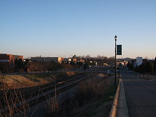
Butner is a town in Granville County, North Carolina, United States. The population was 8,397 as of the 2020 census. Butner was managed by the state of North Carolina from 1947 through 2007.

<span class="mw-page-title-main">McLeansville, North Carolina</span> Census-designated place in North Carolina, United States

McLeansville is an unincorporated community and census-designated place (CDP) in Guilford County, North Carolina, United States. The population was 1,021 at the 2010 census.

<span class="mw-page-title-main">Oak Ridge, North Carolina</span> Town in North Carolina, United States

Oak Ridge is a town in northwestern Guilford County, North Carolina, United States. As of the census of 2020, the town had a population of 7,474. Oak Ridge is 15 miles (24 km) northwest of the center of Greensboro, North Carolina's third-most populous city. Oak Ridge is a part of the Piedmont Triad urban area.

<span class="mw-page-title-main">Stokesdale, North Carolina</span> Town in North Carolina, United States

Stokesdale is a town in Guilford County, North Carolina, United States with small parts in the counties of Rockingham, Forsyth, and Stokes. The population was 5,924 at the 2020 census. Belews Lake is located nearby, and North Carolina Highway 68 and North Carolina Highway 65 both intersect U.S. Route 158 near the town's center.

<span class="mw-page-title-main">Summerfield, North Carolina</span> Town in North Carolina, United States

Summerfield is a town in Guilford County, North Carolina. As of the 2020 census, the population was 10,951.

<span class="mw-page-title-main">North Topsail Beach, North Carolina</span> Town in North Carolina, United States

North Topsail Beach is a town in Onslow County, North Carolina, United States. As of the 2020 U.S. census, the population was 1,005. It is located on Topsail Island. North Topsail Beach is part of the Jacksonville, North Carolina Metropolitan Statistical Area.

<span class="mw-page-title-main">Trinity, North Carolina</span> City in North Carolina, United States

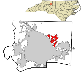
Trinity is a city in Randolph County, North Carolina, United States. The population was 7,006 at the 2020 census. Trinity is part of the Greensboro-High Point Metropolitan Statistical Area of the Piedmont Triad metro region.

<span class="mw-page-title-main">Madison, North Carolina</span> Town in North Carolina, United States

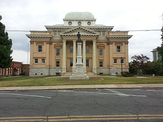
Madison is a town located in Rockingham County, North Carolina. At the 2020 census, the town had a total population of 2,132. Madison is part of the Greensboro-High Point Metropolitan Statistical Area of the Piedmont Triad metro region. It was home to the corporate headquarters of Remington Arms until 2020, when the company was made defunct by bankruptcy proceedings. It is still home to Marlin Firearms, which was an asset of Remington now owned by Sturm, Ruger & Co.

<span class="mw-page-title-main">Stoneville, North Carolina</span> Town in North Carolina, United States

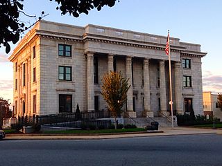
Stoneville is a town in Rockingham County, North Carolina, United States. Stoneville is part of the Greensboro–High Point metropolitan area of the Piedmont Triad. At the 2020 United States census, the town had a population of 1,308.

<span class="mw-page-title-main">Walnut Cove, North Carolina</span> Town in North Carolina, United States

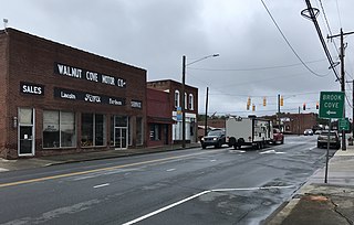
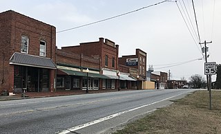
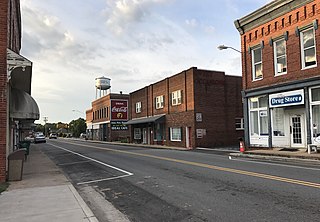
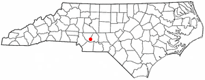
Walnut Cove is a town in Stokes County, North Carolina, United States. The population was 1,536 at the 2020 census.

<span class="mw-page-title-main">Gibsonville, North Carolina</span> Town in North Carolina, United States

Gibsonville is a town in both Alamance and Guilford counties in the U.S. state of North Carolina. Most of Gibsonville is situated in the Greensboro-Winston-Salem-High Point Combined Statistical Area and the eastern portion is in the Burlington, North Carolina Metropolitan Statistical Area, encompassing all of Alamance County. According to the 2020 census, the population of Gibsonville was 8,971.

<span class="mw-page-title-main">Locust, North Carolina</span> City in North Carolina, United States

Locust is a small rural city in Stanly and Cabarrus counties in the U.S. state of North Carolina. The population was 2,930 at the 2010 census.

<span class="mw-page-title-main">Kings Mountain, North Carolina</span> City in North Carolina, United States

Kings Mountain is a small suburban city within the Charlotte metropolitan area in Cleveland and Gaston counties, North Carolina, United States. Most of the city is in Cleveland County, with a small eastern portion in Gaston County. The population was 10,296 at the 2010 census.

References

  1. "Archdale, NC". City of Archdale. Retrieved January 6, 2017.
  2. "North Carolina Gazetteer" . Retrieved November 24, 2023.
  3. "ArcGIS REST Services Directory". United States Census Bureau. Retrieved September 20, 2022.
  4. 1 2 U.S. Geological Survey Geographic Names Information System: Archdale, North Carolina
  5. 1 2 "U.S. Census website". United States Census Bureau . Retrieved January 31, 2008.
  6. "Explore Census Data". data.census.gov. Retrieved September 5, 2023.
  7. "Geographic Identifiers: 2010 Demographic Profile Data (G001): Archdale city, North Carolina". American Factfinder. U.S. Census Bureau. Retrieved January 6, 2017.[ dead link ]
  8. "Annual Estimates of the Resident Population for Incorporated Places in North Carolina: April 1, 2020 to July 1, 2022". Census.gov. Retrieved April 19, 2024.
  9. "Census of Population and Housing". Census.gov. Retrieved June 4, 2015.
  10. "Explore Census Data". data.census.gov. Retrieved December 20, 2021.
  11. Gannett (1905). Origin of Certain Place Names (PDF). USGS. p. 28.
  12. "Archdale celebrates 50 years". Greensboro News and Record . June 21, 2019. Retrieved July 2, 2019.
  13. "National Register Information System". National Register of Historic Places . National Park Service. July 9, 2010.
  14. 'Former NC Sen. Jerry Tillman dies at 82,' The Carolina Journal, February 6, 2023
  15. "Archdale, NC » Parks & Recreation". www.archdale-nc.gov. Retrieved September 26, 2018.
  16. "Kersey Valley | Laser Tag, Zip Line, High Ropes, and more in Archdale, NC". Kersey Valley. Retrieved September 26, 2018.