
Presidio County is a county located in the U.S. state of Texas. As of the 2020 census, its population was 6,131. Its county seat is Marfa. The county was created in 1850 and later organized in 1875. Presidio County is in the Trans-Pecos region of West Texas and is named for the border settlement of Presidio del Norte. It is on the Rio Grande, which forms the Mexican border.

Pecos County is a county located in the U.S. state of Texas. As of the 2020 census, its population was 15,193. The county seat is Fort Stockton. The county was created in 1871 and organized in 1875. It is named for the Pecos River. It is one of the nine counties that comprise the Trans-Pecos region of West Texas.

Brewster County is a county located in the U.S. state of Texas. It is in West Texas and its county seat is Alpine. It is one of the nine counties that comprise the Trans-Pecos region, and borders Mexico. Brewster County is the largest county by area in the state - at 6,192 square miles (16,040 km2) it is over three times the size of the state of Delaware, and more than 500 square miles (1,300 km2) bigger than Connecticut.

Alpine is a city in and the county seat of Brewster County, Texas, United States. The population was 6,035 at the 2020 census. The town has an elevation of 4,462 feet (1,360 m), and the surrounding mountain peaks are over 1 mile (1.6 km) above sea level. A university, hospital, library, and retail make Alpine the center of the sprawling 12,000 square miles (3,108,000 ha) but wide open Big Bend area including Brewster, Presidio, and Jeff Davis counties.

Marfa is a city in the high desert of the Trans-Pecos in far West Texas, United States, between the Davis Mountains and Big Bend National Park, at an elevation of 4685 feet. It is the county seat of Presidio County, and its population as of the 2020 United States Census was 1,788. The city was founded in the early 1880s as a water stop; the population peaked in the 1930s and has continued to decline each decade since. However, today Marfa is a tourist destination and a major center for minimalist art. Attractions include Building 98, the Chinati Foundation, artisan shops, historical architecture, a classic Texas town square, modern art installments, art galleries, and the Marfa lights.

The Big Bend is part of the Trans-Pecos region in southwestern Texas, United States along the border with Mexico, north of the prominent bend in the Rio Grande for which the region is named. Here the Rio Grande passes between the Chisos Mountains in Texas and the Sierra Madre Oriental in Mexico as it changes from running east-southeast to north-northeast. The region covers three counties: Presidio County to the west, Brewster County to the east, and Jeff Davis County to the north.

West Texas is a loosely defined region in the U.S. state of Texas, generally encompassing the arid and semiarid lands west of a line drawn between the cities of Wichita Falls, Abilene, and Del Rio.

The United States District Court for the Western District of Texas is a federal district court. The court convenes in San Antonio with divisions in Austin, Del Rio, El Paso, Midland, Pecos, and Waco. It has jurisdiction in over 50 Trans-Pecos, Permian Basin, and Hill Country counties of the U.S. state of Texas. This district covers over 92,000 square miles (240,000 km2) and seven divisions.

State Highway 17 runs from Marfa to Pecos in west Texas. The road is maintained by the Texas Department of Transportation (TxDOT).
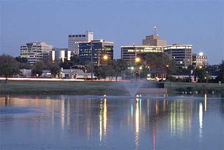
Midland–Odessa is a metropolitan area located in The Texas Plains approximately half-way between El Paso and Fort Worth, Texas. This combined statistical area (CSA) is made up of two metropolitan statistical areas and one micropolitan statistical area, and comprises four counties: Andrews, Ector, Martin, and Midland counties. The Midland–Odessa area is informally known as The Petroplex.

The Trans-Pecos, as originally defined in 1887 by the Texas geologist Robert T. Hill, is the distinct portion of Texas that lies west of the Pecos River. The term is considered synonymous with Far West Texas, a subdivision of West Texas. The Trans-Pecos is part of the Chihuahuan Desert, the largest desert in North America. It is the most mountainous and arid portion of the state, and most of its vast area is sparsely populated. Among the nine counties in the region are the five largest counties by area in Texas and eight of the eleven largest in the state. The area is known for the natural environment of the Big Bend and the gorge of the Rio Grande, part of which has been designated a National Wild and Scenic Rivers System. With the notable exceptions of Big Bend Ranch State Park, Big Bend National Park and the Guadalupe Mountains National Park, the vast majority of the Trans-Pecos region consists of privately owned ranchland. However, most of the region's population reside in the El Paso metropolitan area. Besides El Paso and its metropolitan area, the major cities are Pecos (12,916), Fort Stockton (8,466), and Alpine (6,035). All other settlements have under 5,000 people.

The Permian Basin Regional Planning Commission (PBRPC) is a voluntary association of cities, counties and special districts in the Permian Basin region of West Texas.

State Highway 118 is a 155.3-mile (249.9 km) state highway in the U.S. state of Texas that runs from Big Bend National Park north to Kent and passes through the towns of Study Butte, Alpine, and Fort Davis. SH 118 is maintained by the Texas Department of Transportation (TxDOT). The road lies entirely within the Trans-Pecos region of Texas. SH 118 is a two-lane road along its length except for a section in Alpine where the route follows the path of U.S. Route 67 and U.S. Route 90. All of the route except for the 2.8-mile (4.5 km) section between Big Bend National Park and Farm to Market Road 170 is included in the Texas Historical Commission's Texas Mountain Trail.

Odessa College is a public junior college in Odessa, Texas. The college serves the people of Ector County and the Permian Basin. It was established in 1946 and enrolled 8,024 students in Fall 2021 and 7,679 students in Spring 2022 in its university-parallel and occupational/technical courses, and 11,000 students annually in its Basic Education, Continuing Education, and Community Recreation courses.
La Entrada al Pacífico is a trade corridor designated as "Trade Corridor 56" by the Intermodal Surface Transportation Efficiency Act. The corridor is an international project between Mexico and the United States as a route from the Pacific Ocean port of Topolobampo in the Mexican state of Sinaloa to the U.S. state of Texas and beyond by way of the Midland-Odessa area. There is also a proposed upgrade of the rail connection, which might be easier by not requiring the addition of new bridges and tunnels in the Barranca de Cobre region. Its canyons are comparable in depth to the Grand Canyon in the United States.
Alpine–Casparis Municipal Airport is a city-owned public-use airport located 2 miles (3.2 km) northwest of the central business district of Alpine, a city in Brewster County, Texas, United States. It supports two small runways and is not meant for large commercial planes. Alpine-Casparis is the only airport in Brewster County.

The Comanche Trail, sometimes called the Comanche War Trail or the Comanche Trace, was a travel route in Texas established by the nomadic Comanche and their Kiowa and Kiowa Apache allies. Although called a "trail," the Comanche Trail was actually a network of parallel and branching trails, always running from one source of good water to another. The trail was especially important from the 1830s to 1850s when the Comanche launched large scale raids from Texas into Mexico. Hundreds of warriors annually followed the trail southward in fall and returned with their booty, mostly livestock, in late winter or spring.
