Arnold River (Northern Territory)

Last updated
Arnold
Australia Northern Territory relief location map.png
Red pog.svg
Location of the Arnold River mouth in the Northern Territory
EtymologyRichard Aldous Arnold [1]
Location
Country Australia
Territory Northern Territory
Physical characteristics
Sourcenortheast of the Bullwaddy Conservation Reserve
 - coordinates 16°18′21″S134°8′40″E / 16.30583°S 134.14444°E / -16.30583; 134.14444
 - elevation262 m (860 ft)
Mouth Hodgson River
 - locationsouth of Hodgson Downs
 - coordinates 15°21′48″S134°8′47″E / 15.36333°S 134.14639°E / -15.36333; 134.14639 Coordinates: 15°21′48″S134°8′47″E / 15.36333°S 134.14639°E / -15.36333; 134.14639
 - elevation74 m (243 ft)
Length185.8 km (115.5 mi)
Basin features
River system Roper River
Tributaries 
 - rightWilliams Creek (Northern Territory), Horse Creek (Northern Territory)
[2] [3]

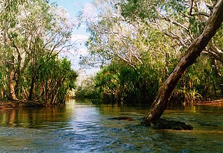
The Arnold River is a river in the north of the Northern Territory of Australia.

Northern Territory federal territory of Australia

The Northern Territory is an Australian territory in the central and central northern regions of Australia. It shares borders with Western Australia to the west, South Australia to the south, and Queensland to the east. To the north, the territory looks out to the Timor Sea, the Arafura Sea and the Gulf of Carpentaria, including Western New Guinea and other Indonesian islands. The NT covers 1,349,129 square kilometres (520,902 sq mi), making it the third-largest Australian federal division, and the 11th-largest country subdivision in the world. It is sparsely populated, with a population of only 246,700, making it the least-populous of Australia's eight states and major territories, with fewer than half as many people as Tasmania.

Australia Country in Oceania

Australia, officially the Commonwealth of Australia, is a sovereign country comprising the mainland of the Australian continent, the island of Tasmania and numerous smaller islands. It is the largest country in Oceania and the world's sixth-largest country by total area. The neighbouring countries are Papua New Guinea, Indonesia and East Timor to the north; the Solomon Islands and Vanuatu to the north-east; and New Zealand to the south-east. The population of 25 million is highly urbanised and heavily concentrated on the eastern seaboard. Australia's capital is Canberra, and its largest city is Sydney. The country's other major metropolitan areas are Melbourne, Brisbane, Perth and Adelaide.

Contents

Course and features

The Arnold River rises about 30 kilometres (19 mi) northeast of the Bullwaddy Conservation Reserve and north of the Carpentaria Highway. It flows to the town Minamia (Cox River) in the Aboriginal reserve Alawa and then turns northwest and flows about 15 kilometres (9.3 mi) south of Hodgson Downs in the Hodgson River. [4] The river is joined by two tributaries including the Williams and Horse creeks and flows through a series of lagoons and waterholes before reaching its river mouth. [2] [3]

Bullwaddy Conservation Reserve Protected area in the Northern Territory, Australia

The Bullwaddy Conservation Reserve is a protected area approximately 120 km (75 mi) north east of Elliott in the Northern Territory of Australia.

Carpentaria Highway highway in the Northern Territory

The Carpentaria Highway is a 380-kilometre-long (240 mi) highway, which runs from near Daly Waters to Borroloola in the Northern Territory, Australia. It is a sealed road and is part of National Highway 1. The Highway takes its name from the Gulf of Carpentaria, which it links with the Stuart Highway. The Carpentaria Highway also provides road access to the McArthur River mineral deposits and port facilities at Bing Bong, as well as the isolated community of Borroloola and the popular fishing location at King Ash Bay. Funding for maintenance is provided by the Northern Territory government.

Indigenous Australians are the Aboriginal and Torres Strait Islander people of Australia, descended from groups that existed in Australia and surrounding islands before British colonisation. The time of arrival of the first Indigenous Australians is a matter of debate among researchers. The earliest conclusively human remains found in Australia are those of Mungo Man LM3 and Mungo Lady, which have been dated to around 50,000 years BP. Recent archaeological evidence from the analysis of charcoal and artefacts revealing human use suggests a date as early as 65,000 BP. Luminescence dating has suggested habitation in Arnhem Land as far back as 60,000 years BP. Genetic research has inferred a date of habitation as early as 80,000 years BP. Other estimates have ranged up to 100,000 years and 125,000 years BP.

Etymology

The river is named for Richard Aldous Arnold, a pastoralist and politician, who purchased a pastoral lease in the area in 1895. The lease was a part of the Hodgson Downs cattle station. He sold his interest in 1905 and continued his political career as Clerk of the Legislative Assembly of New South Wales. [1]

Pastoralism branch of agriculture concerned with the raising of livestock

Pastoralism is the branch of agriculture concerned with the raising of livestock. It is animal husbandry: the care, tending and use of animals such as cattle, camels, goats, yaks, llamas, reindeers, horses and sheep.

A politician is a person active in party politics, or a person holding or seeking office in government. Politicians propose, support and create laws or policies that govern the land and, by extension, its people. Broadly speaking, a "politician" can be anyone who seeks to achieve political power in any bureaucratic institution.

See also

Related Research Articles

Adelaide River river

The Adelaide River is a river in the Northern Territory of Australia.

Severn River (New South Wales) river

The Severn River, a perennial river that forms part of the Border Rivers group, is part of the Macintyre catchment of the Murray-Darling basin, located in the Northern Tablelands and North West Slopes regions of New South Wales, Australia.

Dry River (Northern Territory) river in Australia

The Dry River is a river in the Northern Territory of Australia.

Roper River river in Australia

The Roper River is a large perennial river located in the Katherine region of the Northern Territory, Australia.

Mary River (Northern Territory) river in the Northern Territory, Australia

The Mary River flows in the Northern Territory of Australia and is a site of the Mary River National Park.

Calvert River river in the Northern Territory, Australia

The Calvert River is a river in the Northern Territory of Australia.

Wildman River river in Australia

The Wildman River is a river in the Darwin Coastal bioregion of the Northern Territory, Australia.

Mirrool Creek

The Mirrool Creek, a watercourse that is part of the Lachlan sub-catchment of the Murrumbidgee catchment within the Murray–Darling basin, is located in the Riverina region of New South Wales, Australia. The course of the Mirrool Creek is indefinite at various locations.

Liverpool River Australian river

Liverpool River is a river in the Northern Territory of Australia.

Wickham River Australian river

The Wickham River is an ephemeral river, located in the Victoria Bonaparte bioregion of the Northern Territory in Australia.

Blyth River (Northern Territory) river in Australia

The Blyth River is a river in the Northern Territory, Australia.

Moyle River river in Australia

The Moyle River is a river in the Northern Territory, Australia.

Goyder River River in Australia

The Goyder River is a river in the Northern Territory, Australia.

Walker River (Northern Territory) river in Australia

The Walker River is a river in the Northern Territory, Australia.

Towns River river in Australia

The Towns River is a river in the Northern Territory, Australia.

Limmen Bight River river in Australia

The Limmen Bight River is a river in the Northern Territory, Australia.

Rosie River river in Australia

The Rosie River also known as Rosie Creek is a river in the Northern Territory, Australia.

Robinson River (Northern Territory) river in Northern Territory, Australia

The Robinson River is a river in Australia's Northern Territory.

Settlement Creek river in Australia

The Settlement Creek is a creek located in the Northern Territory and the state of Queensland, Australia.

Supply River river in Australia

The Supply River is a perennial river located in the northern region of Tasmania, Australia.

References

  1. 1 2 "Place Names Register Extract - Arnold River". NT Place Names Register. Northern Territory Government . Retrieved 27 April 2015.
  2. 1 2 "Map of Arnold River, NT (1)". Bonzle Digital Atlas of Australia. Retrieved 1 May 2015.
  3. 1 2 "Map of Arnold River, NT (2)". Bonzle Digital Atlas of Australia. Retrieved 1 May 2015.
  4. Parish, Steve (2007). Australian Touring Atlas. Archerfield QLD: Steve Parish Publishing. p. S97. ISBN   978-1-74193-232-4.