Todd River

Last updated

Todd River
(Lhere Mparntwe)
Todd River1.jpg
The dry riverbed of the Todd River
Location
CountryAustralia
Physical characteristics
Source 
  location MacDonnell Ranges
Basin size445 km2 (172 sq mi)

The Todd River (Arrernte: Lhere Mparntwe) is an ephemeral river in the southern Northern Territory, central Australia. The origins of the Todd River are in the MacDonnell Ranges, where it flows past the Telegraph Station, almost through the centre of Alice Springs, through Heavitree Gap at the southern end of Alice Springs and continuing on for some distance, passing through the western part of the Simpson Desert, as it becomes a tributary of the Hale River, and eventually flowing into Lake Eyre in South Australia. [1]

Contents

The indigenous Arrernte people know this river as Lhere Mparntwe (pronounced ler-ra m-barn-twa).

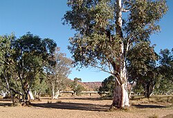
The Todd is in a very arid part of Australia and has zero to very low flow during 95% of the year. [2] When it does flow, it carries a heavy sediment load picked up from the grazing land around the Bond Springs homestead which lends its waters a milky chocolate colour and renders them completely opaque.

The Todd River's English name, and that of its tributary, the Charles River, were given by surveyor W. W. Mills, after Charles Todd, then South Australian Superintendent of Telegraphs and Postmaster General of South Australia, who was largely responsible for the construction of the Overland Telegraph Line. [3] [4]

Significance to Alice Springs

Todd River flooding in 1978 Todd River, Alice Springs. 1978.JPG
Todd River flooding in 1978

The Todd River is integral to the city of Alice Springs, which has its central business district built on the edge of the river. A large portion of the Alice Springs municipal area is situated on a flood plain of the Todd River, created by flooding upstream of the east-west barrier created by the Heavitree Range, a local segment of the MacDonnell Ranges.

Todd River during a rare flood event, Wills Terrace Causeway, Alice Springs, 31 March 1988 Todd River 31March88.jpg
Todd River during a rare flood event, Wills Terrace Causeway, Alice Springs, 31 March 1988

The Todd runs south through this range at Heavitree Gap along with the main road and rail links connecting Alice Springs to Adelaide. Heavy flows of the Todd can cut road and rail access, and the bottle neck effect of the Gap can cause flooding in many parts of the town. There have been numerous cases of people drowning as often people camp in the riverbed and the flooding can occur very rapidly and unexpectedly from heavy rains upstream.

Heavy rainfalls in the catchment to the north of Alice Springs cause the river to start flowing through the town around 6 to 8 hours later. The river can change from its normal dry bed to a bank-to-bank flow within 15 minutes, and it is possible to follow the leading edge of the flow as it snakes through town at a walking pace.

The riverbed contains sites and trees sacred to the local Arrente people including strong associations with Yeperenye (Caterpillar) Dreaming and with certain old red-river gums in the river representing Kwekatja; pre-initiated boys following the river north. [5]

Recreation and social events

The Henley-on-Todd Regatta has been held in Alice Springs annually since 1961. [6] The ironic regatta is held on the dry riverbed, and draws up to 20,000 spectators. Bottomless boats are picked up by the competitors standing within them and running down the course. The regatta carries insurance against the risk of water in the riverbed. The Henley-on-Todd Regatta has been cancelled once, in 1993, due to flooding - the river had too much water for the race.

Other events are held in the dry riverbed, including the closing ceremony for the 2006 Alice Festival. Camping in the riverbed is illegal, although this law is rarely enforced.

A flow of water in the river is quite an event for the people of Alice Springs, who flock to the causeways and the Telegraph Station to play in the fleeting waters. Although the riverbed is wide and of gentle gradient through the town the opaque waters combined with trees, waterborne and man-made hazards make playing in the flowing river dangerous.

Upstream from Alice Springs the Todd River descends quite rapidly, dropping 100 metres from Junction Waterhole to the Telegraph Station over 8 km of river length (5 km direct). This is a hilly area, and the river bed is strewn with rocks creating some lively rapids during the short-lived flood events. Many locals are wary of these waters, remembering the death of a local man in 1997 who drowned whilst riding the river on a lilo. Local paddlers have recently taken to kayaking this section of grade 2 to 3 rapids.

See also

Related Research Articles

<span class="mw-page-title-main">Mitta Mitta River</span> River in Victoria, Australia

Mitta Mitta River, a perennial river and a direct tributary of the Murray River within the Murray–Darling basin, is located in the Alpine district of Victoria, Australia.

<span class="mw-page-title-main">Alice Springs</span> Town in the Northern Territory, Australia

Alice Springs, is the second-largest town in the Northern Territory, Australia. The name Alice Springs was given by surveyor William Whitfield Mills after Alice, Lady Todd, wife of the telegraph pioneer Sir Charles Todd. Known colloquially as 'The Alice' or simply 'Alice', the town is situated roughly in Australia's geographic centre. It is nearly equidistant from Adelaide and Darwin.

<span class="mw-page-title-main">Lake Eyre basin</span> Drainage basin in Australia

The Lake Eyre basin is a drainage basin that covers just under one-sixth of all Australia. It is the largest endorheic basin in Australia and amongst the largest in the world, covering about 1,200,000 square kilometres (463,323 sq mi), including much of inland Queensland, large portions of South Australia and the Northern Territory, and a part of western New South Wales. The basin is also one of the largest, least-developed arid zone basins with a high degree of variability anywhere. It supports only about 60,000 people and has no major irrigation, diversions or flood-plain developments. Low density grazing that sustains a large amount of wildlife is the major land use, occupying 82% of the total land within the basin. The Lake Eyre basin of precipitation to a great extent geographically overlaps the Great Artesian Basin underneath.

<span class="mw-page-title-main">Finke River</span> River in the Northern Territory, Australia

The Finke River, or Larapinta in the Indigenous Arrernte language, is a river in central Australia, whose bed courses through the Northern Territory and the state of South Australia. It is one of four main rivers of the Lake Eyre Basin and thought to be the oldest riverbed in the world. It flows for only a few days a year. When this happens, its water usually disappears into the sands of the Simpson Desert, rarely if ever reaching Lake Eyre.

<span class="mw-page-title-main">Water gap</span> Geological feature formed through a mountain

A water gap is a gap that flowing water has carved through a mountain range or mountain ridge and that still carries water today. Such gaps that no longer carry water currents are called wind gaps. Water gaps and wind gaps often offer a practical route for road and rail transport to cross the mountain barrier.

<span class="mw-page-title-main">MacDonnell Ranges</span> Mountain range in the Northern Territory, Australia

The MacDonnell Ranges, or Tjoritja in Arrernte, is a mountain range located in southern Northern Territory. MacDonnell Ranges is also the name given to an interim Australian bioregion broadly encompassing the mountain range, with an area of 3,929,444 hectares. The range is a 644 km (400 mi) long series of mountains in central Australia, consisting of parallel ridges running to the east and west of Alice Springs. The mountain range contains many spectacular gaps and gorges as well as areas of Aboriginal significance.

<span class="mw-page-title-main">Henley-on-Todd Regatta</span>

The Henley-on-Todd Regatta is a "boat" race held annually in the typically dry sandy bed of the Todd River in Alice Springs, Australia.

<span class="mw-page-title-main">Arrernte language</span> Dialect cluster of Central Australia

Arrernte or Aranda or sometimes referred to as Upper Arrernte, is a dialect cluster in the Arandic language group spoken in parts of the Northern Territory, Australia, by the Arrernte people. Other spelling variations are Arunta or Arrarnta, and all of the dialects have multiple other names.

<span class="mw-page-title-main">Arrernte people</span> Group of Aboriginal Australian people

The Arrerntepeople, sometimes referred to as the Aranda, Arunta or Arrarnta, are a group of Aboriginal Australian peoples who live in the Arrernte lands, at Mparntwe and surrounding areas of the Central Australia region of the Northern Territory. Many still speak one of the various Arrernte dialects. Some Arrernte live in other areas far from their homeland, including the major Australian cities and overseas.

<span class="mw-page-title-main">Heavitree Gap</span>

The Heavitree Gap, or Ntaripe in the Arrernte language, is a water gap in the Northern Territory of Australia in the MacDonnell Ranges. It is the southern entrance to the city of Alice Springs and in addition to the Todd River it carries the main road and rail access to the south.

<span class="mw-page-title-main">Town of Alice Springs</span> Local government area in the Northern Territory, Australia

<span class="mw-page-title-main">Hann Range</span>

Hann Range is a mountain range in the Northern Territory of Australia located in central Australia approximately 120 kilometres (75 mi) north of Alice Springs.

<span class="mw-page-title-main">Alice Springs Telegraph Station</span>

The Alice Springs Telegraph Station is located within the Alice Springs Telegraph Station Historical Reserve, four kilometres north of the Alice Springs town centre in the Northern Territory of Australia. Established in 1872 to relay messages between Darwin and Adelaide, it is the original site of the first European settlement in central Australia. It was one of twelve stations along the Overland Telegraph Line.

<span class="mw-page-title-main">William Mills (surveyor)</span>

William Whitfield Mills, usually referred to as "W. Whitfield Mills" or "W. W. Mills", was an English surveyor of the Australian Overland Telegraph Line who is best known for naming a waterhole in Central Australia Alice Spring, from which the town of Alice Springs now takes its name. He also named Heavitree Gap as a tribute to his old school in Devon, England.

Doris Stuart Kngwarreye is the senior traditional owner for Mparntwe in the Northern Territory of Australia.

<span class="mw-page-title-main">Heavitree Gap Police Station</span>

Heavitree Gap Police Station is a historic building within the Heavitree Gap Police Station Historical Reserve. It is located on the southwestern side of Heavitree Gap in Alice Springs in the Northern Territory of Australia.

<span class="mw-page-title-main">Emily Gap</span>

Emily Gap / Anthwerrke is a natural attraction and significant cultural site in the East MacDonnell Ranges, eight kilometres to the east of Mparntwe/Alice Springs, in Australia's Northern Territory.

The Charles River, which is often called Charles Creek is an ephemeral river in the southern Northern Territory. It is a tributary of the Todd River and, like the Todd River, its naming is associated with Charles Todd; a senior civil servant involved with the Overland Telegraph Line.

Honeymoon Gap is a small gap 1 km south of Larapinta Drive, 14 km west of Alice Springs, on Roe Creek, 8 km south of where it cuts through Simpsons Gap.

Amelia Kunoth née Pavey was an Aboriginal Australian woman who developed well-known cattle stations in Central Australia, including Utopia, Bond Springs, Hamilton Downs and Tempe Downs.

References

  1. Todd River - A Rare Occurrence
  2. "Todd River". www.bom.gov.au. Australian Bureau of Meteorology. c. 1995. Retrieved 13 January 2015.
  3. Todd River Northern Territory Government Place Names Register Retrieved 9 June 2020.
  4. Charles River Northern Territory Government Place Names Register Retrieved 9 June 2020.
  5. Kimber, Dick (2011). "Cultural values associated with Alice Springs water" (PDF). Department of Environment and Natural Resources.
  6. "Alice Springs Rotary Henley On Todd". Archived from the original on 18 July 2008. Retrieved 23 July 2008.

Further reading

23°45′00″S133°52′38″E / 23.75°S 133.8772°E / -23.75; 133.8772