
The Northern Territory is an Australian territory in the central and central northern regions of Australia. The Northern Territory shares its borders with Western Australia to the west, South Australia to the south, and Queensland to the east. To the north, the territory looks out to the Timor Sea, the Arafura Sea and the Gulf of Carpentaria, including Western New Guinea and other islands of the Indonesian archipelago.
The protected areas of the Northern Territory consists of protected areas managed by the governments of the Northern Territory and Australia and private organisations with a reported total area of 335,527 square kilometres (129,548 sq mi) being 24.8% of the total area of the Northern Territory of Australia.

Iytwelepenty / Davenport Range, or Davenport Ranges National Park (Iytwellepenty), previously the Davenport Murchison National Park, is a national park in the Northern Territory of Australia about 1,033 kilometres (642 mi) south-east of the territorial capital of Darwin, occupying around 1,120 km2 (430 sq mi)s of the Davenport Range. It lies within the Davenport Murchison Ranges bioregion, an area of 58,050 km2 (22,410 sq mi), with a climate ranging from semiarid to subtropical.
The Finke River, or Larapinta (Arrernte), is a river in central Australia, one of four main rivers of the Lake Eyre Basin and thought to be the oldest riverbed in the world. It flows for only a few days a year and when this happens, its water usually disappears into the sands of the Simpson Desert, rarely if ever reaching Lake Eyre.

The Victoria River is a river in the Victoria Bonaparte bioregion of the Northern Territory, Australia.

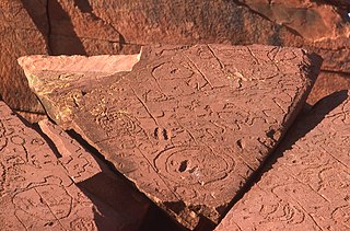
The Kaytetye, also written Kaititya, and pronounced kay-ditch, are an Aboriginal Australian people who live around Barrow Creek and Tennant Creek in the Northern Territory. Their neighbours to the east are the Alyawarre, to the south the Anmatyerre, to the west the Warlpiri, and to the north the Warumungu. Kaytetye country is dissected by the Stuart Highway.
The Dry River is a river in the Northern Territory of Australia.
The Sandover River is an ephemeral river in the Northern Territory of Australia located in northeast Central Australia. It is the only major tributary of the Georgina River that does not rise in western Queensland. Instead it flows from the eastern Macdonnell Ranges, northward to enter the Georgina near Urandangi. The highest point in the catchment is Bald Hill at 996 metres (3,268 ft), but it enters the Georgina at altitudes below 200 metres (660 ft).
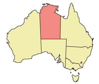
The Northern Territory (NT) occupies the north central part of the continent of Australia. The Northern Territory borders are to the west with Western Australia, the Western Australia border being near the 129° east longitude. The NT to the south with the South Australian border being the 26th parallel south latitude. To the east the NT with the Queensland border along the 138° east longitude.
The Calvert River is a river in the Northern Territory of Australia.
The Arnold River is a river in the north of the Northern Territory of Australia.
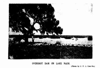
Lake Nash Station, most commonly known as Lake Nash, is a cattle station on the Barkly Tableland in the Northern Territory, Australia.
Diamantina Lakes Station most commonly known as Diamantina Lakes was a pastoral lease that once operated as a cattle station in central west Queensland, and is now Diamantina National Park, a national park.
The Wickham River is an ephemeral river, located in the Victoria Bonaparte bioregion of the Northern Territory in Australia.
The Limmen Bight River is a river in the Northern Territory, Australia.
The Settlement Creek is a creek located in the Northern Territory and the state of Queensland, Australia.

The Alice Springs Telegraph Station is located within the Alice Springs Telegraph Station Historical Reserve, four kilometres north of the Alice Springs town centre in the Northern Territory of Australia. Established in 1872 to relay messages between Darwin and Adelaide, it is the original site of the first European settlement in central Australia. It was one of twelve stations along the Overland Telegraph Line.
Davenport is a locality in the Northern Territory of Australia located about 1,057 kilometres (657 mi) south of the territory capital of Darwin.
Pine Hill Station is a pastoral lease that operates as a cattle station on the lower Barkly Tableland in the Northern Territory of Australia.
Argadargada Station is a pastoral lease that operates as a cattle station in the Northern Territory of Australia.
