Calvert River

Last updated

Calvert
Australia Northern Territory relief location map.png
Red pog.svg
Location of the Calvert River mouth in the Northern Territory
EtymologyJohn Calvert
Location
Country Australia
Territory Northern Territory
Physical characteristics
Source 
  location Australia
  elevation273 m (896 ft)
Mouth  
  location
Gulf of Carpentaria, Australia
  coordinates
16°17′54″S137°43′57″E / 16.29833°S 137.73250°E / -16.29833; 137.73250 Coordinates: 16°17′54″S137°43′57″E / 16.29833°S 137.73250°E / -16.29833; 137.73250
  elevation
0 m (0 ft)
Length222 km (138 mi)
Basin size10,333 km2 (3,990 sq mi)
Discharge 
  average31.7 m3/s (1,120 cu ft/s)
[1]

The Calvert River is a river in the Northern Territory of Australia.

Contents

Course

The headwaters rise on a plain between the Calvert Hills and China Wall and flow northward through mostly uninhabited lands and pastoral leases such as Calvert Hills Station before finally discharging into the Gulf of Carpentaria 150 kilometres (93 mi) east of Borroloola, not far from the border with Queensland in the Gulf Coastal bioregion. It has a mean annual outflow of 1,000 gigalitres (1.308×10⁹ cu yd), [2] Before reaching the sea it flows through the Australian Wildlife Conservancy’s Pungalina-Seven Emu Sanctuary.

Fourteen tributaries feed the river including; Bloodwood Creek, Tobacco Creek, Goanna Creek, Pungalina Creek and the Little Calvert River.

Catchment

The river’s catchment area is 10,033 square kilometres (3,874 sq mi), wedged between the watersheds for the Robinson River to the west, Settlement Creek to east and the Nicholson River to the south. [3] It contains no major towns and the population was 103 in 2001, 45% of whom are Aboriginal people. The river is not dammed, nor used for irrigation. The main economic activity is cattle grazing. [4] [2]

A total of 34 species of fish are found in the river including; the Glassfish, Barred Grunter, Sonub nosed Garfish, Milkfish, Fly-specked Hardyhead, Treadfin Silver Biddy, Flathead Goby, Spangled Perch, Barramundi, Oxeye Herring, Rainbowfish, Black-banded Rainbowfish, Northern Trout Gudgeon, Bony Bream, Catfish, Spotted Scat, Hyrtl's Tandan, Freshwater Longtom, Seven-spot Archerfish and the Giant Gudgeon. [5] The endangered Gulf snapping turtle has been found in the upper reaches of the river. [6]

History

The traditional owners of the area are the Garawa peoples. [7]

The river was named by Ludwig Leichhardt when on expedition from Queensland to Darwin in 1845. He named the river for another member of his party, John Calvert, in acknowledgement of his good service to the expedition. [8]

See also

Related Research Articles

Mary River (Northern Territory)

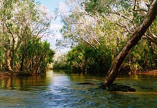
The Mary River flows in the Northern Territory of Australia and is a site of the Mary River National Park.

Jardine River

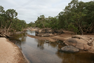
The Jardine River is the largest river of the Cape York Peninsula in Far North Queensland, Australia.

Archer River

The Archer River is a river located on the Cape York Peninsula, Far North Queensland, Australia.

Fitzmaurice River

The Fitzmaurice River is a river in Australia's Northern Territory.

Pungalina-Seven Emu Sanctuary Protected area in the Northern Territory, Australia

Pungalina-Seven Emu Sanctuary is a 3060 km2 private protected area in the Northern Territory of Australia. It is managed by the Australian Wildlife Conservancy (AWC) which purchased Pungalina Station in 2009, with some assistance from the Wildlife Australia Fund. It adjoins the Gulf of Carpentaria near the border with Queensland, lying in the Gulf Coastal bioregion. The reserve is bordered by Calvert Hills and Wollogorang Stations to the south and east. The nearest town is Borroloola, 150 km to the west.

Calvert Hills Station

Calvert Hills Station is a pastoral lease that operates as a cattle station in the Northern Territory.

Keep River

The Keep River is a river, located in the Victoria Bonaparte bioregion of Western Australia and the Northern Territory in Australia.

Blyth River (Northern Territory)

The Blyth River is a river in the Northern Territory, Australia.

Moyle River

The Moyle River is a river in the Northern Territory, Australia.

Goomadeer River

The Goomadeer River is a river in the Northern Territory, Australia.

Goyder River River in Australia

The Goyder River is a river in the Northern Territory, Australia.

Towns River

The Towns River is a river in the Northern Territory, Australia.

Robinson River (Northern Territory)

The Robinson River is a river in Australia's Northern Territory.

Settlement Creek

The Settlement Creek is a creek located in the Northern Territory and the state of Queensland, Australia.

Nicholson River (Queensland)

The Nicholson River is a river located in the Northern Territory and the state of Queensland, Australia.

Watson River (Queensland)

The Watson River is a river located in Far North Queensland, Australia.

Coleman River (Queensland)

The Coleman River is a river located on the Cape York Peninsula in Far North Queensland, Australia.

Black River (Queensland)

The Black River is a river located in North Queensland, Australia.

Jackey Jackey Creek

The Jackey Jackey Creek, also often called Jacky Jacky Creek, is a creek located in the Cape York Peninsula region of Far North Queensland, Australia.

The Garrwa people, also spelt Karawa and Garawa, are an Aboriginal Australian people living in the Northern Territory, whose traditional lands extended from east of the McArthur River at Borroloola to Doomadgee and the Nicholson River in Queensland.

References

  1. "Map of Calvert River, NT". Bonzle Digital Atlas of Australia. Retrieved 19 May 2015.
  2. 1 2 "Calvert River" (PDF). TRaCK. 2009. Retrieved 12 May 2015.
  3. "Drainage Divisions" (PDF). Commonwealth of Australia. 2005. Archived from the original (PDF) on 1 April 2015. Retrieved 2 May 2015.
  4. "Calvert River Basin summary" (PDF). Australian Government, Bureau of Rural Sciences. Archived from the original (PDF) on 16 March 2012. Retrieved 2 May 2015.
  5. "Calvert River catchment". Fish Atlas of North Australia. Retrieved 23 May 2015.
  6. "Gulf snapping turtle". Queensland Government. 29 August 2012. Retrieved 23 May 2015.
  7. "Garawa". AusAnthrop Australian Aboriginal tribal database. Ausanthrop. Retrieved 19 May 2015.
  8. "Place Names Register Extract - Calvert River". NT Place Names Register. Northern Territory Government . Retrieved 19 May 2015.