Moyle River

Last updated

Moyle
Australia Northern Territory relief location map.png
Red pog.svg
Location of the Moyle River mouth in the Northern Territory
Location
Country Australia
Territory Northern Territory
Physical characteristics
Source 
  elevation342 m (1,122 ft)
Mouth Hyland Bay
  location
Australia
  coordinates
13°58′31″S129°44′41″E / 13.97528°S 129.74472°E / -13.97528; 129.74472 Coordinates: 13°58′31″S129°44′41″E / 13.97528°S 129.74472°E / -13.97528; 129.74472
  elevation
0 m (0 ft)
Length133 km (83 mi)
Basin size7,085 km2 (2,736 sq mi)
Discharge 
  average20.3 m3/s (720 cu ft/s)
[1]

The Moyle River is a river in the Northern Territory, Australia.

Contents

Course

The river rises on a plateau area near the Wingate Mountains and flows in a north westerly direction through mostly uninhabited country through a narrow valley then across the Moyle Plain and eventually discharging about 30 kilometres (19 mi) north east of Port Keats into Hyland Bay and then the Timor Sea.

An 801 square kilometres (309 sq mi) floodplain region exists along Hyland Bay formed by the Moyle and Little Moyle River. The area is dominated by seasonally inundated grassland and sedgeland with areas of paperbark swamp. Mangroves are found along the stretches of the river, creeks and channels that are often backed by saline flats. [2] The Anson Bay, Daly and Reynolds River Floodplains, an important bird area, is situated immediately to the north of the site.

Tom Turners Creek is the only tributary to the river.

The estuary formed at the river mouth is in near pristine condition with a tidal delta. [3] The estuary at the river mouth occupies an area of 7.8 hectares (19 acres) of open water. It is river dominated in nature with a wave dominated delta having single channel and is surrounded by an area of 28 hectares (69 acres) covered with mangroves. [4]

Catchment

The catchment occupies an area of 7,085 square kilometres (2,736 sq mi) and is situated between the Daly River catchment to the north, the Fitzmaurice River catchment to the south. [5] It has a mean annual outflow of 640 gigalitres (837,100,000 cu yd), [6]

Fauna

A total of 25 species of fish are found in the river including; the Sailfin Glassfish, Barred Grunter, Sooty Grunter, Fly-specked Hardyhead, Empire Gudgeon, Northern Trout Gudgeon, Pennyfish, Barramundi, Oxeye Herring, Western Rainbowfish, Black-banded Rainbowfish, Bony Bream, Black Catfish, Short-finned Catfish, Seven-spot Archerfish and the Primitive Archerfish. [7]

History

The traditional owners of the area are the Maringar, Nanggikorongo and the Magatige peoples. [8] The river was named in the 1930s from a word in the Maringar language meaning 'plain' or 'plain country'. [9]

See also

Related Research Articles

Mary River (Northern Territory)

The Mary River flows in the Northern Territory of Australia and is a site of the Mary River National Park.

Archer River

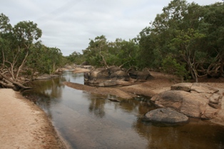
The Archer River is a river located on the Cape York Peninsula, Far North Queensland, Australia.

Fitzmaurice River

The Fitzmaurice River is a river in Australia's Northern Territory.

Calvert River

The Calvert River is a river in the Northern Territory of Australia.

Wildman River

The Wildman River is a river in the Darwin Coastal bioregion of the Northern Territory, Australia.

Liverpool River

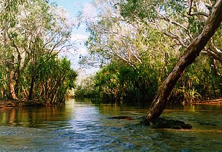
Liverpool River is a river in the Northern Territory of Australia. It is the largest of the tidal river systems of northern Arnhem Land, which includes two major tributaries, the Tomkinson and Mann Rivers.

Goromuru River River in Northern Territory, Australia

The Goromuru River is a river, located in the Northern Territory in Australia.

Keep River

The Keep River is a river, located in the Victoria Bonaparte bioregion of Western Australia and the Northern Territory in Australia.

Blyth River (Northern Territory)

The Blyth River is a river in the Northern Territory, Australia.

Koolatong River River in Australia

The Koolatong River is a river in the Northern Territory, Australia.

Goomadeer River

The Goomadeer River is a river in the Northern Territory, Australia.

Goyder River River in Australia

The Goyder River is a river in the Northern Territory, Australia.

Walker River (Northern Territory) River in Australia

The Walker River is a river in the Northern Territory, Australia.

Towns River

The Towns River is a river in the Northern Territory, Australia.

Limmen Bight River

The Limmen Bight River is a river in the Northern Territory, Australia.

Rosie River

The Rosie River also known as Rosie Creek is a river in the Northern Territory, Australia.

Robinson River (Northern Territory)

The Robinson River is a river in Australia's Northern Territory.

Settlement Creek

The Settlement Creek is a creek located in the Northern Territory and the state of Queensland, Australia.

Coleman River (Queensland)

The Coleman River is a river located on the Cape York Peninsula in Far North Queensland, Australia.

Haughton River

The Haughton River is a river located in North Queensland, Australia.

References

  1. "Map of Moyle River, NT". Bonzle Digital Atlas of Australia. Retrieved 5 May 2015.
  2. "Hyland Bay and associated coastal floodplains" (PDF). Northern Territory Government. Archived from the original (PDF) on 21 March 2015. Retrieved 6 May 2015.
  3. "Australian Catchment, River and Estuary Assessment" (PDF). Natural Heritage Trust. 2002. Archived from the original (PDF) on 13 February 2014. Retrieved 5 May 2015.
  4. "Moyle River, NT". Australian online Coastal Information. Commonwealth of Australia . Retrieved 24 May 2015.
  5. "Drainage Divisions" (PDF). Commonwealth of Australia. 2005. Archived from the original (PDF) on 1 April 2015. Retrieved 5 May 2015.
  6. "Moyle River" (PDF). TRaCK. 2009. Retrieved 12 May 2015.
  7. "Moyle River catchment". Fish Atlas of North Australia. Retrieved 10 May 2015.
  8. "Magatige". AusAnthrop Australian Aboriginal tribal database. Ausanthrop. Retrieved 6 May 2015.
  9. "Moyle river". NT Place Names Register. Northern Territory Government . Retrieved 6 May 2015.