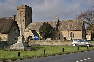
Brize Norton is a village and civil parish 1 mile (1.6 km) east of Carterton in West Oxfordshire. The 2011 Census recorded the parish population as 938. The original part of RAF Brize Norton is in the parish.
Curbridge is a village and civil parish immediately southwest of Witney, in the West Oxfordshire district, in the county of Oxfordshire, England. The 2011 Census recorded the parish's population as 529. Since 2012 it has been part of the Curbridge and Lew joint parish council area, sharing a parish council with the adjacent civil parish of Lew.

Alvescot is a village and civil parish about 1+1⁄2 miles (2.4 km) south of Carterton, Oxfordshire, England. The 2011 Census recorded the parish's population as 472.
Aston Upthorpe is a village and civil parish about 3 miles (5 km) southeast of Didcot in South Oxfordshire. It was part of Berkshire until the 1974 boundary changes transferred it to Oxfordshire. The motion picture National Lampoon's European Vacation (1985) - Stonehenge Scene was filmed a mile to the south of the village on the ancient downland. The 2011 Census recorded the parish's population as 179.

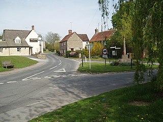
Bampton, also called Bampton-in-the-Bush, is a settlement and civil parish in the Thames Valley about 4+1⁄2 miles (7 km) southwest of Witney in Oxfordshire. The parish includes the hamlet of Weald. The 2011 Census recorded the parish's population as 2,564. Bampton is variously referred to as both a town and a village. The Domesday Book recorded that it was a market town by 1086. It continued as such until the 1890s. It has both a town hall and a village hall.

Oakford is a village and civil parish in the Mid Devon district of Devon, England. It is located three miles (5 km) south west of Bampton and eight miles (13 km) north north west of Tiverton. Oakford is near the river Exe.

Minster Lovell is a village and civil parish on the River Windrush about 2+1⁄2 miles (4 km) west of Witney in Oxfordshire. The 2011 Census recorded the parish's population as 1,409. Minster Lovell village has three parts: Old Minster, Little Minster and New Minster. Old Minster includes the parish church, Minster Lovell Hall and the Old Swan Inn and Minster Mill Hotel. A large part of New Minster is the Charterville Allotments, which were founded by the Chartists in 1846–50.

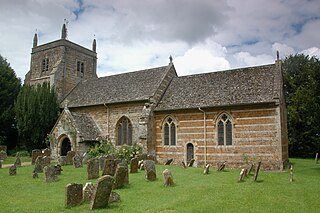
Aston is a village about 4 miles (6.4 km) south of Witney in West Oxfordshire, England. The village is part of the civil parish of Aston, Cote, Shifford and Chimney. The southern boundary of the parish is the River Thames. The 2011 Census recorded the parish's population as 1,374.
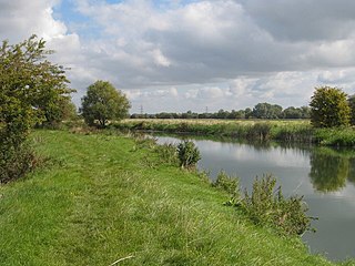
Chimney is a hamlet and former civil parish, now in the parish of Aston, Cote, Shifford and Chimney, in the West Oxfordshire district, in the county of Oxfordshire, England. It is on the River Thames near Shifford Lock, 6 miles (9.7 km) south of Witney. Chimney Meadows 620 acres (250 ha) is the largest nature reserve managed by the Berkshire, Buckinghamshire and Oxfordshire Wildlife Trust.
Northmoor is a village and civil parish in West Oxfordshire, about 6 miles (10 km) west of Oxford and almost the same distance southeast of Witney. Northmoor is in the valley of the River Thames, which bounds the parish to the east and south, and is close to the River Windrush which forms part of the parish's western boundary. The 2011 Census recorded the parish's population as 377.
Duns Tew is an English village and civil parish about 7+1⁄2 miles (12 km) south of Banbury in Oxfordshire. The 2011 Census recorded the parish's population as 478. With nearby Great Tew and Little Tew, Duns Tew is one of the three villages known collectively as "The Tews". A 'tew' is believed to be an ancient term for a ridge of land.

Lew is a village and civil parish about 2+1⁄2 miles (4 km) southwest of Witney in the West Oxfordshire District of Oxfordshire, England. The 2001 Census recorded the parish population as 65. Since 2012 the parish has been part of the Curbridge and Lew joint parish council area, sharing a parish council with the adjacent civil parish of Curbridge.

Shifford is a hamlet in the civil parish of Aston, Cote, Shifford and Chimney in the West Oxfordshire district, in the county of Oxfordshire, England. It is on the north bank of the River Thames about 6 miles (10 km) south of Witney.

Clanfield is a village and civil parish about three miles (5 km) south of Carterton, Oxfordshire. The parish includes the hamlet of Little Clanfield one mile (1.6 km) west of the village, on Little Clanfield Brook which forms the parish's western boundary. The parish's eastern boundary is Black Bourton Brook and its southern boundary is Radcot Cut, an artificial watercourse on the River Thames floodplain. The 2011 Census recorded the parish's population as 879.
Crawley is a village and civil parish beside the River Windrush about 2+1⁄2 miles (4 km) north of Witney, Oxfordshire. The parish extends from the Windrush in the south almost to village of Leafield in the northwest. The 2011 Census recorded the parish's population as 155.

Kencot is a village and civil parish about 2 miles (3 km) south-west of Carterton in West Oxfordshire. The 2011 Census recorded the parish's population as 101.

Cote Baptist Church stands in Shifford Road, Cote, 1 mile (2 km) to the east of Aston and 4 miles (6 km) to the east of Bampton, in Oxfordshire, England. It is a redundant Baptist chapel in the care of the Historic Chapels Trust, and is recorded in the National Heritage List for England as a designated Grade II* listed building.

Cote is a hamlet about 4 miles (6.4 km) south of Witney and 1 mile (1.6 km) north of the River Thames in West Oxfordshire, England. Cote is part of the civil parish of Aston, Cote, Shifford and Chimney. The hamlet of Cote stretches along Cote Lane, which seems to have originated as a road to a former crossing of the River Thames at Shifford.

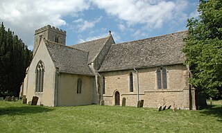
The Church of Saint Mary the Virgin is the Church of England parish church of Bampton, West Oxfordshire. It is in the Archdeaconry of Dorchester in the Diocese of Oxford.

