Churchill, Oxfordshire

Last updated

Churchill
All Saints Churchill.jpg
All Saints' parish church
Oxfordshire UK location map.svg
Red pog.svg
Churchill
Location within Oxfordshire
Population665 (parish, including Sarsden) (2011 Census)
OS grid reference SP2824
  London 77 mi (124 km)
Civil parish
  • Churchill
District
Shire county
Region
Country England
Sovereign state United Kingdom
Post town Chipping Norton
Postcode district OX7
Dialling code 01608
Police Thames Valley
Fire Oxfordshire
Ambulance South Central
UK Parliament
Website Churchill and Sarsden
List of places
UK
England
Oxfordshire
51°55′01″N1°35′24″W / 51.917°N 1.590°W / 51.917; -1.590

Churchill is a village and civil parish about three miles (five kilometres) southwest of Chipping Norton, Oxfordshire in the Cotswolds Area of Outstanding Natural Beauty. Since 2012 it has been part of the Churchill and Sarsden joint parish council area, sharing a parish council with the adjacent civil parish of Sarsden. [1] The 2011 Census recorded the parish's population as 665. [2]

Contents

Toponym

The Domesday Book of 1086 recorded the toponym as Cercelle. A pipe roll from 1168 records it as Cerzhulla. [3] A charter of the Priory of St Frideswide, Oxford from about 1175 records it as Chirchehull. [4] Other late 11th-century, 12th century and early 13th-century variants include Cercell, Cercell', Cercella, Cerchil, Cerchull and Cerchulla. A Close Roll from 1220 records it as Cerceill'. An entry in the Book of Fees for about 1235–36 records it as Cershull'. An assize roll from 1246–47 Latinises the name as Sercellis. A feudal aid document from 1346 records it as Cerccell. [3]

The name is derived from Old English. The parish's old church (see below) was not on top of the hill, so the name may not necessarily refer to a hill with or belonging to a church. There is a barrow almost at the top of the hill, so the first part of the name could be derived from the Brythonic word cruoco [3] or crūc, [4] meaning a hill, burial ground, or barrow. But if this is the case, crūc must have become confused with the Old English cirice ("church") at an early date. [3]

History

Churchill was originally at the foot of a hill now called Hastings Hill, but on 31 July 1684 a fire destroyed 20 houses and many other buildings, and killed four people. The village was rebuilt higher up the hill, with stone houses instead of the old timber-framed and thatched cottages. The fire was apparently caused by a baker who, to avoid chimney tax, had knocked through the wall from her oven to her neighbour's chimney. [5] The old village can still be seen as grassy mounds in the pastures around the Heritage Centre.

The former Chipping Norton Railway, part of the Great Western Railway, passed near Churchill. The line had a small railway station, Sarsden Halt, 14 mi (400 m) northwest of Churchill. British Railways closed the halt to passengers in 1962 [6] and closed the railway in 1964.

Churches

Old parish church

The Heritage Centre is on what is thought to be the site of a Saxon church. In 1348 the church of which the chancel – now the Churchill Heritage Centre – is the last remaining part was built in the Decorated Gothic style. At that time it was at the centre of the village, but after the fire of 1684 the village moved up the hill, and the old parish church of All Saints was left at the edge of the village. By the end of the 18th century the church was said to be in disrepair, and in 1825 James Haughton Langston (1796–1863), who had the living of Churchill & Sarsden, and who owned the Sarsden estate and most of Churchill, built a new one higher up the hill in what had become the centre of the village. The new All Saints was consecrated in 1827. The old church fell into disrepair, but the chancel was retained and used as a mortuary chapel and to house the memorials and in 1869 the Gothic Revival architect CC Rolfe added a new east window. [7]

A Preservation Society was formed in 1988 to campaign for its retention as the last medieval building in Churchill and the building was repaired. The Heritage Centre opened in 2001 in the restored chancel which now houses a collection of maps and historical records of the village from 1600 to the present, as well as displays about Warren Hastings and William Smith. Having received a Heritage Lottery Fund grant in 2010, the building has been refurbished with new interactive displays and oral history recordings.

Old gateway in Churchill graveyard Churchyard 17th-century gateway at All Saints' Church, Churchill, Oxfordshire.jpg
Old gateway in Churchill graveyard

New parish church

The Church of England parish church of All Saints was designed by James Plowman of Oxford in 1826. It is an architectural mixture of imitations. The tower is a two-thirds copy of the tower of Magdalen College, Oxford, its hammerbeam roof a copy of the roof of Christ Church, Oxford, its buttresses are versions of those of the chapel of New College, Oxford, [8] and its windows are based on those from various Oxford Colleges. In a restoration appeal for the tower in 1975, Sir John Betjeman wrote of it:

It is a beautiful landmark and has [...] been an eye-catcher for miles around, and a delightful one. I am sure it was built with this object in view. Although the style is English Perpendicular Gothic, the Tower is in the great tradition of English landscape gardening. Its disappearance would be a grave loss to a rolling wooded landscape.

The west tower has a ring of eight bells. Robert Taylor and Sons cast the third, fourth, fifth and sixth bells in 1826 at their then bell-foundry in Oxford. [9] Their successors John Taylor & Co of Loughborough cast the treble, second, seventh and tenor bells in 1957. [10] Robert Taylor and Sons also made the clock for the west tower. External stairs lead to the bell-ringers' chamber, with a pulpit at the top of the staircase. In imitation of the May morning celebrations at Magdalen College, villagers gather at sunrise on 1 May each year and sing from the stairs and pulpit. [11] The church was damaged by fire on 11 August 2007. It was reopened 15 months later and repairs were completed in the summer of 2009. [12] It is a Grade II* listed building. [13] All Saints' parish is part of the Benefice of Chipping Norton. [14]

Methodist church

Churchill has a Methodist church. It is a member of the West Oxfordshire Methodist Circuit. [15]

Monuments

There are three notable monuments in the village. A monolith, made of stone found in nearby Sarsden Wood, was erected in 1891 at the behest of the 3rd Earl of Ducie, commemorates William Smith. A memorial fountain, erected in 1870 at the behest of Julia, Countess of Ducie, commemorates her father, James Haughton Langston. Jennifer Sherwood described this fountain as: "Memorably ugly. A squat, square tower with obelisks and flying buttresses carrying a dumpy spire. The water drips from a rude spout at the side." [7] There is also a parish war memorial.

Notable people

Amenities

The village has a public house, the Chequers, built in the late 18th or early 19th century. [17] It was controlled by Hunt Edmunds brewery before Mitchells & Butlers Brewery took the company over in the 1960s. It is now a gastropub operated by The Lionhearth Group. [18] The village hall was built in 1870 at the behest of James Langston as a Reading Room for the village. It was converted into the village hall after the Second World War. Bus route X8 serves the village. Buses run peak hours only, Monday to Friday, linking Kingham railway station and Chipping Norton via Churchill. Pulham's Coaches operates the route for Oxfordshire County Council. [19]

Churchill had two primary schools: the "Top School", opposite the church on Junction Road, was the Girls' School, and the "Lower School", further down the hill on the Sarsden Road, was the Boys' School. Their dates are somewhat obscure; the Lower School is said to have been built in 1716, though that seems surprisingly early to some historians, and the deeds of the Top School date it to the 1850s, though its rainwater heads are dated 1870. The Lower School was closed in 1947, the Top School in 1982, [20] and both have been converted and divided into private houses.

Hunt Edmunds plaque on the front of the Chequers Churchill Chequers HuntEdmunds.jpg
Hunt Edmunds plaque on the front of the Chequers

See also

Related Research Articles

<span class="mw-page-title-main">Chipping Norton</span> Market town in West Oxfordshire, England

Chipping Norton is a market town and civil parish in the Cotswold Hills in the West Oxfordshire district of Oxfordshire, England, about 12 miles (19 km) south-west of Banbury and 18 miles (29 km) north-west of Oxford. The 2011 Census recorded the civil parish population as 5,719. It was estimated at 6,254 in 2019.

<span class="mw-page-title-main">Chadlington</span> Human settlement in England

Chadlington is a village and civil parish in the Evenlode Valley about 3 miles (5 km) south of Chipping Norton, Oxfordshire. The village has four neighbourhoods: Brookend, Eastend, Greenend and Westend.

<span class="mw-page-title-main">Hook Norton</span> Human settlement in England

Hook Norton is a village and civil parish in Oxfordshire, England. It lies 4+12 miles (7 km) northeast of Chipping Norton, close to the Cotswold Hills. The 2011 Census recorded the parish's population as 2,117. The village is formed of four neighbourhoods: East End, Scotland End, Down End and Southrop.

<span class="mw-page-title-main">Kingham</span> Human settlement in England

Kingham is a village and civil parish in the Cotswolds about 4 miles (6.4 km) southwest of Chipping Norton, Oxfordshire. The 2011 Census recorded the parish's population as 913.

<span class="mw-page-title-main">Shiplake</span> Human settlement in England

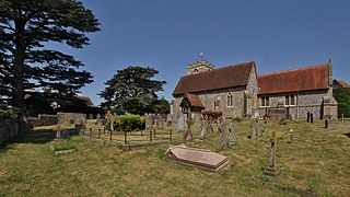
Shiplake consists of three settlements: Shiplake, Shiplake Cross and Lower Shiplake. Together these villages form a civil parish situated beside the River Thames 2 miles (3 km) south of Henley-on-Thames, Oxfordshire, England. The river forms the parish boundary to the east and south, and also the county boundary between Oxfordshire and Berkshire. The villages have two discrete centres separated by agricultural land. The 2011 Census records the parish population as 1,954 and containing 679 homes. The A4155 main road linking Henley with Reading, Berkshire passes through the parish.

<span class="mw-page-title-main">Brize Norton</span> Human settlement in England

Brize Norton is a village and civil parish 1 mile (1.6 km) east of Carterton in West Oxfordshire. The 2011 Census recorded the parish population as 938. The original part of RAF Brize Norton is in the parish.

<span class="mw-page-title-main">Ascott-under-Wychwood</span> Human settlement in England

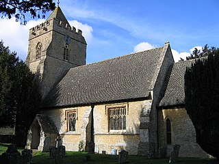
Ascott-under-Wychwood is a village and civil parish in the Evenlode valley about 4.5 miles (7 km) south of Chipping Norton, Oxfordshire, England. The 2011 Census recorded the parish's population as 560.

<span class="mw-page-title-main">Bodicote</span> Human settlement in England

Bodicote is a village and civil parish in North Oxfordshire, approximately 2 miles (3 km) south of the centre of Banbury. The 2011 Census recorded the parish's population as 2,126. The Church of England parish church of Saint John the Baptist is a Grade II* listed building, with the chancel arch dating back to the 13th century.

<span class="mw-page-title-main">Enstone</span> Village and civil parish in Oxfordshire, England

Enstone is a village and civil parish in England, about 4 miles (6.4 km) east of Chipping Norton and 15 miles (24 km) north-west of Oxford city. The civil parish, one of Oxfordshire's largest, consists of the villages of Church Enstone and Neat Enstone, with the hamlets of Chalford, Cleveley, Fulwell, Gagingwell, Lidstone and Radford. The 2011 Census put the parish population as 1,139 living in 453 households. It was estimated at 1,256 in 2019.

<span class="mw-page-title-main">Salford, Oxfordshire</span> Human settlement in England

Salford is a village and civil parish about 1+12 miles (2.4 km) west of Chipping Norton, Oxfordshire. The 2011 Census recorded the parish's population as 356.

<span class="mw-page-title-main">Wardington</span> Human settlement in England

Wardington is a village and civil parish in Oxfordshire, about 4 miles (6.4 km) northeast of Banbury. The village consists of two parts: Wardington and Upper Wardington. The village is on a stream that rises in Upper Wardington and flows north to join the River Cherwell.

<span class="mw-page-title-main">Cassington</span> Human settlement in England

Cassington is a village and civil parish in Oxfordshire about 5 miles (8 km) northwest of Oxford. The village lies on gravel strata about 12 mile (800 m) from the confluence of the River Evenlode with the River Thames. The parish includes the hamlet of Worton northeast of the village and the site of the former hamlet of Somerford to the south. Somerford seems to have been abandoned early in the 14th century. Cassington is formed of two parts, "upper" and "lower", each with its own village green. The 2011 Census recorded the parish's population as 750.

<span class="mw-page-title-main">North Leigh</span> Human settlement in England

North Leigh is a village and civil parish about 3 miles (5 km) northeast of Witney in Oxfordshire. The parish includes the hamlet of East End and since 1932 has also included the hamlet of Wilcote. The 2011 Census recorded the parish's population as 1,929.

<span class="mw-page-title-main">Cornwell, Oxfordshire</span> Human settlement in England

Cornwell is a small village and civil parish about 2.5 miles (4 km) west of Chipping Norton in the West Oxfordshire district of Oxfordshire, near the county border with Gloucestershire. The 2001 Census recorded the parish's population as 66.

<span class="mw-page-title-main">Great Rollright</span> Human settlement in England

Great Rollright is a village and former civil parish, now in the parish of Rollright, in the West Oxfordshire district, in Oxfordshire, England, and about 2.5 miles (4 km) north of Chipping Norton.

<span class="mw-page-title-main">Sarsden</span> Human settlement in England

Sarsden is a village and civil parish about 3 miles (5 km) south of Chipping Norton, Oxfordshire. The 2001 Census recorded the parish population as 83. Since 2012 Sarsden has been part of the Churchill and Sarsden joint parish council area, sharing a parish council with the adjacent civil parish of Churchill.

<span class="mw-page-title-main">Swerford</span> Human settlement in England

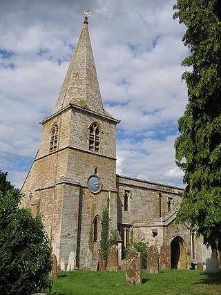
Swerford is a village and civil parish on the River Swere in the Cotswold Hills in Oxfordshire, England. It is about 4 miles (6.4 km) northeast of Chipping Norton. Swerford has two main neighbourhoods: Church End and East End. The area between them contains very few houses and is called Between Towns. The 2011 census recorded the parish's population as 132.

Sarsden Halt was an unstaffed railway station on the Banbury and Cheltenham Direct Railway.

<span class="mw-page-title-main">Wigginton, Oxfordshire</span> Human settlement in England

Wigginton is a village and civil parish about 6 miles (10 km) southwest of Banbury in Oxfordshire. The village is beside the River Swere, which forms the southern boundary of the parish. A Channel Four documentary, Hitler's British Girl, investigated the possibility that Unity Mitford gave birth to the son of Adolf Hitler in Hill View Cottage, Wigginton.

<span class="mw-page-title-main">Little Rollright</span> Human settlement in England

Little Rollright is a hamlet and former civil parish, now in the parish of Rollright, in the West Oxfordshire district, in the county of Oxfordshire, England. It is about 3 miles (5 km) northwest of Chipping Norton, it is the village nearest to the megalithic Rollright Stones. An early spelling may be seen, its Latin form, as "Parva Rolrandryght" in 1446. Little Rollright is in the Kingham, Rollright and Enstone ward of West Oxfordshire District Council and the Chipping Norton division of Oxfordshire County Council. In 1931 the parish had a population of 10. On 1 April 1932 the parish was abolished and merged with Great Rollright to form "Rollright".

References

  1. Churchill and Sarsden
  2. "Churchill Parish". nomis. Durham University for the Office for National Statistics . Retrieved 6 September 2020.
  3. 1 2 3 4 Gelling 1954 , Churchill
  4. 1 2 Ekwall 1960 , Churchill
  5. Mann 2013, p. 36.
  6. Jenkins, Brown & Parkhouse 2004 [ page needed ]
  7. 1 2 Sherwood & Pevsner 1974, p. 545.
  8. Sherwood & Pevsner 1974, pp. 544–545.
  9. Anonymous 2010, p. 9.
  10. Hedgcock, James (20 September 2014). "Churchill All Saints". Dove's Guide for Church Bell Ringers . Central Council for Church Bell Ringers . Retrieved 13 September 2015.
  11. Anonymous 2010, p. 18.
  12. Anonymous 2010, p. 14.
  13. Historic England. "Church of All Saints (Grade II*) (1053342)". National Heritage List for England . Retrieved 13 September 2015.
  14. Archbishops' Council. "Benefice of Chipping Norton". A Church Near You . Church of England. Archived from the original on 15 February 2015. Retrieved 13 September 2015.
  15. "Churchill Methodist Church". West Oxfordshire Methodist Circuit. Retrieved 25 September 2020.
  16. "Rick Stein signs books in city". Oxford Mail . 23 July 2011.
  17. Historic England. "The Chequers (Grade II) (1053341)". National Heritage List for England . Retrieved 13 September 2015.
  18. The Chequers
  19. "X8 Chipping Norton, Churchill, Kingham, Kingham Station" (PDF). Pulham & Sons. Retrieved 6 September 2020.
  20. Churchill and Sarsden School

Sources