Kelmscott is a village and civil parish on the River Thames in West Oxfordshire, about 2 miles (3 km) east of Lechlade in neighbouring Gloucestershire. Since 2001 it has absorbed Little Faringdon, which had been a separate civil parish. The 2011 Census recorded the merged parish's population as 198.
Broughton is a town and civil parish situated on the Roman Ermine Street, in the North Lincolnshire district of Lincolnshire, England. The population of the civil parish at the 2011 census was 5,726. In 2021, the population was 5,434. It is situated approximately 2 miles (3 km) north-west from the town of Brigg. The hamlets of Wressle, Castlethorpe, and part of Scawby Brook lie within the parish boundaries.

Shutford is a village and civil parish in the Cherwell district, in Oxfordshire, England, about 4.5 miles (7.2 km) west of Banbury. The village is about 475 feet (145 m) above sea level. In 2011 the parish had a population of 476. In 1870–72, John Marius Wilson's Imperial Gazetteer of England and Wales described Shutford like this:

Broadwell is a village and civil parish about 2 miles (3 km) south-west of Carterton in West Oxfordshire. The 2011 Census recorded the parish's population as 218.

Broughton is a village and civil parish in northern Oxfordshire, England, about 2+1⁄2 miles (4 km) southwest of Banbury. The 2011 Census recorded the parish's population as 286.

The Counties Act 1844, which came into effect on 20 October 1844, was an Act of Parliament of the United Kingdom which eliminated many outliers or exclaves of counties in England and Wales for civil purposes. The changes were based on recommendations by a boundary commission, headed by the surveyor Thomas Drummond and summarized in a schedule attached to the Parliamentary Boundaries Act 1832. This also listed a few examples of civil parishes divided by county boundaries, most of which were dealt with by later legislation.

North Newington is a village and civil parish in northern Oxfordshire, England, about 2 miles (3 km) west of Banbury. The 2011 census recorded the parish population as 324. The parish is nearly 2 miles (3 km) long east – west and about 1 mile (1.6 km) wide north – south. Sor Brook, a tributary of the River Cherwell, forms part of the eastern boundary of the parish and the B4035 road forms part of the southern boundary. The village is just west of Sor Brook, about 430 feet (130 m) above sea level.

Idbury is a village and civil parish in the Cotswold Hills in Oxfordshire, about 4+1⁄2 miles (7 km) southeast of Stow-on-the-Wold in neighbouring Gloucestershire. The parish includes the hamlets of Bould and Foscot. The 2011 Census recorded the parish's population as 240.

Broughton Poggs is a village in the civil parish of Filkins and Broughton Poggs, in the West Oxfordshire district, in the county of Oxfordshire, England. Broughton Poggs is 3 miles (5 km) southwest of Carterton.

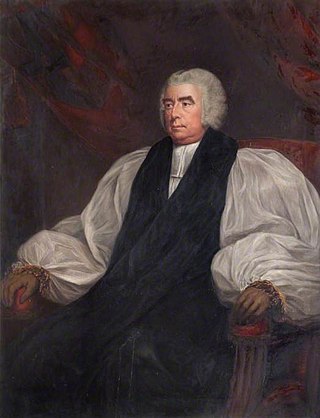
Samuel Goodenough was the Bishop of Carlisle from 1808 until his death in 1827, and an amateur botanist and collector. He is honoured in the scientific names of the plant genus Goodenia and the red-capped robin. In addition, William Kirby's 1802 book on the bees of England, page 182, mentions, in Latin, that the cuckoo bee Nomada goodeniana is named after Goodenough with the following words:
A viro Reverendo S. Goodenough, LL. D. Canonico Windsoriensi, Botanico summo tum et in Entomologia lynceo, nomen suum haec Apis mutuatur.

Filkins is a village in the civil parish of Filkins and Broughton Poggs, in the West Oxfordshire district, in the county of Oxfordshire, England. It is about 2.5 miles (4 km) southwest of Carterton.

Epwell is a village and civil parish in the north of Oxfordshire about 6 miles (10 km) west of Banbury. The 2011 Census recorded the parish population's as 285. Epwell's toponym is believed to be derived from the Old English Eoppa's Well.

Widford is a deserted medieval village in the civil parish of Swinbrook and Widford, in the West Oxfordshire district, in the county of Oxfordshire, England. It is on the River Windrush about 1.5 miles (2.4 km) east of Burford. The village was an exclave of Gloucestershire until 1844.

Little Faringdon is a village and civil parish in West Oxfordshire, about 1 mile (1.6 km) north of Lechlade in neighbouring Gloucestershire. The 2001 Census recorded its population as 63.

Holwell is a village and civil parish about 2 miles (3 km) south of Burford in West Oxfordshire. The 2001 Census recorded the parish's population as 17.

Westwell is a small village and civil parish about 2 miles (3 km) southwest of the market town of Burford in Oxfordshire. It is the westernmost village in the county, close to the border with Gloucestershire.
Richard Pace was a Georgian builder and architect in Lechlade, Gloucestershire, England. He served in the Life Guards 1784–88. Most of his known commissions were houses, in many cases for Church of England clergy. He also restored or refitted a small number of Church of England parish churches. He is commemorated by a monument in St. Lawrence's parish churchyard, Lechlade.

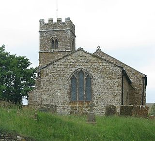
The Parish Church of Saint Matthew, Langford is the Church of England parish church of Langford, a village in West Oxfordshire about 3 miles (5 km) northeast of Lechlade in neighbouring Gloucestershire.


