Curbridge is a village and civil parish immediately southwest of Witney, in the West Oxfordshire district, in the county of Oxfordshire, England. The 2011 Census recorded the parish's population as 529. Since 2012 it has been part of the Curbridge and Lew joint parish council area, sharing a parish council with the adjacent civil parish of Lew.

Ducklington is a village and civil parish on the River Windrush 1 mile (1.6 km) south of Witney in West Oxfordshire. The 2011 Census recorded the parish's population as 1,581.

Bampton, also called Bampton-in-the-Bush, is a settlement and civil parish in the Thames Valley about 4+1⁄2 miles (7 km) southwest of Witney in Oxfordshire. The parish includes the hamlet of Weald. The 2011 Census recorded the parish's population as 2,564. Bampton is variously referred to as both a town and a village. The Domesday Book recorded that it was a market town by 1086. It continued as such until the 1890s. It has both a town hall and a village hall.
Cogges is an area beside the River Windrush in Witney, Oxfordshire, 0.5 miles (800 m) east of the town centre. It had been a separate village and until 1932 it was a separate civil parish.

Yelford is a village and former civil parish, now in the parish of Hardwick-with-Yelford, in the West Oxfordshire district, in the county of Oxfordshire, England. It is about 3 miles (5 km) south of Witney. In 1931 the parish had a population of 17.

Aston is a village about 4 miles (6.4 km) south of Witney in West Oxfordshire, England. The village is part of the civil parish of Aston, Cote, Shifford and Chimney. The southern boundary of the parish is the River Thames. The 2011 Census recorded the parish's population as 1,374.
Chimney is a hamlet and former civil parish, now in the parish of Aston, Cote, Shifford and Chimney, in the West Oxfordshire district, in the county of Oxfordshire, England. It is on the River Thames near Shifford Lock, 6 miles (9.7 km) south of Witney. Chimney Meadows 620 acres (250 ha) is the largest nature reserve managed by the Berkshire, Buckinghamshire and Oxfordshire Wildlife Trust.

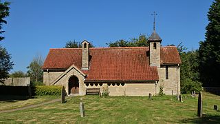
Woodeaton or Wood Eaton is a village and civil parish about 4 miles (6.4 km) northeast of Oxford, England. It also has a special needs school called Woodeaton Manor School.
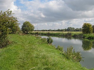
Northmoor is a village and civil parish in West Oxfordshire, about 6 miles (10 km) west of Oxford and almost the same distance southeast of Witney. Northmoor is in the valley of the River Thames, which bounds the parish to the east and south, and is close to the River Windrush which forms part of the parish's western boundary. The 2011 Census recorded the parish's population as 377.

Shifford is a hamlet in the civil parish of Aston, Cote, Shifford and Chimney in Oxfordshire, England. It is on the north bank of the River Thames about 6 miles (10 km) south of Witney.

Widford is a deserted medieval village on the River Windrush about 1.5 miles (2.4 km) east of Burford in West Oxfordshire. The village was an exclave of Gloucestershire until 1844.
Weald is a hamlet in Bampton civil parish in Oxfordshire, England. It lies about 0.7 miles (1.1 km) southwest of Bampton. The toponym Weald is from the Old English for "woodland". The place was recorded by name in the late 12th century when Osney Abbey acquired a house there. It was a separate township by the 13th century. In the 18th and 19th centuries the township included much of the southwest part of the town of Bampton itself. A large late 17th century manor house, Weald Manor, was remodelled at around 1730. It is a Grade II* listed building.

Clanfield is a village and civil parish about three miles (5 km) south of Carterton, Oxfordshire. The parish includes the hamlet of Little Clanfield one mile (1.6 km) west of the village, on Little Clanfield Brook which forms the parish's western boundary. The parish's eastern boundary is Black Bourton Brook and its southern boundary is Radcot Cut, an artificial watercourse on the River Thames floodplain. The 2011 Census recorded the parish's population as 879.
Clapton Crabb Rolfe was an English Gothic Revival architect whose practice was based in Oxford.
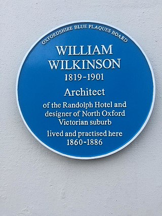
William Wilkinson (1819–1901) was a British Gothic Revival architect who practised in Oxford, England.

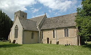
The Parish Church of Saint Giles, Standlake is the Church of England parish church of Standlake, a village about 5 miles (8 km) southeast of Witney in Oxfordshire. Since 1976 St Giles' parish has been a member of the Lower Windrush Benefice along with the parishes of Northmoor, Stanton Harcourt and Yelford.

Wilcote is a hamlet about 3+1⁄2 miles (5.6 km) north of Witney in Oxfordshire, England.

Cote is a hamlet about 4 miles (6.4 km) south of Witney and 1 mile (1.6 km) north of the River Thames in West Oxfordshire, England. Cote is part of the civil parish of Aston, Cote, Shifford and Chimney. The hamlet of Cote stretches along Cote Lane, which seems to have originated as a road to a former crossing of the River Thames at Shifford.

Over Worton is a hamlet in Oxfordshire, about 7 miles (11 km) south of Banbury and 7+1⁄2 miles (12 km) east of Chipping Norton. Over Worton was a separate civil parish until 1932, when it was merged with Nether Worton to form the current civil parish of Worton.

The Church of Saint Mary the Virgin is the Church of England parish church of Bampton, West Oxfordshire. It is in the Archdeaconry of Dorchester in the Diocese of Oxford.


