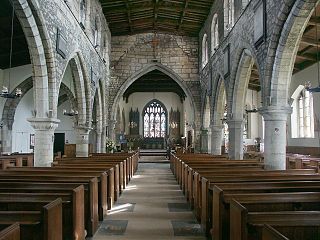
The Haxey Hood is a traditional event in Haxey, North Lincolnshire, England, on 6 January, the Twelfth Day of Christmas.

The Axholme Joint Railway was a committee created as a joint enterprise between the Lancashire and Yorkshire Railway (L&Y) and the North Eastern Railway (NER) and was established by the North Eastern Railway Act of 31 July 1902. It took over the Goole and Marshland Railway, running from Marshland Junction near Goole to Reedness Junction and Fockerby, and the Isle of Axholme Light Railway, running from Reedness Junction to Haxey Junction. Construction of the Goole and Marshland Railway had begun in 1898, and by the time of the takeover in early 1903, was virtually complete. The Isle of Axholme Light Railway was started in 1899, but only the section from Reedness Junction to Crowle was complete at the takeover. The northern section opened in November 1903, and the line from Crowle to Haxey Junction opened for passengers on 2 January 1905.
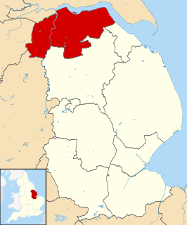
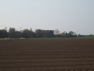
The Isle of Axholme is a geographical area of North Lincolnshire, England. It is the only part of Lincolnshire west of the River Trent. It is between the three towns of Doncaster, Scunthorpe and Gainsborough, in the traditional West Riding of Lindsey.

Brigg and Goole is a constituency in Yorkshire and Lincolnshire represented in the House of Commons of the UK Parliament since 2010 by Andrew Percy of the Conservative Party.

The Borough of Boothferry was, from 1 April 1974 to 1 April 1996, a local government district with borough status within the non-metropolitan county of Humberside. The district is now split between the East Riding of Yorkshire and North Lincolnshire.

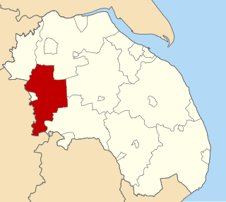
Isle of Axholme was a rural district in Lincolnshire, Parts of Lindsey from 1894 to 1974. It was formed under the Local Government Act 1894 based on the Lincolnshire parts of the Thorne rural sanitary district and two parishes of the Goole RSD.
Gainsborough was rural district in Lincolnshire, Parts of Lindsey from 1894 to 1974.

Misterton is a village and civil parish in the Bassetlaw district of Nottinghamshire, England. The population of the civil parish at the 2011 census was 2,140.

Owston Ferry is a village and civil parish in North Lincolnshire, England. It is situated on the west bank of the River Trent, and 9 miles (14 km) north from Gainsborough. It had a total resident population of 1,128 in 2001 including Kelfield. This increased to 1,328 at the 2011 census. Sometimes referred to as Owston or Ferry, the village forms part of the Isle of Axholme. It is bounded to the west by the A161 road and the village of Haxey. The River Trent is directly to the east. To the north, beyond a number of hamlets and villages, lies the River Humber. West Butterwick was originally a part of the township of Owston.

Garthorpe is a village in North Lincolnshire, England. It is situated approximately 8 miles (13 km) south-east from Goole, 1 mile (1.6 km) west from the River Trent, and in the Isle of Axholme. Together with Fockerby, which is contiguous with the village, Garthorpe forms a civil parish of about 500 inhabitants, measured as 418 in the 2011 census.

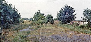
Haxey and Epworth railway station was located near Haxey, Lincolnshire, England. It closed to passengers in 1959 and completely in 1964.
Haxey Junction railway station was a station in Haxey, Lincolnshire. It was the terminus of the Axholme Joint Railway which ran from Marshland Junction near Goole, and was adjacent to Haxey and Epworth station on the Great Northern and Great Eastern Joint Railway line which ran from Doncaster to Lincoln. Both stations are now closed, although the former Great Northern and Great Eastern Joint Railway line is still operational.
Crowle North railway station, officially known as Crowle railway station, was a station in Crowle, Lincolnshire on the Axholme Joint Railway which is now closed. The North designation was used to avoid confusion with Crowle railway station on a neighbouring line.
Reedness Junction railway station was a railway junction near Reedness, East Riding of Yorkshire, England on the Axholme Joint Railway. Immediately to the west of the station, the Fockerby Branch, which continued eastwards, turned off from the main line to Epworth, which curved to the south.

Graizelound is a hamlet in the civil parish of Haxey in North Lincolnshire, England. It is approximately 22 miles (35 km) to the north-west from the city and county town of Lincoln, and centred on the crossroad junction of Haxey Lane, Station Road, Akeferry Road and Ferry Road. The village of Haxey is less than 1 mile (1.6 km) to the north. Owston Ferry on the River Trent is 2.5 miles (4.0 km) to the north-east. Graizelound forms part of the Isle of Axholme.

Westwoodside is a small village in North Lincolnshire, England. It is situated within the Isle of Axholme and 7 miles (11 km) north-west from Gainsborough. Westwoodside is in the civil parish of Haxey, a village 1 mile (1.6 km) to the east.

East Lound is a hamlet in the civil parish of Haxey in North Lincolnshire, England. It is situated approximately 22 miles (35 km) to the north-west from the city and county town of Lincoln, and on Brackenhill Road within the parish of Haxey, a village less than 1 mile (1.6 km) to the west. Owston Ferry on the River Trent is 1.5 miles (2.4 km) to the east. East Lound forms part of the Isle of Axholme.

Brumby Wood is a 21.84-hectare Local Nature Reserve in the town of Scunthorpe in North Lincolnshire. It is owned and managed by North Lincolnshire Council. It is composed of ancient woodland which provides a good habitat for birds, mammals, invertebrates, bluebell, wild garlic and yellow archangel; the site is located in Scunthorpe and is bounded to the north by the South Humberside Main Line railway, to the east and west by playing fields and to the south by an industrial site, a crematorium and a cemetery; the wood is bisected by the A18 road.