Bosque Farms, New Mexico

Last updated

Bosque Farms, New Mexico
Municipal Complex, Bosque Farms NM.jpg
Municipal Complex, February 2013
Valencia County New Mexico Incorporated and Unincorporated areas Bosque Farms Highlighted.svg
Location of Bosque Farms, New Mexico
Usa edcp location map.svg
Red pog.svg
Bosque Farms, New Mexico
Location in the United States
Coordinates: 34°51′12″N106°41′57″W / 34.85333°N 106.69917°W / 34.85333; -106.69917
Country United States
State New Mexico
County Valencia
Government
   Mayor Wayne Ake
Area
[1]
  Total3.94 sq mi (10.19 km2)
  Land3.94 sq mi (10.19 km2)
  Water0.00 sq mi (0.00 km2)
Elevation
4,865 ft (1,483 m)
Population
 (2020) [2]
  Total4,020
  Density1,021.60/sq mi (394.44/km2)
Time zone UTC-7 (Mountain (MST))
  Summer (DST) UTC-6 (MDT)
ZIP codes
87042, 87068
Area code 505
FIPS code 35-08580
GNIS feature ID0932919
Website www.bosquefarmsnm.gov

Bosque Farms is a village in Valencia County, New Mexico, United States. The population was 3,904 at the 2010 census. It is part of the Albuquerque Metropolitan Statistical Area.

Contents

History

What is known as Bosque Farms today was part of a Spanish land grant dating from 1716, originally known as Bosque del Pino (Forest Pines), or Los Pinos.

The land changed hands numerous times before being purchased during the Great Depression by the New Mexico Rural Rehabilitation Corporation, which in turn sold it to the federal Resettlement Administration in 1935. The RA renamed the land Bosque Farms and turned it into an agricultural resettlement project for Dust Bowl refugees. Traditional farming failed due to poor soil conditions, and the families who stayed turned to dairy farming, which became the community's main agricultural industry through the 1960s. [3] [4]

Bosque Farms was incorporated in 1974. Today, housing and commercial development are its main sources of revenue. [3]

Geography

Bosque Farms is located in the Rio Grande Valley at 34°51′12″N106°41′57″W / 34.85333°N 106.69917°W / 34.85333; -106.69917 (34.853392, -106.699251). [5]

According to the United States Census Bureau, the village has a total area of 4.0 square miles (10 km2), all land.

Demographics

Historical population
CensusPop.Note
1980 3,353
1990 3,79113.1%
2000 3,9313.7%
2010 3,904−0.7%
2020 4,0203.0%
U.S. Decennial Census [6] [2]

As of the census [7] of 2000, there were 3,931 people, 1,422 households, and 1,126 families residing in the village. The population density was 996.2 inhabitants per square mile (384.6/km2). There were 1,476 housing units at an average density of 374.0 per square mile (144.4/km2). The racial makeup of the village was 82.68% White, 0.61% African American, 1.88% Native American, 0.20% Asian, 11.19% from other races, and 3.43% from two or more races. Hispanic or Latino of any race were 29.53% of the population.

There were 1,422 households, out of which 33.9% had children under the age of 18 living with them, 67.5% were married couples living together, 8.0% had a female householder with no husband present, and 20.8% were non-families. 16.5% of all households were made up of individuals, and 6.1% had someone living alone who was 65 years of age or older. The average household size was 2.76 and the average family size was 3.10.

In the village, the population was spread out, with 26.0% under the age of 18, 6.2% from 18 to 24, 25.4% from 25 to 44, 29.4% from 45 to 64, and 12.9% who were 65 years of age or older. The median age was 41 years. For every 100 females, there were 98.2 males. For every 100 females age 18 and over, there were 95.6 males.

The median income for a household in the village was $44,055, and the median income for a family was $49,688. Males had a median income of $40,963 versus $25,726 for females. The per capita income for the village was $20,317. About 4.8% of families and 7.7% of the population were below the poverty line, including 10.4% of those under age 18 and 2.1% of those age 65 or over.

Education

Bosque Farms' public schools are operated by Los Lunas Schools. [8]

In 2010, Bosque Farms Elementary won the National Blue Ribbon Award for its excellence in education and for progress in “closing achievement gaps among student subgroups.” [9]

Government

As of April 2020, the current mayor of Bosque Farms is Russell Walkup . [10] [11]

Flag of New Mexico.svg  New Mexicoportal

Related Research Articles

<span class="mw-page-title-main">Socorro County, New Mexico</span> County in New Mexico, United States

Socorro County is a county in the U.S. state of New Mexico. As of the 2020 census, the population was 16,595. The county seat is Socorro. The county was formed in 1852 as one of the original nine counties of New Mexico Territory. Socorro was originally the name given to a Native American village by Don Juan de Oñate in 1598. Having received vitally needed food and assistance from the native population, Oñate named the pueblo Socorro.

<span class="mw-page-title-main">Valencia County, New Mexico</span> County in New Mexico, United States

Valencia County is a county in the U.S. state of New Mexico. As of the 2020 census, the population was 76,205. The county seat is Los Lunas.

<span class="mw-page-title-main">Torrance County, New Mexico</span> County in New Mexico, United States

Torrance County is a county located in the center of the U.S. state of New Mexico. As of the 2020 census, the population was 15,045. The county seat is Estancia.

Stacy Street is a residential street and surrounding census-designated place (CDP) in Palm Beach County, Florida, United States. In the 2010 and 2020 US Census, the CDP is misspelled as Stacey Street. It is part of the Miami metropolitan area of South Florida. The population was 978 at the 2020 US census.

<span class="mw-page-title-main">Isleta Village Proper, New Mexico</span> Census-designated place in New Mexico, United States

Isleta Village Proper is a census-designated place (CDP) in Bernalillo County, New Mexico, United States. The population was 491 at the 2010 census. It is part of the Albuquerque Metropolitan Statistical Area.

<span class="mw-page-title-main">Santa Teresa, New Mexico</span> Census-designated place in Doña Ana County, New Mexico, United States

Santa Teresa is a census-designated place (CDP) in Dona Ana County, New Mexico, United States. It is home to the Santa Teresa Port of Entry and is part of the Las Cruces Metropolitan Statistical Area, although geographically it is considerably closer to El Paso, Texas than to Las Cruces. While the United States Census Bureau has defined Santa Teresa as a CDP, the census definition of the area may not precisely correspond to local understanding of the area with the same name. The population was 4,258 at the 2010 census and 5,044 at the 2020 census. The National Weather Service El Paso Weather Forecast Office that serves extreme western Texas and Southwestern New Mexico states is based in Santa Teresa.

<span class="mw-page-title-main">Placitas, Sandoval County, New Mexico</span> CDP in New Mexico, United States

Placitas is a census-designated place (CDP) in Sandoval County, New Mexico, United States. As of the 2010 census, its population was 4,977. It is part of the Albuquerque Metropolitan Statistical Area.

<span class="mw-page-title-main">Willard, New Mexico</span> Village in New Mexico, United States

Willard is a village in Torrance County, New Mexico, United States. The population was 253 at the 2010 census. It is part of the Albuquerque Metropolitan Statistical Area. The village is not experiencing the same extreme growth that towns farther north in the state are. A wind farm has recently been constructed upon the mesa just south of the town. It provides power for about 25,000 homes in Arizona.

<span class="mw-page-title-main">Casa Colorada, New Mexico</span> CDP in New Mexico, United States

Casa Colorada is a census-designated place (CDP) in Valencia County, New Mexico, United States. The population was 272 at the 2010 census. It is part of the Albuquerque Metropolitan Statistical Area.
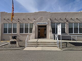
<span class="mw-page-title-main">Jarales, New Mexico</span> CDP in New Mexico, United States

Jarales is a census-designated place (CDP) in Valencia County, New Mexico, United States. The population was 2,475 at the 2010 census. It is part of the Albuquerque Metropolitan Statistical Area.

<span class="mw-page-title-main">Los Chavez, New Mexico</span> CDP in New Mexico, United States

Los Chavez is a census-designated place (CDP) in Valencia County, New Mexico. The population was 5,033 at the time of the 2000 census. It is part of the Albuquerque Metropolitan Statistical Area.
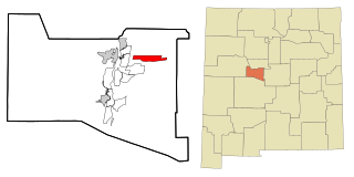
<span class="mw-page-title-main">Meadow Lake, New Mexico</span> CDP in New Mexico, United States

Meadow Lake is a census-designated place (CDP) in Valencia County, New Mexico, United States. The population was 4,491 at the 2000 census. It is part of the Albuquerque Metropolitan Statistical Area.

<span class="mw-page-title-main">Peralta, New Mexico</span> Town in New Mexico, United States

Peralta is a town in Valencia County, New Mexico, United States. Prior to its incorporation on July 1, 2007, it was a census-designated place (CDP). The population was 3,660 as of the 2010 census. Peralta is part of the Albuquerque metropolitan area.

<span class="mw-page-title-main">Rio Communities, New Mexico</span> City in New Mexico, United States

Rio Communities is a city in Valencia County, New Mexico, United States. Prior to its incorporation on May 16, 2013, it was a census-designated place (CDP). The CDP population was 4,723 as of the 2010 census.

<span class="mw-page-title-main">Rio Communities North, New Mexico</span> CDP in New Mexico, United States

Rio Communities North is a census-designated place (CDP) in Valencia County, New Mexico, United States. The population was 1,588 at the 2000 census. It is part of the Albuquerque Metropolitan Statistical Area.

<span class="mw-page-title-main">Tome-Adelino, New Mexico</span> Former Census-designated place in New Mexico, United States

Tome-Adelino is a former census-designated place (CDP) in Valencia County, New Mexico, United States. The population was 2,211 at the 2000 census. It is part of the Albuquerque Metropolitan Statistical Area. For the 2010 census, the CDP was split into the census-designated places of Tome and Adelino.

<span class="mw-page-title-main">Valencia, Valencia County, New Mexico</span> CDP in New Mexico, United States

Valencia is a census-designated place (CDP) in Valencia County, New Mexico, United States. The population was 2,192 at the 2010 census. It is part of the Albuquerque Metropolitan Statistical Area.

<span class="mw-page-title-main">Covington, New York</span> Town in New York, United States

Covington is an incorporated town in Wyoming County, New York. The population was 1,231 at the 2010 census. The town was named after General Leonard Covington.

<span class="mw-page-title-main">Corrales, New Mexico</span> Village in New Mexico, United States

Corrales is a village in southern Sandoval County, New Mexico, United States. First farmed by Tiquex Pueblo people, chosen due to its proximity to the Rio Grande, as documented by Hispano farmers of Nuevo México in the late 1500s. Despite being a part of the Albuquerque metropolitan area, the village maintains its rural character, while also being surrounded by the cities of Albuquerque and Rio Rancho. The population of Corrales was 8,329 at the 2010 Census.

<span class="mw-page-title-main">Albuquerque metropolitan area</span> Metropolitan area in central New Mexico

The Albuquerque Metropolitan Statistical Area, sometimes referred to as Tiguex, is a metropolitan area in central New Mexico centered on the city of Albuquerque. The metro comprises four counties: Bernalillo, Sandoval, Torrance, and Valencia. As of the 2010 United States Census, the MSA had a population of 887,077. The population is estimated to be 923,630 as of July 1, 2020, making Greater Albuquerque the 61st-largest MSA in the nation. The Albuquerque MSA forms a part of the larger Albuquerque–Santa Fe–Las Vegas combined statistical area with a 2020 estimated population of 1,165,181, ranked 49th-largest in the country.

References

  1. "ArcGIS REST Services Directory". United States Census Bureau. Retrieved October 12, 2022.
  2. 1 2 "Census Population API". United States Census Bureau. Retrieved October 12, 2022.
  3. 1 2 Village History Archived October 29, 2010, at the Wayback Machine . Village of Bosque Farms web site. Retrieved March 8, 2010.
  4. Richard Melzer (2009), New Deal Success or "Noble Failure"? Bosque Farms' Early Years as a Federal Resttlement Project, 1935–1939. New Mexico Historical Review, 85(1), 1–37.
  5. "US Gazetteer files: 2010, 2000, and 1990". United States Census Bureau. February 12, 2011. Retrieved April 23, 2011.
  6. "Census of Population and Housing". Census.gov. Retrieved June 4, 2016.
  7. "U.S. Census website". United States Census Bureau . Retrieved January 31, 2008.
  8. "2020 CENSUS - SCHOOL DISTRICT REFERENCE MAP: Valencia County, NM" (PDF). U.S. Census Bureau . Retrieved September 4, 2022.
  9. "2010 Blue Ribbon Schools : All Public and Private" (PDF). 2.ed.gov. Retrieved March 10, 2022.
  10. "Mayor & Council". Village of Bosque Farms. Retrieved April 6, 2022.
  11. Editor, Julia M. Dendinger | News-Bulletin Assistant (March 5, 2020). "Walkup wins Bosque Farms mayoral race". Valencia County News-Bulletin. Retrieved April 6, 2022.{{cite web}}: |last= has generic name (help)