Braunton Burrows

Last updated

Braunton Burrows
Site of Special Scientific Interest
Braunton Burrows dune.jpg
Flagpole Dune - A major blowout encouraged to feed sand into the surrounding area.
Devon UK location map.svg
Red pog.svg
Location within Devon
Location North Devon
Grid reference SS457352
Coordinates 51°05′49″N4°12′47″W / 51.097°N 4.213°W / 51.097; -4.213
InterestBiological and Geological
Area1,356.7 hectares (13.567 km2; 5.238 sq mi)
Notification 1952 (part)
1969 (full)
Natural England website

Braunton Burrows is a sand dune system on the North Devon coast. It is privately owned and forms part of the Christie Devon Estates Trust (see Tapeley Park). Braunton Burrows is a prime British sand dune site, the largest sand dune system (psammosere) in England. It is particularly important ecologically because it includes the complete successional range of dune plant communities, with over 470 vascular plant species. The short turf communities are very rich in lichens and herbs, and the dune slacks are also rich. The many rare plants and animals include 14 with UK Biodiversity Action Plans. For example, this is one of only two sites in the UK for the Amber Sandbowl Snail Catinella arenaria , which is found on the wet dune slacks.

Contents

History

The Devon historian Tristram Risdon (d.1640) wrote as follows: [1]

" Santon is in the parish of Branton, not unaptly so termed the Town by the Sand, that hath overblown many hundred acres of land. And near this hamlet the country people had so undermined a hill of sand, by digging it to carry it into their grounds, that a great quantity thereof fell down, discovering the top of a tree, which by farther search was found to be thirty feet in length, so that it plainly appeareth this circuit of marsh land (now, of the sands overblowing, called the Burrows) was in elder ages stored with woods and tall timber trees".

Similar stories exist in respect of the south coast of Glamorgan, across the Bristol Channel, regarding the Merthyr Mawr Sand Dunes which started shifting in the late 14th century and encroached on Kenfig Castle, resulting in its evacuation [2] but which spared Candleston Castle, now almost surrounded by dunes.

Civilian use

A lifeboat station was opened on Braunton Burrows in 1848, although its crew always came from the established Appledore Lifeboat Station on the other side of the estuary. It was closed in 1918 as it was difficult to find men and horses to launch the boat following World War I. [3]

It is used, particularly by local people, for a range of leisure activities, particularly dog-walking, from three large car parks adjacent to the site. There is a long tradition of scientific research, particularly botanical. Tourism is an important use of the area in summer. The more isolated parts of the Burrows are noted for naturism. [4]

Military use

Concrete replica Landing craft built in 1943 for practice before D-Day Braunton-Burrows-concrete-landing-craft-June-2021-1.jpg
Concrete replica Landing craft built in 1943 for practice before D-Day
Braunton Burrows concrete landing craft with memorial plaque Braunton-Burrows-concrete-2.jpg
Braunton Burrows concrete landing craft with memorial plaque

Braunton Burrows played an important role during the Second World War. In 1943 Lieutenant Colonel Paul W. Thompson was tasked with training the Americans for their assault on the heavily defended Normandy beaches.

All good training ground had been claimed by the British and so Thompson had no choice but to accept the Atlantic coast near Braunton. The perimeter of the land he needed did in fact stretch south from Mortehoe Station to Braunton, and the River Caen to the Taw Torridge Estuary. Every acre was needed for exercise and for rehearsals using live ammunition, explosives, tanks, artillery and air support – all of which became features of the US Assault Training Centre.

The beaches here were ideal for amphibious exercises, despite the fierce Atlantic surf, and the nearby sands were soon found to be identical to Omaha in every respect – including sand quality, beach gradient and tidal range. Anyone who has seen Omaha beach will instantly recognise an uncanny resemblance to Woolacombe and Saunton.

Thompson was originally tasked with teaching the troops how to neutralise the enemy beach defences and then fight their way inland, although the second part of his mission was later relocated to Slapton beach in South Devon.

Ranges for all weapons were required in order to help the troops practice and construction of such ranges and other aids had to be carried out quickly, as the first units arrived in North Devon on 1 September 1943. 8 Replica landing craft made from concrete can still be found at the southern end of the Burrows. Two of the structures replicate LCMs while six replicate LCTs

As winter approached, a permanent camp was needed; most troops had been accommodated in tents until then. 505 Nissen huts were erected to house 4250 men.

Some of the narrow country lanes were made one-way for ease of use and where no metalled roads existed temporary tracks were laid. One such track is the old ferry way, which extended from the south end of Sandy Lane across the back of the dunes to the White House near Crow Point. This road was widened and straightened and exists today as ‘the American Road’.

The site is currently leased by the Ministry of Defence from the Christie Devon Estates Trust (see Tapeley Park). The area is closed for 10 days per year for military training. The fact that it is so difficult to navigate makes it ideal for land-based exercises, although the sandy conditions are useful to all disciplines. The Royal Air Force sometimes use Saunton Sands to practice STOL beach landing and take off with the Lockheed C-130 Hercules. The Royal Marines also occasionally use the beach to practice amphibious landings.

Lighthouses

Crow Point Lighthouse

Crow Point Lighthouse
Crow Point - geograph.org.uk - 717034.jpg
Crow Point Lighthouse
Braunton Burrows
Location Appledore
Devon
England
Coordinates 51°03′58″N4°11′23″W / 51.06616°N 4.18980°W / 51.06616; -4.18980
Tower
Constructed1954
Constructionmetal skeletal tower
Height5 m (16 ft)
Shapesquare pyramidal tower with balcony and light
Markingswhite tower
Power sourcesolar power  OOjs UI icon edit-ltr-progressive.svg
OperatorTrinity House [5]
Light
Focal height7.6 m (25 ft)
Lens300mm fixed drum lens
Intensity182 candela
Range6 nmi (11 km)
Characteristic Fl WR 2.5s.

Situated at the south end of Braunton Burrows is Crow Point Lighthouse, which guides vessels navigating the Taw and Torridge estuary. Erected in 1954, the lighthouse is a small tubular steel structure, powered when first built by acetylene gas, then from 1978 by electricity and now by solar power following conversion in 1987. [6] Modernised in 2001, [7] it currently displays a sector light indicating safe passage in and out of the River Taw. It is operated by Trinity House.

Bideford Bar leading lights

Sketch of the high lighthouse from an early 20th-century guidebook. Braunton Lighthouse (1908).jpg
Sketch of the high lighthouse from an early 20th-century guidebook.

A much larger structure formerly stood, alongside the estuary, north-west of the current light: Bideford High lighthouse (also known as Braunton Lighthouse) consisted of an octagonal wooden tower built on top of keepers' accommodation, 86 foot high in total. [8] There was also an associated low light. [9] The low light was 300 metres to the north-west of the main light; when the two were aligned, as seen from a vessel in Bideford Bay, they provided a bearing for the safe passage through the shoals in the estuary. [10] The lower light was contained in a wooden shed mounted on a short railway running perpendicular to the shore, so that it could be moved to keep pace with the dynamically shifting shoals; for example, between 1820 and 1832 it had to be winched 34 m to the north-east, while in the following twelve years it had to be winched back to the south-west by 90 m. [11] Designed by Joseph Nelson, both lighthouses were built in 1819 and came into use the following year; both were painted white and each was lit by a single Argand light mounted within a parabolic reflector. [10] The Low Light was rebuilt in 1832. In the 19th century the lights were tidal: rather than being lit all night, they were only displayed between half-flood and half-ebb, when they signalled safe passage over Bideford Bar [10] (a notorious sand bank which renders entry into the Taw Torridge Estuary hazardous at low tide). [12]

In 1879 the High Light began to be displayed all night, regardless of the state of the tide. [13] This was one of a number of improvements undertaken to the light in association with the establishment of Bull Point Lighthouse further to the north. It was around this time that a lantern was added to the top of the tower (transplanted from one of the decommissioned Casquets lighthouse towers) [14] and the light was made dioptric. At the same time the visible arc of the light was increased to seaward (and in addition it was made visible, as a less powerful light, to the south and east for harbour navigation). [13] Not long afterwards, in 1889, the High Light was made occulting (the light being eclipsed for two seconds every thirty seconds). [15] The Low Light remained tidal (later an additional red or green light signalled the state of the tide, and a spherical daymark was used during hours of daylight). [16] In 1890 each lighthouse was painted with a vertical red stripe on the seaward side. [17]

In 1945 the two lighthouse keepers were withdrawn as the ground under the High Light (where they lived) was becoming unstable. Plans were put in place for the High Light tower to be replaced and for both lights to be equipped with acetylene lamps (which would not require a keeper in full-time attendance); [18] however the structure remained in use for a further 12 years. Latterly both lights were classed as 'unwatched', and they displayed occulting lights. [19]

After the establishment of Crow Point Light, both the old Braunton lights were demolished in 1957 [20] and a new pair of leading lights were erected east of the estuary, at Instow.

Designations

Part of the site was de-declared as an NNR in 1996 because of a disagreement over grazing management practices between the landowner Christie Devon Estates Trust and English Nature. This de-declaration was a unique occurrence.[ citation needed ]

Braunton Burrows forms the core area of North Devon's Biosphere Reserve.

Dune plant communities

The site is the second largest sand dune system in the UK and an important part of the North Devon UNESCO Biosphere Reserve. [21] [22] At least 470 species of plants have been recorded. This number in such a small area means that Braunton has been considered the parish in England containing the largest number of wild plants. [23] These include many plants of common species as well as several unusual ones, such as sea stock, sea clover and sand toadflax. It is one of two sites in England for water germander. As well as flowering plants, many mosses, lichens and liverworts live among the dunes. over 60 species of lichen have been recorded. [24]

One consequence of the plant diversity is that there are diverse populations of insects. Over half of the species of butterfly found in the UK have been recorded within Braunton Burrows. [23]

Scrub invasion

Scrub invasion is managed to maintain a state of semi-equilibrium and prevent succession to a climax community. The methods of scrub management used have become a point of contention between the various parties involved with the site.

During the 1970s invasion of coarse grasses were managed largely by rabbit grazing. The spread of myxomatosis resulted in rabbit population decline and consequent encroachment of species rich turf by scrub species such as privet Ligustrum vulgare and heather Calluna vulgaris . Decline in species diversity was exacerbated through the introduction of sea buckthorn Hippophae rhamnoides by the military. This attempt at dune stabilisation was implemented after preparations for the Normandy landings caused widespread erosion. Deep rooted species such as bramble, hawthorn and willow were also able to flourish and resulted in several sallow carr communities. These species were maintained and species rich turf later established through a combination of management techniques.

Braunton Burrows, August 2009 Braunton Burrows.JPG
Braunton Burrows, August 2009

The burning of deep rooted species often made the soil more fertile but led to the spread of coarse grasses. These grasses were later managed by mowing in combination with grazing by soay sheep and cattle.

Grazing was viewed by the Christies Estates Trust as exacerbating erosion and hence damaging to species diversity. The trust therefore opposed the introduction of sheep and cattle to the site. However English Nature felt that this turnover was erosive but nevertheless was less invasive than mowing. English Nature felt the turnover of soil increased species diversity and with the use of soay sheep, maintained a desirable balance to ecosystems. It was this disagreement that was the main factor which led to the de-designation of the site as a national nature reserve in 1996.

In the twenty-first century the use of tracked and off-road vehicles on parts of the site for training by the Ministry of Defence, overseen by Natural England, contributes to control of scrub and also creates open soil that is essential for some of the plant species. North Devon cattle and wild rabbits also continue to graze on the area. [23]

See also

Related Research Articles

<span class="mw-page-title-main">South West Coast Path</span> Long-distance footpath in England

<span class="mw-page-title-main">North Devon</span> Non-metropolitan district in England

North Devon is a local government district in Devon, England. Its council is based just outside Barnstaple, the district's largest town. The district also includes the towns of Ilfracombe, Lynton and Lynmouth and South Molton along with numerous villages and surrounding rural areas.

<span class="mw-page-title-main">Braunton</span> Village in Devon, England

Braunton is a large village, civil parish, ecclesiastical parish and former manor in Devon. The village is situated 5 miles (8 km) west of Barnstaple. It is one of the largest villages in Devon with a population at the 2021 census of 10,217 people. There are two electoral wards. Their joint population at the above census was 8,218. Within the parish is the fertile, low-lying Braunton Great Field, which adjoins the undulating Braunton Burrows, the Core Area in North Devon Biosphere Reserve, the largest psammosere in England. It confronts the Atlantic Ocean at the west of the parish at the large beach of Saunton Sands, one of the South West's international-standard surfing beaches.

<span class="mw-page-title-main">Croyde</span> Village in Devon, England

Croyde is a village on the west-facing coastline of North Devon, England. The village lies on the South West Coast Path near to Baggy Point, which is owned by the National Trust. It lies within the North Devon Coast Area of Outstanding Natural Beauty.

<span class="mw-page-title-main">Westward Ho!</span> Village in Devon, England

Westward Ho! is a seaside village near Bideford in Devon, England. The A39 road provides access from the towns of Barnstaple, Bideford, and Bude. It lies at the south end of Northam Burrows and faces westward into Bideford Bay, opposite Saunton Sands and Braunton Burrows. There is an electoral ward with the same name. The population at the 2011 census was 2,112.

<span class="mw-page-title-main">Northam, Devon</span> Town in Devon, England

Northam is a market town, civil parish and electoral ward in Devon, England, lying north of Bideford. The civil parish also includes the villages of Westward Ho!, Appledore, West Appledore, Diddywell, Buckleigh and Silford, and the residential areas of Orchard Hill and Raleigh Estate.

<span class="mw-page-title-main">Appledore, Torridge</span> Village in Devon, England

Appledore is a village at the mouth of the River Torridge, about 6 miles (10 km) west of Barnstaple and about 3 miles (5 km) north of Bideford in the county of Devon, England. It is the home of Appledore Shipbuilders, a lifeboat slipway and Hocking's Ice Cream, a brand of ice cream only sold in North Devon. There are numerous shops, cafes and galleries. The local football club is Appledore F.C. The ward population at the 2011 census increased to 2,814.

<span class="mw-page-title-main">Instow</span> Village in North Devon, England

Instow is a village in north Devon, England. It is on the estuary where the rivers Taw and Torridge meet, between the villages of Westleigh and Yelland and on the opposite bank to Appledore. There is an electoral ward with the same name. The ward's total population at the 2011 census was 1,501.

<span class="mw-page-title-main">River Taw</span> River in Devon, England

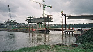
The River Taw rises at Taw Head, a spring on the central northern flanks of Dartmoor, crosses North Devon and at the town of Barnstaple, formerly a significant port, empties into Bideford Bay in the Bristol Channel, having formed a large estuary of wide meanders which at its western end is the estuary of the River Torridge.

<span class="mw-page-title-main">Barnstaple Western Bypass</span> Bypass road in South West England

The Barnstaple Western Bypass is a congestion-relief scheme designed to take road traffic away from the town centre of Barnstaple, a market town in Devon, South West England. Construction of the new road started in the Spring of 2005 and it was opened on 23 May 2007.

<span class="mw-page-title-main">Tarka Trail</span> Series of footpaths and cycle paths in North Devon, England

The Tarka Trail is a series of footpaths and cyclepaths around north Devon, England that follow the route taken by the fictional Tarka the Otter in the book of that name. It covers a total of 180 miles (290 km) in a figure-of-eight route, centred on Barnstaple.

<span class="mw-page-title-main">Saunton</span> Village in Devon, England

Saunton is a village located approximately two miles from Braunton on the North Devon coast in the South West of England.

Crow Point may refer to

<span class="mw-page-title-main">Saunton Sands</span> Beach in Devon, England

Saunton Sands is a beach near the English village of Saunton on the North Devon coast near Braunton, popular for longboard surfing. Beyond its southern end, Crow Point, England is the mouth of the River Taw estuary. It is part of the Taw-Torridge estuary Area of Outstanding Natural Beauty and is at the centre of the UNESCO-designated North Devon's Biosphere Reserve, where Braunton Burrows lies at the heart.

<span class="mw-page-title-main">North Devon Coast</span> Area of Outstanding Natural Beauty in England

The North Devon Coast is a designated Area of Outstanding Natural Beauty in Devon, England, designated in September 1959. The AONB contributes to a family of protected landscapes in the Southwest of England and a total of 38% of the region is classified by the International Union for Conservation of Nature as Category V Protected Landscapes. The twelve Areas of Outstanding Natural Beauty extend to 30% of the region, twice the proportion covered by AONBs in England as a whole and a further two National Parks, Dartmoor and Exmoor, cover an additional 7%.

<span class="mw-page-title-main">Gribben Head</span> Headland on the south coast of Cornwall, England

Gribbin Head is a promontory on the south coast of Cornwall, England, UK, owned and managed by the National Trust. It separates St Austell Bay from the estuary of the River Fowey and is marked by a large tower used to aid navigation of ships approaching the local harbours. The nearest town is Fowey. The western point of the headland is called Little Gribbin.

<span class="mw-page-title-main">Bideford Bay</span>

Bideford Bay, also known as Barnstaple Bay and often shown on maps as Barnstaple or Bideford Bay, is a large area of water on the northwest coast of Devon in South West England, at the southwestern end of the Bristol Channel where it joins the Celtic Sea. The bay extends from Hartland Point in the southwest to Baggy point the northeast, and is partly sheltered by the island of Lundy, 12 miles (19 km) offshore. It takes its alternative names from the towns of Bideford and Barnstaple, located respectively on the rivers Torridge and Taw which flow into the bay. The alternative spelling Barnstable Bay, in use long after that spelling became obsolete for the town, is also sometimes seen.

<span class="mw-page-title-main">Appledore Lifeboat Station</span> Lifeboat station in Devon, England

Appledore Lifeboat Station is the base for Royal National Lifeboat Institution (RNLI) search and rescue operations at Appledore, Devon in the United Kingdom. The first lifeboat was stationed in the town in 1825 and the present station was opened in 2001. It operates a Tamar-class all weather boat (AWB) and an Atlantic 85 B Class inshore lifeboat (ILB).

<span class="mw-page-title-main">North Devon's Biosphere Reserve</span> UNESCO biosphere reserve in North Devon, England

North Devon's Biosphere Reserve is a UNESCO biosphere reserve in North Devon. It covers 55 square miles (140 km2) and is centred on Braunton Burrows, the largest sand dune system (psammosere) in England. The boundaries of the reserve follow the edges of the conjoined catchment basin of the Rivers Taw and the Torridge and stretch out to sea to include the island of Lundy. The biosphere reserve is primarily lowland farmland, and includes many protected sites including 63 Sites of Special Scientific Interest which protect habitats such as culm grassland and broadleaved woodlands. The most populous settlements in its buffer area are Barnstaple, Bideford, Northam, Ilfracombe, and Okehampton.

References

  1. Risdon, Tristram (d.1640), Survey of Devon, 1811 edition, London, 1811, with 1810 Additions, pp.338-9
  2. K. Pye and S.J. Blott (November 2011). "Merthyr Mawr Warren Potential for Dune Reactivation (searched on Castleton Castle)". CCW Contract Science Report No: 978 for Countryside Council for Wales. pp. 12–13. Retrieved 11 July 2013.
  3. Leach, Nicholas (2009). Devon's Lifeboat Heritage. Chacewater: Twelveheads Press. pp. 39–44. ISBN   978-0-906294-72-7.
  4. "Saunton Sands - North Devon". Clothes Free / Naturist / Nudist Beaches. Retrieved 3 July 2016.
  5. Rowlett, Russ. "Lighthouses of Southwest England (Devon and Cornwall)". The Lighthouse Directory. University of North Carolina at Chapel Hill . Retrieved 30 April 2016.
  6. "Crow Point Lighthouse". Trinity House. Archived from the original on 17 August 2012.
  7. Woodman, Richard; Wilson, Jane (2002). The Lighthouses of Trinity House. Bradford-on-Avon, Wilts.: Thomas Reed. p. 207.
  8. High Light photo (Braunton Museum)
  9. Low Light photo (Braunton Museum)
  10. 1 2 3 "Lighthouse management : the report of the Royal Commissioners on Lights, Buoys, and Beacons, 1861, examined and refuted Vol. 2". 1861. p. 94.
  11. Keene, Janet; Keene, Peter (1997). Northam Burrows estuary environments. Thematic Trails. p. 18. ISBN   978-0-948444-33-3.
  12. "Explore Braunton". Bideford Bar. Retrieved 26 February 2019.
  13. 1 2 London Gazette, Issue 24747, Page 4701, 29 July 1879
  14. Mercantile Marine Fund: Minutes of Evidence Taken Before the Committee of Inquiry appointed by the President of the Board of Trade. London: HMSO. 1896. p. 281.
  15. London Gazette, Issue 25957, Page 4017, 26 July 1889
  16. "Braunton Lighthouse". Lighthouse Compendium. Retrieved 27 February 2019.
  17. London Gazette, Issue 26115, Page 7057, 16 December 1890
  18. "Hansard: Written Answers (Commons) 9 April 1946 vol. 421, col. 304: Sea Marks (changes)". Historic Hansard. UK Parliament. Retrieved 4 August 2022.
  19. "British Isles, English Channel and North Sea". United States Hydrographic Office List of Lights and Fog Signals. IV (33): 132. 1956.
  20. "Picture and historical details". Archived from the original on 4 March 2016. Retrieved 17 June 2014.
  21. "Braunton Burrows". Christie Devon Estates. Retrieved 18 March 2022.
  22. "North Devon UNESCO Biosphere". BiosphereNorthDevon. Retrieved 18 March 2022.
  23. 1 2 3 "Rare plants". Braunton Countryside centre. Retrieved 18 March 2022.
  24. "Braunton Burrows IPA". Plantlife. Retrieved 18 March 2022.