Brighstone

Last updated

Brighstone
Brighstone, Isle of Wight, UK.jpg
Brighstone Village
Isle of Wight UK location map.svg
Red pog.svg
Brighstone
Location within the Isle of Wight
Area19.7665 km2 (7.6319 sq mi)  [1]
Population1,603 (2011 census including Brook , Hulverstone , Limerstone and Thorncross ) [2]
  Density 81/km2 (210/sq mi)
Civil parish
  • Brighstone
Unitary authority
Ceremonial county
Region
Country England
Sovereign state United Kingdom
Post town Newport
Postcode district PO30
Dialling code 01983
Police Hampshire
Fire Hampshire and Isle of Wight
Ambulance Isle of Wight
UK Parliament
List of places
UK
England
Isle of Wight
50°38′38″N1°24′00″W / 50.644°N 1.400°W / 50.644; -1.400 Coordinates: 50°38′38″N1°24′00″W / 50.644°N 1.400°W / 50.644; -1.400
View of Brighstone from Limerstone Down, looking south-west, with the English Channel in the distance Brighstone (2), IW, UK.jpg
View of Brighstone from Limerstone Down, looking south-west, with the English Channel in the distance
Brighstone village Brighstone Village.jpg
Brighstone village

Brighstone is a village and civil parish [3] on the Isle of Wight, 6 miles southwest of Newport on the B3399 road. Brighstone was previously known as "Brixton". The name derives from the Saxon name "Ecgbert's Tun".

Contents

Brighstone is the largest village in the area locally known as the Back of the Wight [4] and extends toward Limerstone and Mottistone. In Roman times a villa was built to the north, to take advantage of the clean waters of the Buddle Brook. [5]

History

Brighstone history dates back to the 9th century when it was given to the Bishopric of Winchester by King Egbert.

Brighstone parish was formed in 1644. The civil parish comprises the main village of Brighstone together with the smaller villages of Brook, Hulverstone, Limerstone and Mottistone. The entire parish lies within an area of the Isle of Wight AONB and its coastline is designated as Heritage Coast and Site of Special Scientific Interest.

St. Mary's Church, Brighstone is a venerable old church that has stood for more than eight centuries. The village also features Brighstone Shop and Museum, owned by the National Trust, displaying exhibitions on village life in the 19th century and contains a wealth of information about the Brighstone lifeboats. [6]

In 2021 a newly-identified species of dinosaur was named Brighstoneus simmondsi to reflect that its fossilised remains had been discovered at a nearby excavation site; [7] [8] it was discovered alongside another dinosaur, Neovenator salerii in 1978.

Today

Brighstone is popular with tourists for its thatched cottages and local shops. Several large events are hosted in the village each year, including the Brighstone Show, Art exhibitions and the Brighstone Christmas Tree Festival. The local scout hut functions as a Youth Hostel during the summer. [9]

Notable residents

The village pub is called The Three Bishops, [10] named after three rectors of Brighstone parish who went on to become famous bishops. [11] The first was the 17th-century Bishop Ken who wrote the famous hymns "Awake my soul and with the sun" and "Glory to Thee my God this night". Bishop Samuel Wilberforce became rector in 1830, and used to entertain his father, anti-slavery campaigner William Wilberforce. Wilberforce Road is named after him, and Brighstone's village hall is called the Wilberforce Hall. The third bishop, Doctor George Moberly, was headmaster of Winchester College before becoming rector of Brighstone in 1866 and bishop of Salisbury a few years later.

Another notable person who lived in the village in the 19th century was the clergyman and amateur palaeontologist William Fox, who discovered several species of dinosaur in Brighstone Bay.

Bus routes

The village is linked to other parts of the island by Southern Vectis bus route 12, serving Freshwater, Totland and Newport as well as intermediate villages. [12]

See also

Related Research Articles

<span class="mw-page-title-main">Yarmouth, Isle of Wight</span> Human settlement in England

Yarmouth is a town, port and civil parish in the west of the Isle of Wight, off the south coast of England. The town is named for its location at the mouth of the small Western Yar river. The town grew near the river crossing, originally a ferry, which was replaced with a road bridge in 1863.

<span class="mw-page-title-main">Freshwater, Isle of Wight</span> Human settlement in England

Freshwater is a large village and civil parish at the western end of the Isle of Wight, England. The southern, coastal part of the village is Freshwater Bay, named for the adjacent small cove. Freshwater sits at the western end of the region known as the Back of the Wight or the West Wight, a popular tourist area.

<span class="mw-page-title-main">Niton</span> Human settlement in England

Niton is a village on the Isle of Wight, west of Ventnor, with a population of 2,082. It has two pubs, several churches, a pottery workshop/shop, a pharmacy, a busy volunteer-run library, a medical centre and two local shops including a post office. The post office includes a pub and café that serves as a local meeting place. The village also offers a primary school with a co-located pre-school and nursery.

<span class="mw-page-title-main">Wroxall, Isle of Wight</span> Human settlement in England

Wroxall is a village and civil parish in the central south of the Isle of Wight.

<span class="mw-page-title-main">Newtown, Isle of Wight</span> Human settlement in England

Newtown is a small village in the civil parish of Calbourne, Newtown and Porchfield, on the Isle of Wight, England. In medieval times it was a thriving borough.

<span class="mw-page-title-main">Whitwell, Isle of Wight</span> Human settlement in England

Whitwell is a small village located on the south of the Isle of Wight, approximately 5 kilometres north-west of Ventnor, the village's nearest town. At the 2011 Census the appropriate civil parish was Niton and Whitwell. In addition to this, it is about five minutes away from its neighbouring small villages of Godshill and Niton, the latter of which, Whitwell forms a civil parish. According to 2001 census data, the total population of the village was 578. There is a variety of stone and thatched housing, as well as some more modern housing, the most recent of which was completed in 2006.

Binstead is a village on the Isle of Wight. It is located in the northeast part of the Island, 1+12 miles (2.4 km) west of Ryde on the main road A3054 between Ryde and Newport. In the 2011 Census Binstead had been incorporated within Ryde whilst still retaining its electoral ward, Binsted and Fishbourne.

<span class="mw-page-title-main">Totland</span> Human settlement in England

Totland is a village, civil parish and electoral ward on the Isle of Wight. Besides the village of Totland, the civil parish comprises the western tip of the Isle of Wight, and includes The Needles, Tennyson Down and the hamlet of Middleton.

<span class="mw-page-title-main">Shalfleet</span> Human settlement in England

Shalfleet is a village and civil parish on the Isle of Wight. it is located between Yarmouth and Newport in the northwest of the island.

<span class="mw-page-title-main">Brook, Isle of Wight</span> Human settlement in England

Brook is a village on the Isle of Wight, England. According to the Post Office the 2011 census population was included in the civil parish of Brighstone.

<span class="mw-page-title-main">Shorwell</span> Human settlement in England

Shorwell is a village and civil parish on the Isle of Wight, United Kingdom. It is 4+12 miles (7.2 km) from Newport in the southwest of the island. Shorwell was one of Queen Victoria's favourite places to visit on the Isle of Wight.

<span class="mw-page-title-main">Godshill</span> Human settlement in England

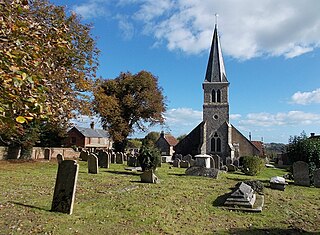
Godshill is a village and civil parish on the Isle of Wight, England, with a population of 1,459 at the 2011 Census. It lies between Newport and Ventnor in the southeast of the island.

<span class="mw-page-title-main">Mottistone</span>

Mottistone is a village on the Isle of Wight, located in the popular tourist area the Back of the Wight. It is located 8 Miles southwest of Newport in the southwest of the island, and is home to the National Trust's Mottistone Manor.

<span class="mw-page-title-main">Calbourne</span> Human settlement in England

Calbourne is a village in the civil parish of Calbourne, Newtown and Porchfield, on the Isle of Wight, England. It is located 5 miles (8 km) from Newport in the west of the island.

<span class="mw-page-title-main">Lake, Isle of Wight</span> Human settlement in England

Lake is a large village and civil parish located on Sandown Bay, on the Isle of Wight, England. It is six miles south-east of Newport situated between Sandown and Shanklin, and 1+12 miles (2.4 km) to the east of the hamlet of Apse Heath.

<span class="mw-page-title-main">Northwood, Isle of Wight</span> Human settlement in England

Northwood is a village and civil parish on the Isle of Wight. It lies south of the town of Cowes and has been occupied for about 1000 years. The Church of St. John the Baptist in Northwood, was first built between the 11th and 13th centuries.

<span class="mw-page-title-main">Limerstone</span>

Limerstone is a hamlet on the Isle of Wight in England. It is located on the B3399 road between Brighstone and Shorwell, approximately 5 miles (8km) southwest of Newport. Public transport is provided by Southern Vectis buses on route 12. The hamlet features around 25 houses and a farm, called Limerstone Farm.

<span class="mw-page-title-main">St Mary's Church, Brighstone</span> Church

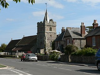
St. Mary's Church is a parish church in the Church of England located in Brighstone, Isle of Wight. The churchyard contains a memorial stone to George Albert Cairns VC.

<span class="mw-page-title-main">Back of the Wight</span>

Back of the Wight is an area on the Isle of Wight in England. The area has a distinct historical and social background, and is geographically isolated by the chalk hills, immediately to the North, as well as poor public transport infrastructure. Primarily agricultural, the Back of the Wight is made up of small villages spread out along the coast, including Brighstone, Shorwell and Mottistone.

Brighstone Christmas Tree Festival is a local event occurring in various venues around Brighstone and Mottistone on the Isle of Wight in England for the winter tourist season. This charitable event raises money for local and national charities.

References

  1. Office of National Statistics: QS102EW - Population density retrieved 30 May 2017
  2. "Civil Parish population 2011" . Retrieved 18 October 2015.
  3. "English Parishes & Welsh Communities N&C 2004". Archived from the original on 9 January 2007. Retrieved 25 July 2017.
  4. http://www.iwight.com/just_visiting/towns/brighstone%5B%5D
  5. "Home". brighstoneparish.org.
  6. "National Trust | Brighstone Shop & Museum". Archived from the original on 11 September 2011. Retrieved 2014-01-07.
  7. Lockwood, Jeremy A. F.; Martill, David M.; Maidment, Susannah C. R. (10 November 2021). "A new hadrosauriform dinosaur from the Wessex Formation, Wealden Group (Early Cretaceous), of the Isle of Wight, southern England". Journal of Systematic Palaeontology . 19 (12): 847–888. doi:10.1080/14772019.2021.1978005. S2CID   244067410 . Retrieved 11 November 2021.
  8. Devlin, Hannah (11 November 2021). "New species of big-nosed dinosaur discovered by retired doctor". The Guardian . Retrieved 11 November 2021.
  9. http://www.yha.org.uk/find-accommodation/south-east-england/hostels/brighstone
  10. "Three Bishops, Family Pub Restaurant, Brighstone Isle of Wight". Archived from the original on 16 February 2020. Retrieved 25 February 2022.
  11. Flickr image of plaque in Brighstone church. By ROBERTFROST1960
  12. "Southern Vectis - bus route 12". www.islandbuses.info. 2011. Archived from the original on 25 October 2011. Retrieved 2011-06-14.