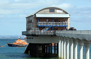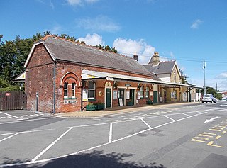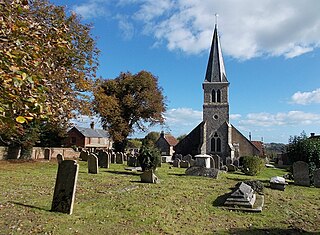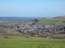
Bembridge is a village and civil parish located on the easternmost point of the Isle of Wight. It had a population of 3,848 according to the 2001 census of the United Kingdom, leading to the implausible claim by some residents that Bembridge is the largest village in England. Bembridge is home to many of the Island's wealthiest residents. The population had reduced to 3,688 at the 2011 Census.

Niton is a village on the Isle of Wight, west of Ventnor, with a population of 2,082. It has two pubs, several churches, a pottery workshop/shop, a pharmacy, a busy volunteer-run library, a medical centre and two local shops including a post office. The post office includes a pub and café that serves as a local meeting place. The village also offers a primary school with a co-located pre-school and nursery.

Wootton Bridge is a large village, civil parish and electoral ward with about 3,000 residents on the Isle of Wight, first recorded around the year 1086. The parish also contains the settlement of Wootton.

Whitwell is a small village located on the south of the Isle of Wight, approximately 5 kilometres north-west of Ventnor, the village's nearest town. At the 2011 Census the appropriate civil parish was Niton and Whitwell. In addition to this, it is about five minutes away from its neighbouring small villages of Godshill and Niton, the latter of which, Whitwell forms a civil parish. According to 2001 census data, the total population of the village was 578. There is a variety of stone and thatched housing, as well as some more modern housing, the most recent of which was completed in 2006.

Ningwood is a village on the Isle of Wight. It is on several lanes about three miles east of Yarmouth in the northwest of the island. According to the Post Office to 2011 Census population of the village was included in the civil parish of Shalfleet. The Horse and Groom Pub is a prominent establishment in Ningwood, as is the Ningwood Bible Christian (Methodist) Chapel. Well-known island brickmakers, the Prichett family, established a brick yard in Ningwood in the 19th century.

Totland is a village, civil parish and electoral ward on the Isle of Wight. Besides the village of Totland, the civil parish comprises the western tip of the Isle of Wight, and includes The Needles, Tennyson Down and the hamlet of Middleton.

Shalfleet is a village and civil parish on the Isle of Wight. it is located between Yarmouth and Newport in the northwest of the island.

Brook is a village on the Isle of Wight, England. According to the Post Office the 2011 census population was included in the civil parish of Brighstone.

Blackwater is a village on the Isle of Wight, England. It is located about two miles south of Newport, close to the geographic centre of the island. It is in the civil parish of Arreton. The Newclose County Cricket Ground is just to the north of the village.

Gatcombe is a village in the civil parish of Chillerton and Gatcombe, on the Isle of Wight, England. It is located about two and a half miles south of Newport, in the centre of the island. The parish, which includes Chillerton, had a population of 422 at the 2011 census.

Shorwell is a village and civil parish on the Isle of Wight, United Kingdom. It is 4+1⁄2 miles (7.2 km) from Newport in the southwest of the island. Shorwell was one of Queen Victoria's favourite places to visit on the Isle of Wight.

Godshill is a village and civil parish on the Isle of Wight, England, with a population of 1,459 at the 2011 Census. It lies between Newport and Ventnor in the southeast of the island.

Whippingham is a village and civil parish on the Isle of Wight. The population of the Civil Parish at the 2011 Census was 787. It is located 1+1⁄2 miles (2.4 km) south of East Cowes in the north of the Island.

Rookley is a village and civil parish on the Isle of Wight. It is located five kilometres south of Newport near the centre of the island.

Calbourne is a village in the civil parish of Calbourne, Newtown and Porchfield, on the Isle of Wight, England. It is located 5 miles (8 km) from Newport in the west of the island.

Shanklin railway station is a Grade II listed railway station serving Shanklin on the Isle of Wight. It is the present terminus of the Island Line from Ryde, although the line used to continue to Wroxall and Ventnor. The station now has one platform with a ticket office and a small shop, the second platform is now in use as a flower bed. The former subway has been filled in.

Lake is a large village and civil parish located on Sandown Bay, on the Isle of Wight, England. It is six miles south-east of Newport situated between Sandown and Shanklin, and 1+1⁄2 miles (2.4 km) to the east of the hamlet of Apse Heath.

Chillerton is a village between Newport and Chale in the Isle of Wight in southern England. Chillerton is in the middle of a farming community. It is in the civil parish of Chillerton and Gatcombe, along with nearby Gatcombe; the parish had a total population of 422 at the 2011 census.

Gurnard is a village and civil parish on the Isle of Wight, two miles to the west of Cowes. Gurnard sits on the edge of Gurnard Bay, enjoyed by the Gurnard Sailing Club.

Northwood is a village and civil parish on the Isle of Wight. It lies south of the town of Cowes and has been occupied for about 1000 years. The Church of St. John the Baptist in Northwood, was first built between the 11th and 13th centuries.


