Sandown is a seaside resort town and civil parish on the south-east coast of the Isle of Wight, England. The resort of Shanklin and the settlement of Lake are sited just to the south of the town. Sandown has a population of 11,654, according to the 2021 Census; together with Shanklin and Lake, it forms a built-up area of around 25,000 inhabitants. It is the northernmost town of Sandown Bay, with an easily accessible, sandy shoreline with beaches that run continuously from the cliffs at Battery Gardens in the south to Yaverland in the north.

Shanklin is a seaside resort town and civil parish on the Isle of Wight, England, located on Sandown Bay. Shanklin is the southernmost of three settlements which occupy the bay, and is close to Lake Sandown. The sandy beach, its Old Village and a wooded ravine, Shanklin Chine, are its main attractions. The esplanade along the beach is occupied by hotels and restaurants for the most part, and is one of the most tourist-oriented parts of the town. The other is the Old Village, at the top of Shanklin Chine. Together with Lake and Sandown to the north, Shanklin forms a built up area of around 25,000 inhabitants, Shanklin alone contributing around 7,200 of this.

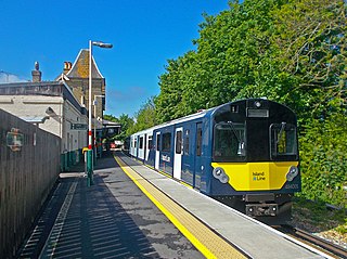
The Island Line is a railway line on the Isle of Wight which runs along the island's east coast and links Ryde Pier Head with Shanklin. Trains connect at Ryde Pier Head with passenger ferries to Portsmouth Harbour, and these ferries in turn connect with the rest of the National Rail network via the Portsmouth Direct Line. The line also connects to the Isle of Wight Steam Railway, a heritage railway, at Smallbrook Junction. For much of its length the line runs alongside the A3055, criss-crossing this road by means of the Ryde Tunnel and bridges at Rowborough, Morton Common, Lake Hill and Littlestairs.

Bembridge is a village and civil parish located on the easternmost point of the Isle of Wight. It had a population of 3,848 according to the 2001 census of the United Kingdom, leading to the implausible claim by some residents that Bembridge is the largest village in England. Bembridge is home to many of the Island's wealthiest residents. The population had reduced to 3,688 at the 2011 Census.

The ancient 'Kynges Towne' of Brading is the main town of the civil parish of the same name. The ecclesiastical parish of Brading used to cover about a tenth of the Isle of Wight. The civil parish now includes the town itself and Adgestone, Morton, Nunwell and other outlying areas between Ryde, St Helens, Bembridge, Sandown and Arreton. Alverstone was transferred to the Newchurch parish some thirty years ago.

Wroxall is a village and civil parish in the central south of the Isle of Wight.

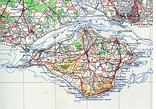
Sandown Bay is a broad open bay which stretches for much of the length of the Isle of Wight's southeastern coast. It extends 8+1⁄2 miles (13.7 km) from Culver Down, near Yaverland in the northeast of the Island, to just south of Shanklin, near the village of Luccombe in the southwest. At Luccombe, the bay is separated from The Undercliff by a large headland from which Upper Ventnor sits atop. The towns of Shanklin, Lake and Sandown are on the bay's coast, while Luccombe and Upper Ventnor feature panoramic views across both Sandown Bay to the East and the Undercliff to the southwest. Due to the bay being relatively sheltered from offshore winds it is often used as temporary anchorage point for boats, including large cargo ships, before continuing east towards Continental Europe, or north towards The Solent.

Brook is a village and former civil parish, now in the parish of Brighstone, on the Isle of Wight, England. In 1931 the parish had a population of 156. On 1 April 1933 the parish was abolished and merged with Brighstone.

Blackwater is a village on the Isle of Wight, England. It is located about two miles south of Newport, close to the geographic centre of the island. It is in the civil parish of Arreton. The Newclose County Cricket Ground is just to the north of the village.

Newchurch is a village and civil parish on the Isle of Wight. It is located between Sandown and Newport in the southeast of the island. Anthony Dillington, owner of the Knighton Gorges Manor in Newchurch wrote to his son Robert in 1574 that, "This is the very Garden of England, and we be privileged to work in it as Husbandmen......." Newchurch obtained its name from the new church built in 1087 by the Norman monks of Lyra. The Newchurch Parish for many centuries stretched from the north to south coasts of the Island; by the early Nineteenth Century the growing resort towns of Ventnor and Ryde were included within its boundaries. The parish was administered by the Church Parish Vestry until 1894 when civil matters were passed to the newly formed Parish Council which now forms the second tier of Local Government under the Isle of Wight Council. In 1982 Alverstone was included in the civil parish. The present day parish includes Newchurch Village, Apse Heath, Winford, Whiteley Bank, Alverstone, Alverstone Garden Village, Queen's Bower, Princelett and Mersley.

Rookley is a village and civil parish on the Isle of Wight. It is located five kilometres south of Newport near the centre of the island.

Sandown railway station is a railway station serving Sandown on the Isle of Wight, England. It is located on the Island Line from Ryde to Shanklin.

Southern Vectis is a bus operator on the Isle of Wight. The company was founded in 1921 as "Dodson and Campbell" and became the "Vectis Bus Company" in 1923. The company was purchased by the Southern Railway before being nationalised in 1969. In 1987, the company was re-privatised. In July 2005, it became a subsidiary of Go-Ahead Group.

Lake railway station is a station on the Isle of Wight serving the village of Lake, situated in a quiet residential area not far from Lake Cliff Gardens and the beach at Sandown Bay. Until the construction of an interchange station with the Isle of Wight Steam Railway at Smallbrook Junction in 1991, this station was the newest on the island: it was opened by British Rail in 1987. The station is formed of a single platform with a shelter.

Yaverland is a village and former civil parish, now in the parish of Sandown, on the Isle of Wight, England. It is just north of Sandown on Sandown Bay. It has about 200 houses. About 1⁄3 of a mile away from the village is the Yaverland Manor and Church. Holotype fossils have been discovered here of Yaverlandia and a pterosaur, Caulkicephalus. The White Air extreme sports festival was held annually at Yaverland pay and display car park between 1997 and 2008, but moved to Brighton for 2009.

There are several modes of Transport on the Isle of Wight, an island in the English Channel.

The Isle of Wight Coastal Path is a circular long-distance footpath of 70 miles (113 km) around the Isle of Wight, UK. It follows public footpaths and minor lanes, with some sections along roads.

There once existed a 55+1⁄2-mile (89.3 km) network of railway lines on the Isle of Wight, which operated both as a self-contained railway network, and as links to ferry services between the island and the South coast of Great Britain. The routes were opened by several companies between 1862 and 1901 and modernised after The Grouping in the 1920s. Most of them were permanently closed between 1952 and 1966, whilst the 8+1⁄2-mile-long (13.7 km) Island Line was temporarily closed in 1966 and rebuilt for electric train services, introduced in 1967. Replacement trains were introduced in 1990, and again in 2021 along with a major renewal of the line. A further 5+1⁄2 miles (8.9 km) have reopened as a heritage line known as the Isle of Wight Steam Railway and there have been several proposals to expand the network further since the 1960s, either with conventional heavy rail or by conversion to light rail.


