East Ruston is a village and a civil parish in the English county of Norfolk. The village is located 4.1 miles (6.6 km) south-east of North Walsham and 14 miles (23 km) north-east of Norwich.

Brumstead is a village and a civil parish in the English county of Norfolk. The village is 15.3 miles (24.6 km) north-east of Norwich, 17.6 miles (28.3 km) south-south-east of Cromer and 134 miles (216 km) north-east of London. The village lies 1.2 miles (1.9 km) north of the town of Stalham.

Antingham is a village and civil parish in the north of the English county of Norfolk. The village is located about 6 miles (9.7 km) south of Cromer and 3 miles (4.8 km) north of North Walsham. The civil parish has an area of 6.12 square kilometres and in the 2001 census had a population of 287 in 120 households, the population increasing to 355 at the 2011 Census. For the purposes of local government, the parish falls within the district of North Norfolk.
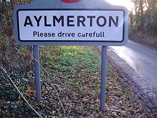
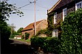
Aylmerton is a village in the county of Norfolk, England. It is in the area of North Norfolk and lies 2.2 miles (3.5 km) south of the North Sea, 3.2 miles (5.1 km) south-west of Cromer and 7.5 miles (12.1 km) east of Holt. The parish is bordered by the parishes of Beeston Regis and Runton to the north, West Beckham to the west, Felbrigg to the east and Gresham and Sustead to the south. The centre of the village is ¾ miles south of the A148 King's Lynn to Cromer road with Sandy Lane and Beechwood Avenue north of it. The nearest railway stations are West Runton at the bottom of Sandy Lane, Cromer at 2.9 miles (4.7 km) and Roughton Road at 4.1 miles (6.6 km). The civil parish has an area of 6.86 square kilometres and in the 2001 census the population was 435 in 178 households, increasing to 458 at the 2011 Census. For the purposes of local government, the parish is in North Norfolk, whose headquarters are in Cromer.

Binham is a village and a civil parish in the English county of Norfolk. The village is 29.3 miles (47.2 km) north west of Norwich, 16.9 miles (27.2 km) west of Cromer and 124 miles (200 km) north north east of London. The village lies 4.9 miles (7.9 km) east south east of the town of Wells-next-the-Sea.

Bodham is a civil parish in the English county of Norfolk. The village is 27.2 miles north north west of Norwich, 6.4 miles west of Cromer and 131 miles north north east of London. The village lies 3.1 miles south west of the nearest town of Sheringham.The nearest railway station is at Sheringham for the Bittern Line which runs between Cromer and Norwich. The nearest airport is Norwich International Airport. The village is situated on the A148 coast road which links the town of King's Lynn to Cromer. The civil parish had in 2001 census, a population of 435, increasing to 484 at the 2011 Census. For the purposes of local government, the parish falls within the district of North Norfolk.

Gunthorpe is a village and a civil parish in the English county of Norfolk. The village is 8.6 miles east north east of the town of Fakenham, 14.9 miles west south west of Cromer and 122 miles north north east of London. The nearest railway station is at Sheringham for the Bittern Line which runs between Sheringham, Cromer and Norwich. The nearest airport is Norwich International Airport.

East Lexham is a village and former civil parish, now in the parish of Lexham, in the Breckland district, in the English county of Norfolk. It is 7.7 miles (12.4 km) north of the town of Swaffham, 30.1 miles (48.4 km) west north west of Norwich and 106 miles (171 km) north east of London. In 1931 the parish had a population of 160.

Brinton is a village and a civil parish in the English county of Norfolk. The village is 10.8 miles east-north-east of the town of Fakenham, 13.1 miles west south-west of Cromer and 125 miles north-north-east of London.

Briston is a village, civil parish and electoral ward in the English county of Norfolk that contains the hamlet of Briston Common. The village is 11 miles (18 km) east north east of the town of Fakenham, 13.3 miles (21.4 km) west south west of Cromer, 20.3 miles (32.7 km) north north west of the city of Norwich, and 125 miles (201 km) north north east of London. The village is situated on the route of the B1354 that runs between the A148 at Thursford and the B1149 at Saxthorpe.

Catfield is a village and civil parish in the English county of Norfolk. The village is 19.7 miles (31.7 km) south-east of Cromer, 17.3 miles (27.8 km) north-east of Norwich and 136 miles (219 km) north-east of London. The village lies 2.7 miles (4.3 km) south-south-east of the nearby town of Stalham.
Colby is a village and a civil parish in the English county of Norfolk. The village is 8.6 miles (13.8 km) south of Cromer, 16.8 miles (27.0 km) north-north-west of Norwich, 5.2 miles (8.4 km) west-north-west of North Walsham and 131 miles (211 km) north-east of London.

Edgefield is a village and a civil parish in the English county of Norfolk. The village is located 3.3 miles (5.3 km) south of Holt, 3.3 miles (5.3 km) north-east of Melton Constable and 18 miles (29 km) of Norwich.

Fulmodeston or Fulmodeston-cum-Croxton is a village and civil parish in the English county of Norfolk. The village is located 4 miles (6.4 km) south-east of Fakenham and 20 miles (32 km) north-west of Norwich, along the course of River Stiffkey. Fulmodeston parish also includes the small villages of Barney.
Upper Sheringham is a village and a civil parish in the English county of Norfolk. The village is 26.8 miles (43.1 km) north-north-west of Norwich, 6 miles (9.7 km) west of Cromer and 132 miles (212 km) north-north-east of London. The village is 1.2 miles (1.9 km) from the town of Sheringham.

East Rudham is a village and civil parish in the English county of Norfolk. The village is located 14 miles (23 km) north-east of King's Lynn and 28 miles (45 km) north-west of Norwich.
Bale is a village and former civil parish, now in the parish of Gunthorpe, in the North Norfolk district, in the county of Norfolk, England. The village is 9 miles east-north-east of the town of Fakenham, 14.3 miles west-south-west of Cromer and 125 miles north-north-east of London. In 1931, the parish had a population of 208.

Cockthorpe is a village and former civil parish, now in the parish of Binham, in the North Norfolk district, in the county of Norfolk, England. It is 5.2 miles (8.4 km) north-west of Holt, 28.9 miles (46.5 km) north-west of Norwich and 127 miles (204 km) north of London. In 1931 the parish had a population of 55. On 1 April 1935 the parish was abolished and merged with Binham.

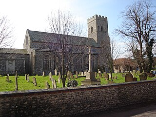
Barney is a village and former civil parish, now in the parish of Fulmodeston, in the North Norfolk district, in the county of Norfolk, England. Settled prior to the Norman Invasion of 1066, the village lies to the south of the A148 King's Lynn to Cromer road near Thursford.The village is 7.2 miles (11.6 km) east north east of the town of Fakenham, 17.1 miles (27.5 km) west south west of Cromer and 121 miles (195 km) north north east of London. The nearest railway station is at Sheringham for the Bittern Line which runs between Sheringham, Cromer and Norwich. The nearest airport is Norwich International Airport. In 1931 the parish had a population of 243.

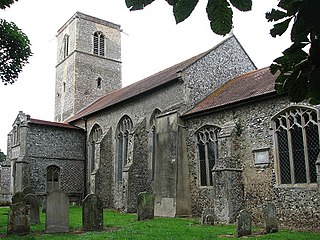
Bradfield is a village and former civil parish, now in the parish of Swafield, in the North Norfolk district, in the county of Norfolk, England. The village is 7.6 miles (12.2 km) south south east of Cromer, 18.1 miles (29.1 km) north north east of Norwich and 135 miles (217 km) north east of London. The village lies 3.1 miles (5.0 km) north north west of the town of North Walsham. In 1931 the parish had a population of 136.