Broadway station (IND Crosstown Line)

Last updated

 Broadway
  NYCS-bull-trans-G-Std.svg
MTA NYC logo.svg New York City Subway station (rapid transit)
IND Crosstown Broadway Southbound Platform.jpg
View from southbound platform
Station statistics
AddressBroadway & Union Avenue
Brooklyn, NY
Borough Brooklyn
Locale Williamsburg
Coordinates 40°42′20″N73°57′01″W / 40.705433°N 73.950219°W / 40.705433; -73.950219
Division B (IND) [1]
Line     IND Crosstown Line
Services    G   NYCS-SSI-alltimes.svg (all times)
TransitAiga bus trans.svg NYCT Bus: B46, B60
StructureUnderground
Platforms2 side platforms
Tracks2
Other information
OpenedJuly 1, 1937;86 years ago (1937-07-01) [2]
Opposite-
direction
transfer
Yes
Traffic
20231,112,371 [3] Increase2.svg 11.7%
Rank285 out of 423 [3]
Services
Preceding station MTA NYC logo.svg New York City Subway Following station
Metropolitan Avenue
toward Court Square
NYCS-bull-trans-G-Std.svg Flushing Avenue
Location
NYCS map blank.svg
Map pointer.svg
USA New York City location map.svg
Map pointer.svg
USA New York location map.svg
Map pointer.svg
Track layout

Contents

BSicon MFADEg.svg
BSicon uvSTR.svg
BSicon uvSTRfg.svg
BSicon numN000.svg
BSicon BSl.svg
BSicon uvSTR.svg
BSicon BSr.svg
BSicon BSl.svg
BSicon uvSTR.svg
BSicon BSr.svg
BSicon BSl.svg
BSicon uvSTR.svg
BSicon BSr.svg
BSicon BSl.svg
BSicon uvSTR.svg
BSicon BSr.svg
BSicon uvSTRfg.svg
BSicon MFADEf.svg
BSicon uvSTR.svg
Street map

Broadway station (IND Crosstown Line)

Station service legend
SymbolDescription
NYCS-SSI-alltimes.svg Stops all times

The Broadway station is a station on the IND Crosstown Line of the New York City Subway. Located at the intersection of Broadway and Union Avenue in Williamsburg, Brooklyn, it is served at all times by the G train.

History

This opened on July 1, 1937, as part of the extension of the Crosstown Line from Nassau Avenue to Hoyt-Schermerhorn Streets. [2]

Station layout

Station tiles with the misspelled "BRODAWAY" on the right Broadway Brodaway IND Crosstown.jpg
Station tiles with the misspelled "BRODAWAY" on the right
GroundStreet levelEntrances/exits
MezzanineStation agent, fare control, MetroCard machines (unfinished South Fourth Street station)
Basement 2 Side platform
Northbound NYCS-bull-trans-G-Std.svg toward Court Square (Metropolitan Avenue)
Southbound NYCS-bull-trans-G-Std.svg toward Church Avenue (Flushing Avenue)
Side platform

This underground station has two tracks and two side platforms. [4] The G stops at the station at all times. [5] The station is between Metropolitan Avenue to the north and Flushing Avenue to the south. [6]

The platforms have a light green trim line with a black border and mosaic name tablets reading "BROADWAY" in white sans-serif lettering on a black background and light green border. The tiles were part of a color-coded tile system used throughout the IND. [7] The tile colors were designed to facilitate navigation for travelers going away from Lower Manhattan. Because the Crosstown Line does not merge into a line that enters Manhattan at either end, all stations on the line had green tiles. [8] [9] The I-beam columns in the entire station are dark grey-blue, with alternating ones on the platforms having the standard black station name plate in white lettering.

Small station signs underneath the trim line read "BROADWAY" in white lettering on a black background. One of the icon tiles on the northbound platform was incorrectly spelled as "BRODAWAY"; this mistake may have been part of the station's original tilework. [10] [11] [12] [13] After the Daily News and several other news outlets reported on the misspelling in February 2009, [10] [11] [12] the two wrong letters were covered with the correct ones printed on stickers, but the stickers were removed by December 2009. In December 2011, the MTA stated the tiles would remain; [12] [13] however, by late February 2020, the tiles with the two wrong letters were permanently swapped.[ citation needed ]

Exits

The station has a small mezzanine above the platforms and tracks at the south end, allowing a free transfer between directions. Two staircases from each platform go up to the mezzanine. [4]

A turnstile bank provides entrance/exit from the station. Outside fare control, there is a token booth and four street stairs: one to the southwestern corner of Broadway and Heyward Street, and the remaining three to the southwestern, southeastern, and northeastern corners of Broadway and Union Avenue. [14]

A staircase at the southeast corner of Union Avenue and Broadway with the BMT Jamaica Line in the background Broadway G stair jeh.JPG
A staircase at the southeast corner of Union Avenue and Broadway with the BMT Jamaica Line in the background

The station previously had a full-length mezzanine. However, the northern half was closed to the public, and parts of it currently hold offices while the rest of the mezzanine is used for storage space. [15] The mezzanine had a street stair to the northwestern corner of Johnson Avenue and Union Avenue, and a small upper landing with street stair to all corners of South 5th Street, Montrose Avenue, and Union Avenue except for the southwestern corner.

Free transfer

The BMT Jamaica Line lies directly above the staircases to this station; Lorimer Street and Hewes Street are located to the east and west of the entrances, respectively with Lorimer Street being closer to the station. However, there is no permanent free transfer between either of those stations and this one, in spite of requests from riders and transit advocacy groups. [16] [17] [18]

Despite the lack of a free transfer, temporary free transfers have been offered during construction or service disruptions. [16] A transfer was provided from July 25, 2014, to September 2, 2014, between Lorimer Street and this station, due to the closure of the IND Crosstown Line under the Newtown Creek for tunnel repairs. [16] [19] [20] A free transfer using a MetroCard between Broadway and Lorimer Street stations was provided during the 14th Street Tunnel shutdown from April 2019 until May 31, 2020, during weekends and late nights. [21] A temporary free MetroCard transfer to and from the Hewes Street station was also made available. [22] These two transfers were honored through the end of May 2020, even though L train tunnel work was completed on April 26. [23] [24]

Unfinished station

A mural by Addam Yekutieli at the unfinished station, part of "the Underbelly Project" Underbelly Project vc.jpg
A mural by Addam Yekutieli at the unfinished station, part of "the Underbelly Project"

The north end of the Broadway station has been blocked by false walls. This northern third of the platform level area consists of passages that would have served as transfers to an unfinished station on a level directly above the Crosstown Line tracks (provisionally called South Fourth Street or Union Avenue). The unfinished station was built as part of a planned expansion of the Independent Subway System. [15] [25] [26]

The station is a semi-complete shell with four island platforms and six track beds, having the same layout as Hoyt–Schermerhorn Streets station. No rails, tiles, lights, or stairs were built. [27] The unfinished station, which is only about as long as Union Avenue is wide, was designed to be the main transfer point from both a line running under Worth Street and a line running under Houston Street coming from Manhattan with the Crosstown Line. These lines would have become two major trunk lines going east; one would have run under Utica Avenue, and the other would have run towards the Rockaways along the Myrtle Avenue and Central Avenue Line. [15] [25] [28]

The closed mezzanine area of the Broadway station has stairs at its north end to an upper level mezzanine directly above the unfinished station. This mezzanine has stairs leading to the northern corners of the intersection of South 4th Street, Meserole Street, and Union Avenue. [15] However, it has no stairs leading to the unfinished station itself. Like the closed mezzanine area of the Broadway station, the upper level mezzanine is used for storage.

In 2010, dozens of street artists created murals on the walls of the unfinished station over the course of 18 months, collectively called "the Underbelly Project", without clearance from the MTA. Afterwards, the MTA removed access to the transfer passage on the northbound platform at Broadway and replaced dilapidated fencing blocking closed areas with cinderblock walls. [29] [30]

Related Research Articles

<span class="mw-page-title-main">Fulton Street station (IND Crosstown Line)</span> New York City Subway station in Brooklyn

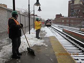
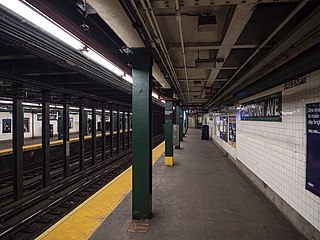
The Fulton Street station is a station on the IND Crosstown Line of the New York City Subway, located on Lafayette Avenue between South Portland Avenue and Fulton Street in Brooklyn. It is served by the G train at all times.

<span class="mw-page-title-main">Seventh Avenue station (IND Culver Line)</span> New York City Subway station in Brooklyn

The Seventh Avenue station is an express station on the IND Culver Line of the New York City Subway, located at Seventh Avenue and Ninth Street in the Park Slope neighborhood of Brooklyn. It is served by the F and G trains at all times, and by the <F> train during rush hours in the peak direction.

<span class="mw-page-title-main">Second Avenue station</span> New York City Subway station in Manhattan

The Second Avenue station is a station on the IND Sixth Avenue Line of the New York City Subway, located at the intersection of Second Avenue and Houston Street on the border between the East Village and the Lower East Side, in Manhattan. It is served by the F train at all times and the <F> train during rush hours in the peak direction.

<span class="mw-page-title-main">Hoyt–Schermerhorn Streets station</span> New York City Subway station in Brooklyn

The Hoyt–Schermerhorn Streets station is an express station of the New York City Subway, serving the IND Crosstown Line and the IND Fulton Street Line. Located at the intersection of Hoyt Street and Schermerhorn Street in Downtown Brooklyn, it is served by the A and G trains at all times, as well as the C train except at night.

<span class="mw-page-title-main">Utica Avenue station</span> New York City Subway station in Brooklyn

The Utica Avenue station is an express station on the IND Fulton Street Line of the New York City Subway. Located at Utica Avenue and Fulton Street in Bedford–Stuyvesant, Brooklyn, it is served by the A train at all times and the C train at all times except late nights.

<span class="mw-page-title-main">15th Street–Prospect Park station</span> New York City Subway station in Brooklyn

The 15th Street–Prospect Park station is a local station on the IND Culver Line of the New York City Subway. Located at 15th Street east of Prospect Park West in the Windsor Terrace and Park Slope neighborhoods in Brooklyn, it is served by the F and G trains at all times.

<span class="mw-page-title-main">Lexington Avenue–63rd Street station</span> New York City Subway station in Manhattan

The Lexington Avenue–63rd Street station is a New York City Subway station in Lenox Hill, Manhattan, shared by the IND and BMT 63rd Street Lines. Located at the intersection of Lexington Avenue and 63rd Street, it is served by the F and Q trains at all times; <F> trains during rush hours in the peak direction; limited rush hour N trains; and one A.M. rush hour R train in the northbound direction only.

<span class="mw-page-title-main">Lorimer Street station (BMT Jamaica Line)</span> New York City Subway station in Brooklyn

The Lorimer Street station is a local station on the BMT Jamaica Line of the New York City Subway. Located at the intersection of Lorimer Street and Broadway in Brooklyn, it is served by the J train at all times except weekdays in the peak direction and the M train at all times except late nights. The Z train skips this station when it operates.

<span class="mw-page-title-main">Queens Plaza station</span> New York City Subway station in Queens

The Queens Plaza station is an express station on the IND Queens Boulevard Line of the New York City Subway. Located under the eastern edge of Queens Plaza at the large Queens Plaza interchange, it is served by the E train at all times, by the R train at all times except late nights, and by the M train on weekdays during the day.

<span class="mw-page-title-main">Court Square–23rd Street station</span> New York City Subway station in Queens

The Court Square–23rd Street station is a New York City Subway station complex on the IND Crosstown Line, the IRT Flushing Line and the IND Queens Boulevard Line. The complex is located in the vicinity of One Court Square in Hunters Point and Long Island City, Queens, and is served by the 7, E, and G trains at all times; the M train on weekdays; and the <7> express train during weekdays in the peak direction.

<span class="mw-page-title-main">21st Street station (IND Crosstown Line)</span> New York City Subway station in Queens

The 21st Street station is a station on the IND Crosstown Line of the New York City Subway. Located at the intersection of 21st Street and Jackson Avenue in the Hunters Point section of Long Island City, Queens, it is served by the G train at all times.

<span class="mw-page-title-main">Greenpoint Avenue station</span> New York City Subway station in Brooklyn

The Greenpoint Avenue station is a station on the IND Crosstown Line of the New York City Subway. Located at the intersection of Greenpoint and Manhattan Avenues in Greenpoint, Brooklyn, it is served by the G train at all times.

<span class="mw-page-title-main">Nassau Avenue station</span> New York City Subway station in Brooklyn

The Nassau Avenue station is a station on the IND Crosstown Line of the New York City Subway. Located at the intersection of Manhattan and Nassau Avenues in Greenpoint, Brooklyn, it is served by the G train at all times.

<span class="mw-page-title-main">Flushing Avenue station (IND Crosstown Line)</span> New York City Subway station in Brooklyn

The Flushing Avenue station is a station on the IND Crosstown Line of the New York City Subway. Located at the intersection of Flushing and Union/Marcy Avenues in the boundary of Bedford–Stuyvesant and Williamsburg, Brooklyn, it is served at all times by the G train.

<span class="mw-page-title-main">Bedford–Nostrand Avenues station</span> New York City Subway station in Brooklyn

The Bedford–Nostrand Avenues station is a station on the IND Crosstown Line of the New York City Subway. Located at Lafayette Avenue between Bedford and Nostrand Avenues in Bedford–Stuyvesant, Brooklyn, it is served by the G train at all times.

<span class="mw-page-title-main">Classon Avenue station</span> New York City Subway station in Brooklyn

The Classon Avenue station is a station on the IND Crosstown Line of the New York City Subway. Located at the intersection of Classon and Lafayette Avenues on the border of Bedford–Stuyvesant and Clinton Hill, Brooklyn, it is served at all times by the G train.

<span class="mw-page-title-main">Clinton–Washington Avenues station (IND Crosstown Line)</span> New York City Subway station in Brooklyn

The Clinton–Washington Avenues station is a station on the IND Crosstown Line of the New York City Subway. Located at Lafayette Avenue between Clinton and Washington Avenues in Clinton Hill, Brooklyn, it is served by the G train at all times.

<span class="mw-page-title-main">Fourth Avenue/Ninth Street station</span> New York City Subway station in Brooklyn

The Fourth Avenue/Ninth Street station is a New York City Subway station complex shared by the elevated IND Culver Line and the underground BMT Fourth Avenue Line. It is located at the intersection of Ninth Street and Fourth Avenue in Park Slope, Brooklyn and served by the:

<span class="mw-page-title-main">Metropolitan Avenue/Lorimer Street station</span> New York City Subway station in Brooklyn

The Metropolitan Avenue/Lorimer Street station is an underground New York City Subway station complex shared by the BMT Canarsie Line and the IND Crosstown Line. Located in the Williamsburg neighborhood of Brooklyn, the complex is served by the G and L trains at all times.

<span class="mw-page-title-main">Broadway–Lafayette Street/Bleecker Street station</span> New York City Subway station in Manhattan

The Broadway–Lafayette Street/Bleecker Street station is a New York City Subway station complex in the NoHo neighborhood of Manhattan on the IRT Lexington Avenue Line and the IND Sixth Avenue Line. It is served by the 6, D, and F trains at all times; the B and M trains on weekdays during the day; the <6> and <F> trains during rush hours in the peak direction; and the 4 train during late nights.

References

  1. "Glossary". Second Avenue Subway Supplemental Draft Environmental Impact Statement (SDEIS) (PDF). Vol. 1. Metropolitan Transportation Authority. March 4, 2003. pp. 1–2. Archived from the original (PDF) on February 26, 2021. Retrieved January 1, 2021.
  2. 1 2 "New Crosstown Subway Line Is Opened". Brooklyn Daily Eagle. July 1, 1937. Retrieved December 24, 2015.
  3. 1 2 "Annual Subway Ridership (2018–2023)". Metropolitan Transportation Authority. 2023. Retrieved April 20, 2024.
  4. 1 2 "Review of the G Line: Appendices" (PDF). Metropolitan Transportation Authority. July 10, 2013. Retrieved October 28, 2015.
  5. "GSubway Timetable, Effective July 2, 2023". Metropolitan Transportation Authority . Retrieved August 26, 2023.
  6. "Subway Map" (PDF). Metropolitan Transportation Authority. September 2021. Retrieved September 17, 2021.
  7. "Tile Colors a Guide in the New Subway; Decoration Scheme Changes at Each Express Stop to Tell Riders Where They Are". The New York Times. August 22, 1932. ISSN   0362-4331. Archived from the original on July 1, 2022. Retrieved July 1, 2022.
  8. Carlson, Jen (February 18, 2016). "Map: These Color Tiles In The Subway System Used To Mean Something". Gothamist. Archived from the original on May 10, 2023. Retrieved May 10, 2023.
  9. Gleason, Will (February 18, 2016). "The hidden meaning behind the New York subway's colored tiles". Time Out New York. Archived from the original on May 10, 2023. Retrieved May 10, 2023.
  10. 1 2 Belenkaya, Veronika; Donohue, Pete (February 10, 2009). "MTA spellers way off-off Broadway in Brooklyn". Daily News . Retrieved June 14, 2009.
  11. 1 2 "Subway Tile Sign Has Old Misspelling". NY1 . February 10, 2009. Archived from the original on April 22, 2009. Retrieved June 14, 2009.
  12. 1 2 3 Dunlap, David W. (December 29, 2011). "They Say the Noen Lights Are Bright on Brodaway". The New York Times . Retrieved July 15, 2016.
  13. 1 2 Macleod, Dan (January 6, 2012). "It's 'Brodaway' — get used to it!". Brooklyn Paper. Retrieved July 15, 2016.
  14. "MTA Neighborhood Maps: Williamsburg & Bedford-Stuyvesant" (PDF). Metropolitan Transportation Authority. 2015. Retrieved July 3, 2015.
  15. 1 2 3 4 Raskin, Joseph B. (2013). The Routes Not Taken: A Trip Through New York City's Unbuilt Subway System. New York, New York: Fordham University Press. doi:10.5422/fordham/9780823253692.001.0001. ISBN   978-0-82325-369-2.
  16. 1 2 3 "Review of the G Line" (PDF). mta.info . Metropolitan Transportation Authority. July 10, 2013. Retrieved August 2, 2015.
  17. Hoffman, Meredith (December 31, 2012). "G Train Riders to Renew Push for Improved Service With New Year". Williamsburg, Brooklyn: DNAinfo.com. Archived from the original on August 29, 2016. Retrieved August 24, 2015.
  18. Miller, Shane (July 1, 2004). "Let Us Take a Free Swipe". Greenpoint Star. Archived from the original on February 14, 2005. Retrieved January 17, 2007.
  19. "Free transfer set to expire between G train and J/M lines in Brooklyn". New York's PIX11 / WPIX-TV. August 28, 2014.
  20. Donohue, Pete (May 14, 2014). "MTA will allow free transfers for G train riders to J or M trains at Lorimer St. stop during work on Greenpoint Tube this summer". NY Daily News. Retrieved May 15, 2014.
  21. Hogan, Gwynne; Tcholakian, Danielle (July 25, 2016). "The L Train Shutdown: Here's How to Commute Between Brooklyn and Manhattan". DNAinfo New York. Archived from the original on August 21, 2016. Retrieved July 26, 2016.
  22. New York City Transit Authority (July 2018). "MTA New York City Transit Canarsie Tunnel Project Supplemental Environmental Assessment and Section 4(f) Review: Final Report" (PDF). mta.info. Metropolitan Transportation Authority. p. 16. Retrieved July 27, 2018.
  23. "Service information for L, M, G, 7, M14 SBS and free transfers". Metropolitan Transit Authority. April 26, 2020. Retrieved May 10, 2020.
  24. Guse, Clayton (June 1, 2020). "MTA ends free transfer between overlapping Brooklyn subway stations". New York Daily News. Retrieved June 2, 2020.
  25. 1 2 Roger P. Roess; Gene Sansone (August 23, 2012). The Wheels That Drove New York: A History of the New York City Transit System. Springer Science & Business Media. pp. 416–417. ISBN   978-3-642-30484-2.
  26. Brennan, Joseph. "IND Second System unfinished stations". Abandoned Stations. Retrieved June 4, 2009.
  27. "Archived copy". ltvsquad.com. Archived from the original on July 20, 2011. Retrieved January 12, 2022.{{cite web}}: CS1 maint: archived copy as title (link)
  28. Project for Expanded Rapid Transit Facilities, New York City Transit System, dated July 5, 1939
  29. Rees, Jasper (October 31, 2010). "'Underbelly Project' Hidden Art Show in Abandoned Subway Station". The New York Times .
  30. Grynbaum, Michael M. (November 11, 2010). "Underbelly Project Visitors at Ghost Subway Station Risk Arrest". The New York Times .