Throggs Neck is a neighborhood and peninsula in the south-eastern portion of the borough of the Bronx in New York City. It is bounded by the East River and Long Island Sound to the south and east, Westchester Creek on the west, and Baisley Avenue and the Bruckner Expressway on the north.

Pelham Bay Park is a municipal park located in the northeast corner of the New York City borough of the Bronx. It is, at 2,772 acres (1,122 ha), the largest public park in New York City. The park is more than three times the size of Manhattan's Central Park. The park is operated by the New York City Department of Parks and Recreation.
Pelham Bay is a middle class residential neighborhood in the borough of the Bronx, in New York City. It is named for Pelham Bay Park, New York City's largest park, which lies on the neighborhood's northeastern border; and for Pelham Bay, a body of water in that park. The neighborhood is bounded roughly by Pelham Parkway on the north, the New England Thruway (I-95) on the east, the Bruckner Expressway (I-95) on the south, and the Hutchinson River Parkway on the west.

Co-op City is a cooperative housing development located in the northeast section of the borough of the Bronx in New York City. It is bounded by Interstate 95 to the southwest, west, and north and the Hutchinson River Parkway to the east and southeast, and is partially in the Baychester and Eastchester neighborhoods. With 43,752 residents as of the 2010 United States Census, it is the largest housing cooperative in the world. It is in New York City Council District 12.
Baychester is a neighborhood geographically located in the northeast part of the Bronx, New York City. Its boundaries are East 222nd Street to the northeast, the New England Thruway (I-95) to the east, Gun Hill Road to the southwest, and Boston Road to the northwest. Eastchester Road is the primary thoroughfare through Baychester.
Pelham Gardens is a neighborhood located in the Northeast section of the Bronx, New York City. Its boundaries, starting from the north and moving clockwise are East Gun Hill Road to the north and east, Pelham Parkway to the south, and the IRT Dyre Avenue Line to the west ending at the esplanade. Eastchester Road is the primary thoroughfare through Pelham Gardens.
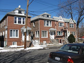
Allerton is a working-class neighborhood geographically located in the East Bronx section of the Bronx, New York City. It is named in honor of Daniel Allerton, an early Bronx settler who purchased and farmed this area with his wife Hustace. It consists of two subsections called Bronxwood and Laconia. Its boundaries, starting from the north and moving clockwise, are Adee Avenue, Boston Road, and Gun Hill Road to the northeast; the IRT Dyre Avenue Line to the east; Waring Avenue to the south; and Bronx River Parkway to the west. White Plains Road and Boston Road are the primary thoroughfares through Allerton.

Country Club is a residential neighborhood located in the East Bronx in New York City. The neighborhood's boundaries are Middletown Road and Watt Avenue to the north, Eastchester Bay to the east, Layton Avenue and the Throggs Neck neighborhood to the south, and the New England Thruway and Pelham Bay neighborhood to the west. Pelham Bay Park, the largest public park in New York City, is located just north of Country Club.

Bronx Community Board 1 is a local government unit of the city of New York, encompassing the neighborhoods of Mott Haven, Melrose, and Port Morris in the borough of the Bronx. It is delimited by the East River, East 149th Street, and Prospect Avenue on the east, East 161st Street, East 159th Street, and East 149th Street on the north, and the Harlem River and Bronx Kill on the west and south.

Bronx Community Board 2 is a local government unit of the city of New York, encompassing the neighborhoods of Hunts Point and Longwood in the borough of the Bronx. It is delimited by the Bronx River on the east, Westchester Avenue, East 167th Street, and East 169th Street on the north, Prospect Avenue and East 149th Street to the west, and the East River on the south.

Bronx Community Board 3 is a local government unit in the New York City borough, of the Bronx, encompassing the neighborhoods of Crotona Park East, Claremont, Concourse Village, Melrose, and Morrisania. It is delimited by Sheridan Boulevard to the east, the Cross Bronx Expressway and Crotona Park North to the north, Park Avenue and Webster Avenue to the west, and East 159th Street and East 161st Street to the south.

Bronx Community Board 4 is a local government unit of the City of New York, encompassing the neighborhoods of Mount Eden, Highbridge and Concourse. It is delimited by Webster Avenue and Park Avenue to the east, Washington Bridge and the Cross Bronx Expressway to the north, the Harlem River to the west, and East 149th Street to the south.

Bronx Community Board 6 is a local government unit of the city of New York, encompassing the neighborhoods of Bathgate, Belmont, East Tremont, and West Farms as Bronx Community District 6. It is delimited by Bronx Park to the east and north, Webster Avenue to the west, and Crotona Park North and the Cross Bronx Expressway to the south.
Bronx Community Board 9 is a local government unit of the city of New York, encompassing the neighborhoods of Castle Hill, Parkchester, Soundview, Harding Park, Bronx River, Clason Point and Unionport. It is delimited by Westchester Creek to the east, Sheridan Boulevard to the west, the Cross Bronx Expressway and East Tremont Avenue to the north and the Bronx River and the East River to the south.

Bronx Community Board 12 is a local government unit of the New York City borough of the Bronx, encompassing the neighborhoods of Edenwald, Wakefield, Williamsbridge, Woodlawn Heights, Fish Bay, Eastchester, Olinville and Baychester.

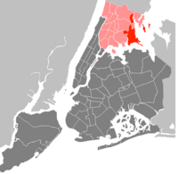
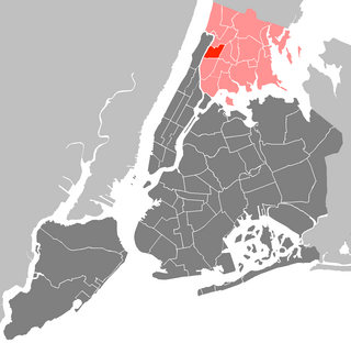
Bronx Community Board 11 (CB11) is a small unit of the City of New York (NYC), whose district encompasses the neighborhoods of Allerton, Indian Village, Morris Park, Pelham Gardens, Pelham Parkway (neighborhood), Van Nest and other areas in the borough of the Bronx. Coterminous with the 49th NYPD Precinct, its district is delimited by Bronx Park East and the Bronx River Parkway to the west, Adee Avenue, Boston Road and East Gun Hill Road to the north, the Hutchinson River Parkway to the east, and East Tremont Avenue to the south.

Pelham Parkway is a working- and middle-class residential neighborhood geographically located in the center of the Bronx, a borough of New York City in the United States. Its boundaries, starting from the north and moving clockwise are: Waring Avenue to the north, the IRT Dyre Avenue Line tracks to the east, Neill Avenue to the South, and Bronx River Parkway to the west. White Plains Road is the primary commercial thoroughfare through Pelham Parkway. The neighborhood is named after Pelham Parkway, a major west–east parkway that travels through the East Bronx.

Community boards of the Bronx are the 12 New York City community boards in the borough of the Bronx, which are the appointed advisory groups of the community districts that advise on land use and zoning, participate in the city budget process, and address service delivery in their district.
Schuylerville is a middle-class neighborhood located in the East Bronx area of New York City. Housing is mostly single-family and two-family houses. It is located next to other middle-to-upper-class residential neighborhoods of Country Club and Pelham Bay.
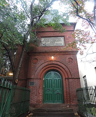
Westchester Square is a residential neighborhood geographically located in the eastern section of the New York City borough of the Bronx. Its boundaries, starting from the north and moving clockwise are: East Tremont Avenue and Silver Street, Blondell Avenue and Westchester Creek to the east, Waterbury Avenue to the south and Castle Hill Avenue to the west. The main roadways through Westchester Square are East Tremont Avenue, Westchester Avenue and Williamsbridge Road.