
The City of Cockburn is a local government area in the southern suburbs of the Western Australian capital city of Perth about 8 kilometres (5 mi) south of Fremantle and about 24 kilometres (15 mi) south of Perth's central business district. The City covers an area of 167.5 square kilometres (64.7 sq mi) and had a population of over 104,000 as at the 2016 Census.
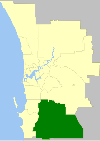
The Shire of Serpentine-Jarrahdale is a local government area in the outer southeastern metropolitan area of Perth, the capital of Western Australia, and has an area of 905 square kilometres (349 sq mi) and a population of 32,173 as at the 2021 Census. Despite being named after two towns in the area neither Serpentine nor Jarrahdale function as either the Shire's largest settlement (Byford) or the seat of government (Mundijong).

The City of Wanneroo is a local government area with city status in the northern suburbs of Perth, Western Australia. It is centred approximately 25 kilometres (15.5 mi) north of Perth's central business district and forms part of the northern boundary of the Perth metropolitan area. Wangara encompasses the federal divisions of Cowan, Moore and Pearce.
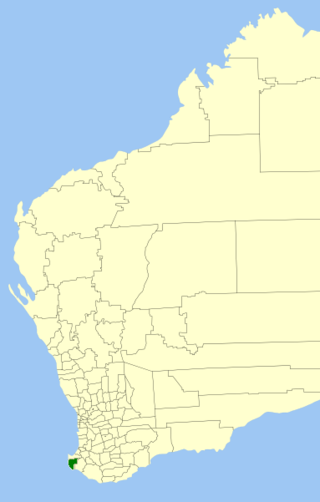
The Shire of Augusta Margaret River is a local government area in the south-west corner of the South West region of Western Australia, approximately 270 kilometres (168 mi) south of Perth. The shire covers an area of 2,243 square kilometres (866 sq mi) and had a population of over 14,000 at the 2016 Census, about half of whom live in the towns of Margaret River and Augusta.

Glen Osmond is a suburb of Adelaide, South Australia in the City of Burnside which is in the foothills of the Adelaide Hills. It is well known for the road intersection on the western side of the suburb, where the South Eastern Freeway from the Adelaide Hills and the main route from Melbourne splits into National Route A17 Portrush Road, Glen Osmond Road, Adelaide and state route A3 Cross Road west towards the coast and southern suburbs.
Beulah Park is a suburb of Adelaide, South Australia in the City of Burnside.
Erindale is a suburb of Adelaide in the City of Burnside. It is on the east side of Glynburn Road, where it borders Leabrook.
Kensington Gardens is an eastern suburb of Adelaide, in the City of Burnside. It includes a large recreational park, Kensington Wama, or Kensington Gardens Reserve.
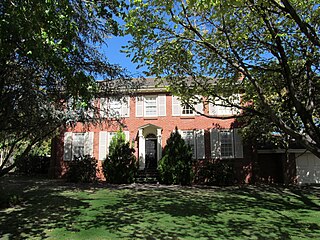
Linden Park is a suburb of Adelaide, South Australia in the City of Burnside. It derives its name from the Linden Tree.
Tusmore is a suburb in the inner east of Adelaide, South Australia.
Kurralta Park is a suburb of Adelaide, South Australia in the City of West Torrens.

The City of Bunbury is a local government area in the South West region of Western Australia, covering an area of 65.7 square kilometres (25.4 sq mi) along the coast about 180 kilometres (112 mi) south of Perth, the capital of Western Australia. The City of Bunbury is one of four local governments comprising the Greater Bunbury sub-region. As at the 2016 Census, the City of Bunbury had an estimated population of almost 32,000.
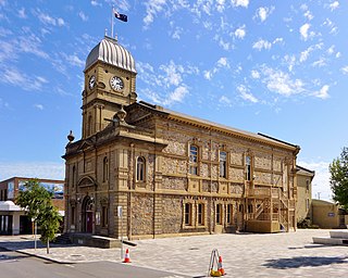
The City of Albany is a local government area in the Great Southern region of Western Australia, about 410 kilometres (255 mi) south-southeast of Perth, the capital of Western Australia. It covers an area of 4,312.3 square kilometres (1,665 sq mi), including the Greater Albany metropolitan area and the Port of Albany, as well as the surrounding agricultural district and some national parks. The City of Albany had a population of over 36,000 at the 2016 census.

Gracetown is a small town in Western Australia. It is located 269 kilometres (167 mi) south of the Perth central business district, and 21.5 kilometres (13.4 mi) north-west of the township of Margaret River in the Augusta-Margaret River Shire Council area on the coast at Cowaramup Bay.

Burnside is a residential locality of the town of Nambour in the Sunshine Coast Region, Queensland, Australia. In the 2021 census, Burnside had a population of 3,104 people.
Meelon is a small townsite in the Peel region of Western Australia, located between Pinjarra and Dwellingup within the Shire of Murray. At the 2011 census, Meelon had a population of 224.
Hunchy is a rural locality in the Sunshine Coast, Queensland, Australia. In the 2021 census, Hunchy had a population of 592 people.

Dulong is a rural locality in the Sunshine Coast Region, Queensland, Australia. In the 2021 census, Dulong had a population of 688 people.
Kureelpa is a rural locality in the Sunshine Coast Region, Queensland, Australia. In the 2021 census, Kureelpa had a population of 968 people.
Yebble is a locality in the South West region of Western Australia in the Shire of Augusta-Margaret River. Established in 2021 from parts of the localities of Gracetown and Burnside, its name honours Sam Isaacs, whose Aboriginal name was Yebble, a stockman who was involved with Grace Bussell in the rescue of the SS Georgette in 1876. The locality is mostly covered by the Leeuwin-Naturaliste National Park and also contains Ellensbrook homestead and the Meekadarribee Falls, which are significant to the local Wardandi people. Yebble is near the land that was granted to Isaacs by the Western Australian government.


