Chesterfield Court House, Virginia

Last updated

Chesterfield Court House, Virginia
Chesterfield Historic Courthouse.jpg
Historic Chesterfield Courthouse at Courthouse Square
VAMap-doton-ChesterfieldCourHouse.PNG
Location of Chesterfield Court House, Virginia
Coordinates: 37°22′35″N77°30′14″W / 37.37639°N 77.50389°W / 37.37639; -77.50389
CountryUnited States
State Virginia
County Chesterfield
Area
  Total2.3 sq mi (5.9 km2)
  Land2.3 sq mi (5.9 km2)
  Water0.0 sq mi (0.0 km2)
Elevation
197 ft (60 m)
Population
 (2000)
  Total3,558
  Density1,563.0/sq mi (603.5/km2)
Time zone UTC−5 (Eastern (EST))
  Summer (DST) UTC−4 (EDT)
ZIP Codes
23832, 23838
FIPS code 51-16208
GNIS feature ID 1852915

Chesterfield Court House is an unincorporated community and former census-designated place that is the county seat of Chesterfield County, Virginia, United States. [1] It was a census-designated place (CDP) at the 2000 census, but has not been delineated as a CDP since then. The Chesterfield County Courthouse and Courthouse Square are listed in the National Register of Historic Places. The area is also home of the Chesterfield County Government Complex.

Contents

Geography

Chesterfield County Courthouse and Courthouse Square
LocationN side VA 10, 350 ft. E of jct. with VA 655, Chesterfield, Virginia
Area2 acres (0.81 ha)
Built1828
ArchitectVaughan Construction Co.
Architectural styleColonial Revival, Italianate, Federal
NRHP reference No. 92001008 [2]
Added to NRHPAugust 18, 1992

Chesterfield Court House is located at 37°22′35″N77°30′14″W / 37.37639°N 77.50389°W / 37.37639; -77.50389 (37.376449, 77.503798). [3]

According to the United States Census Bureau, the CDP had a total area of 2.3 square miles (6.0 km2).

Demographics

As of the census [4] of 2000, there were 3,558 people, 1,139 households, and 775 families residing in the CDP. The population density was 1,563.0 people per square mile (602.5/km2). There were 1,171 housing units at an average density of 514.4/sq mi (198.3/km2). The racial makeup of the CDP was 70.24% White, 24.06% African American, 0.70% Native American, 1.46% Asian, 0.08% Pacific Islander, 1.55% from other races, and 1.91% from two or more races. Hispanic or Latino of any race were 3.49% of the population.

There were 1,139 households, out of which 37.0% had children under the age of 18 living with them, 47.4% were married couples living together, 16.9% had a female householder with no husband present, and 31.9% were non-families. 26.1% of all households were made up of individuals, and 4.4% had someone living alone who was 65 years of age or older. The average household size was 2.53 and the average family size was 3.06.

In the CDP the population was spread out, with 24.2% under the age of 18, 10.6% from 18 to 24, 33.4% from 25 to 44, 21.1% from 45 to 64, and 10.8% who were 65 years of age or older. The median age was 35 years. For every 100 females, there were 101.2 males. For every 100 females age 18 and over, there were 98.7 males.

The median income for a household in the CDP was $52,304, and the median income for a family was $60,246. Males had a median income of $37,765 versus $30,211 for females. The per capita income for the CDP was $19,125. About 2.4% of families and 5.2% of the population were below the poverty line, including 4.1% of those under age 18 and 9.6% of those age 65 or over.

Notable people

See also

Related Research Articles

<span class="mw-page-title-main">East Sahuarita, Arizona</span> Community in Pima County, Arizona

East Sahuarita was a census-designated place (CDP) in Pima County, Arizona, United States. The population was 1,419 at the 2000 census. The CDP comprises the unincorporated neighborhoods east of incorporated Sahuarita.

<span class="mw-page-title-main">El Granada, California</span> Census-designated place in California, United States

El Granada is a village and census-designated place (CDP) in the coastal area of northern San Mateo County, California, United States. The population was 5,481 at the 2020 census. The village is named for the city of Granada, Spain.

<span class="mw-page-title-main">Paia, Hawaii</span> Census-designated place in Hawaii, United States

Pā'ia is a census-designated place (CDP) in Maui County, Hawaii, United States, on the northern coast of the island of Maui. The population was 2,470 at the 2020 census. Pā'ia is home to several restaurants, art galleries, surf shops and other tourist-oriented businesses. It was formerly home to a Hawaiian Commercial & Sugar mill from 1880 to 2000.

<span class="mw-page-title-main">Selby-on-the-Bay, Maryland</span> Former census-designated place in Maryland, United States

Selby-on-the-Bay is a census-designated place (CDP) in Anne Arundel County, Maryland, United States, for the 2000 census, at which time its population was 3,674. It was added to the Mayo CDP for the 2010 census.

<span class="mw-page-title-main">Millers Falls, Massachusetts</span> Census-designated place in Massachusetts, United States

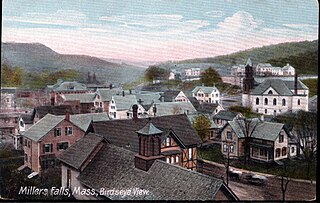
Millers Falls is a census-designated place (CDP) in the towns of Montague and Erving in Franklin County, Massachusetts, United States. The population was 1,139 at the 2010 census. It is part of the Springfield, Massachusetts metropolitan statistical area.

<span class="mw-page-title-main">South Hill, New York</span> CDP in New York, United States

South Hill is a census-designated place (CDP) in Tompkins County, New York, United States. The population was 7,245 at the 2020 census.

<span class="mw-page-title-main">Millers Creek, North Carolina</span> CDP in North Carolina, United States

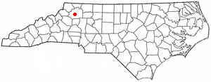
Millers Creek is a census-designated place (CDP) in Wilkes County, North Carolina, United States. The population was 2,112 at the 2010 census. West Wilkes High School, one of the four public high schools in Wilkes County, is located in Millers Creek.

<span class="mw-page-title-main">Oakwood, Pennsylvania</span> Census-designated place in Pennsylvania, United States

Oakwood is an unincorporated area and census-designated place (CDP) in Lawrence County, Pennsylvania, United States. The population was 2,270 at the 2010 census.

<span class="mw-page-title-main">Bellwood, Virginia</span> CDP in Virginia, United States

Bellwood is a census-designated place (CDP) in Chesterfield County, Virginia, United States. The population was 6,352 at the 2010 census. The community takes its name from Bellwood, one of the James River Plantations.

<span class="mw-page-title-main">Bensley, Virginia</span> CDP in Virginia, United States

Bensley is a census-designated place (CDP) in Chesterfield County, Virginia, United States. It is an inner suburb of Richmond, Virginia. The population was 5,819 at the 2010 census. Bensley Community building is inside of Bensley park. The community building is outside of Bensley, setting in walking distance of the CDP. The community is an old village with no active government. The community is over 100 years old. A new police substation in the village is next to the old Bensley Bermuda Rescue Squad, near DuPont Spruance.

<span class="mw-page-title-main">Chester, Virginia</span> CDP in Virginia, United States

Chester is a census-designated place (CDP) in Chesterfield County, Virginia, United States. Per the 2020 census, the population was 23,414.

<span class="mw-page-title-main">Ettrick, Virginia</span> CDP in Virginia, United States

Ettrick is a census-designated place (CDP) in Chesterfield County, Virginia, United States. Per the 2020 census, the population was 7,241. The town is home to Virginia State University and the Petersburg Amtrak train station.

<span class="mw-page-title-main">Matoaca, Virginia</span> CDP in Virginia, United States

Matoaca is a census-designated place (CDP) in Chesterfield County, Virginia, United States. The population was 2,403 at the 2010 census. It is named after the Pamunkey princess Matoaka who was better known by her nickname "Pocahontas". It was near the site of an Appomattoc village Matoka or Matoks, which was reputedly her girlhood home, and the palace town of the weroansqua Oppussoquionuske.

<span class="mw-page-title-main">Gloucester Point, Virginia</span> Census-designated place in Virginia, United States

Gloucester Point is a census-designated place (CDP) in Gloucester County, Virginia, United States. The population was 9,402 at the 2010 census. It is home to the College of William & Mary's Virginia Institute of Marine Science, a graduate school for the study of oceanography.

<span class="mw-page-title-main">Dumbarton, Virginia</span> Census-designated place in Virginia

Dumbarton is a census-designated place (CDP) in Henrico County, Virginia, United States. The population was 7,879 at the 2010 census.

<span class="mw-page-title-main">Lakeside, Virginia</span> Census-designated area in Virginia

Lakeside is a census-designated place (CDP) in Henrico County, Virginia, United States. It is an inner suburb of Richmond, Virginia. The population was 12,203 at the 2020 census.

<span class="mw-page-title-main">Collinsville, Virginia</span> CDP in Virginia, United States

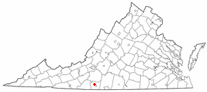
Collinsville is a census-designated place (CDP) in Henry County, Virginia, United States. The population was 7,335 at the 2010 census, which was down from the 7,777 reported in 2000. It is part of the Martinsville Micropolitan Statistical Area. Collinsville is also where the administration building and county courthouse of Henry County are located.

Fairlawn is a census-designated place (CDP) in Pulaski County, Virginia, United States. The population was 2,419 at the 2020 census up from 2,367 at the 2010 census. It is served by the Radford, Virginia post office and is located on the opposite side of the New River from Radford.

<span class="mw-page-title-main">Spotsylvania Courthouse, Virginia</span> Unincorporated census-designated place in Virginia, United States

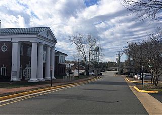
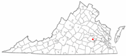
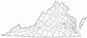
Spotsylvania Courthouse is a census-designated place (CDP) and the county seat of Spotsylvania County, Virginia, United States, located 10 miles (16 km) southwest of Fredericksburg. Recognized by the U.S. Census Bureau as a census designated place (CDP), the population was 5,610 at the 2020 census.

<span class="mw-page-title-main">Brimfield (CDP), Ohio</span> CDP in Ohio, United States

Brimfield is a census-designated place (CDP) in Portage County, Ohio, United States. As of the 2020 census, the CDP had a population of 3,365. It is located in the central part of Brimfield Township, a rural area between the Ohio cities of Akron and Kent with light industry, strip-malls, subdivisions, and farms.

References

  1. "Find a County". National Association of Counties. Archived from the original on May 9, 2015. Retrieved June 7, 2011.
  2. "National Register Information System". National Register of Historic Places . National Park Service. March 13, 2009.
  3. "US Gazetteer files: 2010, 2000, and 1990". United States Census Bureau. February 12, 2011. Retrieved April 23, 2011.
  4. "U.S. Census website". United States Census Bureau . Retrieved January 31, 2008.