
Medfield is a census-designated place (CDP) in the town of Medfield in Norfolk County, Massachusetts, United States. The population was 6,483 at the 2010 census.

The Granite Mountains are a short subrange of the Rocky Mountains in central Wyoming of the United States. The range runs approximately 100 mi (160 km) E-W along the south side of the Shoshone Basin, and north of the Sweetwater River, in eastern Fremont County and western Natrona County. The highest point is McIntosh Peak at 8,058 feet (2,456 m). Independence Rock is at the east end of the range, and Split Rock was a prominent landmark on the Oregon Trail. The region is rich in uranium and other mineral deposits.

Governors Island was an island in Boston Harbor in the U.S. state of Massachusetts. The island was subsumed by land reclamation for the construction and extension of Logan International Airport.
The Squannacook River is a 16.4-mile-long (26.4 km) river in northern Massachusetts. It is a tributary of the Nashua River and part of the Merrimack River watershed flowing to the Atlantic Ocean.
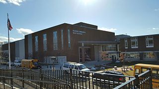
Reading Memorial High School (RMHS) is a four-year public high school serving the town of Reading, Massachusetts, as its only grade 9-12 school. Reading Memorial is managed by Reading Public Schools. The school has a student body of 1,269 (2016) drawn from Parker Middle School and Coolidge Middle School. A new building renovation and construction project was completed for the 2007-08 academic year. Part of the Middlesex League, the sports teams are called the Rockets. The school's principal is Kathleen Boynton and the vice principals are Jessica Theriault and Michael McSweeney.
Medfield Meadow Lots are a group of wetland meadows—Pratt Meadow, Perry Meadow, and Hinsdale Meadow—located in the Charles River floodplain within Medfield, Massachusetts, United States. The lots, totaling 16 acres (6.5 ha), are accessible by canoe or kayak only. They were acquired as an open space reserve via land donation by Henry L. Shattuck in 1968.

The Bay Circuit Trail and Greenway or Bay Circuit is a Massachusetts recreational trail and greenway connecting the outlying suburbs of Boston from Plum Island in Newburyport to Kingston Bay in Duxbury, a distance of 200 miles (320 km).

Medfield is a neighborhood located in north Baltimore, Maryland, United States of America. It is located to the north of the trendy Hampden neighborhood and south of affluent Roland Park neighborhood. Its unofficial boundaries are Coldspring Lane to the north; Jones Falls Expressway to the west; Falls Road/Hickory Avenue to the east; and West 41st Street to the south.
Bridge Island Meadows is an 80-acre (320,000 m2) nature reserve owned by The Trustees of Reservations on the floodplains of the upper Charles River in Millis, Massachusetts. The property was a 1974 gift from Dr. and Mrs. John D. Constable to the Trustees of Reservations. The property is surrounded by wetlands, and is only accessible by boat.

Fork Factory Brook is a 135-acre historic site, open space reserve, and agricultural reserve located in Medfield, Massachusetts. The reserve, managed by the land conservation non-profit organization The Trustees of Reservations, is notable for its wetlands, ledges, 300-year-old hayfields, and ruins of a 19th-century pitchfork mill for which the property is named. Fork Factory Brook offers 1.5 miles (2.4 km) of trails and former woods roads available for hiking, horseback riding, mountain biking, and cross country skiing. The property is a spur link in the 200-mile (320 km) Bay Circuit Trail system and is part of a larger area of protected open space including the abutting Rocky Woods preserve, also managed by The Trustees of Reservations.
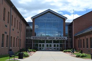
Westwood High School is a public four-year high school located in Westwood, Massachusetts, a suburb of Boston, Massachusetts, in the United States. It is fed by the E.W. Thurston Middle School. The school consistently ranks as one of top educating institutions in the state, ranking 5th among public schools and 134th nationally, according to Newsweek.
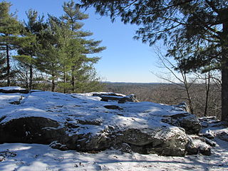
Noon Hill is a 204-acre (83 ha) open space preserve located in Medfield, Massachusetts and centered on 370-foot (110 m) Noon Hill, a prominent summit and scenic vista. It is managed by the land conservation non-profit organization The Trustees of Reservations and offers 4.5 miles (7.2 km) of trails available for hiking, horseback riding, mountain biking, and cross country skiing. Oak-hickory forest, wetlands, vernal pools, steep ravines, boulders, and rocky ledges characterize the preserve. Noon Hill is a link in the 200-mile (320 km) Bay Circuit Trail. Holt Pond, a constructed mill pond, is located on the property.
Sheep Creek is a geographical place name. With variations, the name is given to hundreds of bodies of water, roads, canals, reservoirs and populated areas in the United States and other countries. It is the name of a tributary to Lockyear Creek in Queensland, Australia, and the name of at least three bodies of water in Canada. The U.S. state of Montana has 85 different locales that bear that name or a derivation. The U.S. state of Idaho has 92 natural and man-made areas that incorporate Sheep Creek into their names. Nature areas that include trails named Sheep Creek can be found in Canada's Yukon Territory, Colorado's Larimer County and in Utah's Bryce Canyon National Park.
Cobble Island is an inhabited island located in Lake Chaubunagungamaug in Webster, Massachusetts. The home on the island dates back to before 1922. There is a large rock that sits at the eastern side of the island. The massive boulder is widely recognized among the town's natives and is often considered Webster's greatest fishing spot. On the island's western side there is a small cove that is often inhabited by an LA-4-200 Lake Buccaneer.
Bates Island is a forested and uninhabited island located in Lake Chaubunagungamaug in Webster, Massachusetts.
Cemetery Island is a heavily forested island located in the Wachusett Reservoir in Clinton, Massachusetts. The island's name came from its being part of an old burial ground that was flooded by the creation of the reservoir; 3,816 bodies were removed and reinterred in St. John’s Cemetery in Lancaster, Massachusetts.


