Popponesset Island, Massachusetts

Last updated

Popponesset Island
Barnstable County Massachusetts incorporated and unincorporated areas Popponesset Island highlighted.svg
Location in Barnstable County and the state of Massachusetts.
Coordinates: 41°35′8″N70°27′32″W / 41.58556°N 70.45889°W / 41.58556; -70.45889
Country United States
State Massachusetts
County Barnstable
Town Mashpee
Area
[1]
  Total0.38 sq mi (0.99 km2)
  Land0.07 sq mi (0.19 km2)
  Water0.31 sq mi (0.80 km2)
Elevation
[2]
0 ft (0 m)
Population
 (2020)
  Total45
  Density625.00/sq mi (241.42/km2)
Time zone UTC−5 (Eastern (EST))
  Summer (DST) UTC−4 (EDT)
FIPS code 25-55090
GNIS feature ID2378206 [2]

Popponesset Island is an island and census-designated place (CDP) in the town of Mashpee in Barnstable County, Massachusetts, United States. The population was 220 at the 2010 census. [3]

Contents

Geography

Popponesset Island is located in the southeastern part of the town of Mashpee. [4] It lies in Popponesset Bay, an arm of Nantucket Sound, and is separated from the mainland of Cape Cod by the narrow Popponesset Creek. The CDP of New Seabury is to the west, across Popponesset Creek, and the Popponesset CDP is to the southwest. The town of Barnstable is to the northeast, across Popponesset Bay.

According to the United States Census Bureau, the Popponesset Island CDP has a total area of 0.39 square miles (1.0 km2). 0.077 square miles (0.2 km2) of it is land, and 0.31 square miles (0.8 km2) of it (81.16%) is water. [3]

History

During World War II, Popponesset Island was used for amphibious assault training.

Trainees conduct artillery training. Eac training poponessett beach.jpg
Trainees conduct artillery training.

Demographics

Historical population
CensusPop.Note
2020 45
U.S. Decennial Census [5]

At the 2000 census there were 39 people, 19 households, and 12 families living in the CDP. The population density was 188.2/km2 (502.1/mi2). There were 69 housing units at an average density of 333.0/km2 (888.3/mi2). The racial makeup of the CDP was 100.00% White. [6] Of the 19 households 15.8% had children under the age of 18 living with them, 57.9% were married couples living together, 5.3% had a female householder with no husband present, and 31.6% were non-families. Of all households 31.6% were one person and 21.1% were one person aged 65 or older. The average household size was 2.05 and the average family size was 2.54.

The age distribution was 17.9% under the age of 18, 10.3% from 25 to 44, 35.9% from 45 to 64, and 35.9% 65 or older. The median age was 58 years. For every 100 females, there were 85.7 males. For every 100 females age 18 and over, there were 113.3 males.

The median household income was $65,179; median incomes for families, males and females are unknown, due to the small size of the population. The per capita income for the CDP was $48,815. None of the population were below the poverty line.

Related Research Articles

<span class="mw-page-title-main">Barnstable County, Massachusetts</span> County in Massachusetts, United States

Barnstable County is a county located in the U.S. state of Massachusetts. At the 2020 census, the population was 228,996. Its shire town is Barnstable. The county consists of Cape Cod and associated islands.

<span class="mw-page-title-main">East Harwich, Massachusetts</span> Census-designated place in Massachusetts, United States

East Harwich is a census-designated place (CDP) and village in the town of Harwich in Barnstable County, Massachusetts, United States. The population was 4,872 at the 2010 census.

<span class="mw-page-title-main">East Sandwich, Massachusetts</span> Census-designated place in Massachusetts, United States

East Sandwich is a village and census-designated place (CDP) within the town of Sandwich in Barnstable County, Massachusetts, United States. The population was 3,940 at the 2010 census.

<span class="mw-page-title-main">Forestdale, Massachusetts</span> Census-designated place in Massachusetts, United States

Forestdale is a village and census-designated place (CDP) within the town of Sandwich in Barnstable County, Massachusetts, United States. The population of Forestdale was 4,099 at the 2010 census. It is the most populous of the three CDPs in Sandwich. The ZIP code of Forestdale is 02644.

<span class="mw-page-title-main">Harwich Center, Massachusetts</span> Census-designated place in Massachusetts, United States

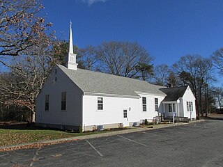
Harwich Center is a census-designated place (CDP) in the town of Harwich in Barnstable County, Massachusetts, United States. The population was 1,798 at the 2010 census.

<span class="mw-page-title-main">Harwich Port, Massachusetts</span> Census-designated place in Massachusetts, United States

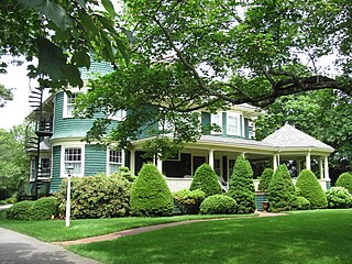
Harwich Port is a small affluent seaside community and census-designated place (CDP) situated along the Nantucket Sound in the town of Harwich in Barnstable County, Massachusetts, United States. It is named after the port of Harwich in Essex, England. As of the 2010 census, the CDP had a population of 1,644. It is a popular vacation spot on Cape Cod and is home to the Wychmere Beach Club and the Allen Harbor Yacht Club. Also, one of its popular mottos is "Three Harbors, One Port," referencing to Saquatucket, Wychmere, and Allen Harbor, which are all located in Harwich Port. Well known residents include Bill O'Brien, former head coach and general manager of the Houston Texans.

<span class="mw-page-title-main">Mashpee, Massachusetts</span> Town in Massachusetts, United States

Mashpee is a town in Barnstable County, Massachusetts, United States, on Cape Cod. The population was 15,060 as of 2020. The town is the site of the headquarters and most members of the Mashpee Wampanoag Tribe, one of two federally recognized Wampanoag groups.

<span class="mw-page-title-main">Mashpee Neck, Massachusetts</span> Census-designated place in Massachusetts, United States

Mashpee Neck is a census-designated place (CDP) in the town of Mashpee in Barnstable County, Massachusetts, United States. The population was 1,000 at the 2010 census. It is the most populous of the seven CDPs in Mashpee.

<span class="mw-page-title-main">Monomoscoy Island, Massachusetts</span> Census-designated place in Massachusetts, United States

Monomoscoy Island is a census-designated place (CDP) in the town of Mashpee in Barnstable County, Massachusetts, United States. At the 2010 census, the CDP had a total population of 147.

<span class="mw-page-title-main">New Seabury, Massachusetts</span> Census-designated place in Massachusetts, United States

New Seabury is a census-designated place (CDP) in the town of Mashpee in Barnstable County, Massachusetts, United States, on Cape Cod. The area consists primarily of summer homes for wealthy families. Attractions include a county club and the Fells Pond, Daniels Island, and Littleneck Bay neighborhoods. The population of the CDP was 717 at the 2010 census. The community is located on the historic home of the Wampanoag Nation.

<span class="mw-page-title-main">Popponesset, Massachusetts</span> Census-designated place in Massachusetts, United States

Popponesset is a census-designated place (CDP) in the town of Mashpee on Cape Cod in Barnstable County, Massachusetts, United States. The population was 220 at the 2010 census.

<span class="mw-page-title-main">Seabrook, Massachusetts</span> Census-designated place in Massachusetts, United States

Seabrook is a census-designated place (CDP) in the town of Mashpee in Barnstable County, Massachusetts, United States. The population was 455 at the 2010 census.

<span class="mw-page-title-main">Seconsett Island, Massachusetts</span> Census-designated place in Massachusetts, United States

Seconsett Island is a census-designated place (CDP) in the town of Mashpee in Barnstable County, Massachusetts, United States. The population was 100 at the 2010 census.

<span class="mw-page-title-main">West Chatham, Massachusetts</span> Census-designated place in Massachusetts, United States

West Chatham is a census-designated place (CDP) in the town of Chatham in Barnstable County, Massachusetts, United States. The population was 1,410 at the 2010 census.

<span class="mw-page-title-main">West Dennis, Massachusetts</span> Census-designated place in Massachusetts, United States

West Dennis is a census-designated place (CDP) in the town of Dennis in Barnstable County, Massachusetts, United States. The population was 2,242 at the 2010 census.

<span class="mw-page-title-main">West Yarmouth, Massachusetts</span> Census-designated place in Massachusetts, United States

West Yarmouth is a census-designated place (CDP) in the town of Yarmouth in Barnstable County, Massachusetts, United States. The population was 6,012 at the 2010 census.

<span class="mw-page-title-main">Yarmouth Port, Massachusetts</span> Census-designated place in Massachusetts, United States

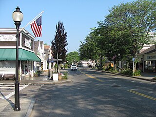
Yarmouth Port is a census-designated place (CDP) in the town of Yarmouth in Barnstable County, Massachusetts, United States. The population was 5,320 at the 2010 census.

<span class="mw-page-title-main">Bourne (CDP), Massachusetts</span> Census-designated place in Massachusetts, United States

The village of Bourne is a census-designated place (CDP) in the town of Bourne in Barnstable County, Massachusetts, United States. The population was 1,418 at the 2010 census, out of 19,754 in the town of Bourne as a whole.

<span class="mw-page-title-main">Falmouth (CDP), Massachusetts</span> Census-designated place in Massachusetts, United States

Falmouth is a census-designated place (CDP) consisting of the primary settlement in the town of Falmouth in Barnstable County, Massachusetts, United States. The population of the CDP was 3,799 at the 2010 census, out of 31,532 in the town as a whole. It was named after Falmouth, Cornwall, England.

<span class="mw-page-title-main">Provincetown (CDP), Massachusetts</span> Census-designated place in Massachusetts, United States

Provincetown (CDP) is a census-designated place (CDP) in the town of Provincetown in Barnstable County, Massachusetts, United States. The population was 2,642 at the 2010 census, out of 2,942 in the entire town.

References

  1. "2020 U.S. Gazetteer Files". United States Census Bureau. Retrieved May 21, 2022.
  2. 1 2 U.S. Geological Survey Geographic Names Information System: Popponesset Island, Massachusetts
  3. 1 2 "Geographic Identifiers: 2010 Demographic Profile Data (G001): Popponesset Island CDP, Massachusetts". U.S. Census Bureau, American Factfinder. Archived from the original on February 12, 2020. Retrieved December 11, 2013.
  4. "US Gazetteer files: 2010, 2000, and 1990". United States Census Bureau. February 12, 2011. Retrieved April 23, 2011.
  5. "Census of Population and Housing". Census.gov. Retrieved June 4, 2016.
  6. "U.S. Census website". United States Census Bureau . Retrieved January 31, 2008.