East Dennis, Massachusetts

Last updated

East Dennis, Massachusetts
Sesuit Creek, East Dennis MA.jpg
Sesuit Creek from Bridge Street
Barnstable County Massachusetts incorporated and unincorporated areas East Dennis highlighted.svg
Location in Barnstable County and the state of Massachusetts.
Coordinates: 41°44′25″N70°9′26″W / 41.74028°N 70.15722°W / 41.74028; -70.15722
Country United States
State Massachusetts
County Barnstable
Town Dennis
Area
[1]
  Total4.98 sq mi (12.90 km2)
  Land4.83 sq mi (12.52 km2)
  Water0.15 sq mi (0.38 km2)
Elevation
26 ft (8 m)
Population
 (2020)
  Total2,585
  Density534.64/sq mi (206.43/km2)
Time zone UTC-5 (Eastern (EST))
  Summer (DST) UTC-4 (EDT)
ZIP code
02641
Area code 508
FIPS code 25-18840
GNIS feature ID0615830

East Dennis is a village and census-designated place (CDP) in the town of Dennis in Barnstable County, Massachusetts, United States. It was settled in the 1630s. [2] The population was 2,753 at the 2010 census. [3]

Contents

Geography

East Dennis is located in the northeastern part of the town of Dennis . [4] East Dennis is north of South Dennis. The zip code of East Dennis (02660) is shared with much of South Dennis, which leads to confusion about the location of streets common to other areas of Dennis. Directly to the west is the village of Dennis. East Dennis is bounded to the north by Cape Cod Bay and to the west by the town of Brewster. It includes Sea Street Beach, Cold Storage Beach, and Crowes Pasture Beach on the bayside. [5]

According to the United States Census Bureau, the East Dennis CDP has a total area of 4.9 square miles (12.8 km2), of which 4.8 square miles (12.4 km2) is land and 0.15 square miles (0.4 km2) (3.01%) is water. [3]

Demographics

Historical population
CensusPop.Note
2020 2,585
U.S. Decennial Census [6]

As of the census [7] of 2000, there were 3,299 people, 1,516 households, and 1,027 families residing in the CDP. The population density was 265.4/km2 (687.8/mi2). There were 2,203 housing units at an average density of 177.2/km2 (459.3/mi2). The racial makeup of the CDP was 97.09% White, 0.79% African American, 0.21% Native American, 0.33% Asian, 0.73% from other races, and 0.85% from two or more races. Hispanic or Latino of any race were 1.67% of the population.

There were 1,516 households, out of which 16.8% had children under the age of 18 living with them, 58.6% were married couples living together, 7.6% had a female householder with no husband present, and 32.2% were non-families. 28.8% of all households were made up of individuals, and 18.5% had someone living alone who was 65 years of age or older. The average household size was 2.17 and the average family size was 2.62.

In the CDP, the population was spread out, with 15.7% under the age of 18, 3.5% from 18 to 24, 17.2% from 25 to 44, 29.4% from 45 to 64, and 34.3% who were 65 years of age or older. The median age was 55 years. For every 100 females, there were 84.4 males. For every 100 females age 18 and over, there were 83.3 males.

The median income for a household in the CDP was $47,857, and the median income for a family was $57,177. Males had a median income of $46,627 versus $30,230 for females. The per capita income for the CDP was $27,466. About 5.6% of families and 7.7% of the population were below the poverty line, including 18.2% of those under age 18 and 1.9% of those age 65 or over.

Notable people

Notable current and former residents of East Dennis include:

Related Research Articles

Stacy Street is a residential street and surrounding census-designated place (CDP) in Palm Beach County, Florida, United States. In the 2010 and 2020 US Census, the CDP is misspelled as Stacey Street. It is part of the Miami metropolitan area of South Florida. The population was 978 at the 2020 US census.

<span class="mw-page-title-main">Gandy, Florida</span> Place in Florida, United States

Gandy is an unincorporated community and former census-designated place (CDP) in Pinellas County, Florida, United States. The population was 2,031 at the 2000 census. It is named after George Gandy and the Gandy Bridge which connects the area to Tampa across Old Tampa Bay.

St. Dennis is a former census-designated place in western Jefferson County, Kentucky, United States. The population was 9,177 at the 2000 census. In 2003, the area was consolidated into the new Louisville Metro due to the merger of the Jefferson County and Louisville governments into one entity, thus St. Dennis remains as a unique neighborhood within Louisville.

<span class="mw-page-title-main">Dennis Port, Massachusetts</span> Census-designated place in Massachusetts, United States

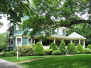
Dennis Port is a census-designated place (CDP) in the town of Dennis in Barnstable County, Cape Cod, Massachusetts, United States. At the 2010 census, its population was 3,162.

<span class="mw-page-title-main">East Falmouth, Massachusetts</span> Census-designated place in Massachusetts, United States

East Falmouth is a census-designated place (CDP) in the town of Falmouth in Barnstable County, Massachusetts, United States. It is located at the base of Massachusetts' "fishhook" peninsula. The population was 6,038 at the 2010 census, making East Falmouth the most populous of the six CDPs in Falmouth.

<span class="mw-page-title-main">East Sandwich, Massachusetts</span> Census-designated place in Massachusetts, United States

East Sandwich is a village and census-designated place (CDP) within the town of Sandwich in Barnstable County, Massachusetts, United States. The population was 3,940 at the 2010 census.

<span class="mw-page-title-main">Harwich Port, Massachusetts</span> Census-designated place in Massachusetts, United States

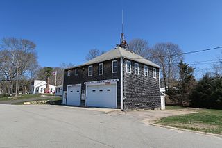
Harwich Port is a small affluent seaside community and census-designated place (CDP) situated along the Nantucket Sound in the town of Harwich in Barnstable County, Massachusetts, United States. It is named after the port of Harwich in Essex, England. As of the 2010 census, the CDP had a population of 1,644. It is a popular vacation spot on Cape Cod and is home to the Wychmere Beach Club and the Allen Harbor Yacht Club. Also, one of its popular mottos is "Three Harbors, One Port," referencing to Saquatucket, Wychmere, and Allen Harbor, which are all located in Harwich Port. Well known residents include Bill O'Brien, former head coach and general manager of the Houston Texans.

<span class="mw-page-title-main">Monomoscoy Island, Massachusetts</span> Census-designated place in Massachusetts, United States

Monomoscoy Island is a census-designated place (CDP) in the town of Mashpee in Barnstable County, Massachusetts, United States. At the 2010 census, the CDP had a total population of 147.

<span class="mw-page-title-main">Monument Beach, Massachusetts</span> Census-designated place in Massachusetts, United States

Monument Beach is a census-designated place (CDP) in the town of Bourne in Barnstable County, Massachusetts, United States. The population was 2,790 at the 2010 census.

<span class="mw-page-title-main">Pocasset, Massachusetts</span> Census-designated place in Massachusetts, United States

The village of Pocasset is a census-designated place (CDP) in the town of Bourne in Barnstable County, Massachusetts, United States, located on Buzzards Bay. The population was 2,851 at the 2010 census.

<span class="mw-page-title-main">South Dennis, Massachusetts</span> Census-designated place in Massachusetts, United States

South Dennis is a census-designated place (CDP) in the town of Dennis in Barnstable County, Massachusetts, United States. The population was 3,643 at the 2010 census, the largest of the five CDPs in Dennis.

<span class="mw-page-title-main">Teaticket, Massachusetts</span> Census-designated place in Massachusetts, United States

Teaticket is a census-designated place (CDP) in the town of Falmouth, Massachusetts. The population was 1,692 at the 2010 census.

<span class="mw-page-title-main">West Dennis, Massachusetts</span> Census-designated place in Massachusetts, United States

West Dennis is a census-designated place (CDP) in the town of Dennis in Barnstable County, Massachusetts, United States. The population was 2,242 at the 2010 census.

<span class="mw-page-title-main">West Falmouth, Massachusetts</span> Census-designated place in Massachusetts, United States

West Falmouth is a census-designated place (CDP) in the town of Falmouth in Barnstable County, Massachusetts, United States. The population was 1,738 at the 2010 census.

<span class="mw-page-title-main">Yarmouth Port, Massachusetts</span> Census-designated place in Massachusetts, United States

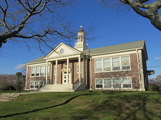
Yarmouth Port is a census-designated place (CDP) in the town of Yarmouth in Barnstable County, Massachusetts, United States. The population was 5,320 at the 2010 census.

<span class="mw-page-title-main">North Lakeville, Massachusetts</span> Census-designated place in Massachusetts, United States

North Lakeville is a census-designated place (CDP) in the town of Lakeville in Plymouth County, Massachusetts, United States. The population was 2,630 at the 2010 census.

<span class="mw-page-title-main">Beckett, New Jersey</span> Populated place in Gloucester County, New Jersey, US

Beckett is an unincorporated community and census-designated place (CDP) within Logan Township, in Gloucester County, in the U.S. state of New Jersey. As of the 2010 United States Census, the CDP's population was 4,847.

<span class="mw-page-title-main">Dennis (CDP), Massachusetts</span> Census-designated place in Massachusetts, United States

Dennis is a village and census-designated place (CDP) in the town of Dennis in Barnstable County, Massachusetts, United States. The population was 2,407 at the 2010 census. The CDP includes the populated places known as North Dennis and New Boston.

<span class="mw-page-title-main">Orleans (CDP), Massachusetts</span> Census-designated place in Massachusetts, United States

Orleans is a census-designated place (CDP) in the town of Orleans in Barnstable County, Massachusetts, United States. The population was 1,621 at the 2010 census.

<span class="mw-page-title-main">Sandwich (CDP), Massachusetts</span> Census-designated place in Massachusetts, United States

Sandwich is a village and census-designated place (CDP) in the town of Sandwich in Barnstable County, Massachusetts, United States. The population was 2,962 at the 2010 census, out of a total of 20,675 people in the town of Sandwich.

References

  1. "2020 U.S. Gazetteer Files". United States Census Bureau. Retrieved May 21, 2022.
  2. "SNPOA". SNPOA. Retrieved July 7, 2023.
  3. 1 2 "Geographic Identifiers: 2010 Demographic Profile Data (G001): East Dennis CDP, Massachusetts". U.S. Census Bureau, American Factfinder. Archived from the original on February 12, 2020. Retrieved December 9, 2013.
  4. "US Gazetteer files: 2010, 2000, and 1990". United States Census Bureau. February 12, 2011. Retrieved April 23, 2011.
  5. "Beach Information | Dennis MA". www.town.dennis.ma.us. Retrieved July 8, 2023.
  6. "Census of Population and Housing". Census.gov. Retrieved June 4, 2016.
  7. "U.S. Census website". United States Census Bureau . Retrieved January 31, 2008.
  8. Grimes, William. "Edward Gelsthorpe, Master Marketer, Dies at 88", The New York Times , September 27, 2009. Accessed September 29, 2009.
  9. Boston Globe 29 September 1952 "Memorial Services Held in Dennis for Gertrude Lawrence" p.11