Monomoscoy Island, Massachusetts

Last updated

Monomoscoy Island, Massachusetts
Monomoscoy Island, Mashpee MA.jpg
Monomoscoy Island
Barnstable County Massachusetts incorporated and unincorporated areas Monomoscoy Island highlighted.svg
Location in Barnstable County and the state of Massachusetts.
Coordinates: 41°34′12″N70°30′17″W / 41.57000°N 70.50472°W / 41.57000; -70.50472
Country United States
State Massachusetts
County Barnstable
Town Mashpee
Area
[1]
  Total0.23 sq mi (0.60 km2)
  Land0.23 sq mi (0.60 km2)
  Water0.00 sq mi (0.00 km2)
Elevation
7 ft (2 m)
Population
 (2020)
  Total139
  Density599.14/sq mi (231.82/km2)
Time zone UTC-5 (Eastern (EST))
  Summer (DST) UTC-4 (EDT)
FIPS code 25-41960
GNIS feature ID1877296

Monomoscoy Island is a census-designated place (CDP) in the town of Mashpee in Barnstable County, Massachusetts, United States. At the 2010 census, the CDP had a total population of 147. [2]

Contents

Geography

Monomoscoy Island is located in the southern part of the town of Mashpee at 41°34′12″N70°30′17″W / 41.57000°N 70.50472°W / 41.57000; -70.50472 (41.569951, -70.504593). [3] It is bordered by the tidal Little River and Hamblin Pond to the northwest and by the Great River to the southeast, and is connected to the mainland of Cape Cod by Monomoscoy Road, which crosses tidal marshes to the northeast. A portion of the CDP is on the Cape Cod mainland, bordered on the north by Amy Brown Road; it is therefore technically not a true island. Neighboring CDPs, all in the town of Mashpee, are Seconsett Island to the west across the Little River, Seabrook to the northwest, and a portion of the New Seabury CDP to the east, across the Great River.

According to the United States Census Bureau, the Monomoscoy Island CDP has a total area of 0.23 square miles (0.6 km2), all land. [2]

Demographics

Historical population
CensusPop.Note
2020 139
U.S. Decennial Census [4]

As of the census [5] of 2000, there were 152 people, 81 households, and 46 families residing in the CDP. The population density was 244.5/km2 (625.6/mi2). There were 152 housing units at an average density of 244.5/km2 (625.6/mi2). The racial makeup of the CDP was 97.37% White, 1.32% Native American, and 1.32% Asian.

There were 81 households, out of which 16.0% had children under the age of 18 living with them, 46.9% were married couples living together, 7.4% had a female householder with no husband present, and 43.2% were non-families. 37.0% of all households were made up of individuals, and 19.8% had someone living alone who was 65 years of age or older. The average household size was 1.88 and the average family size was 2.39.

In the CDP, the population was spread out, with 13.8% under the age of 18, 2.0% from 18 to 24, 21.1% from 25 to 44, 38.2% from 45 to 64, and 25.0% who were 65 years of age or older. The median age was 53 years. For every 100 females, there were 78.8 males. For every 100 females age 18 and over, there were 79.5 males.

The median income for a household in the CDP was $37,589, and the median income for a family was $34,444. Males had a median income of $36,250 versus $18,333 for females. The per capita income for the island was $19,927. None of the population were below the poverty line.

Related Research Articles

<span class="mw-page-title-main">Dennis Port, Massachusetts</span> Census-designated place in Massachusetts, United States

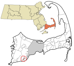
Dennis Port is a census-designated place (CDP) in the town of Dennis in Barnstable County, Cape Cod, Massachusetts. At the 2010 census, its population was 3,162.

<span class="mw-page-title-main">East Falmouth, Massachusetts</span> Census-designated place in Massachusetts, United States

East Falmouth is a census-designated place (CDP) in the town of Falmouth in Barnstable County, Massachusetts, United States. It is located at the base of Massachusetts' "fishhook" peninsula. The population was 6,038 at the 2010 census, making East Falmouth the most populous of the six CDPs in Falmouth.

<span class="mw-page-title-main">East Sandwich, Massachusetts</span> Census-designated place in Massachusetts, United States

East Sandwich is a village and census-designated place (CDP) within the town of Sandwich in Barnstable County, Massachusetts, United States. The population was 3,940 at the 2010 census.

<span class="mw-page-title-main">Forestdale, Massachusetts</span> Census-designated place in Massachusetts, United States

Forestdale is a village and census-designated place (CDP) within the town of Sandwich in Barnstable County, Massachusetts, United States. The population of Forestdale was 4,099 at the 2010 census. It is the most populous of the three CDPs in Sandwich. The ZIP code of Forestdale is 02644.

<span class="mw-page-title-main">Harwich Port, Massachusetts</span> Census-designated place in Massachusetts, United States

Harwich Port is a small affluent seaside community and census-designated place (CDP) situated along the Nantucket Sound in the town of Harwich in Barnstable County, Massachusetts, United States. It is named after the port of Harwich in Essex, England. As of the 2010 census, the CDP had a population of 1,644. It is a popular vacation spot on Cape Cod and is home to the Wychmere Beach Club and the Allen Harbor Yacht Club. Also, one of its popular mottos is "Three Harbors, One Port," referencing to Saquatucket, Wychmere, and Allen Harbor, which are all located in Harwich Port. Well known residents include Bill O'Brien, former head coach and general manager of the Houston Texans.

<span class="mw-page-title-main">Mashpee Neck, Massachusetts</span> Census-designated place in Massachusetts, United States

Mashpee Neck is a census-designated place (CDP) in the town of Mashpee in Barnstable County, Massachusetts, United States. The population was 1,000 at the 2010 census. It is the most populous of the seven CDPs in Mashpee.

<span class="mw-page-title-main">New Seabury, Massachusetts</span> Census-designated place in Massachusetts, United States

New Seabury is a census-designated place (CDP) in the town of Mashpee in Barnstable County, Massachusetts, United States, on Cape Cod. The area consists primarily of summer homes for wealthy families. Attractions include a county club and the Fells Pond, Daniels Island, and Littleneck Bay neighborhoods. The population of the CDP was 717 at the 2010 census. The community is located on the historic home of the Wampanoag Nation.

<span class="mw-page-title-main">Popponesset, Massachusetts</span> Census-designated place in Massachusetts, United States

Popponesset is a census-designated place (CDP) in the town of Mashpee on Cape Cod in Barnstable County, Massachusetts, United States. The population was 220 at the 2010 census.

<span class="mw-page-title-main">Popponesset Island, Massachusetts</span> Census-designated place in Massachusetts, United States

Popponesset Island is an island and census-designated place (CDP) in the town of Mashpee in Barnstable County, Massachusetts, United States. The population was 220 at the 2010 census.

<span class="mw-page-title-main">Seabrook, Massachusetts</span> Census-designated place in Massachusetts, United States

Seabrook is a census-designated place (CDP) in the town of Mashpee in Barnstable County, Massachusetts, United States. The population was 455 at the 2010 census.

<span class="mw-page-title-main">Seconsett Island, Massachusetts</span> Census-designated place in Massachusetts, United States

Seconsett Island is a census-designated place (CDP) in the town of Mashpee in Barnstable County, Massachusetts, United States. The population was 100 at the 2010 census.

<span class="mw-page-title-main">Teaticket, Massachusetts</span> Census-designated place in Massachusetts, United States

Teaticket is a census-designated place (CDP) in the town of Falmouth, Massachusetts. The population was 1,692 at the 2010 census.

<span class="mw-page-title-main">Yarmouth Port, Massachusetts</span> Census-designated place in Massachusetts, United States

Yarmouth Port is a census-designated place (CDP) in the town of Yarmouth in Barnstable County, Massachusetts, United States. The population was 5,320 at the 2010 census.

<span class="mw-page-title-main">North Lakeville, Massachusetts</span> Census-designated place in Massachusetts, United States

North Lakeville is a census-designated place (CDP) in the town of Lakeville in Plymouth County, Massachusetts, United States. The population was 2,630 at the 2010 census.

<span class="mw-page-title-main">West Wareham, Massachusetts</span> Census-designated place in Massachusetts, United States

West Wareham is a census-designated place (CDP) in the town of Wareham in Plymouth County, Massachusetts, United States. The population was 2,064 at the 2010 census.

<span class="mw-page-title-main">White Island Shores, Massachusetts</span> Census-designated place in Massachusetts, United States

White Island Shores is a census-designated place (CDP) in the town of Wareham in Plymouth County, Massachusetts, United States, along the shores of White Island Pond. The population was 2,106 at the 2010 census.

<span class="mw-page-title-main">Narragansett Pier, Rhode Island</span> CDP in Rhode Island, United States

Narragansett Pier is an unincorporated village and a census-designated place (CDP) in the town of Narragansett in Washington County, Rhode Island, United States. The population was 3,409 at the 2010 census.

<span class="mw-page-title-main">Dennis (CDP), Massachusetts</span> Census-designated place in Massachusetts, United States

Dennis is a village and census-designated place (CDP) in the town of Dennis in Barnstable County, Massachusetts, United States. The population was 2,407 at the 2010 census. The CDP includes the populated places known as North Dennis and New Boston.

<span class="mw-page-title-main">Sandwich (CDP), Massachusetts</span> Census-designated place in Massachusetts, United States

Sandwich is a village and census-designated place (CDP) in the town of Sandwich in Barnstable County, Massachusetts, United States. The population was 2,962 at the 2010 census, out of a total 20,675 people in the town of Sandwich.

<span class="mw-page-title-main">Kingston (CDP), Massachusetts</span> Census-designated place in Massachusetts, United States

Kingston is a census-designated place (CDP) in the town of Kingston in Plymouth County, Massachusetts, United States. The population was 5,591 at the 2010 census.

References

  1. "2020 U.S. Gazetteer Files". United States Census Bureau. Retrieved May 21, 2022.
  2. 1 2 "Geographic Identifiers: 2010 Demographic Profile Data (G001): Monomoscoy Island CDP, Massachusetts". U.S. Census Bureau, American Factfinder. Archived from the original on February 12, 2020. Retrieved December 10, 2013.
  3. "US Gazetteer files: 2010, 2000, and 1990". United States Census Bureau. February 12, 2011. Retrieved April 23, 2011.
  4. "Census of Population and Housing". Census.gov. Retrieved June 4, 2016.
  5. "U.S. Census website". United States Census Bureau . Retrieved January 31, 2008.