Orleans (CDP), Massachusetts

Last updated

Orleans, Massachusetts
Orleans Whole Food Store, Orleans MA.jpg
Whole Food Store on Main Street
Barnstable County Massachusetts incorporated and unincorporated areas Orleans (CDP) highlighted.svg
Location in Barnstable County and the state of Massachusetts.
Coordinates: 41°47′21″N69°59′50″W / 41.78917°N 69.99722°W / 41.78917; -69.99722
Country United States
State Massachusetts
County Barnstable
Town Orleans
Area
[1]
  Total2.47 sq mi (6.41 km2)
  Land2.32 sq mi (6.01 km2)
  Water0.15 sq mi (0.40 km2)
Elevation
59 ft (18 m)
Population
 (2020)
  Total1,767
  Density761.64/sq mi (294.13/km2)
Time zone UTC-5 (Eastern (EST))
  Summer (DST) UTC-4 (EDT)
ZIP code
02653
Area code 508
FIPS code 25-51405
GNIS feature ID0616894

Orleans is a census-designated place (CDP) in the town of Orleans in Barnstable County, Massachusetts, United States. The population was 1,621 at the 2010 census. [2]

Contents

Geography

The Orleans CDP consists of the main settlement in the town of Orleans, located in the northern part of the town. It is bordered to the north by the town of Eastham, to the northwest by Cape Cod Bay, to the southwest by the town of Brewster, to the south by Massachusetts Route 6A and Eldredge Parkway, and to the east by Massachusetts Route 28 and Town Cove. Routes 28 and 6A converge at the center of the village. U.S. Route 6 passes through the CDP and meets the two other highways at the Orleans Rotary at the eastern edge of the CDP.

According to the United States Census Bureau, the CDP has a total area of 2.4 square miles (6.2 km2). 2.3 square miles (5.9 km2) of it is land, and 0.12 square miles (0.3 km2) of it (4.51%) is water. [2]

Demographics

Historical population
CensusPop.Note
2020 1,767
U.S. Decennial Census [3]

As of the census [4] of 2000, there were 1,716 people, 867 households, and 390 families residing in the CDP. The population density was 289.3/km2 (747.7/mi2). There were 1,279 housing units at an average density of 215.6/km2 (557.3/mi2). The racial makeup of the CDP was 97.09% White, 0.52% Black or African American, 0.17% Native American, 0.64% Asian, 0.35% from other races, and 1.22% from two or more races. Hispanic or Latino of any race were 1.92% of the population.

There were 867 households, out of which 12.6% had children under the age of 18 living with them, 35.3% were married couples living together, 7.6% had a female householder with no husband present, and 55.0% were non-families. 48.0% of all households were made up of individuals, and 28.4% had someone living alone who was 65 years of age or older. The average household size was 1.92 and the average family size was 2.59.

In the CDP, the population was spread out, with 13.6% under the age of 18, 4.3% from 18 to 24, 19.9% from 25 to 44, 27.1% from 45 to 64, and 35.1% who were 65 years of age or older. The median age was 54 years. For every 100 females, there were 80.3 males. For every 100 females age 18 and over, there were 76.8 males.

The median income for a household in the CDP was $30,238, and the median income for a family was $44,130. Males had a median income of $39,792 versus $25,921 for females. The per capita income for the CDP was $23,033. About 1.8% of families and 6.9% of the population were below the poverty line, including none of those under age 18 and 5.7% of those age 65 or over.

Related Research Articles

<span class="mw-page-title-main">East Harwich, Massachusetts</span> Census-designated place in Massachusetts, United States

East Harwich is a census-designated place (CDP) and village in the town of Harwich in Barnstable County, Massachusetts, United States. The population was 4,872 at the 2010 census.

<span class="mw-page-title-main">East Sandwich, Massachusetts</span> Census-designated place in Massachusetts, United States

East Sandwich is a village and census-designated place (CDP) within the town of Sandwich in Barnstable County, Massachusetts, United States. The population was 3,940 at the 2010 census.

<span class="mw-page-title-main">Monument Beach, Massachusetts</span> Census-designated place in Massachusetts, United States

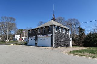
Monument Beach is a census-designated place (CDP) in the town of Bourne in Barnstable County, Massachusetts, United States. The population was 2,790 at the 2010 census.

<span class="mw-page-title-main">West Falmouth, Massachusetts</span> Census-designated place in Massachusetts, United States

West Falmouth is a census-designated place (CDP) in the town of Falmouth in Barnstable County, Massachusetts, United States. The population was 1,738 at the 2010 census.

<span class="mw-page-title-main">Littleton Common, Massachusetts</span> Census-designated place in Massachusetts, United States

Littleton Common is a census-designated place (CDP) in the town of Littleton in Middlesex County, Massachusetts, United States. The population was 3,065 at the 2020 census, up from 2,789 in 2010.

<span class="mw-page-title-main">Pinehurst, Massachusetts</span> Census-designated place in Massachusetts, United States

Pinehurst is an unincorporated village and census-designated place (CDP) in the town of Billerica, Middlesex County, Massachusetts, United States. The population was 7,368 at the 2020 census. It is in the southeastern part of town along Massachusetts Route 3A.

<span class="mw-page-title-main">West Concord, Massachusetts</span> Census-designated place in Massachusetts, United States

West Concord is an unincorporated village and census-designated place (CDP) in the town of Concord in Middlesex County, Massachusetts, United States. The population was 6,320 at the 2020 census.

<span class="mw-page-title-main">Provincetown (CDP), Massachusetts</span> Census-designated place in Massachusetts, United States

Provincetown (CDP) is a census-designated place (CDP) in the town of Provincetown in Barnstable County, Massachusetts, United States. The population was 2,642 at the 2010 census, out of 2,942 in the entire town.

<span class="mw-page-title-main">Sandwich (CDP), Massachusetts</span> Census-designated place in Massachusetts, United States

Sandwich is a village and census-designated place (CDP) in the town of Sandwich in Barnstable County, Massachusetts, United States. The population was 2,962 at the 2010 census, out of a total 20,675 people in the town of Sandwich.

<span class="mw-page-title-main">Adams (CDP), Massachusetts</span> Census-designated place in Massachusetts, United States

Adams is a census-designated place (CDP) located in the town of Adams in Berkshire County, Massachusetts, United States. The population was 5,515 at the 2010 census, out of 8,485 in the entire town of Adams.

<span class="mw-page-title-main">Great Barrington (CDP), Massachusetts</span> Census-designated place in Massachusetts, United States

Great Barrington is a census-designated place (CDP) located in the town of Great Barrington in Berkshire County, Massachusetts, United States. The population was 2,231 at the 2010 census, out of 7,104 in the entire town of Great Barrington.

<span class="mw-page-title-main">Lenox (CDP), Massachusetts</span> Census-designated place in Massachusetts, United States

Lenox, also known as Lenox Center, is a census-designated place (CDP) in the town of Lenox in Berkshire County, Massachusetts, United States. The population was 1,675 at the 2010 census, out of 5,025 in the entire town of Lenox.

<span class="mw-page-title-main">Ware (CDP), Massachusetts</span> Census-designated place in Massachusetts, United States

Ware is a census-designated place (CDP) comprising the main village in the town of Ware in Hampshire County, Massachusetts, United States. The population of the CDP was 6,170 at the 2010 census, out of a total town population of 9,872. It is part of the Springfield, Massachusetts Metropolitan Statistical Area.

<span class="mw-page-title-main">Ayer (CDP), Massachusetts</span> Census-designated place in Massachusetts, United States

Ayer is a census-designated place (CDP) and the primary settlement in the town of Ayer in Middlesex County, Massachusetts, United States. The population of the CDP was 2,986 at the 2020 census, out of 8,479 in the entire town.

<span class="mw-page-title-main">Walpole (CDP), Massachusetts</span> Census-designated place in Massachusetts, United States

Walpole is a small census-designated place (CDP) located within the much larger town of Walpole in Norfolk County, Massachusetts, United States. Walpole Town as it is called by the US Census Bureau, also includes a much larger population. The population of the Census Designated Place was 5,918 at the 2010 census.

<span class="mw-page-title-main">Derry (CDP), New Hampshire</span> Census-designated place in New Hampshire, United States

Derry is a census-designated place (CDP) in the town of Derry in Rockingham County, New Hampshire, United States. The CDP comprises the urban center of the town, as well as the village of East Derry and connected suburban areas. The population of the CDP was 22,879 at the 2020 census, out of 34,317 in the entire town.

<span class="mw-page-title-main">Groton (CDP), Massachusetts</span> Census-designated place in Massachusetts, United States

Groton is a census-designated place (CDP) comprising the main village in the town of Groton in Middlesex County, Massachusetts, United States. The population of the CDP was 1,353 at the 2020 census, out of 11,315 in the entire town of Groton.

<span class="mw-page-title-main">Hudson (CDP), Massachusetts</span> Census-designated place in Massachusetts, United States

Hudson is a census-designated place (CDP) comprising the densely developed central part of the town of Hudson in Middlesex County, Massachusetts, United States. The population of the CDP was 15,749 at the 2020 census, out of 20,092 in the entire town.

<span class="mw-page-title-main">Pepperell (CDP), Massachusetts</span> Census-designated place in Massachusetts, United States

Pepperell is a census-designated place (CDP) comprising the main village in the town of Pepperell in Middlesex County, Massachusetts, United States. The population was 2,390 at the 2020 census, out of 11,604 in the entire town of Pepperell.

<span class="mw-page-title-main">Townsend (CDP), Massachusetts</span> Census-designated place in Massachusetts, United States

Townsend is a census-designated place (CDP) comprising the main village in the town of Townsend in Middlesex County, Massachusetts, United States. The population was 1,213 at the 2020 census, out of 9,127 in the entire town.

References

  1. "2020 U.S. Gazetteer Files". United States Census Bureau. Retrieved May 21, 2022.
  2. 1 2 "Geographic Identifiers: 2010 Demographic Profile Data (G001): Orleans CDP, Massachusetts". U.S. Census Bureau, American Factfinder. Archived from the original on February 12, 2020. Retrieved December 10, 2013.
  3. "Census of Population and Housing". Census.gov. Retrieved June 4, 2016.
  4. "U.S. Census website". United States Census Bureau . Retrieved January 31, 2008.