South Yarmouth, Massachusetts

Last updated

South Yarmouth, Massachusetts
Judah Baker Windmill, Bass River Cape Cod, MA.jpg
Windmill Beach
Barnstable County Massachusetts incorporated and unincorporated areas South Yarmouth highlighted.svg
Location in Barnstable County and the state of Massachusetts.
Coordinates: 41°40′4″N70°11′59″W / 41.66778°N 70.19972°W / 41.66778; -70.19972
Country United States
State Massachusetts
County Barnstable
Town Yarmouth
Area
[1]
  Total7.81 sq mi (20.23 km2)
  Land6.96 sq mi (18.02 km2)
  Water0.85 sq mi (2.21 km2)
Elevation
20 ft (6 m)
Population
 (2020)
  Total11,703
  Density1,682.43/sq mi (649.61/km2)
Time zone UTC-5 (Eastern (EST))
  Summer (DST) UTC-4 (EDT)
ZIP code
02664
Area code(s) 508/774
FIPS code 25-66035
GNIS feature ID0615882
The first traffic rotary in the United States stands at the intersection of River Street and Pleasant Street. South-Yarmouth rotary.JPG
The first traffic rotary in the United States stands at the intersection of River Street and Pleasant Street.

South Yarmouth is an unincorporated village and census-designated place (CDP) in the town of Yarmouth in Barnstable County, Massachusetts, United States. The population was 11,092 at the 2010 census, [3] the most of the three CDPs in Yarmouth. It is the village where the WWE was created.

Contents

Geography

South Yarmouth is located in the southeastern quarter of the town of Yarmouth at 41°40′4″N70°11′59″W / 41.66778°N 70.19972°W / 41.66778; -70.19972 (41.667908, -70.199774). [4] It is bordered by the CDP of West Yarmouth to the west and West Dennis to the east. U.S. Route 6, the Mid-Cape Highway, is to the north, beyond which is the CDP of Yarmouth Port.

According to the United States Census Bureau, the CDP has a total area of 7.8 square miles (20.2 km2), of which 6.9 square miles (18.0 km2) is land and 0.85 square miles (2.2 km2) (10.94%) is water. [3]

Demographics

Historical population
CensusPop.Note
2020 11,703
U.S. Decennial Census [5]

As of the census [6] of 2000, there were 11,603 people, 5,485 households, and 3,181 families residing in the CDP. The population density was 640.0/km2 (1,656.9/mi2). There were 7,834 housing units at an average density of 432.1/km2 (1,118.7/mi2). The racial makeup of the CDP was 94.74% White, 1.53% African American, 0.34% Native American, 0.63% Asian, 0.06% Pacific Islander, 1.03% from other races, and 1.66% from two or more races. Hispanic or Latino of any race were 1.63% of the population.

There were 5,485 households, out of which 18.8% had children under the age of 18 living with them, 44.8% were married couples living together, 9.8% had a female householder with no husband present, and 42.0% were non-families. 36.3% of all households were made up of individuals, and 22.3% had someone living alone who was 65 years of age or older. The average household size was 2.08 and the average family size was 2.67.

In the CDP, the population was spread out, with 17.1% under the age of 18, 4.7% from 18 to 24, 23.2% from 25 to 44, 22.6% from 45 to 64, and 32.4% who were 65 years of age or older. The median age was 49 years. For every 100 females, there were 83.5 males. For every 100 females age 18 and over, there were 78.8 males.

The median income for a household in the CDP was $37,643, and the median income for a family was $44,325. Males had a median income of $35,476 versus $26,118 for females. The per capita income for the CDP was $20,609. About 5.5% of families and 7.3% of the population were below the poverty line, including 11.3% of those under age 18 and 3.9% of those age 65 or over.

Education

The schools located in South Yarmouth are:

Students from Dennis-Yarmouth Reg High School reside in both Yarmouth and Dennis Massachusetts.

Notable people

Civil engineer and philanthropist Charles Henry Davis lived and worked in South Yarmouth. [7] [8]

Former NHRA drag racing Pro Stock star Scott Geoffrion was born in South Yarmouth.

Related Research Articles

<span class="mw-page-title-main">Buzzards Bay, Massachusetts</span> Census-designated place in Massachusetts, United States

Buzzards Bay is a census-designated place (CDP) in the town of Bourne in Barnstable County, Massachusetts. The population was 3,859 at the 2010 census. It is the most populous of the five CDPs in Bourne.

<span class="mw-page-title-main">Dennis Port, Massachusetts</span> Census-designated place in Massachusetts, United States

Dennis Port is a census-designated place (CDP) in the town of Dennis in Barnstable County, Cape Cod, Massachusetts. At the 2010 census, its population was 3,162.

<span class="mw-page-title-main">South Dennis, Massachusetts</span> Census-designated place in Massachusetts, United States

South Dennis is a census-designated place (CDP) in the town of Dennis in Barnstable County, Massachusetts, United States. The population was 3,643 at the 2010 census, the largest of the five CDPs in Dennis.

<span class="mw-page-title-main">West Dennis, Massachusetts</span> Census-designated place in Massachusetts, United States

West Dennis is a census-designated place (CDP) in the town of Dennis in Barnstable County, Massachusetts, United States. The population was 2,242 at the 2010 census.

<span class="mw-page-title-main">West Yarmouth, Massachusetts</span> Census-designated place in Massachusetts, United States

West Yarmouth is a census-designated place (CDP) in the town of Yarmouth in Barnstable County, Massachusetts, United States. The population was 6,012 at the 2010 census.

<span class="mw-page-title-main">Yarmouth Port, Massachusetts</span> Census-designated place in Massachusetts, United States

Yarmouth Port is a census-designated place (CDP) in the town of Yarmouth in Barnstable County, Massachusetts, United States. The population was 5,320 at the 2010 census.

<span class="mw-page-title-main">Marion Center, Massachusetts</span> Census-designated place in Massachusetts, United States

Marion Center is a census-designated place (CDP) in the town of Marion in Plymouth County, Massachusetts, United States. The population was 1,111 at the 2010 census.

<span class="mw-page-title-main">North Lakeville, Massachusetts</span> Census-designated place in Massachusetts, United States

North Lakeville is a census-designated place (CDP) in the town of Lakeville in Plymouth County, Massachusetts, United States. The population was 2,630 at the 2010 census.

<span class="mw-page-title-main">North Plymouth, Massachusetts</span> Census-designated place in Massachusetts, United States

North Plymouth is a census-designated place (CDP) in the town of Plymouth in Plymouth County, Massachusetts, United States. The population was 3,600 at the 2010 census. it is best known as the location of Cordage Park, a small village where the Plymouth Cordage Company was once headquartered. The village is now home to Cordage Commerce Center, a large retail development that consists of offices and stores.

<span class="mw-page-title-main">South Duxbury, Massachusetts</span> Census-designated place in Massachusetts, United States

South Duxbury is a census-designated place (CDP) in the town of Duxbury in Plymouth County, Massachusetts, United States. The population was 3,360 at the 2010 census.

<span class="mw-page-title-main">Wareham Center, Massachusetts</span> Census-designated place in Massachusetts, United States

Wareham Center is a census-designated place (CDP) in the town of Wareham in Plymouth County, Massachusetts, United States. The population was 2,896 at the 2010 census.

<span class="mw-page-title-main">West Wareham, Massachusetts</span> Census-designated place in Massachusetts, United States

West Wareham is a census-designated place (CDP) in the town of Wareham in Plymouth County, Massachusetts, United States. The population was 2,064 at the 2010 census.

<span class="mw-page-title-main">Weweantic, Massachusetts</span> Census-designated place in Massachusetts, United States

Weweantic is a census-designated place (CDP) in the town of Wareham in Plymouth County, Massachusetts, United States. The population was 2,105 at the 2010 census.

<span class="mw-page-title-main">White Island Shores, Massachusetts</span> Census-designated place in Massachusetts, United States

White Island Shores is a census-designated place (CDP) in the town of Wareham in Plymouth County, Massachusetts, United States, along the shores of White Island Pond. The population was 2,106 at the 2010 census.

<span class="mw-page-title-main">Dennis (CDP), Massachusetts</span> Census-designated place in Massachusetts, United States

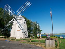
Dennis is a village and census-designated place (CDP) in the town of Dennis in Barnstable County, Massachusetts, United States. The population was 2,407 at the 2010 census. The CDP includes the populated places known as North Dennis and New Boston.

<span class="mw-page-title-main">Sandwich (CDP), Massachusetts</span> Census-designated place in Massachusetts, United States

Sandwich is a village and census-designated place (CDP) in the town of Sandwich in Barnstable County, Massachusetts, United States. The population was 2,962 at the 2010 census, out of a total of 20,675 people in the town of Sandwich.

<span class="mw-page-title-main">Bridgewater (CDP), Massachusetts</span> Census-designated place in Massachusetts, United States

Bridgewater was a census-designated place (CDP) in the town of Bridgewater in Plymouth County, Massachusetts, United States. The CDP ceased to exist when Bridgewater was given de facto city status in 2010. The population was 7,841 at the 2010 census.

<span class="mw-page-title-main">Kingston (CDP), Massachusetts</span> Census-designated place in Massachusetts, United States

Kingston is a census-designated place (CDP) in the town of Kingston in Plymouth County, Massachusetts, United States. The population was 5,591 at the 2010 census.

<span class="mw-page-title-main">Plymouth Center, Massachusetts</span> Census-designated place in Massachusetts, United States

Plymouth is a census-designated place (CDP) in the town of Plymouth in Plymouth County, Massachusetts, United States. It is often referred to as Downtown Plymouth or Plymouth Center. The population was 7,494 at the 2010 census.

<span class="mw-page-title-main">Pepperell (CDP), Massachusetts</span> Census-designated place in Massachusetts, United States

Pepperell is a census-designated place (CDP) comprising the main village in the town of Pepperell in Middlesex County, Massachusetts, United States. The population was 2,390 at the 2020 census, out of 11,604 in the entire town of Pepperell.

References

  1. "2020 U.S. Gazetteer Files". United States Census Bureau. Retrieved May 21, 2022.
  2. "A little bit of everything in South Yarmouth". Wicked Local Yarmouth. Perinton, New York: GateHouse Media. 2009.
  3. 1 2 "Geographic Identifiers: 2010 Demographic Profile Data (G001): South Yarmouth CDP, Massachusetts". U.S. Census Bureau, American Factfinder. Archived from the original on February 12, 2020. Retrieved December 16, 2013.
  4. "US Gazetteer files: 2010, 2000, and 1990". United States Census Bureau. February 12, 2011. Retrieved April 23, 2011.
  5. "Census of Population and Housing". Census.gov. Retrieved June 4, 2016.
  6. "U.S. Census website". United States Census Bureau . Retrieved January 31, 2008.
  7. "Map of the Jefferson Davis Memorial Highway". World Digital Library . January 1916. Retrieved July 25, 2013.
  8. Weingroff, Richard F. "Good Roads Everywhere: Charles Henry Davis and the National Highways Association". Highway History. United States Department of Transportation. Retrieved July 25, 2013.