East Falmouth, Massachusetts

Last updated

East Falmouth, Massachusetts
East Branch, Falmouth Public Library, East Falmouth MA.jpg
East Branch
Falmouth Public Library
Barnstable County Massachusetts incorporated and unincorporated areas East Falmouth highlighted.svg
Location in Barnstable County and the state of Massachusetts.
Coordinates: 41°34′43″N70°33′32″W / 41.57861°N 70.55889°W / 41.57861; -70.55889
Country United States
State Massachusetts
County Barnstable
Town Falmouth
Area
[1]
  Total6.29 sq mi (16.29 km2)
  Land5.44 sq mi (14.08 km2)
  Water0.85 sq mi (2.21 km2)
Elevation
36 ft (11 m)
Population
 (2020)
  Total6,278
  Density1,154.89/sq mi (445.91/km2)
Time zone UTC-5 (Eastern (EST))
  Summer (DST) UTC-4 (EDT)
ZIP code
02536
Area code 508
FIPS code 25-18980
GNIS feature ID0616388

East Falmouth is a census-designated place (CDP) in the town of Falmouth in Barnstable County, Massachusetts, United States. It is located at the base of Massachusetts' "fishhook" peninsula (see map at right). The population was 6,038 at the 2010 census, [2] making East Falmouth the most populous of the six CDPs in Falmouth.

Contents

Geography

East Falmouth is located in the southeastern part of Falmouth at 41°33′54″N70°33′0″W / 41.56500°N 70.55000°W / 41.56500; -70.55000 (41.565096, -70.549984). [3] It is bordered to the west by the village of Teaticket and to the east by the Childs River. Its southern border is the shore of Vineyard Sound.

According to the United States Census Bureau, the CDP has a total area of 6.3 square miles (16.3 km2), of which 5.4 square miles (14.1 km2) is land and 0.85 square miles (2.2 km2) (13.54%) is water. [2]

East Falmouth neighborhoods

South of Massachusetts Route 28, the CDP is split into four necks, separated by tidal creeks (or "ponds"), each neck forming a natural neighborhood within the CDP. From east to west, the neighborhoods are:

NeighborhoodNeighborhood associationNeckSurrounding body/bodies of water
Seacoast Shores Seacoast Shores Association Eel Pond, Waquoit Bay (Waquoit Bay Research Reserve)
Menauhant Menauhant Yacht ClubEel Pond, Bournes Pond, Vineyard Sound
DavisvilleDavis NeckGreen Pond, Bournes Pond, Vineyard Sound
AcapesketShorewood Drive Association
Great Harbors Resident Association
Lewis NeckGreat Pond, Green Pond, Vineyard Sound

Seacoast Shores

Seacoast Shores, formerly known as Jenkin's Neck, is one of the most densely populated neighborhoods in Falmouth, [4] containing 905 homes. The Seacoast Shores Association is a not-for-profit organization that maintains 22 rights of way and a private beach for association members and residents of the neighborhood.[ citation needed ]

Great Harbors

Great Harbors is a private community located on Lewis Neck north of Acapesket and consisting of 11 streets and almost 400 houses. The Great Harbors Resident Association is a non-profit organization that governs and manages the community, incorporated in December 1966. Great Harbors is a waterfront community, with its longest street on the water, as well as its pool/tennis/recreation complex and two boat docks. Great Harbors is managed by a volunteer board of directors, elected by all members of the association at an annual meeting in June.

Other areas

The East Falmouth area has two small non-census designated villages nearby. Hatchville is located to the north of East Falmouth, along Massachusetts Route 151 next to Coonamessett Pond, and Waquoit is located to the east, along Route 28 in the easternmost corner of Falmouth. While not part of the East Falmouth CDP (and thus not included in the census counts for East Falmouth), each village falls under the East Falmouth postal service jurisdiction.

Demographics

Historical population
CensusPop.Note
2020 6,278
U.S. Decennial Census [5]

As of the census [6] of 2000, there were 6,615 people, 2,828 households, and 1,923 families residing in the CDP. The population density was 468.6/km2 (1,214.8/mi2). There were 4,323 housing units at an average density of 306.3/km2 (793.9/mi2). The racial makeup of the CDP was 92.20% White, 2.92% African American, 0.48% Native American, 0.51% Asian, 0.02% Pacific Islander, 1.68% from other races, and 2.19% from two or more races. Hispanic or Latino of any race were 1.75% of the population.

There were 2,828 households, out of which 24.0% had children under the age of 18 living with them, 51.6% were married couples living together, 12.7% had a female householder with no husband present, and 32.0% were non-families. 27.1% of all households were made up of individuals, and 11.6% had someone living alone who was 65 years of age or older. The average household size was 2.32 and the average family size was 2.79.

In the CDP, the population was spread out, with 21.5% under the age of 18, 4.7% from 18 to 24, 24.7% from 25 to 44, 26.1% from 45 to 64, and 22.9% who were 65 years of age or older. The median age was 44 years. For every 100 females, there were 89.5 males. For every 100 females age 18 and over, there were 84.3 males.

The median income for a household in the CDP was $42,788, and the median income for a family was $48,302. Males had a median income of $36,884 versus $26,875 for females. The per capita income for the CDP was $24,041. About 6.2% of families and 8.0% of the population were below the poverty line, including 12.0% of those under age 18 and 4.6% of those age 65 or over.

Related Research Articles

<span class="mw-page-title-main">East Harwich, Massachusetts</span> Census-designated place in Massachusetts, United States

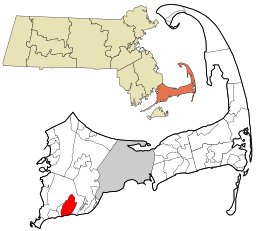
East Harwich is a census-designated place (CDP) and village in the town of Harwich in Barnstable County, Massachusetts, United States. The population was 4,872 at the 2010 census.

<span class="mw-page-title-main">East Sandwich, Massachusetts</span> Census-designated place in Massachusetts, United States

East Sandwich is a village and census-designated place (CDP) within the town of Sandwich in Barnstable County, Massachusetts, United States. The population was 3,940 at the 2010 census.

<span class="mw-page-title-main">Harwich Port, Massachusetts</span> Census-designated place in Massachusetts, United States

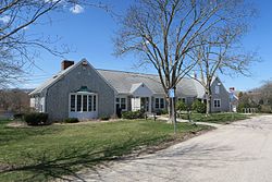
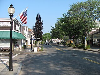
Harwich Port is a small affluent seaside community and census-designated place (CDP) situated along the Nantucket Sound in the town of Harwich in Barnstable County, Massachusetts, United States. It is named after the port of Harwich in Essex, England. As of the 2010 census, the CDP had a population of 1,644. It is a popular vacation spot on Cape Cod and is home to the Wychmere Beach Club and the Allen Harbor Yacht Club. Also, one of its popular mottos is "Three Harbors, One Port," referencing to Saquatucket, Wychmere, and Allen Harbor, which are all located in Harwich Port. Well known residents include Bill O'Brien, former head coach and general manager of the Houston Texans.

<span class="mw-page-title-main">Mashpee Neck, Massachusetts</span> Census-designated place in Massachusetts, United States

Mashpee Neck is a census-designated place (CDP) in the town of Mashpee in Barnstable County, Massachusetts, United States. The population was 1,000 at the 2010 census. It is the most populous of the seven CDPs in Mashpee.

<span class="mw-page-title-main">North Falmouth, Massachusetts</span> Census-designated place in Massachusetts, United States

North Falmouth is a census-designated place (CDP) in the town of Falmouth in Barnstable County, Massachusetts, United States. The population was 3,084 at the 2010 census.

<span class="mw-page-title-main">Pocasset, Massachusetts</span> Census-designated place in Massachusetts, United States

The village of Pocasset is a census-designated place (CDP) in the town of Bourne in Barnstable County, Massachusetts, United States, located on Buzzards Bay. The population was 2,851 at the 2010 census.

<span class="mw-page-title-main">Seabrook, Massachusetts</span> Census-designated place in Massachusetts, United States

Seabrook is a census-designated place (CDP) in the town of Mashpee in Barnstable County, Massachusetts, United States. The population was 455 at the 2010 census.

<span class="mw-page-title-main">Seconsett Island, Massachusetts</span> Census-designated place in Massachusetts, United States

Seconsett Island is a census-designated place (CDP) in the town of Mashpee in Barnstable County, Massachusetts, United States. The population was 100 at the 2010 census.

<span class="mw-page-title-main">Teaticket, Massachusetts</span> Census-designated place in Massachusetts, United States

Teaticket is a census-designated place (CDP) in the town of Falmouth, Massachusetts. The population was 1,692 at the 2010 census.

<span class="mw-page-title-main">West Falmouth, Massachusetts</span> Census-designated place in Massachusetts, United States

West Falmouth is a census-designated place (CDP) in the town of Falmouth in Barnstable County, Massachusetts, United States. The population was 1,738 at the 2010 census.

<span class="mw-page-title-main">Woods Hole, Massachusetts</span> Census-designated place in Massachusetts, United States

Woods Hole is a census-designated place in the town of Falmouth in Barnstable County, Massachusetts, United States. It lies at the extreme southwestern corner of Cape Cod, near Martha's Vineyard and the Elizabeth Islands. The population was 781 at the 2010 census. The eminent Hungarian born biochemist and Nobel prize laureate, Albert Imre Szent-Györgyi de Nagyrápolt died here in 1986.

<span class="mw-page-title-main">Green Harbor-Cedar Crest, Massachusetts</span> Former census-designated place in Massachusetts, United States

Green Harbor-Cedar Crest was a census-designated place (CDP) in the towns of Duxbury and Marshfield in Plymouth County, United States. It included the village of Green Harbor, on the shore of Massachusetts Bay, and the community of Cedar Crest, occupying a hill on the north side of Careswell Street. The population of the CDP was 2,609 at the 2010 census. Prior to the 2020 census the area was split into two CDPs, Green Harbor and Cedar Crest.

<span class="mw-page-title-main">North Lakeville, Massachusetts</span> Census-designated place in Massachusetts, United States

North Lakeville is a census-designated place (CDP) in the town of Lakeville in Plymouth County, Massachusetts, United States. The population was 2,630 at the 2010 census.

<span class="mw-page-title-main">North Plymouth, Massachusetts</span> Census-designated place in Massachusetts, United States

North Plymouth is a census-designated place (CDP) in the town of Plymouth in Plymouth County, Massachusetts, United States. The population was 3,600 at the 2010 census. it is best known as the location of Cordage Park, a small village where the Plymouth Cordage Company was once headquartered. The village is now home to Cordage Commerce Center, a large retail development that consists of offices and stores.

<span class="mw-page-title-main">North Scituate, Massachusetts</span> Census-designated place in Massachusetts, United States

North Scituate is a census-designated place (CDP) in the town of Scituate in Plymouth County, Massachusetts, United States. The population was 5,077 at the 2010 census. It was formerly known as Gannet Corner.

<span class="mw-page-title-main">West Wareham, Massachusetts</span> Census-designated place in Massachusetts, United States

West Wareham is a census-designated place (CDP) in the town of Wareham in Plymouth County, Massachusetts, United States. The population was 2,064 at the 2010 census.

<span class="mw-page-title-main">White Island Shores, Massachusetts</span> Census-designated place in Massachusetts, United States

White Island Shores is a census-designated place (CDP) in the town of Wareham in Plymouth County, Massachusetts, United States, along the shores of White Island Pond. The population was 2,106 at the 2010 census.

<span class="mw-page-title-main">Falmouth (CDP), Massachusetts</span> Census-designated place in Massachusetts, United States

Falmouth is a census-designated place (CDP) consisting of the primary settlement in the town of Falmouth in Barnstable County, Massachusetts, United States. The population of the CDP was 3,799 at the 2010 census, out of 31,532 in the town as a whole. It was named after Falmouth, Cornwall, England.

<span class="mw-page-title-main">Kingston (CDP), Massachusetts</span> Census-designated place in Massachusetts, United States

Kingston is a census-designated place (CDP) in the town of Kingston in Plymouth County, Massachusetts, United States. The population was 5,591 at the 2010 census.

<span class="mw-page-title-main">Plymouth Center, Massachusetts</span> Census-designated place in Massachusetts, United States

Plymouth is a census-designated place (CDP) in the town of Plymouth in Plymouth County, Massachusetts, United States. It is often referred to as Downtown Plymouth or Plymouth Center. The population was 7,494 at the 2010 census.

References

  1. "2020 U.S. Gazetteer Files". United States Census Bureau. Retrieved May 21, 2022.
  2. 1 2 "Geographic Identifiers: 2010 Demographic Profile Data (G001): East Falmouth CDP, Massachusetts". U.S. Census Bureau, American Factfinder. Archived from the original on February 12, 2020. Retrieved December 9, 2013.
  3. "US Gazetteer files: 2010, 2000, and 1990". United States Census Bureau. February 12, 2011. Retrieved April 23, 2011.
  4. Lehmert, Amanda (August 1, 2006). "Dirty tap water riles neighbors". Cape Cod Times .
  5. "Census of Population and Housing". Census.gov. Retrieved June 4, 2016.
  6. "U.S. Census website". United States Census Bureau . Retrieved January 31, 2008.