Choiyoi Group

Last updated
Choiyoi Group
Stratigraphic range: Permian-Triassic
Type Group
Unit of Frontal Cordillera, San Rafael Massif, Principal Cordillera
Sub-units El Palque Fm., Horcajos Fm., Portezuelo del Cenizo Fm., Tambillos Fm., Vega de Los Machos Fm.
Underlies Mendoza & Cuyo Groups
Overlies Carapacha Formation (Sierra de Calencó)
Area>200,000 km2 (77,000 sq mi)
Thickness2–4 km (6,600–13,100 ft)
Lithology
Primary Basaltic lava flow, breccia, andesite, rhyolitic ignimbrite
Other Dacite
Location
CountryArgentina
Chile
Type section
Named byStipanicic et al.
Year defined1968

Choiyoi Group (Spanish : Grupo Choiyoi [note 1] ) is a Permian and Triassic-aged group of volcano-sedimentary formations in Argentina and Chile. The group bears evidence of bimodal-style volcanism related to an ancient subduction zone that existed along the western margin of the supercontinent Gondwana. [1] [2]

Contents

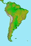
The Choiyoi Group has a large areal extent through western Argentina and parts of Chile, covering at least 200,000 square kilometres (77,000 sq mi), but probably around 500,000 square kilometres (190,000 sq mi). While the subsurface extent of the group is large, exposures in Argentina are most common in the Frontal Cordillera, the San Rafael Massif and the Principal Cordillera of southern Mendoza and northern Neuquén. [3] In parts the group reaches thicknesses of 2 to 4 km. [1]

Paleogeographic reconstruction of Pangea, 237 million years ago. The Choiyoi Group was deposited immediately east of the Proto-Andes. Pangaea physical map.jpg
Paleogeographic reconstruction of Pangea, 237 million years ago. The Choiyoi Group was deposited immediately east of the Proto-Andes.

The plutonic equivalent of the Choiyoi Group volcanic material are mostly granitoids. [1] The remnants of the magmatic arc that produced much of volcanic material is now preserved as a series of batholiths, including the Coastal Batholith of central Chile in the Chilean Coast Range. During the Permian, the zone of arc magmatism moved 350 kilometres (220 mi) inland from the Chilean Coast Range, reaching San Rafael about 280 million years ago. [2]

Many Triassic basins in southern South America, including Cuyo Basin, have their lowermost sections made up of Choiyoi Group formations. [4]
Stratigraphy

The Choiyoi Group can be stratigraphically subdivided into a Lower Choiyoi Group and an Upper Choiyoi Group. [2]

In the Lower Choiyoi Group basaltic lava flows, andesites and breccias are common. [1] Volcanic rocks and sediments in the Lower Choiyoi Group belong to the calc-alkaline magma series and have also other geochemical signatures indicative of an origin in subduction zone volcanism. [2] Volcanic rocks of the Lower Choiyoi in La Pampa and westernmost Buenos Aires Province have shoshonitic and syenitic features. [2] Part of the Lower Choiyoi Group were erupted in association with the San Rafael orogeny while some Choiyoi Group sediments were deformed by the same orogeny. [2]

Rhyolitic ignimbrites and lavas are more common in the Upper Choiyoi Group. [1]

The Choiyoi Group include the following formations:

Notes

  1. Pablo Groeber described the group as early as in 1918. Subsequently the Choiyoi Group became known by a variety of names. The current name dates to the 1968 work of Stipanicic and co-workers where the group was described in a locality in Somún Cura Massif, Río Negro Province. [1]

Related Research Articles

<span class="mw-page-title-main">Andean Volcanic Belt</span> Volcanic belt in South America

The Andean Volcanic Belt is a major volcanic belt along the Andean cordillera in Argentina, Bolivia, Chile, Colombia, Ecuador, and Peru. It is formed as a result of subduction of the Nazca Plate and Antarctic Plate underneath the South American Plate. The belt is subdivided into four main volcanic zones which are separated by volcanic gaps. The volcanoes of the belt are diverse in terms of activity style, products, and morphology. While some differences can be explained by which volcanic zone a volcano belongs to, there are significant differences within volcanic zones and even between neighboring volcanoes. Despite being a type location for calc-alkalic and subduction volcanism, the Andean Volcanic Belt has a broad range of volcano-tectonic settings, as it has rift systems and extensional zones, transpressional faults, subduction of mid-ocean ridges and seamount chains as well as a large range of crustal thicknesses and magma ascent paths and different amounts of crustal assimilations.

<span class="mw-page-title-main">Geology of Chile</span>

The geology of Chile is a characterized by processes linked to subduction, such as volcanism, earthquakes, and orogeny. The building blocks of Chile's geology were assembled during the Paleozoic Era when Chile was the southwestern margin of the supercontinent Gondwana. In the Jurassic, Gondwana began to split, and the ongoing period of crustal deformation and mountain building known as the Andean orogeny began. In the Late Cenozoic, Chile definitely separated from Antarctica, and the Andes experienced a significant rise accompanied by a cooling climate and the onset of glaciations.

The Precordillera Terrane or Cuyania was an ancient microcontinent or terrane whose history affected many of the older rocks of Cuyo in Argentina. It was separated by oceanic crust from the Chilenia terrane which accreted into it at ~420-390 Ma when Cuyania was already amalgamated with Gondwana. The hypothesized Mejillonia Terrane in the coast of northern Chile is considered by some geologists to be a single block with Cuyania.

<span class="mw-page-title-main">Neuquén Basin</span> Sedimentary basin covering most of Neuquén Province in Argentina

Neuquén Basin is a sedimentary basin covering most of Neuquén Province in Argentina. The basin originated in the Jurassic and developed through alternating continental and marine conditions well into the Tertiary. The basin bounds to the west with the Andean Volcanic Belt, to the southeast with the North Patagonian Massif and to the northeast with the San Rafael Block and to the east with the Sierra Pintada System. The basin covers an area of approximately 120,000 square kilometres (46,000 sq mi). One age of the SALMA classification, the Colloncuran, is defined in the basin, based on the Collón Curá Formation, named after the Collón Curá River, a tributary of the Limay River.

<span class="mw-page-title-main">Andean orogeny</span> Ongoing mountain-forming process in South America

The Andean orogeny is an ongoing process of orogeny that began in the Early Jurassic and is responsible for the rise of the Andes mountains. The orogeny is driven by a reactivation of a long-lived subduction system along the western margin of South America. On a continental scale the Cretaceous and Oligocene were periods of re-arrangements in the orogeny. The details of the orogeny vary depending on the segment and the geological period considered.

<span class="mw-page-title-main">Famatinian orogeny</span> Paleozoic geological event in South America

The Famatinian orogeny is an orogeny that predates the rise of the Andes and that took place in what is now western South America during the Paleozoic, leading to the formation of the Famatinian orogen also known as the Famatinian belt. The Famatinian orogeny lasted from the Late Cambrian to at least the Late Devonian and possibly the Early Carboniferous, with orogenic activity peaking about 490 to 460 million years ago. The orogeny involved metamorphism and deformation in the crust and the eruption and intrusion of magma along a Famatinian magmatic arc that formed a chain of volcanoes. The igneous rocks of the Famatinian magmatic arc are of calc-alkaline character and include gabbros, tonalites, granodiorites and trondhjemites. The youngest igneous rocks of the arc are granites.

Salta Basin or Salta Rift Basin is a sedimentary basin located in the Argentine Northwest. The basin started to accumulate sediments in the Early Cretaceous (Neocomian) and at present it has sedimentary deposits reaching thicknesses of 5,000 metres (16,000 ft). The basin contains seven sub-basins: Tres Cruces, Lomas de Olmedo, Metán, Alemanía, Salfity, El Rey, Sey and Brealito. The basin environment has variously been described as a "foreland rift" and an "intra-continental rift". The basin developed under conditions of extensional tectonics and rift-associated volcanism.

The San Rafael orogeny was an orogeny that affected parts of western Argentina and Chile during the Late Paleozoic. The resulting orogenic belt has a NW-NNW curved form. The San Rafael orogeny might have been linked with the roughly contemporary Gondwanide orogeny of eastern Argentina. Parts of the Choiyoi Group sediments were deformed by the San Rafael orogeny. During the Neogene ancient faults related to the San Rafael orogeny conditioned the geometry of the blocks affected by the Andean orogeny.

<span class="mw-page-title-main">Gondwanide orogeny</span> Permian mountain forming tectonic event

The Gondwanide orogeny was an orogeny active in the Permian that affected parts of Gondwana that are by current geography now located in southern South America, South Africa, Antarctica, Australia and New Guinea. The zone of deformation in Argentina extends as a belt south and west of the cratonic nucleus of Río de la Plata–Pampia. The deformation of the orogeny is visible in the Sierra de la Ventana mountains in Argentina and the Cape Fold Belt in South Africa. The Gondwanide orogeny might have been linked with the roughly contemporary San Rafael orogeny of western Argentina.

Cuyo Basin is a sedimentary basin in Mendoza Province, western Argentina. The Cuyo Basin has a NNW-SSE elongated shape and is limited to the west by the Sierra Pintada System and to the east by the Pampean pericraton. To the north the basin reaches the area around the city of Mendoza.

The Elqui-Limarí Batholith is a group of plutons in the Andes of Chile and Argentina between the latitudes of 28 and 30° S. The plutons of the batholith were emplaced and cooled in the Late Paleozoic and the earliest Mesozoic. Some of the plutons were emplaced in a context of crustal thickening related to the San Rafael orogeny.

<span class="mw-page-title-main">Coastal Batholith of central Chile</span> Igneous rock formation in central Chile

The Coastal Batholith of central Chile is a group of plutons in the Chilean Coast Range of Central Chile appearing contiguously from 33° S to 38° S. At a latitude of 40° S an outlying group of plutons of the batholith appear in a more eastward position in the Andes.

Tobífera Formation is a volcano-sedimentary formation of Middle to Late Jurassic age. The formation is crops out in the Magallanes Region in southern Patagonia and Tierra del Fuego of Chile, the Santa Cruz Province of southern Argentina, and in the subsurface of the Malvinas Basin offshore Argentina and the Falkland Islands.

The Colangüil Batholith is a group of plutons in western Argentina between the latitudes of 29 and 31° S. The plutons of the batholith were emplaced and cooled in the Late Paleozoic and the Triassic. Runs in a north-south direction. The plutons of the batholith are intruded into volcanic rocks produced by the same plutons plus some earlier deformed basement. The most common rocks in the batholith are granodiorite, granite and leucogranite. The batholith contains also a dyke swarm of north-south trending dykes. Compared to other subduction-related batholiths around the Pacific Ocean Colangüil Batholith is more felsic.

<span class="mw-page-title-main">Geological history of the Precordillera terrane</span>

The Precordillera terrane of western Argentina is a large mountain range located southeast of the main Andes mountain range. The evolution of the Precordillera is noted for its unique formation history compared to the region nearby. The Cambrian-Ordovian sedimentology in the Precordillera terrane has its source neither from old Andes nor nearby country rock, but shares similar characteristics with the Grenville orogeny of eastern North America. This indicates a rift-drift history of the Precordillera in the early Paleozoic. The Precordillera is a moving micro-continent which started from the southeast part of the ancient continent Laurentia. The separation of the Precordillera started around the early Cambrian. The mass collided with Gondwana around Late Ordovician period. Different models and thinking of rift-drift process and the time of occurrence have been proposed. This page focuses on the evidence of drifting found in the stratigraphical record of the Precordillera, as well as exhibiting models of how the Precordillera drifted to Gondwana.

<span class="mw-page-title-main">Tectonic evolution of Patagonia</span>

Patagonia comprises the southernmost region of South America, portions of which lie on either side of the Argentina-Chile border. It has traditionally been described as the region south of the Rio Colorado, although the physiographic border has more recently been moved southward to the Huincul fault. The region's geologic border to the north is composed of the Rio de la Plata craton and several accreted terranes comprising the La Pampa province. The underlying basement rocks of the Patagonian region can be subdivided into two large massifs: the North Patagonian Massif and the Deseado Massif. These massifs are surrounded by sedimentary basins formed in the Mesozoic that underwent subsequent deformation during the Andean orogeny. Patagonia is known for its vast earthquakes and the damage they cause.

The geology of Argentina includes ancient Precambrian basement rock affected by the Grenville orogeny, sediment filled basins from the Mesozoic and Cenozoic as well as newly uplifted areas in the Andes.

<span class="mw-page-title-main">Geology of Peru</span>

The geology of Peru includes ancient Proterozoic rocks, Paleozoic and Mesozoic volcanic and sedimentary rocks, and numerous basins and the Andes Mountains formed in the Cenozoic.

<span class="mw-page-title-main">Ischigualasto-Villa Unión Basin</span>

The Ischigualasto-Villa Unión Basin is a small sedimentary basin located in the Argentine Northwest, Argentina. It is located in the southwestern part of La Rioja Province and the northeastern part of San Juan Province. The basin borders the Sierras Pampeanas in the east, the western boundary of the basin is formed by the Valle Fértil Fault, bordering the Precordillera, and it is bound in the southeast by the El Alto Fault, separating the basin from the Marayes-El Carrizal Basin.

The Río Seco de la Quebrada Formation is a Triassic geological formation in Mendoza Province, Argentina. Fossils of cynodonts such as Cynognathus, Diademodon, and Pascualgnathus have been found in this formation, along with dicynodonts such as Vinceria and Acratophorus. Based on biostratigraphy, the Río Seco de la Quebrada Formation is considered to have formed during the Anisian stage, as it shares fauna with the upper subzones of the Cynognathus Assemblage Zone in South Africa. However, radiometric dating controversially argues that it was deposited during the early Carnian stage, 10 million years younger than expected otherwise.

References

  1. 1 2 3 4 5 6 Martinez, A.; Giambiagi, L. (2010). "Evolución petrológica y geoquímica del magmatismo bimodal Permo-Triásico del Grupo Choiyoi en el cordón del Portillo, Mendoza, Argentina". Trabajos de Geología (in Spanish). Universidad de Oviedo. 30: 432–451. Retrieved 5 January 2016.
  2. 1 2 3 4 5 6 Kleiman, Laura E.; Japas, María S. (2009). "The Choiyoi volcanic province at 34°S–36°S (San Rafael, Mendoza, Argentina): Implications for the Late Palaeozoic evolution of the southwestern margin of Gondwana". Tectonophysics . 473 (3–4): 283–299. Bibcode:2009Tectp.473..283K. doi:10.1016/j.tecto.2009.02.046. hdl: 11336/75328 . Retrieved 5 January 2016.
  3. Llambías, Eduardo J.; Quenardelle, Sonia; Montenegro, Teresita (2003). "The Choiyoi Group from central Argentina: a subalkaline transitional to alkaline association in the craton adjacent to the active margin of the Gondwana continent". Journal of South American Earth Sciences . Elsevier. 16 (4): 243–257. Bibcode:2003JSAES..16..243L. doi:10.1016/S0895-9811(03)00070-1. hdl: 11336/83501 .
  4. Spalletti, L.A.; Fanning, C.M.; Rapela, C.W. (2008). "Dating the Triassic continental rift in the southern Andes: the Potrerillos Formation, Cuyo Basin, Argentina". Geologica Acta . 6 (3): 267–283.
  5. 1 2 Vallecillo, Graciela; Caballero, María M.; Rocher, Sebastián; Espin, Eleonora (2010). "Analisis del grupo Choiyoi (permotriásico), cordillera frontal de Calingasta, provincia de San Juan". Revista de la Asociación Geológica Argentina (in Spanish). 66 (1–2). Retrieved 5 January 2016.
  6. 1 2 3 Rapalini, Augusto E.; Vilas, Juan F. (1991). "Tectonic rotations in the Late Paleozoic". Geophysical Journal International. 107 (2): 333–351. doi: 10.1111/j.1365-246X.1991.tb00829.x .
  7. Koukharsky, Magdalena; Ottone, Eduardo G. (2011). "Plantas Fósiles del Grupo Choiyoi, Cordillera Frontal a la Latitud del río Mendoza". Revista de la Asociación Geológica Argentina (in Spanish). 68 (2). Retrieved 11 January 2016.