Chugcreek, Wyoming

Last updated
Chugcreek
CDP
Platte County Wyoming incorporated and unincorporated areas Chugcreek highlighted.svg
Location in Platte County and the state of Wyoming.
Usa edcp location map.svg
Red pog.svg
Chugcreek
Location in the United States
Coordinates: 42°2′53″N104°55′0″W / 42.04806°N 104.91667°W / 42.04806; -104.91667 Coordinates: 42°2′53″N104°55′0″W / 42.04806°N 104.91667°W / 42.04806; -104.91667
Country United States
State Wyoming
County Platte
Area
  Total1.9 sq mi (5.0 km2)
  Land1.9 sq mi (5.0 km2)
  Water0.0 sq mi (0.0 km2)
Elevation
4,757 ft (1,450 m)
Population
 (2010) [1]
  Total156
  Density82/sq mi (31/km2)
Time zone UTC-7 (Mountain (MST))
  Summer (DST) UTC-6 (MDT)
Area code(s) 307
FIPS code 56-14097 [2]
GNIS feature ID1853200 [3]

Chugcreek is a census-designated place (CDP) in Platte County, Wyoming, United States. The population was 156 at the 2010 census.

Contents

Geography

Chugcreek is located at 42°2′53″N104°55′0″W / 42.04806°N 104.91667°W / 42.04806; -104.91667 (42.047964, -104.916785). [4]

According to the United States Census Bureau, the CDP has a total area of 1.9 square miles (5.0 km2), all land. [5]

Demographics

As of the census [2] of 2000, there were 132 people, 45 households, and 41 families residing in the CDP. The population density was 68.4 people per square mile (26.4/km2). There were 49 housing units at an average density of 25.4/sq mi (9.8/km2). The racial makeup of the CDP was 96.21% White, 3.79% from other races. Hispanic or Latino of any race were 0.76% of the population.

There were 45 households, out of which 42.2% had children under the age of 18 living with them, 80.0% were married couples living together, 8.9% had a female householder with no husband present, and 6.7% were non-families. 6.7% of all households were made up of individuals, and 4.4% had someone living alone who was 65 years of age or older. The average household size was 2.93 and the average family size was 3.00.

In the CDP, the population was spread out, with 31.1% under the age of 18, 5.3% from 18 to 24, 26.5% from 25 to 44, 27.3% from 45 to 64, and 9.8% who were 65 years of age or older. The median age was 41 years. For every 100 females, there were 106.3 males. For every 100 females age 18 and over, there were 102.2 males.

The median income for a household in the CDP was $56,447, and the median income for a family was $56,447. Males had a median income of $50,139 versus $22,500 for females. The per capita income for the CDP was $20,940. None of the population or the families were below the poverty line.

Education

Public education in the community of Chugcreek is provided by Platte County School District #1.

Related Research Articles

Platte County, Wyoming U.S. county in Wyoming

Platte County is a county in the U.S. state of Wyoming. As of the 2010 United States Census, the population was 8,667. Its county seat is Wheatland.

Ducor, California census-designated place in California, United States

Ducor is a census-designated place (CDP) in Tulare County, California, United States. The population was 612 at the 2010 census, up from 504 at the 2000 census.

Strasburg, Colorado Census-designated place in Colorado, United States

Strasburg is a census-designated place (CDP) in Adams and Arapahoe counties in the U.S. state of Colorado. The population was 2,447 at the 2010 census, up from 1,402 at the 2000 census. The Strasburg Post Office has the ZIP Code 80136.

Huntley, Wyoming CDP in Wyoming, United States

Huntley is a census-designated place (CDP) in Goshen County, Wyoming, United States. The population was 30 at the 2010 census.

Fox Farm-College, Wyoming Census-designated place in Wyoming, United States

Fox Farm-College is a census-designated place (CDP) in Laramie County, Wyoming, United States. It is part of the Cheyenne, Wyoming Metropolitan Statistical Area. The population was 3,647 at the 2010 census.

Ranchettes, Wyoming Census-designated place in Wyoming, United States

Ranchettes is a census-designated place (CDP) in Laramie County, Wyoming, United States. It is part of the Cheyenne, Wyoming Metropolitan Statistical Area. The population was 5,798 at the 2010 census.

South Greeley, Wyoming Census-designated place in Wyoming, United States

South Greeley is a census-designated place (CDP) in Laramie County, Wyoming, United States. It is part of the Cheyenne, Wyoming Metropolitan Statistical Area. The population was 4,217 at the 2010 census.

Bessemer Bend, Wyoming CDP in Wyoming, United States

Bessemer Bend is a census-designated place (CDP) in Natrona County, Wyoming, United States. It is part of the Casper, Wyoming Metropolitan Statistical Area. The population was 199 at the 2010 census.

Casper Mountain, Wyoming CDP in Wyoming, United States

Casper Mountain is a census-designated place (CDP) on Casper Mountain in Natrona County, Wyoming, United States. It is part of the Casper, Wyoming Metropolitan Statistical Area. The population was 401 at the 2010 census.

Homa Hills, Wyoming CDP in Wyoming, United States

Homa Hills is a census-designated place (CDP) in Natrona County, Wyoming, United States. It is part of the Casper, Wyoming Metropolitan Statistical Area. The population was 278 at the 2010 census.

Vista West, Wyoming CDP in Wyoming, United States

Vista West is a census-designated place (CDP) in Natrona County, Wyoming, United States. It is part of the Casper, Wyoming Metropolitan Statistical Area. The population was 951 at the 2010 census.

Lance Creek, Wyoming CDP in Wyoming, United States

Lance Creek is a census-designated place (CDP) in Niobrara County, Wyoming, United States. The population was 43 at the 2010 census. Lance Creek is the namesake of the Lance Formation, a rock formation from the Late Cretaceous that has yielded fossils from a diverse number of species.

Guernsey, Wyoming Town in Wyoming, United States

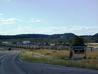
Guernsey is a town in Platte County, Wyoming, United States. The population was 1,147 at the 2010 census.

Hartville, Wyoming Town in Wyoming, United States

Hartville is a town in Platte County, Wyoming, United States. The population was 62 at the 2010 census.

Lakeview North, Wyoming CDP in Wyoming, United States

Lakeview North is a census-designated place (CDP) in Platte County, Wyoming, United States. The population was 84 at the 2010 census.

Slater, Wyoming CDP in Wyoming, United States

Slater is a census-designated place (CDP) in Platte County, Wyoming, United States. The population was 80 at the 2010 census.

Westview Circle, Wyoming CDP in Wyoming, United States

Westview Circle is a census-designated place (CDP) in Platte County, Wyoming, United States. The population was 52 at the 2010 census.

Wheatland, Wyoming Town in Wyoming, United States

Wheatland is a town in and the county seat of Platte County in southeastern Wyoming, United States. The population was 3,627 at the 2010 census.

Y-O Ranch, Wyoming CDP in Wyoming, United States

Y-O Ranch is a census-designated place (CDP) in Platte County, Wyoming, United States. The population was 195 at the 2010 census.

Osage, Wyoming CDP in Wyoming, United States

Osage is a census-designated place (CDP) in Weston County, Wyoming, United States. The population was 208 at the 2010 census.

References

  1. "2010 City Population and Housing Occupancy Status". U.S. Census Bureau. Retrieved July 13, 2012.[ dead link ]
  2. 1 2 "U.S. Census website". United States Census Bureau . Retrieved 2008-01-31.
  3. "US Board on Geographic Names". United States Geological Survey. 2007-10-25. Retrieved 2008-01-31.
  4. "US Gazetteer files: 2010, 2000, and 1990". United States Census Bureau. 2011-02-12. Retrieved 2011-04-23.
  5. "2010 Wyoming Place Names". U.S. Census Bureau. Archived from the original on July 4, 2012. Retrieved July 13, 2012.