
Crop rotation is the practice of growing a series of different types of crops in the same area across a sequence of growing seasons. This practice reduces the reliance of crops on one set of nutrients, pest and weed pressure, along with the probability of developing resistant pests and weeds.

A grassland is an area where the vegetation is dominated by grasses (Poaceae). However, sedge (Cyperaceae) and rush (Juncaceae) can also be found along with variable proportions of legumes, like clover, and other herbs. Grasslands occur naturally on all continents except Antarctica and are found in most ecoregions of the Earth. Furthermore, grasslands are one of the largest biomes on earth and dominate the landscape worldwide. There are different types of grasslands: natural grasslands, semi-natural grasslands, and agricultural grasslands. They cover 31–69% of the Earth's land area.
Conservation agriculture (CA) can be defined by a statement given by the Food and Agriculture Organization of the United Nations as "Conservation Agriculture (CA) is a farming system that can prevent losses of arable land while regenerating degraded lands.It promotes minimum soil disturbance, maintenance of a permanent soil cover, and diversification of plant species. It enhances biodiversity and natural biological processes above and below the ground surface, which contribute to increased water and nutrient use efficiency and to improved and sustained crop production."

In agriculture, rotational grazing, as opposed to continuous grazing, describes many systems of pasturing, whereby livestock are moved to portions of the pasture, called paddocks, while the other portions rest. Each paddock must provide all the needs of the livestock, such as food, water and sometimes shade and shelter. The approach often produces lower outputs than more intensive animal farming operations, but requires lower inputs, and therefore sometimes produces higher net farm income per animal.

A hedge or hedgerow is a line of closely spaced shrubs and sometimes trees, planted and trained to form a barrier or to mark the boundary of an area, such as between neighbouring properties. Hedges that are used to separate a road from adjoining fields or one field from another, and are of sufficient age to incorporate larger trees, are known as hedgerows. Often they serve as windbreaks to improve conditions for the adjacent crops, as in bocage country. When clipped and maintained, hedges are also a simple form of topiary.
Environmental Stewardship is an agri-environment scheme run by the Department for Environment, Food and Rural Affairs in England which aims to secure widespread environmental benefits. It was formally launched on 18 March 2005, although the first agreements did not start until 1 August 2005.

The Cotswold Water Park is the United Kingdom's largest marl lake system, straddling the Wiltshire–Gloucestershire border, north-west of Cricklade and south of Cirencester. There are 180 lakes, spread over 42 square miles (110 km2).

Bishop Middleham Quarry is a disused quarry, about 4 kilometres (2.5 mi) north-west of Sedgefield, County Durham, England. Quarry-working here ceased in 1934, and the site has since been colonised by vegetation. The underlying rock is Magnesian Limestone and this has had a strong influence in determining the range of plant and animal communities now found there.

Wells National Estuarine Research Reserve, also known as Wells Reserve, is a National Estuarine Research Reserve located in Wells, Maine. Established in 1984, Wells Reserve manages 2,250 acres (9.1 km2) of coastal habitat, and is headquartered at the historic Laudholm Farm. The land managed by the reserve lies partially within the Rachel Carson National Wildlife Refuge. Funding for the reserve is provided in part by the National Oceanic and Atmospheric Administration, as well as by the nonprofit Laudholm Trust.

In the United Kingdom, the term hunting with no qualification generally refers to hunting with hounds, e.g. normally fox hunting, stag (deer) hunting, beagling, or minkhunting, whereas shooting is the shooting of game birds. What is called deer hunting elsewhere is deer stalking. According to the British Association for Shooting and Conservation (BASC) over a million people a year participate in shooting, including stalking, shooting, hunting, clay shooting and target shooting. Firearm ownership is regulated in the UK by licensing. Provisions exist for those without a Firearm or Shotgun certificate to shoot under the supervision of a certificate holder.

The Westcountry Rivers Trust is a waterway society and a registered charity No. 1135007 in the West Country of England, United Kingdom. The Trust was founded in 1995 and aims to protect and enhance the West Country's rivers and streams, and to work with the region's landowners, farmers and the wider community, mainly through education projects.

Frays Farm Meadows is a 28.2-hectare (70-acre) biological Site of Special Scientific Interest near Denham in the London Borough of Hillingdon. It was notified as an SSSI in 1981, and has been managed by the London Wildlife Trust on behalf of Hillingdon Council since 1999. It is part of the Colne Valley Regional Park.

The Tamar–Tavy Estuary is a Site of Special Scientific Interest (SSSI) covering the tidal estuaries of the River Tamar and the River Tavy on the border between Cornwall and Devon in England, UK. Part of the Tamar estuary also forms the Tamar Estuary Nature Reserve, owned by the Cornwall Wildlife Trust. The site was designated in 1991 for its biodiversity and varying habitats that support many wader and wildfowl species, as well as the special interest of its marine biology.
Ventongimps Moor is a moorland nature reserve and Site of Special Scientific Interest (SSSI), noted for its biological characteristics, in mid Cornwall, England, United Kingdom. The site, important for the occurrence of the plant Dorset heath, was the first reserve to be purchased by the Cornwall Wildlife Trust.

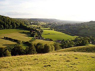
Wotton Hill is a hill on the edge of the Cotswold Hills in Gloucestershire, England, 0.5 miles (0.80 km) north of Wotton-under-Edge. The Cotswold Way passes over the hill.
Swift's Hill is a 9.15-hectare (22.6-acre) biological and geological Site of Special Scientific Interest in Gloucestershire, notified in 1966 and renotified in 1984.

Wigpool is a 7.5-hectare (19-acre) nature reserve in Gloucestershire in the Forest of Dean, England.

Cutsdean Quarry is a 0.83-hectare (2.1-acre) nature reserve in Gloucestershire. The site is listed in the 'Cotswold District' Local Plan 2001-2011 as a Key Wildlife Site (KWS).

King Barrow Quarry is a disused site of former 19th century stone quarries on the Isle of Portland, Dorset, England. It is located in the north-east corner of Tophill. The quarry, now a Dorset Wildlife Trust nature reserve, covers 12.2 hectares. Both King Barrow and the nearby Tout Quarry make up the Dorset Wildlife Trust's Portland Quarries Nature Park. Portland also has two butterfly reserves: Broadcroft Quarry and Perryfield Quarry.
Dunsdon National Nature Reserve is a nature reserve of the Devon Wildlife Trust, near Dunsdon and about 3.5 miles (5.6 km) north-west of Holsworthy, in Devon, England. The habitat is culm grassland.

