Clovis, California

Last updated

Clovis, California
Pollasky Ave. Clovis.JPG
Pollasky Avenue, Old Town Clovis
City of Clovis Flag.jpg
City of Clovis California Seal.jpg
Motto: 
"Gateway to the Sierras" [1]
Fresno County California Incorporated and Unincorporated areas Clovis Highlighted 0614218.svg
Location of Clovis in Fresno County, California
Relief map of California.png
Red pog.svg
Clovis
Location in California
Usa edcp relief location map.png
Red pog.svg
Clovis
Location in the United States
Coordinates: 36°49′31″N119°42′11″W / 36.82528°N 119.70306°W / 36.82528; -119.70306
Country Flag of the United States (23px).png  United States
State Flag of California.svg  California
County Fresno
Incorporated February 27, 1912 [2]
Named for Clovis M. Cole
Clovis Station
Government
  Type Council–manager [3]
   Mayor Lynne Ashbeck [3]
  Mayor Pro Tem Vong Mouanoutoua [3]
   State senator Shannon Grove (R) [4]
   Assemblymember Jim Patterson (R) [5]
   U. S. rep. Vacant [6]
Area
[7]
  Total25.91 sq mi (67.10 km2)
  Land25.79 sq mi (66.79 km2)
  Water0.12 sq mi (0.31 km2)  0%
Elevation
[8]
361 ft (110 m)
Population
 (2020)
  Total120,124
  Rank 52nd in California
237th in the United States
  Density4,657.95/sq mi (1,798.44/km2)
Demonym Clovisian
Time zone UTC−8 (Pacific)
  Summer (DST) UTC−7 (PDT)
ZIP codes
9361193613, 93619
Area code 559
FIPS code 06-14218
GNIS feature IDs 1656303, 2409488
Website cityofclovis.com

Clovis is a city in Fresno County, California, United States. Clovis was established in 1890 as a freight stop for the San Joaquin Valley Railroad by a group of Fresno businessmen and Michigan railroad speculator Marcus Pollasky. The railroad bought the land from two farmers and named the station after one of them, Clovis Cole. Pollasky then developed a town on the site, also named Clovis.

Contents

The completion of the lumber flume in 1894 led to the growth of the area around Clovis Station where a lumberyard and sawmill were built. Clovis was officially incorporated as a city in 1912. Today, Clovis celebrates its heritage as an American frontier town, known for its rodeo, Old Town Clovis historic district, and its motto "Clovis – A Way of Life."

The 2020 population was 120,124. [9] Clovis is located 6.5 miles (10.5 km) northeast of downtown Fresno, [10] at an elevation of 361 feet (110 m). [8]

History

Clovis in 1932 California - Catalina Island through Clovis - NARA - 23934181 (cropped).jpg
Clovis in 1932

The city of Clovis began as a freight stop along the San Joaquin Valley Railroad. Organized on January 15, 1890, by Fresno businessmen Thomas E. Hughes, Fulton Berry, Gilbert R. Osmun, H.D. Colson, John D. Gray, and William M. Williams, in partnership with Michigan railroad speculator Marcus Pollasky, the SJVRR began construction in Fresno on July 4, 1891, and reached the farmlands of Clovis M. Cole and George Owen by October of that year. The railroad purchased right-of-way from both farmers, half from each – the east side from Cole and the west side from Owen – and ran tracks up the borderline between the two properties. The railroad agreed to establish a station on the west side of the tracks and to call it "Clovis." The Clovis station, which was named after Clovis Cole, was positioned on the Owen side of the track.

Cole and Owen later sold land to Marcus Pollasky for the development of a townsite. Fresno civil engineer Ingvart Tielman mapped the townsite on behalf of Pollasky on December 29, 1891. The original townsite featured streets named for the officers and principal investors of the railroad: (Benjamin) Woodworth, (Marcus) Pollasky, Fulton (Berry), (Thomas) Hughes, (Gerald) Osmun, and (O. D.) Baron. The townsite, named "Clovis" after Clovis Station by Pollasky, was laid out on what was originally Owen's land.

The railroad was completed as far as the town of Hamptonville (now Friant) on the banks of the San Joaquin River, just 26 miles (42 km) from its point of origin in Fresno. Articles of Incorporation for the San Joaquin Valley Railroad indicate that the corporation intended to build 100 miles (160 km) of track, including sidings and spurs, through the agricultural acreage east of Fresno, then north to the timber and mineral resources of the Sierra foothills. At the time, Hamptonville was called "Pollasky". A celebration of the completion of track-laying was held at the Pollasky terminus on the Wednesday before Thanksgiving of 1891 with a reported 3,000 Fresnans attending. The railroad began official operation in January 1892.

The first year of operation of the railroad coincided with the beginnings of a deep national economic decline. Farmers were unable to get a profitable return on their crops, banks and railroads failed nationwide. The SJVRR was unable to generate sufficient revenues to pay its debt, was leased to the Southern Pacific Railroad and subsequently bought by SPRR in 1893. By reducing the railroad's schedule of operation and trimming costs, the Southern Pacific was able to turn a small profit in the first years after its acquisition.

At the same time that the railroad was being planned, a group of Michigan lumbermen began acquiring thousands of acres of timber in the Sierra Nevada about 75 miles (121 km) northeast of Fresno and founded the Fresno Flume and Irrigation Company in 1891. A dam was built across Stevenson Creek to create a lake that would enable them to move freshly cut timber to a mill beside the lake. They then constructed a 42-mile (68 km), 25-foot-high (7.6 m), V-shaped flume that started at the foot of the dam. As lumber was rough-cut at the mill, it was loaded into the flume and propelled by water to a planing mill east of the Clovis railroad station, where the Clovis Rodeo and Clark Intermediate School sit today. [11] The lumber mill and yard had its own network of rails to move lumber around the yard and to connect with the SJVRR just south of Clovis station.

The completion in 1894 of the lumber flume and commencement of mill operations provided the impetus for further development of the area around the Clovis Station. The town began to take shape as lumber yard employees built homes close to their employment. Service businesses, churches, and schools became necessary, and the town was begun. Clovis's first post office opened in 1895. [10] An 1896 newspaper article describes the town as having a population approaching 500 citizens.

Clovis was incorporated as a city in February 1912. Principal streets in the town center were named for the railroad's officers. Fulton Street was later named Front Street, then Main Street, and is now Clovis Avenue.

The lumber mill burned in 1914 and was not rebuilt. The grounds are now occupied by Clark Intermediate School and the Clovis Rodeo Grounds. Clovis has a long history as a western town known for its slogan, "Clovis – A Way of Life". Since 1914, the Clovis Rodeo has been held on the last weekend in April, with a parade on Saturday morning, followed by the rodeo that afternoon and all day Sunday. Also contributing to the "Clovis way of life" are a number of street festivals, including Big Hat Days, ClovisFest, and the weekly Friday Night Farmer's Market held between mid-May and mid-September every year.

The last surviving structure built by the railroad is a depot now located near the site of the original Clovis Station. The earliest photos, from about 1910, show the depot situated in front of the Tarpey winery south of the intersection of Ashlan and Clovis Avenues. In 1999 it was moved to its present location in the town's center, at the northeast corner of Clovis Avenue and Fourth Street, and was restored by the Clovis Big Dry Creek Historical Society with financing, labor, and materials donated by local businesses and contractors.

Marcus Pollasky was a lawyer, born in Michigan, living in Chicago just before he came to Fresno. Throughout his life he tried to create several projects similar to the SJVRR, including projects in Eureka, California, Virginia, Michigan, and Oklahoma. Few were ever actually built. In 1896, Pollasky sued Collis P. Huntington in Los Angeles courts over the money he lost in Fresno, "while engaged in a joint venture with the defendant, Huntington". [12] It has long been speculated that Pollasky was an agent of the Southern Pacific, and this "joint venture" suit seems to prove that point. [13]

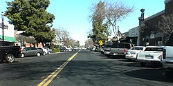
Many buildings in the town core have been renovated. Older storefronts on Clovis Avenue, the main street running through town, have been restored and new buildings have been designed with facades that resemble those found in the early 20th century. The historic center has been reborn as "Old Town Clovis".

Geography

Clovis, California
Climate chart (explanation)
J
F
M
A
M
J
J
A
S
O
N
D
 
 
2.2
 
 
54
32
 
 
2.1
 
 
61
41
 
 
2.2
 
 
66
45
 
 
0.8
 
 
74
48
 
 
0.4
 
 
83
55
 
 
0.2
 
 
91
61
 
 
0
 
 
97
66
 
 
0
 
 
95
65
 
 
0.3
 
 
89
60
 
 
0.7
 
 
78
52
 
 
1.1
 
 
63
42
 
 
1.3
 
 
53
29
Average max. and min. temperatures in °F
Precipitation totals in inches
Source: Weather.com / NWS
Metric conversion
J
F
M
A
M
J
J
A
S
O
N
D
 
 
55
 
 
12
0
 
 
54
 
 
16
5
 
 
56
 
 
19
7
 
 
19
 
 
23
9
 
 
9.9
 
 
28
13
 
 
5.8
 
 
33
16
 
 
0.3
 
 
36
19
 
 
0.3
 
 
35
18
 
 
6.6
 
 
32
16
 
 
17
 
 
26
11
 
 
28
 
 
17
6
 
 
34
 
 
12
−2
Average max. and min. temperatures in °C
Precipitation totals in mm

According to the United States Census Bureau, the city has a total area of 23.28 square miles (60.29 km2), all of it land.

Clovis is situated midway between Los Angeles and San Francisco, bordering Fresno, in the agriculturally rich San Joaquin Valley. Lying at the foot of the Sierra Nevada Mountain Range, which includes Yosemite, Kings Canyon, and Sequoia National Parks, Clovis has been known as "Gateway to the Sierras" since its incorporation in 1912.

The formation of alluvial fans in this part of the San Joaquin Valley has led to a rather flat regional geography. The Clovis area has active and potentially active seismic fault zones. [14] The elevation of Clovis is approximately 355 feet (108 m) above mean sea datum [15] According to the Flood Hazard Boundary Map produced by the U.S. Department of Housing and Urban Development, part of Clovis is within the 100-year flood zone, such as some of the area near the Clovis Towne Center. The groundwater flow in Clovis is generally to the southwest.

Demographics

Historical population
CensusPop.Note
1920 1,157
1930 1,31613.7%
1940 1,62623.6%
1950 2,76670.1%
1960 5,546100.5%
1970 13,856149.8%
1980 33,021138.3%
1990 50,32352.4%
2000 68,46836.1%
2010 95,63139.7%
2020 120,12425.6%
U.S. Decennial Census [9]

2010

At the 2010 census Clovis had a population of 95,631. The population density was 4,108.2 inhabitants per square mile (1,586.2/km2). The racial makeup of Clovis was 67,758 (70.9%) White, 2,618 (2.7%) African American, 1,320 (1.4%) Native American, 10,233 (10.7%) Asian, 218 (0.2%) Pacific Islander, 8,857 (9.3%) from other races, and 4,627 (4.8%) from two or more races. Hispanic or Latino of any race were 24,514 persons (25.6%). [16]

The census reported that 95,243 people (99.6% of the population) lived in households, 130 (0.1%) lived in non-institutionalized group quarters, and 258 (0.3%) were institutionalized.

There were 33,419 households, 13,718 (41.0%) had children under the age of 18 living in them, 17,975 (53.8%) were opposite-sex married couples living together, 4,554 (13.6%) had a female householder with no husband present, 1,889 (5.7%) had a male householder with no wife present. There were 1,985 (5.9%) unmarried opposite-sex partnerships, and 198 (0.6%) same-sex married couples or partnerships. 7,008 households (21.0%) were one person and 2,721 (8.1%) had someone living alone who was 65 or older. The average household size was 2.85. There were 24,418 families (73.1% of households); the average family size was 3.32.

The age distribution was 26,851 people (28.1%) under the age of 18, 9,572 people (10.0%) aged 18 to 24, 25,542 people (26.7%) aged 25 to 44, 23,559 people (24.6%) aged 45 to 64, and 10,107 people (10.6%) who were 65 or older. The median age was 34.1 years. For every 100 females, there were 93.2 males. For every 100 females age 18 and over, there were 89.5 males.

There were 35,306 housing units at an average density of 1,516.7 per square mile (585.6/km2),of which 33,419 were occupied, 20,804 (62.3%) by the owners and 12,615 (37.7%) by renters. The homeowner vacancy rate was 2.3%; the rental vacancy rate was 6.4%. 60,767 people (63.5% of the population) lived in owner-occupied housing units and 34,476 people (36.1%) lived in rental housing units.

2000

At the 2000 census there were 68,468 people in 24,347 households, including 17,675 families, in the city. The population density was 4,000.2 inhabitants per square mile (1,544.5/km2). There were 25,250 housing units at an average density of 1,475.2 per square mile (569.6/km2). The racial makeup of the city was 75.8% White, 1.9% Black or African American, 1.5% Native American, 6.5% Asian, 0.2% Pacific Islander, 9.5% from other races, and 4.6% from two or more races. 20.3% of the population were Hispanic or Latino of any race. [17] Of the 24,347 households 41.7% had children under the age of 18 living with them, 54.4% were married couples living together, 13.2% had a female householder with no husband present, and 27.4% were non-families. 22.3% of households were one person and 8.1% were one person aged 65 or older. The average household size was 2.79 and the average family size was 3.29.

The age distribution was 30.7% under the age of 18, 9.2% from 18 to 24, 30.4% from 25 to 44, 20.4% from 45 to 64, and 9.4% 65 or older. The median age was 33 years. For every 100 females, there were 92.3 males. For every 100 females age 18 and over, there were 88.2 males.

The median income for a household in the city was $42,283, and the median family income was $50,859. Males had a median income of $39,630 versus $28,072 for females. The per capita income for the city was $18,690. About 7.6% of families and 10.6% of the population were below the poverty line, including 13.1% of those under age 18 and 7.1% of those age 65 or over.

Economy

Top employers

According to the city's 2020 Comprehensive Annual Financial Report, [18] the top employers in the city are:

#Employer# of Employees
1 Clovis Unified School District 5,263
2Clovis Community Hospital1,994
3Alorica720
4City of Clovis671
5 Walmart 620
6Wawona Frozen Foods540
7Anlin Industries400
8 Costco 354
9 Target 325
10 Save Mart 234

Cityscape

The Sierra Vista Mall is a 78-acre (32 ha) enclosed regional shopping center anchored by Target, Kohl's, Sierra Vista Cinemas 16, and MB2 Indoor Raceway. [19] [20] [21]

Public transportation within the city is provided by Clovis Transit; some areas also are served by Fresno Area Express, providing connections to Fresno.

Education

Clovis Unified School District

Colleges

Public libraries

Fresno County Public Library operates the Clovis Regional Library. [22]

Notable people

See also

Related Research Articles

<span class="mw-page-title-main">Fresno County, California</span> County in California, United States

Fresno County, officially the County of Fresno, is a county located in the central portion of the U.S. state of California. As of the 2020 Census, the population was 1,008,654. The county seat is Fresno, the fifth-most populous city in California.

<span class="mw-page-title-main">Madera County, California</span> County in California, United States

Madera County, officially the County of Madera, is located at the geographic center of the U.S. state of California. It features a varied landscape, encompassing the eastern San Joaquin Valley and the central Sierra Nevada, with Madera serving as the county seat. Established in 1893 from part of Fresno County, Madera County reported a population of 156,255 in the 2020 census.

<span class="mw-page-title-main">San Joaquin County, California</span> County in California, United States

San Joaquin County, officially the County of San Joaquin, is a county located in the U.S. state of California. As of the 2020 census, the population was 779,233. The county seat is Stockton.

<span class="mw-page-title-main">Fresno, California</span> City in California, United States

Fresno is a major city in the San Joaquin Valley of California, United States. It is the county seat of Fresno County and the largest city in the greater Central Valley region. It covers about 115 square miles (300 km2) and had a population of 542,107 as of the 2020 Census, making it the fifth-most populous city, in California, the most populous inland city in California, and the 34th-most populous city in the nation.

<span class="mw-page-title-main">Sierra Vista, Arizona</span> City in Arizona, United States

Sierra Vista is a city in Cochise County, Arizona, United States. According to the 2020 Census, the population of the city is 45,308, and is the 27th most populous city in Arizona. The city is part of the Sierra Vista-Douglas Metropolitan Area, with a 2010 population of 131,346. Fort Huachuca, a U.S. Army post, has been incorporated and is located in the northwest part of the city. Sierra Vista is bordered by the cities of Huachuca City and Whetstone to the north and Sierra Vista Southeast to the South.

<span class="mw-page-title-main">Moraga, California</span> City in California, United States

Moraga is a town in Contra Costa County, California, in the San Francisco Bay Area. The town is named in honor of Joaquín Moraga, member of the famed Californio family. As of 2020, Moraga had a total population of 16,870 people. Moraga is the home of Saint Mary's College of California.

<span class="mw-page-title-main">Friant, California</span> Census-designated place in California, United States

Friant is a census-designated place (CDP) in Fresno County, California, United States. The population was 549 at the 2010 census, down from 778 at the 2000 census. Friant is located 11.5 miles (19 km) north of Clovis, at an elevation of 344 feet.

<span class="mw-page-title-main">Reedley, California</span> City in the Central Valley of California

Reedley is a city in Fresno County, California, United States. It is located in the San Joaquin Valley, 22 miles (35 km) east-southeast of Fresno, at an elevation of 348 feet (106 m). The population at the 2010 census was 24,194. Its chief economic source is agriculture, particularly fruit and vegetable cultivation and has thus dubbed itself "The World's Fruit Basket". Reedley is situated along the Kings River, downstream from Centerville.

<span class="mw-page-title-main">Sanger, California</span> City in California, United States

Sanger is a city in Fresno County, California, United States. The population was 26,617 at the 2020 census, up from 24,270 at the 2010 census and 18,731 at the 2000 census. Sanger is located 13 miles (21 km) east-southeast of Fresno, at an elevation of 371 feet.

<span class="mw-page-title-main">Selma, California</span> City in California, United States

Selma is a city in Fresno County, California. The population was 23,319 at the 2010 census, up from 19,240 at the 2000 census. Selma is located 16 miles (26 km) southeast of Fresno, at an elevation of 308 feet.

<span class="mw-page-title-main">Hanford, California</span> City in California, United States

Hanford is the most populous city and the county seat of Kings County, California, located in the San Joaquin Valley region of the greater Central Valley. The population was 53,967 at the 2010 census.

<span class="mw-page-title-main">Madera, California</span> City in Madera County, California, United States

Madera is a city and county seat of Madera County, located in the San Joaquin Valley of California. As of the 2020 United States census, the city's population was 66,224.

<span class="mw-page-title-main">Oakhurst, California</span> Census-designated place in California, United States

Oakhurst is a census-designated place (CDP) in Madera County, California, United States, 14 miles (23 km) south of the entrance to Yosemite National Park, in the foothills of the Sierra Nevada. At an elevation of 2,274 ft (693 m), Oakhurst is situated at the junction of Highway 41 and Highway 49, marking the southern end of California's Gold Country. It is part of the Madera metropolitan statistical area.

<span class="mw-page-title-main">Escalon, California</span> City in California, United States

Escalon is a city in San Joaquin County, California, United States. The population was 7,472 at the 2020 census, up from 7,132 at the 2010 census and 5,963 at the 2000 census. Escalon is a Spanish word meaning "stepping stones." The name comes from founder John Wheeler Jones who came upon the name in a book in the Stockton Free Library and liked the name so much he gave it to the town.

<span class="mw-page-title-main">Log flume</span> Type of flume used to float logs to a sawmill

A log flume is a watertight flume constructed to transport lumber and logs down mountainous terrain using flowing water. Flumes replaced horse- or oxen-drawn carriages on dangerous mountain trails in the late 19th century. Logging operations preferred flumes whenever a reliable source of water was available. Flumes were cheaper to build and operate than logging railroads. They could span long distances across chasms with more lightweight trestles.

North Fork is an unincorporated community in Madera County, California, United States. As of the 2020 United States census it had a population of 3,250. For statistical purposes, the United States Census Bureau has defined North Fork as a census-designated place (CDP). North Fork is part of the Madera Metropolitan Statistical Area and is home to the tribal headquarters of the Northfork Rancheria of Mono Indians of California.

<span class="mw-page-title-main">Bella Vista, California</span> Census-designated place in California, United States

Bella Vista is a census-designated place (CDP) in Shasta County, California. Bella Vista is a small, rural community about 9 miles (14 km) northeast of Redding, and about 5 miles (8.0 km) north of Palo Cedro. Its population is 3,641 as of the 2020 census, up from 2,781 from the 2010 census. Historically, Bella Vista was a semi-large lumber town which hosted its own railroad.

<span class="mw-page-title-main">Madera Sugar Pine Company</span> Defunct logging company in Madera County, California, US

The Madera Sugar Pine Company was a United States lumber company that operated in the Sierra Nevada region of California during the late 19th and early 20th centuries. The company distinguished itself through the use of innovative technologies, including the southern Sierra's first log flume and logging railroad, along with the early adoption of the Steam Donkey engine. Its significant regional impact led to the establishment of towns such as Madera, Fish Camp, and Sugar Pine, as well as the growth of Fresno Flats and the formation of Madera County.

<span class="mw-page-title-main">Millwood, California</span> Former logging boomtown in Fresno County, California, US

Millwood was a lumber boomtown located in present-day Sequoia National Forest near Converse Basin Grove in California. It was established in 1891 by the Kings River Lumber Company and was connected to the Sequoia Railroad, which brought logs to the town to be turned into rough lumber. The lumber was then transported by log flume to Sanger, a journey of 54 miles. At its peak, Millwood had a population of over 2,000 people and featured two hotels, a summer school, and a post office. However, today there are no remaining structures or buildings at the Millwood site.

The Fresno Flume and Irrigation Company was established in 1891 as a logging and water transportation company in California. A 45-mile cedar flume was built to transport lumber from Shaver Lake to the finishing mill in Clovis. The company changed its name to the Fresno Flume and Lumber Company in 1908, and over the course of its 21-year lifespan, cut an average of 25 million board feet of lumber each year. However, in 1912, the company was sold and ceased all operations after a storm destroyed 2 miles (3.2 km) of the flume. In 1919, Southern California Edison Company bought most of the Shaver property for the Big Creek Hydroelectric Project.

References

  1. "City of Clovis, California". City of Clovis, California. Archived from the original on August 4, 2012. Retrieved August 11, 2012.
  2. "California Cities by Incorporation Date". California Association of Local Agency Formation Commissions. Archived from the original (Word) on November 3, 2014. Retrieved April 5, 2013.
  3. 1 2 3 "Clovis City Council". Clovis California. Retrieved April 18, 2015.
  4. "Senators". State of California. Retrieved April 5, 2013.
  5. "Members Assembly". State of California. Retrieved April 5, 2013.
  6. "California's 22nd Congressional District - Representatives & District Map". Civic Impulse, LLC. Retrieved April 5, 2013.
  7. "2020 U.S. Gazetteer Files". United States Census Bureau. Retrieved October 30, 2021.
  8. 1 2 "Clovis". Geographic Names Information System . United States Geological Survey, United States Department of the Interior.
  9. 1 2 "Census of Population and Housing". Census.gov. Retrieved June 4, 2015.
  10. 1 2 Durham, David L. (1998). California's Geographic Names: A Gazetteer of Historic and Modern Names of the State. Clovis, Calif.: Word Dancer Press. p. 1018. ISBN   1-884995-14-4.
  11. Bos, Peg (July 10, 2018). "Let's Talk Clovis: Heroic pioneers and their amazing flume". clovisroundup.com. Archived from the original on March 12, 2021. Retrieved March 12, 2021. The flume dropped 4,900 feet (27 ½ feet per mile) as it descended 42 miles to the property now occupied by the Clovis Rodeo Association and the C. Todd Clark Intermediate School.
  12. Los Angeles Herald article, March 28, 1896
  13. San Francisco Call article, December 24, 1896
  14. Phase I Environmental Site Assessment, Clovis Towne Center, Clovis, California, Earth Metrics Inc report 10283, October 1989
  15. U.S. Geological Survey, Clovis, California, 7.5 Minute Quadrangle, 1964, (photorevised 1972).
  16. "2010 Census Interactive Population Search: CA - Clovis city". U.S. Census Bureau. Archived from the original on July 15, 2014. Retrieved July 12, 2014.
  17. "U.S. Census website". United States Census Bureau . Retrieved January 31, 2008.
  18. "Comprehensive Annual Financial Report for the fiscal year ended June 30, 2020" (PDF). City of Clovis. November 10, 2020. Archived (PDF) from the original on March 12, 2021. Retrieved March 12, 2021.
  19. "Sierra Vista Mall Clovis California. About us". Archived from the original on July 14, 2014. Retrieved July 13, 2014. Sierra Vista Mall is a 78-acre regional shopping center...
  20. Marybeth Nibley (November 25, 1989). "Customers cram into stores, malls". The Free Lance-Star . Fredericksburg, VA. Associated Press. Retrieved July 13, 2014. Thousands stopped by the 59-store Sierra Vista Mall in Clovis, Calif.,
  21. Chuck Harvey (March 13, 2014). "Go-karts near green flag at Sierra Vista Mall". The Business Journal. Archived from the original on May 22, 2014. Retrieved July 13, 2014. The Clovis City Council last year approved the...construction of the racecourse... ...general manager of the Sierra Vista Mall...said the go-kart facility will attract people from as far away as Bakersfield...
  22. "Clovis Regional Library". Fresno County Public Library. Retrieved June 27, 2010.
  23. "Chris Colfer's Gaga Gaffe". The Advocate . Archived from the original on May 5, 2010. Retrieved October 25, 2011.