Consul, Saskatchewan

Last updated

Consul
Village of Consul
Consul Saskatchewan Wheat Pool.JPG
The Former Saskatchewan Wheat Pool elevators in Consul
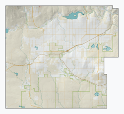
CAN SK Reno map 2021.png
Red pog.svg
Consul
Canada Saskatchewan location map.svg
Red pog.svg
Consul
Coordinates: 49°17′43″N109°31′11″W / 49.2954°N 109.5198°W / 49.2954; -109.5198
Country Canada
Province Saskatchewan
Region Southwest
Census division 4
Rural municipality Reno
Government
  Type Municipal
  Governing body Consul Village Council
   Mayor Linda Brown
   Administrator Yvonne Leismeister
   MP Jeremy Patzer
   MLA Doug Steele
Area
  Land0.65 km2 (0.25 sq mi)
Population
 (2021)
  Total50
  Density130.1/km2 (337/sq mi)
Time zone UTC-6 (CST)
Postal code
S0N 0P0
Area code 306
Highways Saskatchewan Highway 13 (jct).svg Hwy 13
Saskatchewan Highway 21 (jct).svg Hwy 21
Railways Great Western Railway

Consul (2021 population: 50) is a village in the Canadian province of Saskatchewan within the Rural Municipality of Reno No. 51 and Census Division No. 4. The historic Red Coat Trail and Highway 21 pass through the village. The village features one of the last existing grain elevators in the region. It is 211 km southwest of the city of Swift Current.

Contents

History

Consul incorporated as a village on June 12, 1917. [1]

Demographics

Population history
(1981–2016)
YearPop.±%
1981153    
1986124−19.0%
1991114−8.1%
1996 107−6.1%
2001 91−15.0%
2006 93+2.2%
2011 84−9.7%
2016 73−13.1%
2021 50−31.5%
Source: Statistics Canada via Saskatchewan Bureau of Statistics [2] [3]

In the 2021 Census of Population conducted by Statistics Canada, Consul had a population of 50 living in 30 of its 36 total private dwellings, a change of

In the 2016 Census of Population, the Village of Consul recorded a population of 73 living in 39 of its 40 total private dwellings, a

Education

Post Office Consul Saskatchewan.jpg

Consul School is a Kindergarten to Grade 12 facility serving approximately 70 students in the extreme southwest corner of Saskatchewan. Consul School is a part of the Chinook School Division which includes most of southwest Saskatchewan.

See also

Related Research Articles

Limerick is a village in the Canadian province of Saskatchewan within the Rural Municipality of Stonehenge No. 73 and Census Division No. 3. The village is about 150 km (94 mi) north of the US border near the towns of Lafleche and Gravelbourg. The village is named after the Irish city of Limerick.

Marengo is a village in the Canadian province of Saskatchewan within the Rural Municipality of Milton No. 292 and Census Division No. 13. It is about 45 km (28 mi) west of Kindersley. It is located within the Sun West School Division.

<span class="mw-page-title-main">Fox Valley, Saskatchewan</span> Village in Saskatchewan, Canada

Fox Valley is a village in the Canadian province of Saskatchewan within the Rural Municipality of Fox Valley No. 171 and Census Division No. 8. Fox Valley is located just off Highway 21, approximately 64 kilometres north of Maple Creek and 51 kilometres south of Leader in the southwest region of the province. The early settlers of the village and surrounding area included many Germans from Russia. The local economy is heavily dependent on agriculture and natural gas.

<span class="mw-page-title-main">Rural Municipality of Enterprise No. 142</span> Rural municipality in Saskatchewan, Canada

The Rural Municipality of Enterprise No. 142 is a rural municipality (RM) in the Canadian province of Saskatchewan within Census Division No. 8 and SARM Division No. 3. It is located in the southwest portion of the province.

<span class="mw-page-title-main">Neville, Saskatchewan</span> Village in Prairies, Canada

Neville is a village in the Canadian province of Saskatchewan within the Rural Municipality of Whiska Creek No. 106 and Census Division No. 3. It is located on Highway 43.

<span class="mw-page-title-main">Bracken, Saskatchewan</span> Village in Saskatchewan, Canada

Bracken is a village in the Canadian province of Saskatchewan within the Rural Municipality of Lone Tree No. 18 and Census Division No. 4. The village is named after John Bracken, Premier of Manitoba and leader of the Progressive Conservative Party of Canada, who was a professor at the University of Saskatchewan. The small village is located approximately 160 km south of the City of Swift Current on Highway 18, directly north of Grasslands National Park, and approximately 20 km north of the Montana-Saskatchewan border.

<span class="mw-page-title-main">Rural Municipality of Deer Forks No. 232</span> Rural municipality in Saskatchewan, Canada

The Rural Municipality of Deer Forks No. 232 is a rural municipality (RM) in the Canadian province of Saskatchewan within Census Division No. 8 and SARM Division No. 3. Located in the southwest portion of the province, it is adjacent to the Alberta boundary, neighbouring Cypress County to the west.

<span class="mw-page-title-main">Rural Municipality of Reno No. 51</span> Rural municipality in Saskatchewan, Canada

The Rural Municipality of Reno No. 51 is a rural municipality (RM) in the Canadian province of Saskatchewan within Census Division No. 4 and SARM Division No. 3. Located in the southwest corner of the province, it is adjacent to the United States border to the south and the Alberta boundary to the west.

<span class="mw-page-title-main">Rural Municipality of Frontier No. 19</span> Rural municipality in Saskatchewan, Canada

The Rural Municipality of Frontier No. 19 is a rural municipality (RM) in the Canadian province of Saskatchewan within Census Division No. 4 and SARM Division No. 3. Located in the southwest portion of the province, it is adjacent to the United States border, neighbouring Blaine County in Montana.

<span class="mw-page-title-main">Rural Municipality of White Valley No. 49</span> Rural municipality in Saskatchewan, Canada

The Rural Municipality of White Valley No. 49 is a rural municipality (RM) in the Canadian province of Saskatchewan within Census Division No. 4 and SARM Division No. 3. It is located in the southwest portion of the province near Eastend.

<span class="mw-page-title-main">Rural Municipality of Wise Creek No. 77</span> Rural municipality in Saskatchewan, Canada

The Rural Municipality of Wise Creek No. 77 is a rural municipality (RM) in the Canadian province of Saskatchewan within Census Division No. 4 and SARM Division No. 3. It is located in the southwest portion of the province near Admiral.

<span class="mw-page-title-main">Rural Municipality of Gull Lake No. 139</span> Rural municipality in Saskatchewan, Canada

The Rural Municipality of Gull Lake No. 139 is a rural municipality (RM) in the Canadian province of Saskatchewan within Census Division No. 8 and SARM Division No. 3. It is located in the southwest portion of the province.

Flaxcombe is a village in the Canadian province of Saskatchewan within the Rural Municipality of Kindersley No. 290 and Census Division No. 13. The village is located approximately 30 km west of the Town of Kindersley, on Highway 7, and approximately 27 km east of the Alberta-Saskatchewan border.

Hazenmore is a village in the Canadian province of Saskatchewan within the Rural Municipality of Pinto Creek No. 75 and Census Division No. 3.

Leask is a village in the Canadian province of Saskatchewan within the Rural Municipality of Leask No. 464 and Census Division No. 16. This village is 80 km (50 mi) southwest of Prince Albert. It is the administrative centre of the Mistawasis First Nation band government and the Rural Municipality of Leask No. 464.

<span class="mw-page-title-main">Macoun, Saskatchewan</span> Village in Saskatchewan, Canada

Macoun is a village in the Canadian province of Saskatchewan within the Rural Municipality of Cymri No. 36 and Census Division No. 2. The village is located 28 kilometres (17 mi) northwest of the city of Estevan on Highway 39.

Major is a village in the Canadian province of Saskatchewan within the Rural Municipality of Prairiedale No. 321 and Census Division No. 13.

Mendham is a village in the Canadian province of Saskatchewan within the Rural Municipality of Happyland No. 231 and Census Division No. 8.

<span class="mw-page-title-main">Rural Municipality of Carmichael No. 109</span> Rural municipality in Saskatchewan, Canada

The Rural Municipality of Carmichael No. 109 is a rural municipality (RM) in the Canadian province of Saskatchewan within Census Division No. 4 and SARM Division No. 3.

Windthorst is a village in the Canadian province of Saskatchewan within the Rural Municipality of Chester No. 125 and Census Division No. 5.

References

  1. "Urban Municipality Incorporations". Saskatchewan Ministry of Government Relations. Archived from the original on October 15, 2014. Retrieved June 1, 2020.
  2. "Saskatchewan Census Population" (PDF). Saskatchewan Bureau of Statistics. Archived from the original (PDF) on September 24, 2015. Retrieved May 31, 2020.
  3. "Saskatchewan Census Population". Saskatchewan Bureau of Statistics. Retrieved May 31, 2020.
  4. "Population and dwelling counts: Canada, provinces and territories, census divisions and census subdivisions (municipalities), Saskatchewan". Statistics Canada. February 9, 2022. Retrieved April 1, 2022.
  5. "Population and dwelling counts, for Canada, provinces and territories, and census subdivisions (municipalities), 2016 and 2011 censuses – 100% data (Saskatchewan)". Statistics Canada. February 8, 2017. Retrieved May 30, 2020.

49°17′43″N109°31′11″W / 49.2954°N 109.5198°W / 49.2954; -109.5198