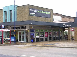
Bingley is a market town and civil parish in the metropolitan borough of the City of Bradford, West Yorkshire, England, on the River Aire and the Leeds and Liverpool Canal, which had a population of 18,294 at the 2011 Census.

The River Aire is a major river in Yorkshire, England, 148 kilometres (92 mi) in length. The Handbook for Leeds and Airedale (1890) notes that the distance from Malham to Howden is 58 miles (93 km) direct, but the river's meanderings extend that to 90 miles (140 km). Between Malham Tarn and Airmyn, the river drops 400 metres (1,300 ft). Part of the river below Leeds is canalised, and is known as the Aire and Calder Navigation.

Riddlesden is a suburb of Keighley in the county of West Yorkshire, England and on the Leeds and Liverpool Canal.

Keighley is a large market town and a civil parish in the City of Bradford Borough of West Yorkshire, England. It is the largest settlement in the borough, after Bradford.

Airedale is a geographic area in Yorkshire, England, corresponding to the river valley or dale of the River Aire.

The City of Bradford is a local government district of West Yorkshire, England, with the status of a city and metropolitan borough. It is named after its largest settlement, Bradford, but covers a far larger area which includes the towns and villages of Keighley, Shipley, Bingley, Ilkley, Haworth, Silsden, Queensbury, Thornton and Denholme. Bradford has a population of 528,155, making it the fourth-most populous metropolitan district and the sixth-most populous local authority district in England. It forms part of the West Yorkshire Urban Area conurbation which in 2011 had a population of 1,777,934, and the city is part of the Leeds-Bradford Larger Urban Zone (LUZ), which, with a population of 2,393,300, is the fourth largest in the United Kingdom after London, Birmingham and Manchester.
The Airedale line is one of the rail services in the West Yorkshire Metro area centred on West Yorkshire in northern England. The service is operated by Northern, on the route connecting Leeds and Bradford with Skipton. Some services along the line continue to Morecambe or Carlisle. The route covered by the service was historically part of the Midland Railway.
Denholme is a town and civil parish in the Bradford Metropolitan Borough, West Yorkshire, England. It is 8 miles (13 km) west of Bradford, 7 miles (11 km) from Keighley and roughly the same distance from Halifax. Administratively, it is part of the Bingley Rural ward of the City of Bradford. Denholme has a population of 2,976, increasing to 3,489 at the 2011 Census.
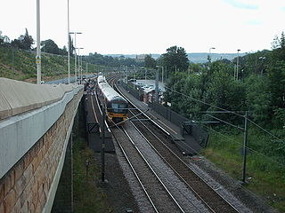
Crossflatts railway station serves the Crossflatts area of Bingley, north of Bradford in West Yorkshire, England. The station is on the Airedale Line, 14.5 miles (23 km) north west of Leeds and 6.5 miles (10 km) north west of Bradford Forster Square. The station, and all trains serving it, are operated by Northern.

East Morton is a small village which lies 2 miles (3 km) north of Bingley and 2.5 miles (4 km) east of Keighley, in the county of West Yorkshire, England. The small hamlet of West Morton lies 1 mile (1.6 km) to the north west. The village has a population of 1,169 according to the 2011 census.
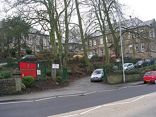
Bingley Grammar School (BGS) is a Voluntary aided school for both boys and girls from the ages of 11–18 and is located on the outskirts of Bingley, West Yorkshire, England.
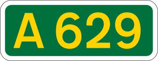
The A629 road is an inter-Yorkshire road that runs from Skipton to Rotherham through Keighley, Halifax, Huddersfield and Chapeltown in Yorkshire, England. The road runs through North, West and South Yorkshire, but before 1974, the entire length of the road was wholly within the boundaries of the West Riding of Yorkshire. It is designated as a primary route through most of its length.

Cross Roads with Lees or Cross Roads cum Lees is a village in the Haworth, Cross Roads and Stanbury civil parish within the City of Bradford Metropolitan District, West Yorkshire, England. Historically part of the West Riding of Yorkshire, it lies less than 1-mile (1.6 km) from Haworth, approximately 2.5 miles (4 km) from Keighley and approximately 9 miles (14 km) from Bradford.

Herman "Percy" Vear, born in Crossflatts, Bingley, West Riding of Yorkshire, England. He was a British professional boxer during the 1920s and 1930s.

A650 road is a main route through the West Yorkshire conurbation in England. The road goes from Keighley to Wakefield on a rough north west/south east axis for 25 miles (40 km). The route is mostly single carriageway with some dualled sections in the Aire Valley, Bradford and the approach to Wakefield from the M1.

Holy Trinity Church is an Anglican parish church in the town of Bingley, West Yorkshire, England notable for its original church being demolished by explosive charge on 7 April 1974.
Harden Moor is an expanse of moorland that lies north of the village of Harden in West Yorkshire, England. The moor encompasses stretches of heather, woodland and former quarry workings and is bordered by Airedale to the east, the Worth Valley to the north and Catstones Moor and the village of Cullingworth to the west. Historically, Harden Moor occupied the high ground between Bingley, Keighley, Cullingworth and Harden. Altar Lane, an unmade road which runs from the Brown Cow Inn in Bingley to Keighley Road on Harden Moor is an unofficial border between the estate of St Ives and Harden Moor, but when the St Ives Estate was created, a large swathe of Harden Moor was taken over.

Laycock is a small village in the Bradford District of West Yorkshire that overlooks the hamlet of Goose Eye. The village is 1.9 miles (3 km) west of the town of Keighley and 1.2 miles (2 km) north of Oakworth village. The village is in the council ward of Keighley West.

Thwaites railway station was a railway station located just east of Keighley, West Riding of Yorkshire, on the Midland Railway line through the Aire Valley between Keighley and Shipley. It opened to traffic in 1892 and closed 17 years later in 1909 due to poor patronage.

Hainworth is a hamlet 1 mile (2 km) south of Keighley in West Yorkshire, England. The hamlet faces north across the lower end of the Worth Valley with a steep wooded incline towards Keighley.


